
77 percent of state in drought
The latest Drought Monitor revealed more drought expansion across the state, particularly in north central Nebraska where the remaining abnormal dryness (D0) has been downgraded to moderate drought (D1). There also was expansion of severe drought into Cedar, Dixon, Holt, and Boyd counties in the northeast quadrant of the state and into more of Sioux and Dawes counties in the northern Panhandle. Over 25 percent of the state is now in severe drought. Still better than a year ago but the degradation this winter has been impressive. Only the winter of 2021-2022 saw comparable levels of winter degradation in recent memory.
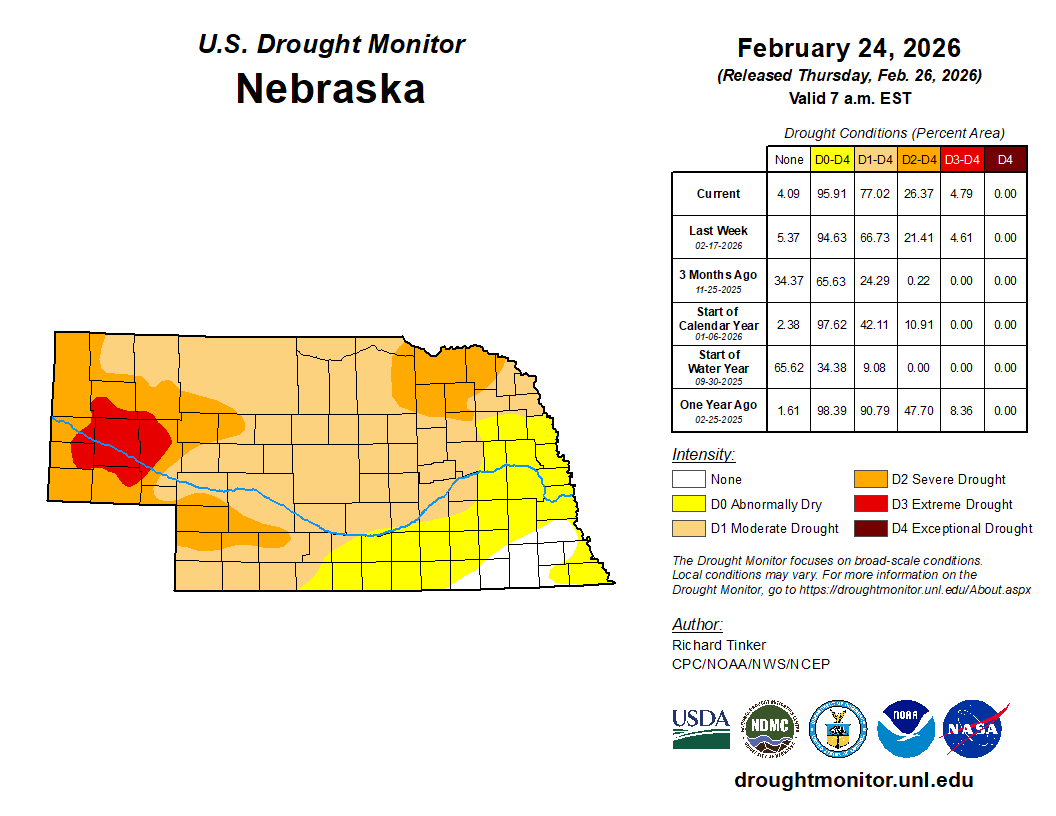
Figure 1. Latest U.S. Drought Monitor
Strong cold front and snow chances in eastern NE on Sunday
It is a gorgeous day across all of Nebraska and tomorrow looks to be a top-10 weather type day as well: sunshine and temperatures in the 60's and lower 70's. However, a strong front will wander through most of the state Friday night into Saturday morning. Temperatures will be cooler statewide on Saturday. But the biggest temperature drops between Friday and Saturday are likely to be in north central and northeast Nebraska where highs may struggle to get out of the mid 30's. Temperatures may still crack 60 in the southern Panhandle. Most of the state will see seasonal highs in the 40's.
A shortwave will make its way from Wyoming into Nebraska on Sunday and this is likely to help initiate light snow or a light wintry mix across the eastern part of the state on Sunday. This does not appear to be a particularly potent shortwave and snowfall totals should be under 2 inches. No snow is likely to fall in the western half of the state and the precipitation may be predominantly south of Highway 30. Will also need to watch for the potential for freezing drizzle in areas outside the main snow area and it's possible that everyone east of Highway 281 could see some period of freezing drizzle during the day on Sunday.
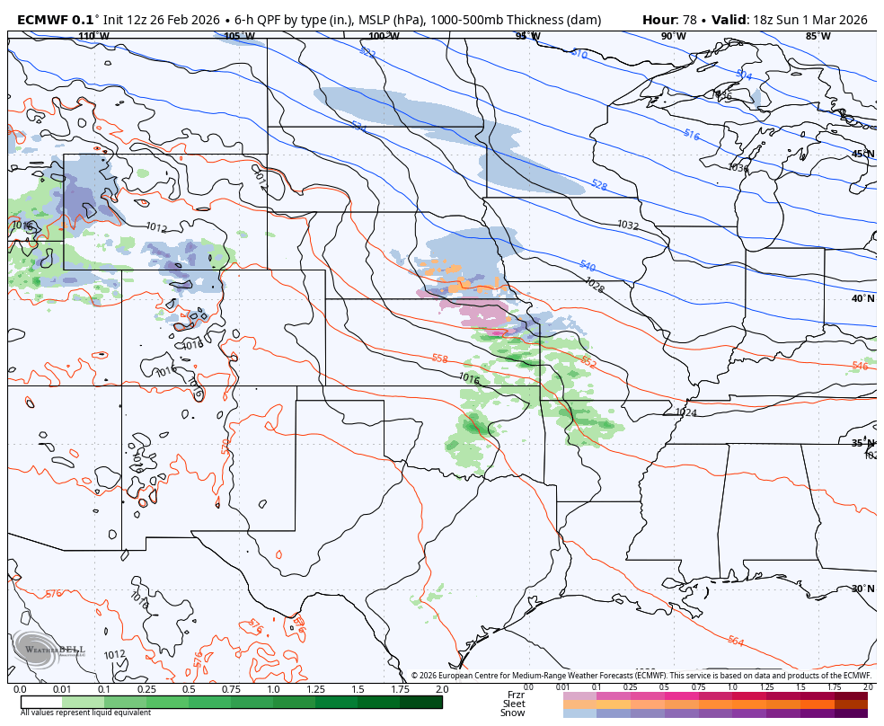
Figure 2. ECMWF projections of light snow or light wintry mix in the eastern half of the state on Sunday
It will be chilly and overcast for all but the Panhandle on Sunday. Highs in the lower 30's will be likely in almost all of eastern and central Nebraska. Highs in the 40's will be more common west of Highway 83 and highs in the 50's will be probable in the Panhandle where there will be more sunshine.
More active pattern. Drought relief?
Sunday looks to just be the first in a series of systems coming into this region of the country. An extended period of rising motion appears likely across the state between Monday night and Wednesday morning, which should allow for more extensive cloud cover and good chances for precipitation between Monday afternoon and midday Tuesday across the state. There is potential for snow in western Nebraska. By Wednesday a shortwave (Figure 3), should be entering the Front Range and this will help generate rain across at least the eastern part of Nebraska between Wednesday afternoon and Thursday morning.
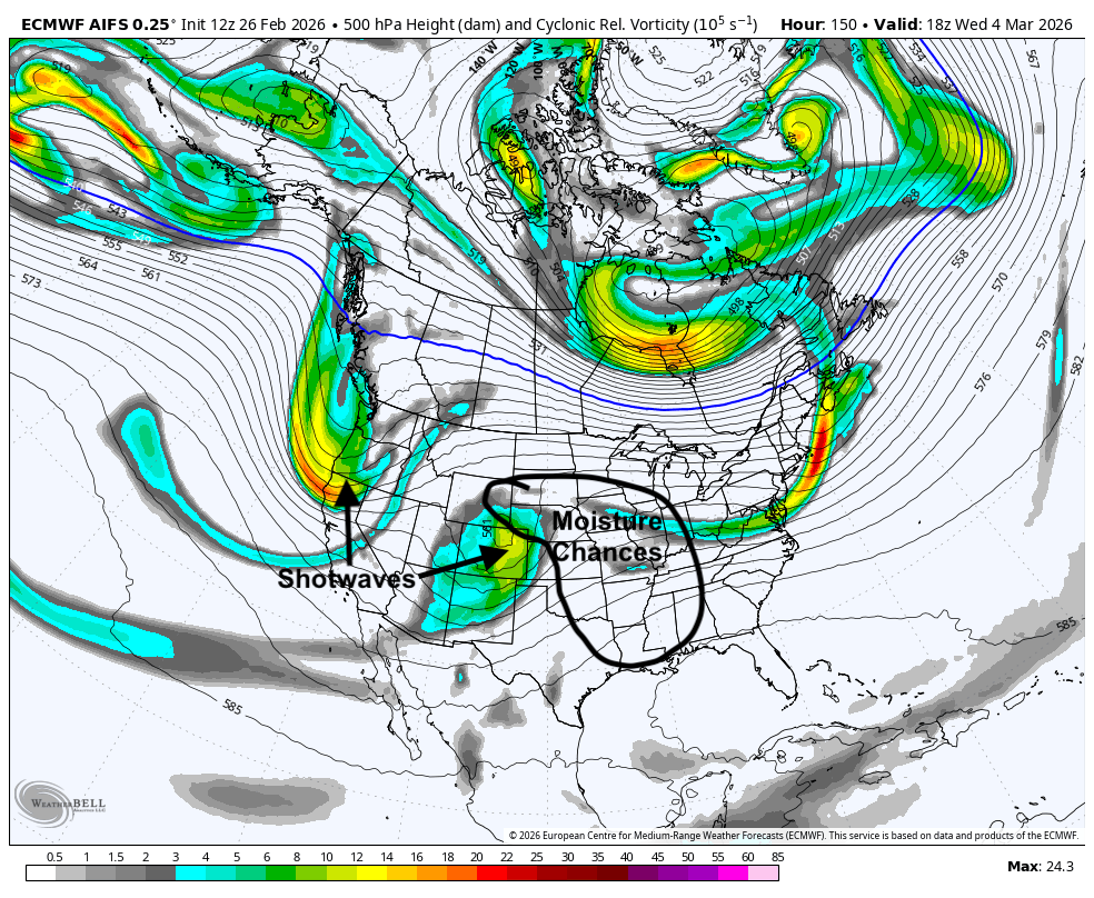
Figure 3. 500-mb heights and areas of vorticity.
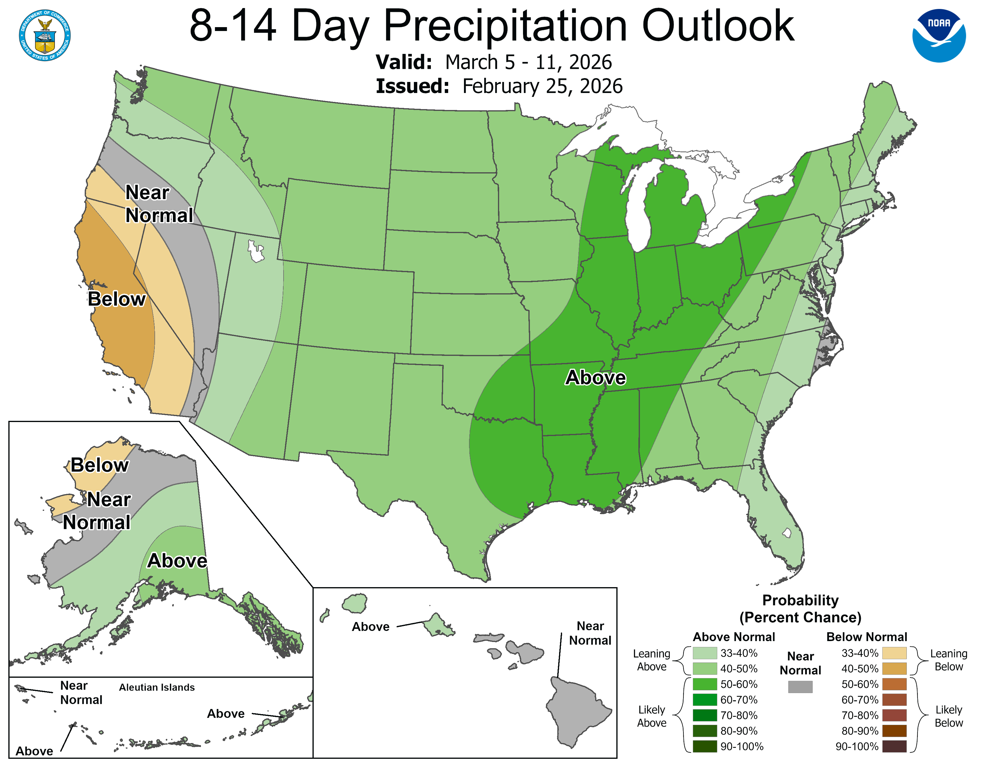
There should be a ~ 24 hour break in precipitation toward the end of the week but another shortwave appears poised to come into the central U.S. by next weekend. This storm system may be worth watching for winter storm potential, particularly in the western third to half of the state. There could be some severe storm potential to our southeast as well. Regardless, there does appear to be chances for meaningful precipitation for everyone next week. The ECMWF ensemble does show a good chance of 1 inch of moisture in the southeast quadrant of the state and some chance of that much moisture across the entire state. This may not necessarily bring about immediate improvement on the USDM but it certainly may stop the degradation for a little time. The CPC's 8-14 day outlook shows above average precipitation favored, so that is also a good sign.
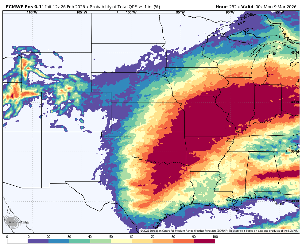
Figure 4. ECMWF ensemble probability of 1" or more of precipitation
March gloom
Recommend enjoying the sunshine the next few days because the first 10-12 days of March are going to be on the cloudy side. Temperatures are generally going to be mild between Tuesday and the end of the week. But it is likely that the overnight temperatures will be milder than the daily high temperatures. Depending on the track of next weekend's storm system, it may be fairly cold in the western half of the state and possibly even the whole state if the storm goes to our southeast. Recommend paying attention to the forecast closely next week to see what transpires.


