
Two-thirds
The latest U.S. Drought Monitor released yesterday morning revealed that drought continues to get worse. Roughly two-thirds of the state is now in some form of drought with increasing areal coverage of both severe (D2) and extreme (D3) drought. Drought has been present on every USDM map in Nebraska since June 9, 2020, so it's been a long time since we were truly free of drought. But a wetter summer and decent start to fall last year did get drought down below the 10 percent threshold for the last half of September.
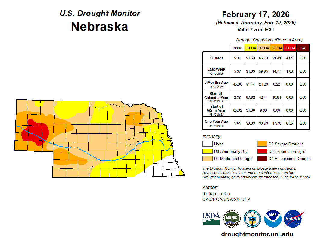
Figure 1. Latest USDM map for Nebraska with various statistics
Very little moisture since mid-October
Moisture started becoming scarce last fall and it has been a very dry last four months for the majority of the state. Pockets of south central and southeast Nebraska have been around average but most of the state has had less than 50 percent of average over the last 120 days (through Wednesday). Much of the Sand Hills, Panhandle, and pockets of central/northeast Nebraska have received less than 25 percent of average.
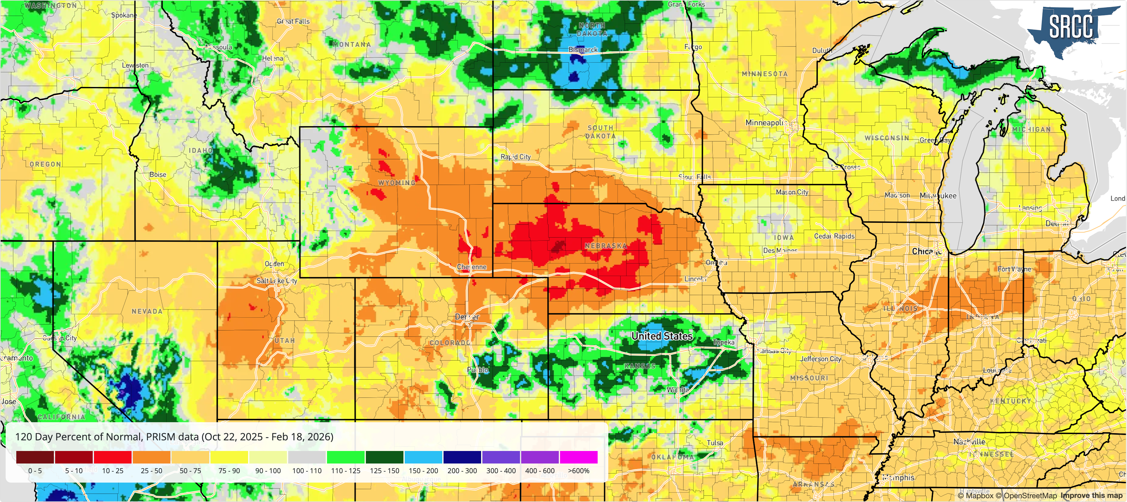
Figure 2. 120-day percent of normal
Late October through mid-February is not a wet time of year, so the absolute magnitude of the precipitation deficits is not like being less than 50 percent of normal between April and July. If the past few months had been cold with frozen soils and more snow cover, the acute dryness would be less of a concern. But this winter has been exceptionally mild, with average high temperatures at or near record levels for most locations around the state (see reference article).
Abnormal atmospheric demand
The warm temperatures combined with plenty of sun and some breezy days have led to record levels of potential ET for practically all of western and central Nebraska, as shown by the Evaporative Demand Drought Index (EDDI) in Figure 3. The potential ET has been less exceptional in southeast Nebraska, but still above average. Potential ET can be thought of as atmospheric demand on moisture that is in the ground and in plants from rainfall. Perhaps a good analogy is potential ET is the atmospheric equivalent of your teenager wanting money you have earned for various activities.
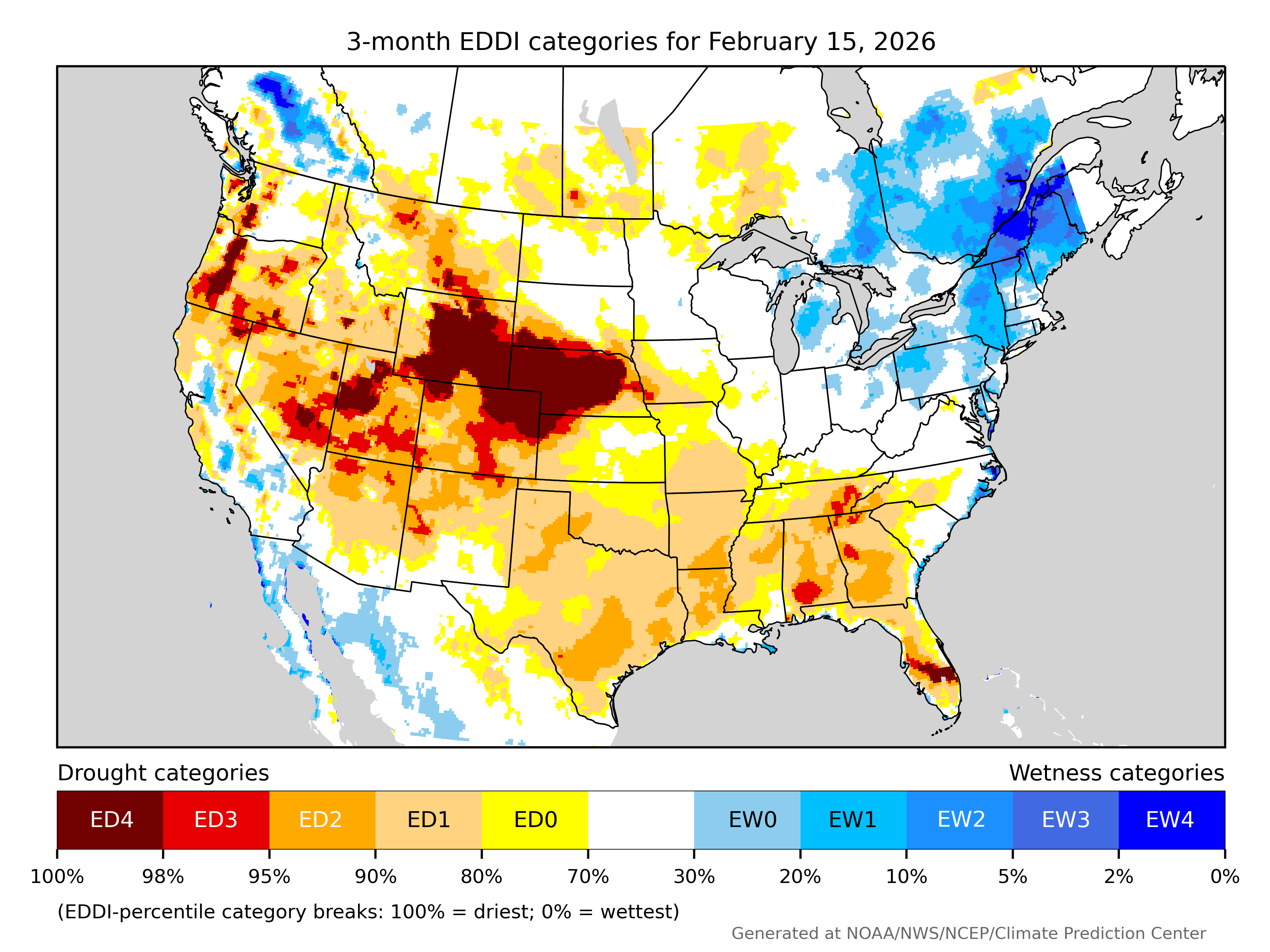
Figure 3. Three-month Evaporative Demand Drought Index (EDDI)
Soil moisture
The abnormally high potential ET is an indicator that moisture has been lost out of fields this winter and top soil moisture is very short over most of the state as shown in Figure 4. The snow that fell yesterday will be useful moisture once it melts next week since the ground isn't frozen. But that snow is more like a temporary band-aid for a patient that needs stitches. It helps but is not the full solution. Most of the state needs a longer stretch of above average precipitation to make a true dent in the drought.
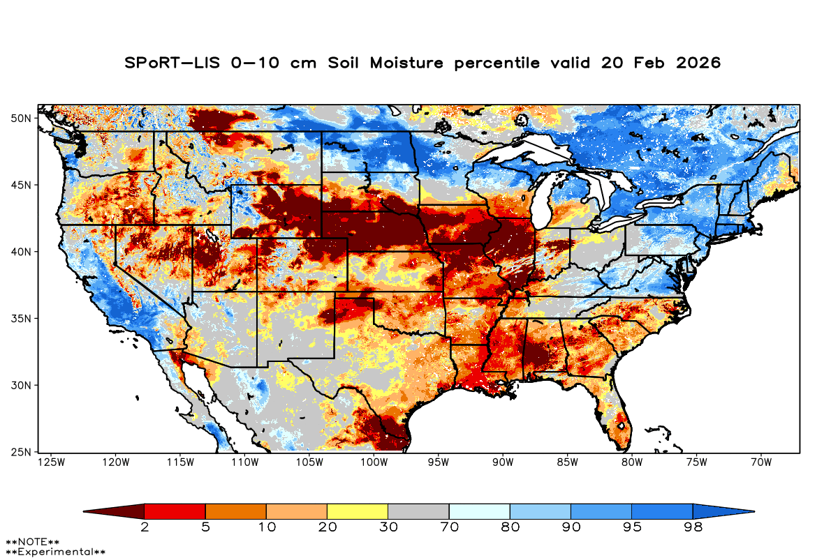
Figure 4. 10-cm soil moisture percentiles from SPORTLIS
Outlook
The latest Drought Outlook doesn't contain much good news either, showing drought persisting in areas where drought currently exists (brown) and developing in more of south central Nebraska (yellow). Some of the white area in central Nebraska is already in drought. Same story for the area around Wayne. My biggest concern about the outlook is that it is not accounting for the likelihood of drought developing in the northern Sand Hills and possibility the whole state is in drought by the time we start planting corn and soybean in April. March could deliver enough moisture to stave off drought in southeast Nebraska and possibly allow for some improvement elsewhere. We can sure hope.
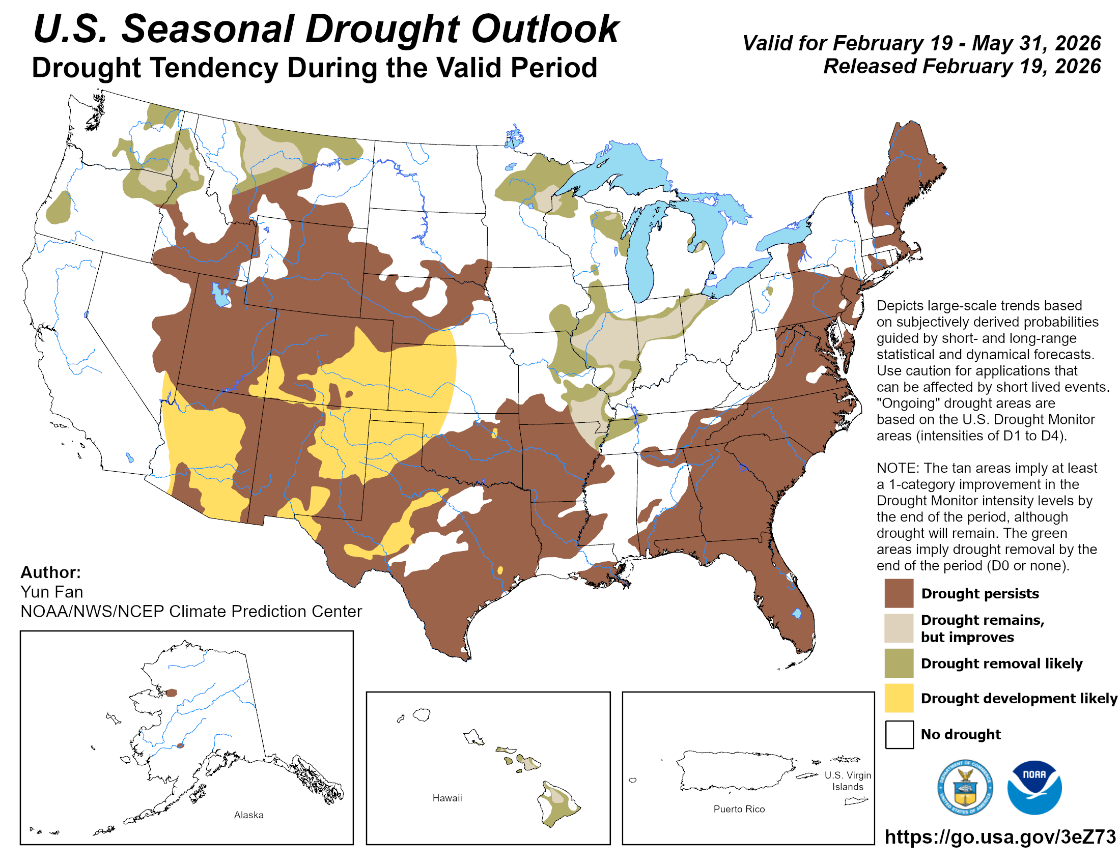
Figure 5. CPC's drought outlook
Report on drought conditions
The USDM is based on many things but user-feedback is always appreciated. If you would like to report on conditions in your area, please submit a report to the Drought Center's Condition Monitoring Observations Report (CMOR) website (see related link). Or feel free to reach out to your local Extension educator, NRCS staff, or directly to me. Impacts by themselves won't affect the Drought Monitor but it can help us understand what statistical indicators are more reflective of conditions on the ground.

