Drought Monitor
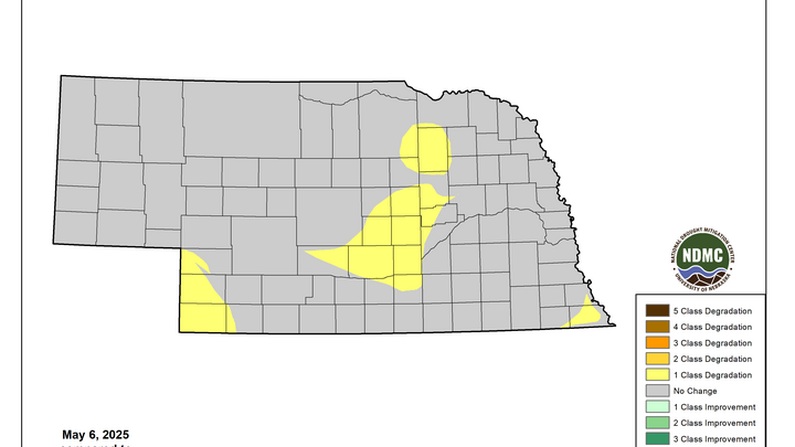
The latest U.S. Drought Monitor was released this morning and showed a wide expansion of severe drought in central Nebraska and introduction of extreme drought into an area centered on Antelope County. Drought was introduced to more of southeast Nebraska and abnormal dryness was introduced to the southwest corner. Additional degradation in eastern Nebraska is likely next week with a warm, dry forecast.
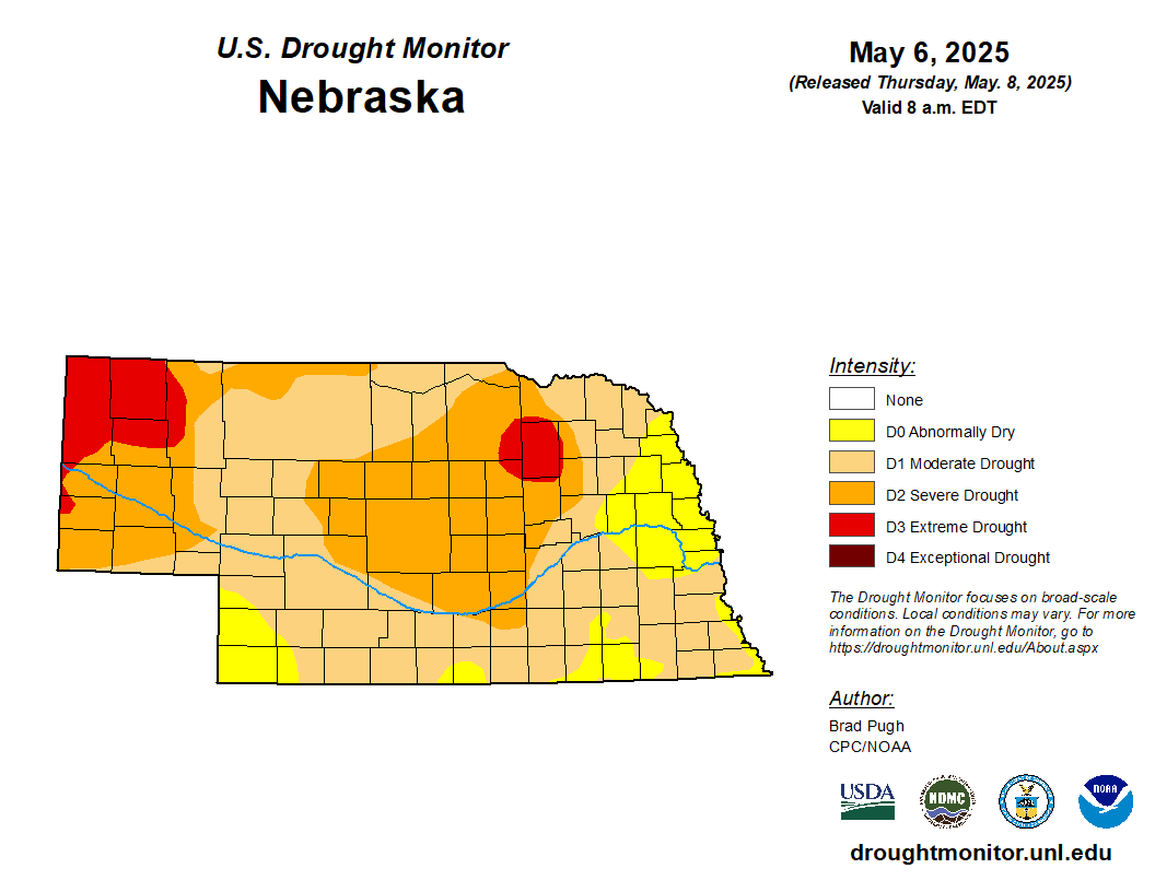
Figure 1. Latest U.S. Drought Monitor
Precipitation deficits and soil moisture
With a few exceptions, most of the state has had a dry to very dry last 30 days and deficits of 1-2 inches during that time frame are common. It is even worse in central Nebraska where deficits in excess of 2-3" are common. We are getting into our wettest time of year and are starting to get to a point where these deficits will be hard to offset, especially between O'Neill and Grand Island, unless above average precipitation can be sustained for several weeks. That is not impossible but it is not the most likely outcome.
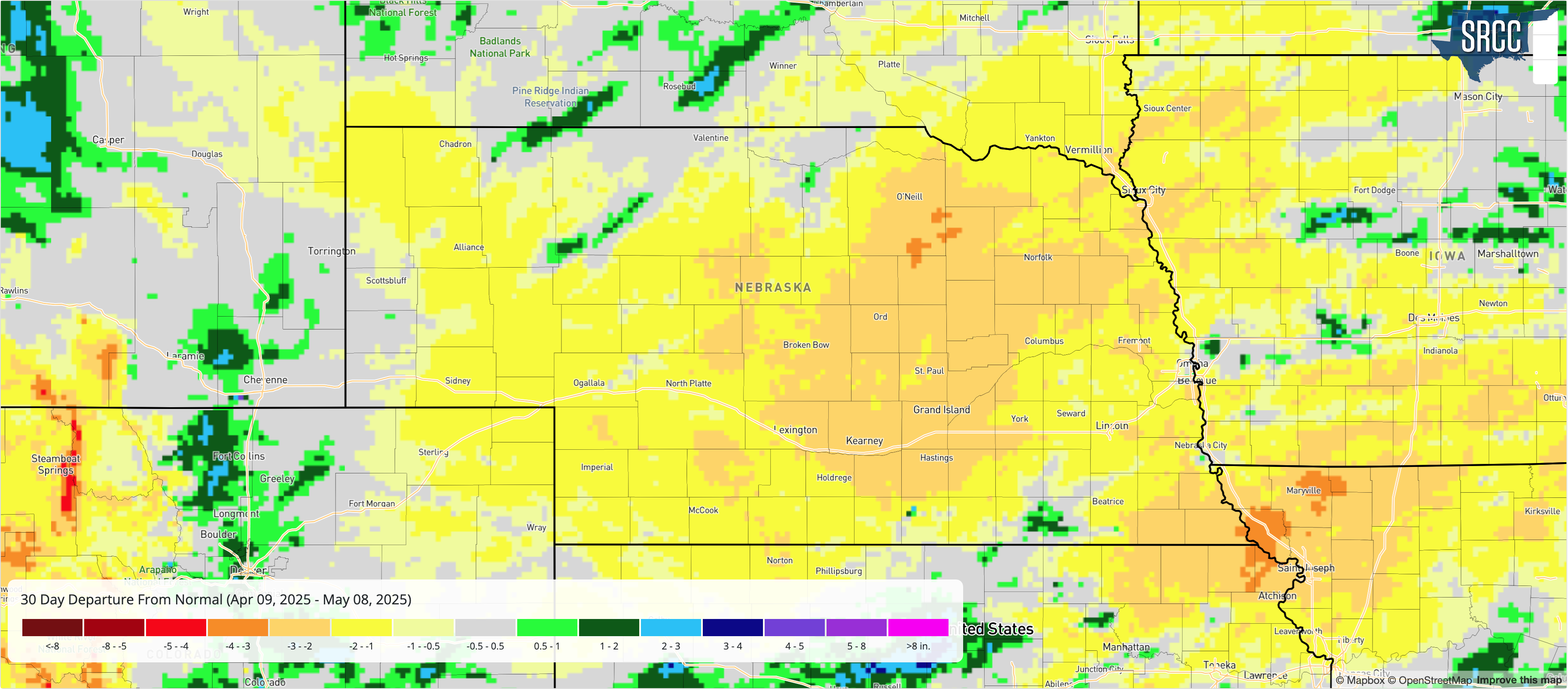
Figure 2. 30-day precipitation departures
The dry weather has also led to further depletion of soil moisture, especially across the central section of the state, where soil moisture percentiles are generally below the 10th percentile. Many areas are below the 5th percentile. Pivots have already been running according to CMOR reports in the central part of the state to ensure crops have enough water to get started. Above average precipitation for the next several weeks would be welcome but with thirsty vegetation and summer temperatures around the corner, it will be difficult to fully recharge the profile without going over super wet like they have in the Southern Plains the last 30 days.
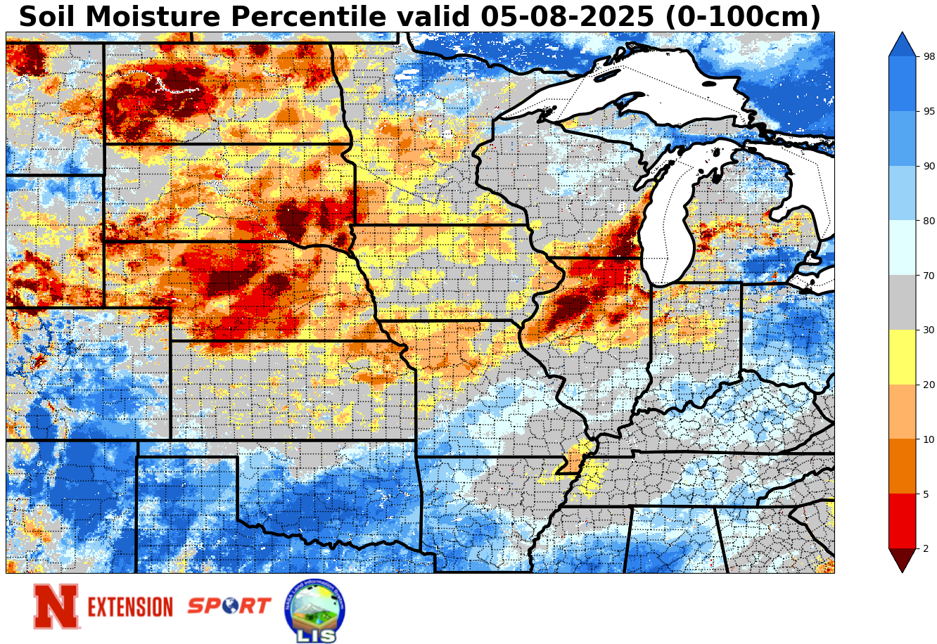
Figure 3. Latest soil moisture percentiles
VegDRI update
Most of the state experience is experiencing some level of drought stress according to VegDRI, which combines precipitation and satellite reflectance to estimate vegetation health. This signal is worst in the Panhandle and Sand Hills, with Antelope County possibly experiencing the worst conditions relative to normal. Pockets of southern and eastern Nebraska are in better shape but will likely see rangelands deteriorate over the next week with abnormally warm, dry, and breezy conditions prevailing.
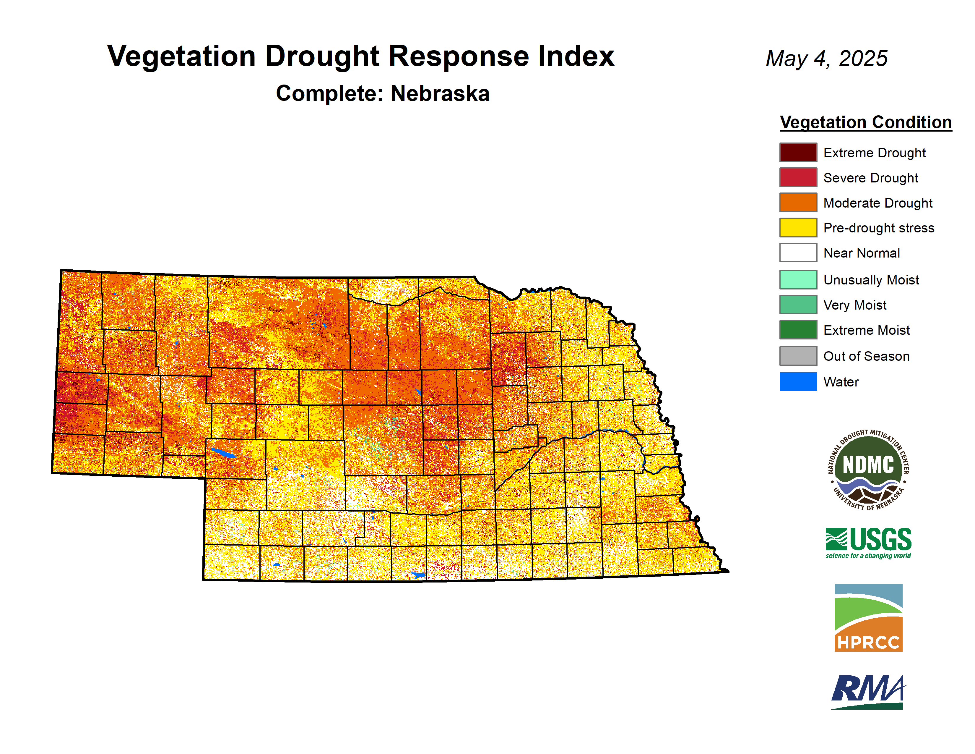
Figure 4. Latest VegDRI map across Nebraska
Fire danger will be elevated to critical across much of the state Sunday-Wednesday, especially between Highways 183 and 281 where drought conditions are the most acute and winds will be strongest. A burn ban issued by Governor Pillen in April is currently set to expire this weekend. But controlled burns are strongly discouraged through at least Wednesday and likely through next weekend.


