Main highlights
The average temperature in Nebraska for February 2025 was 22.5°F, which was -4.2°F below the 20th-century average and was the 27th coolest overall. Polar vortex stretching during the middle of the month contributed to the cold temperatures. Only the northeast and southeast corners of Nebraska had temperatures that were in the near average range historically. Much warmer temperatures during the last six days of the month, including record temperature swings in parts of central Nebraska, prevented anyone from having a top 15 cold February.
Nebraska's average precipitation in February 2025 was 0.41 inches, which is -0.25 inches below the 20th-century average and the 40th driest on record. Only a few locations in the state were above average. Most of western and central Nebraska were around average while eastern Nebraska was below average. Below are relevant maps from NCEI's Climate at a Glance.
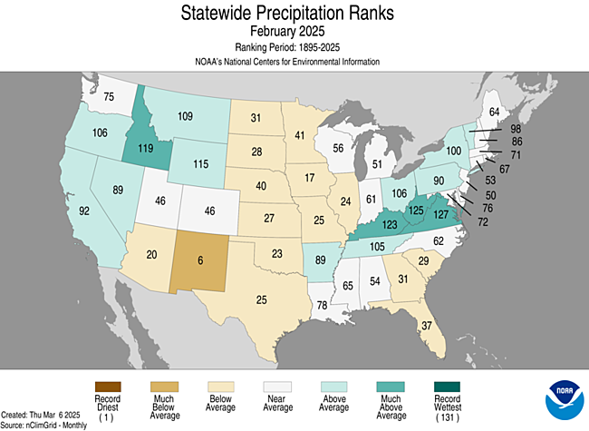
Figure 1. February 2025 statewide precipitation ranks
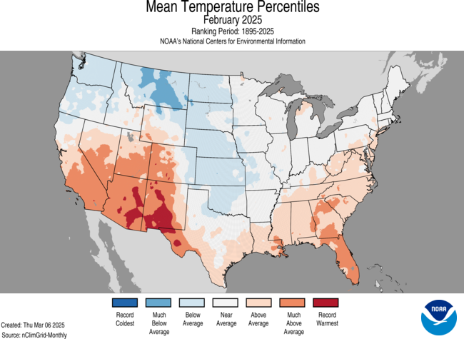
Figure 2. February 2025 average temperature percentiles
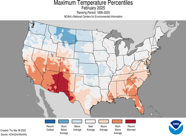
Figure 3. February 2025 maximum temperature percentiles
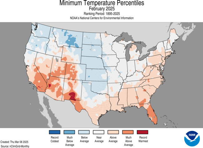
Figure 4. February 2025 minimum temperature percentiles
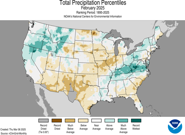
Figure 5. February 2025 total precipitation percentiles
Polar Vortex Yoga
The tenth stretching exercise of the polar vortex in the 2024-2025 cold season coupled with a trough in the troposphere over the north central section of the continent brought historically cold temperatures to Nebraska.
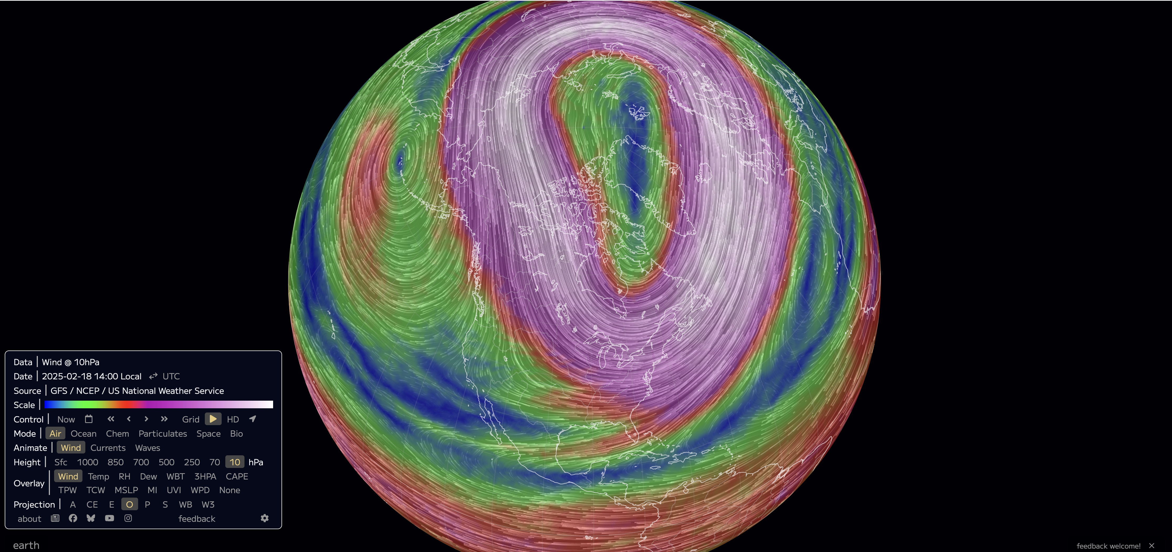
Figure 6. Wind speed at 10 mb at 2 PM CST on February 18th, 2025. This pressure level is used to observe the polar vortex in the stratosphere.
No location set all-time record cold temperatures but this cold was impressive for that late in the season. The following locations (with near-continuous long-term records) set record low high temperatures on February 18th: Grand Island (-3°F), Hastings* (-2°F), Omaha (2°F), Lincoln (1°F), Norfolk (1°F), North Platte (-2°F), Valentine (-4°F), McCook* (-2°F), O'Neill (-5°F). For Hastings and McCook this was the latest subzero high temperatures on record. These records broke records set at the end of a prolonged stretch of brutal cold in 1936. Several sites in central Nebraska dropped below -30°F on February 20th, with the coldest of -35°F at Broken Bow.
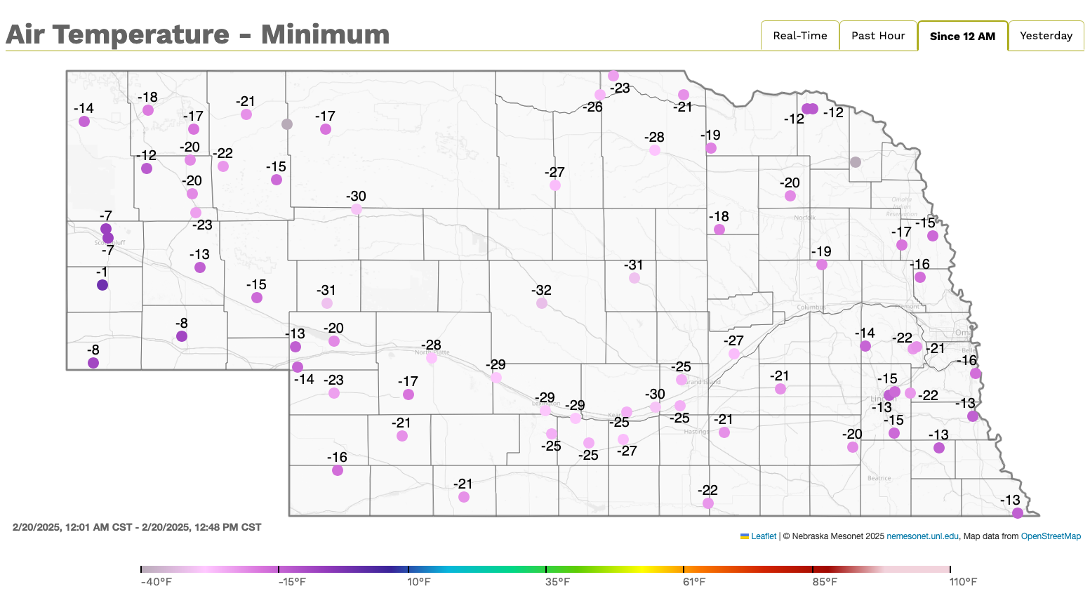
Figure 7. Minimum temperatures on February 20th, 2025 at Nebraska Mesonet stations.
Drought Update
Drought conditions worsened across western and central Nebraska due to the lack of significant precipitation. The U.S. Drought Monitor showed a class 1 degradation in areas such as the Panhandle and southwestern Nebraska. In contrast, southeastern Nebraska saw slight improvements, with class 1 improvements in the Richardson and Pawnee counties.
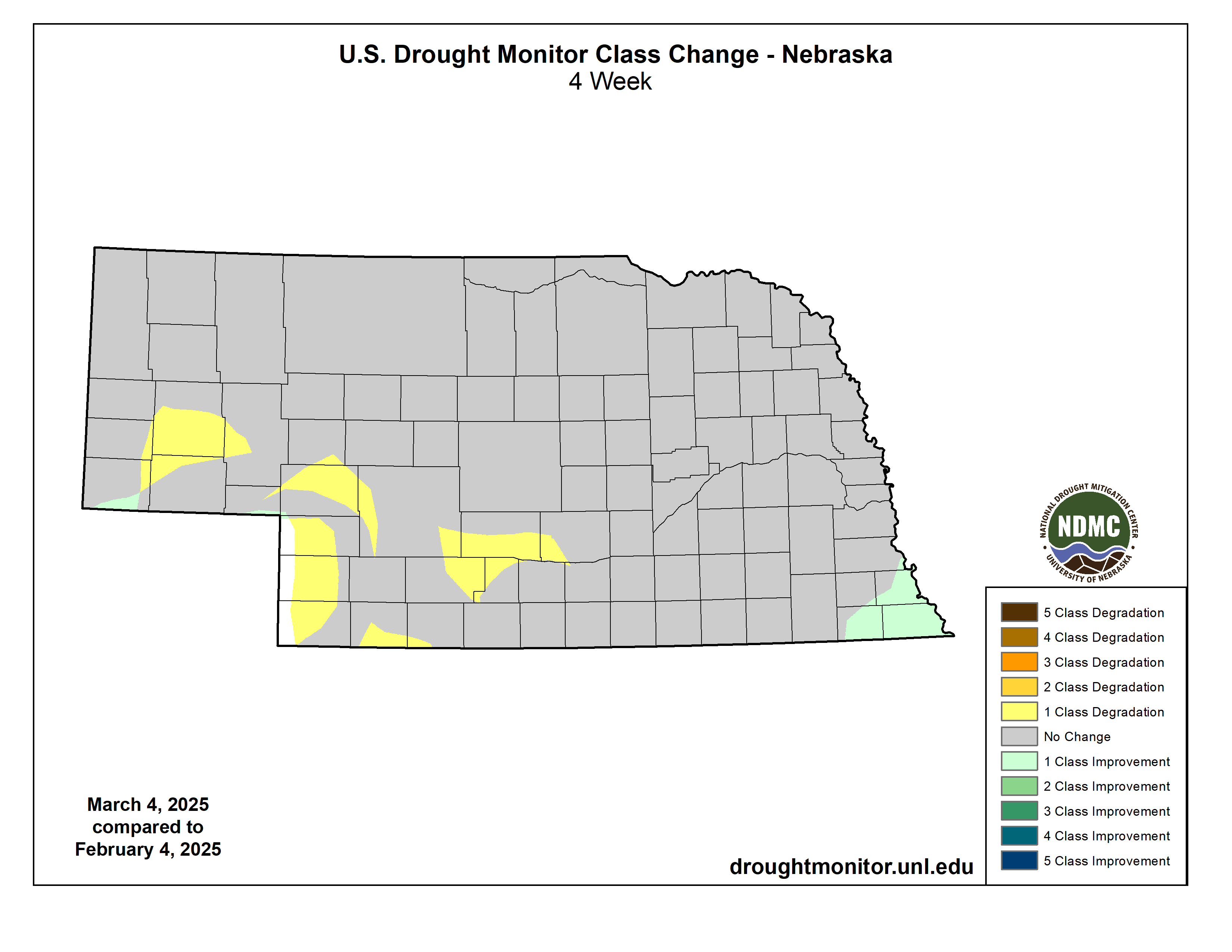
Figure 8. Changes in Drought Monitor category
Temperature and Precipitation Extremes
The Mesonet summary (see related links) contains the absolute maximum and minimum temperatures, the average temperature, the number of days with subfreezing high temperatures and subzero low temperatures, the number of growing-degree days, the average soil temperature, and the average cattle comfort index.
Here are the temperature and precipitation extremes around the state:
Maximum high temperature: 77°F, Cambridge
Minimum high temperature: -10°F, Arnold
Minimum low temperature: -35°F, Broken Bow 2 W
Maximum low temperature: 41°F, Scottsbluff W B Heilig Field
Maximum precipitation: 1.73", Kilgore 1 NE
Maximum snowfall: 16.5", Scottsbluff W B Heilig Field


