Fire and Ice
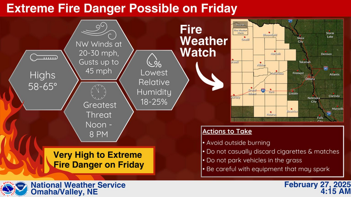
In what may seem like something straight out of Exodus or a Pat Benatar song, we are going to be dealing with high fire danger tomorrow and the potential for flooding from ice jams over the next several days. Let's start with the fire potential first. A cold front will be moving through the state early tomorrow and winds will shift to the northwest and get increasingly strong during the late morning hours.
Temperatures should still top out between 55-60 north of Highway 30 and should get into the 60's across the southern half of the state before starting to drop later in the afternoon. This will be a dry frontal passage and conditions will be optimal tomorrow for high fire danger: Sustained winds between 20-25 mph for several hours, low relative humidity, and a dry surface with a high fuel load. The rapid swing in temperatures led to rapid snow melt last weekend and any benefit to surface moisture has mostly disappeared. Soil moisture percentiles are better than last October but it is still dry for this time of year.
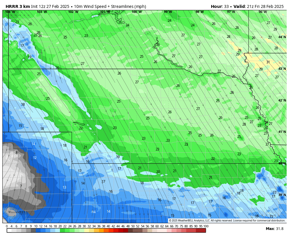
Figure 1. Projected sustained winds tomorrow at 3PM CST/2 MST.
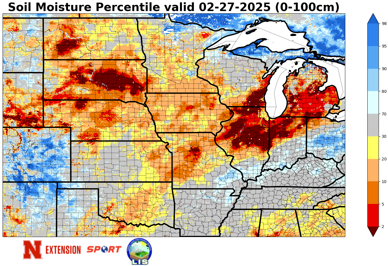
Figure 2. Current soil moisture percentiles
Prescribed burns should not be done tomorrow and extreme caution should be taken in general. Red flag warnings will likely be issued for much of central and eastern Nebraska tomorrow. Fires have already been an issue in Custer County this week and we don't need thousands of acres burning tomorrow.
The record swing in temperatures across the region is also leading to rapid ice melt and flood warnings have been issued in counties along the Loup, Elkhorn and Platte Rivers. Be prepared for a rapid rise in water levels and flooding of low lying areas for a brief period this weekend.
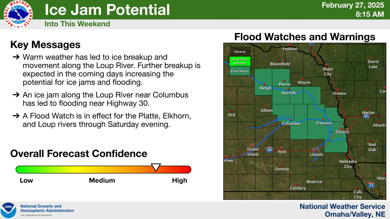
Figure 3. Ice jam potential this weekend
Brief cool down
Temperatures will be closer to seasonal levels in eastern Nebraska on Saturday with highs mostly in the 40's. Western sections of the state will remain above average, though not as warm as some days earlier this week. Temperatures will rebound back into the 50's on Sunday in central and eastern sections of Nebraska and should be in the upper 50's to mid 60's across the western third of the state. Temperatures warm further on Monday with highs in the 60's across most of the state. It will be a bit breezy both days but fire danger levels will be a bit lower than tomorrow, especially with increased low level moisture on Monday.
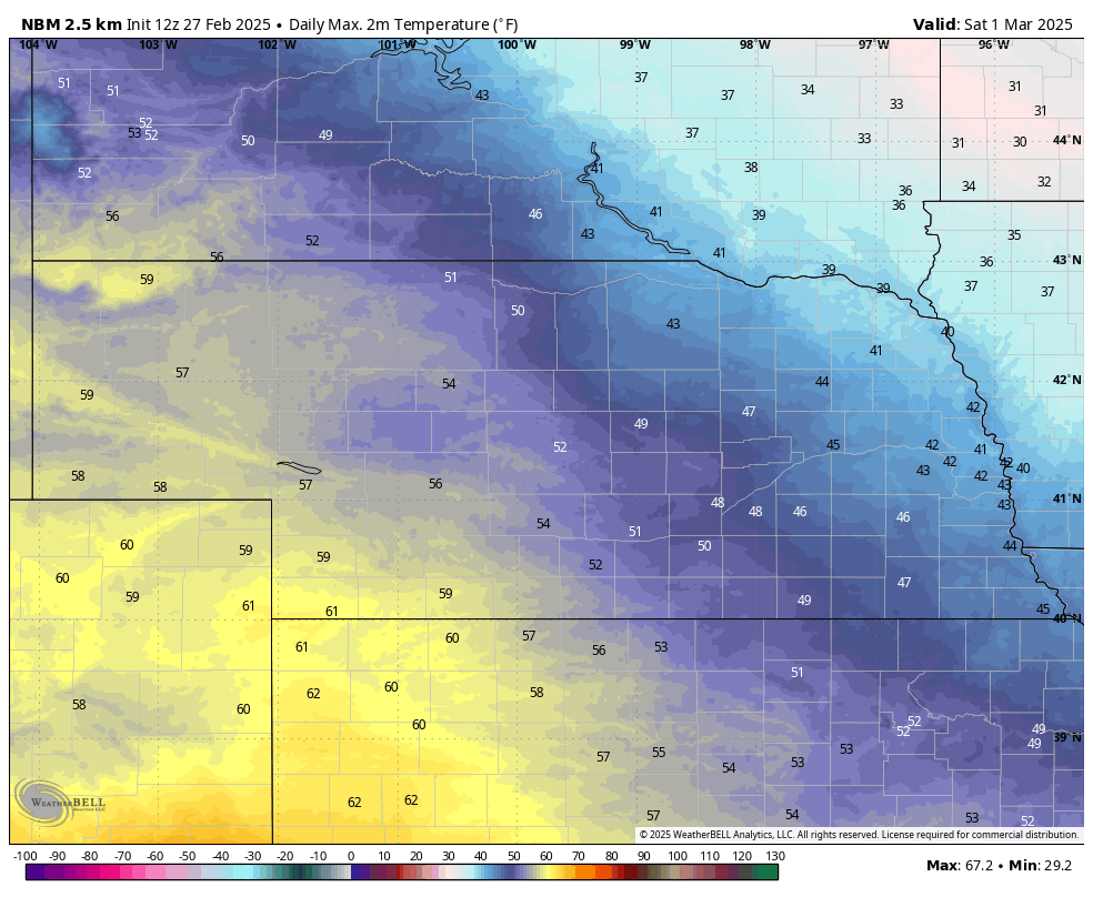
Figure 4. Projected high temperatures on Saturday
Precipitation chances
We will be entering a more active period starting early next week and there will be a chance of showers across southeast Nebraska early Monday. The bigger event will start on Monday night into Tuesday as an upper level trough moves into the Central Plains from the southwestern U.S.
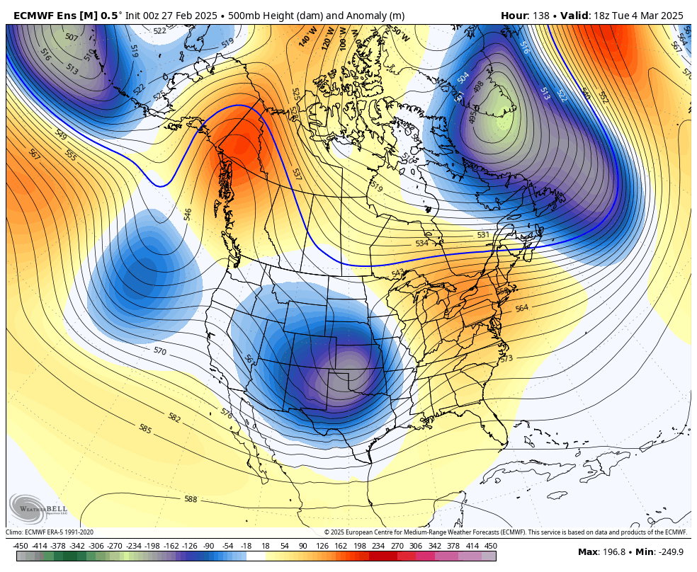
Figure 5. 500-mb height anomalies on Tuesday
This will be a relatively quick moving system and the surface low and best dynamics will likely remain to the south of the state. Nevertheless, there will be chances for beneficial moisture for all. In eastern Nebraska, this should be an all rain event with a possibility of 0.50-0.75" by late Tuesday evening. Far southeast Nebraska has the best shot at getting the whole inch.
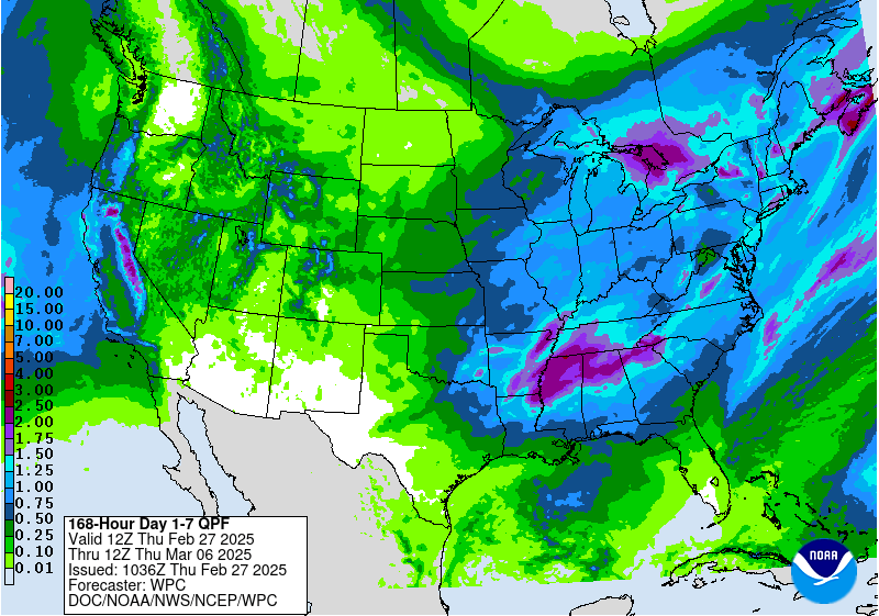
Figure 6. Projected precipitation totals next week
The western half of the state has a bit trickier forecast. Some models are currently indicating what appears to be a secondary area of enhanced precipitation across western Nebraska (likely because of a deformation band), which could mean a transition of rain to snow on Tuesday. If this happens, there could be a larger area of accumulating snow with isolated areas picking up several inches of snow. Recommend paying closer attention to the forecast as we get to Monday as pinpointing the possibility of heavier snow in the western side of the state. A transition from rain to snow will also be possible into central and southeast sections of the state. There won't be a lot of cold air to work with so snow that does fall (especially east of Highway 183) will be dynamically driven and falling with temperatures closer to freezing.
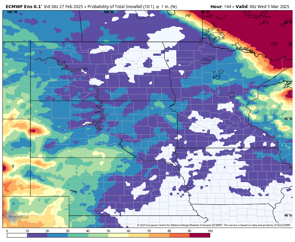
Figure 7. Probability of getting >1 inch of snow through next Wednesday morning.
Another shortwave looks poised to move into the region late in the week, which could bring additional precipitation the state at the end of the week. It's worth noting that the ECMWF AI is a bit further north with the second system toward the end of the week. If that is the correct solution, there would be chances for most of the state to pick up an additional 0.10-0.50" of moisture.
After that there should be a lull in activity for a little while and the CPC is favoring above average temperatures with no signal on precipitation for the early portion of the week after next. A little deeper look into the crystal ball shows troughing coming back into the western U.S. in the middle of the month and then working its way east. That should bring chances for more moisture and should also bring temperatures back down to seasonal or below seasonal averages. One last hurrah for the polar vortex may also be possible by then too, which would mean winter isn't done with us yet.
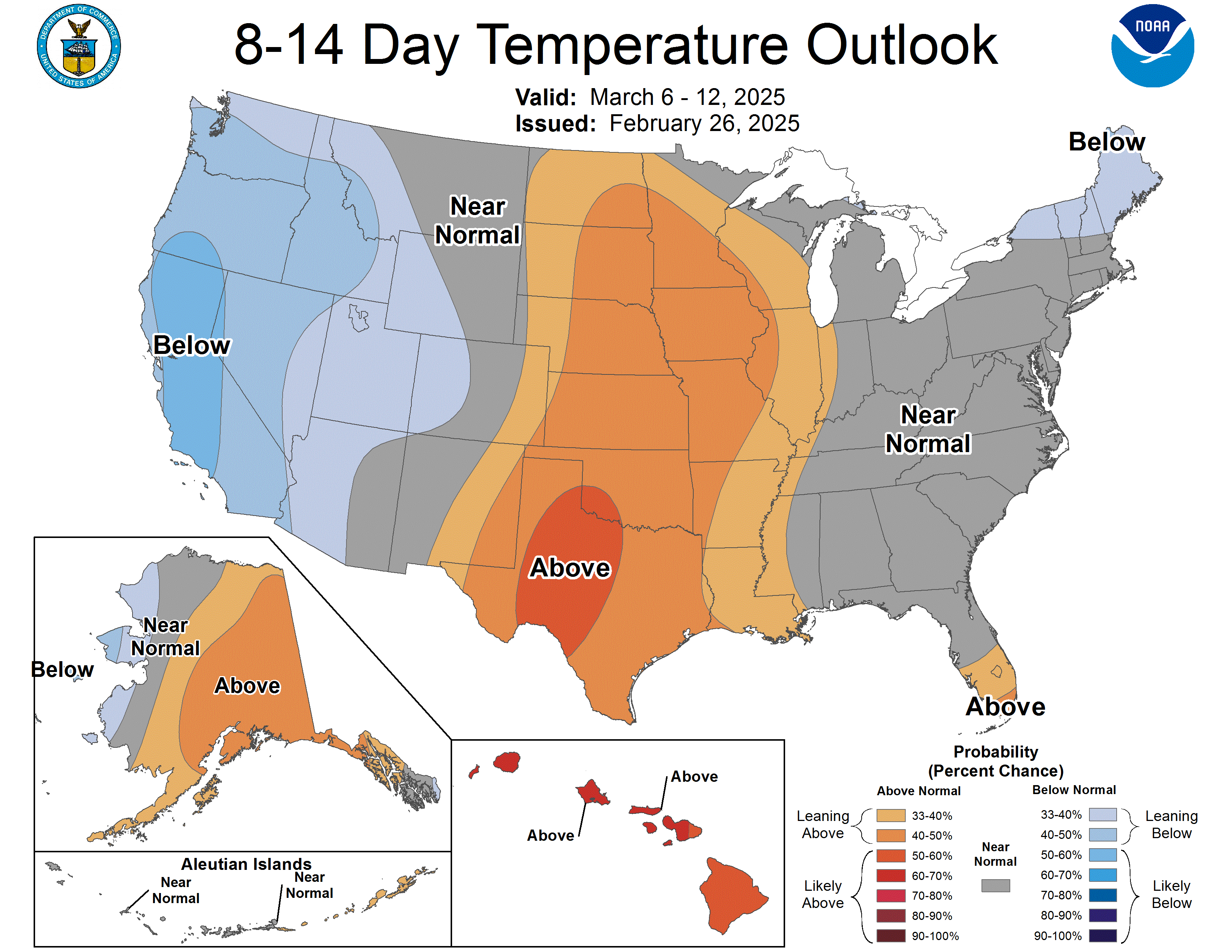
Figure 8. CPC 8-14 day temperature outlook
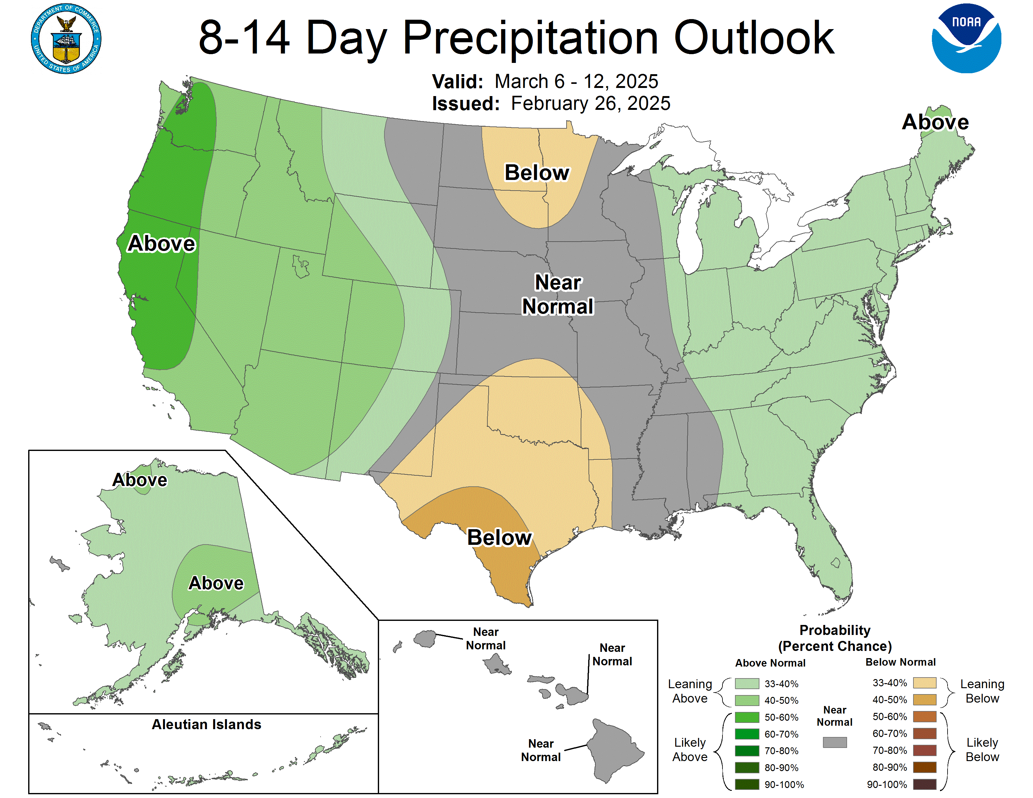
Figure 9. CPC 8-14 day precipitation outlook