100°F Heat
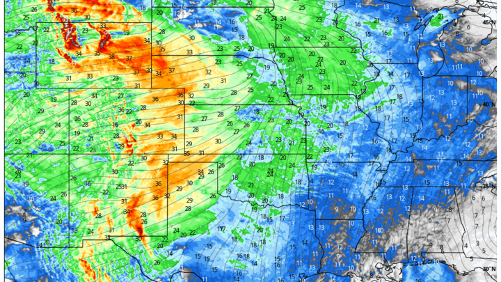
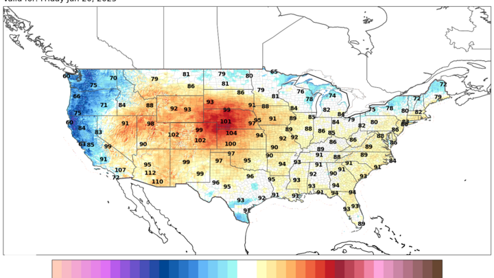
As I mentioned in yesterday's article, the heat is coming later this week and Friday will likely be the first 100°F reading of the season at various places in southwest Nebraska. Given that we have made it almost to the summer solstice without hitting the century mark in the state, this seems a good time to review our triple digit climatology.
Most places in the state outside of the northeast section and the highest elevations in the Panhandle typically reach 100°F in a typical year as shown in Figure 1. This map is a reflection of where upper/mid-level ridging tends to be more dominant and where factors like aridity and downsloping can play roles in the High Plains region. It would be the exception for southwest Nebraska to not get to that temperature at least a few times in a typical year and parts of north central Nebraska also typically have multiple days over 100°F. The last time Valentine didn't hit the century mark in a calendar year was 2009 and McCook hasn't done without it since 1996. This year isn't going to break the streak in McCook and probably won't in Valentine either.
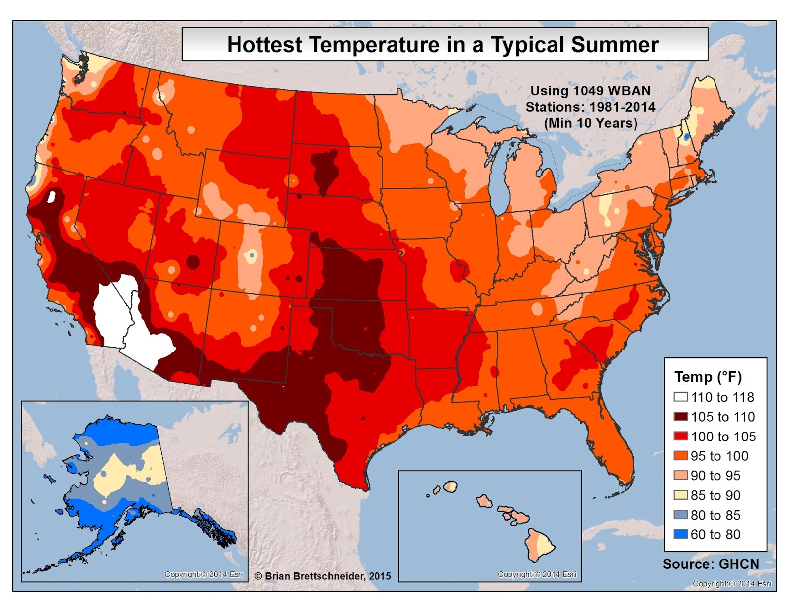
Figure 1. Hottest temperature in a typical summer between 1981-2014
The metro areas of Omaha and Lincoln tend to officially hit triple digits in a typical year (at the airport sites) but outside of major drought years, it is historically uncommon to have more than a few days of 100°F heat in our state's biggest cities. This is especially true for Omaha as Eppley Airfield is the official observation site and is likely the coolest spot in the city on a lot of summer afternoons. Lincoln's airport has always tended to be more representative of the urban heat during the daytime hours.
Crops can have an impact on the temperature too as the partitioning of incoming energy between latent and sensible heat will favor the former if crops are healthy and have moisture available. Thus, the heavily irrigated region between Grand Island and western Seward County tends to have a low number days at or above the triple digit threshold in most summers. The ASOS by York hasn't managed to hit 100°F in the month of July since 2012, a reflection of how irrigation affects the landscape. Triple digit heat also is also uncommon in the ~ 100% rainfed area of eastern Sarpy and Cass counties if crops are healthy, making them more representative of the 'I' states in summer. This comes at the expense of higher humidity levels, which can make the heat index and WBGT higher than in areas where the air temperature is higher.
Triple digits since 2010
Looking back to 2010 here are the dates and location of the first 100°F reading in the state:
2010: June 25, Sidney Municipal Airport, 101°F
2011: May 9, Genoa 2W, 101°F
2012: May 22, Scottsbluff W B Heilig Field, 100°F
2013: May 14, Several locations in central and eastern NE, 100-108°F
2014: May 7, Auburn 5 ESE, 100°F
2015: June 9, Tekamah Municipal Airport, 100°F
2016: June 10, Several locations in western NE, 100-102°F
2017: June 9, Valentine Miller Field, 102°F
2018: May 26, Several locations in central and eastern NE, 100-101°F
2019: June 29, Several locations in western NE, 100-104°F
2020: June 2, McCook Municipal Airport, 100°F
2021: June 14, Scottsbluff W B Heilig Field, 101°F
2022: April 23, Wallace 2 W, 101°F
2023: June 29, Lincoln Municipal Airport, 101°F
2024: June 8, Stapleton 5W, 100°F