
Fire and Drought Update
A controlled burn in Brown County got out of control on Monday afternoon and is likely still trying to be contained. Several thousand acres have burned, 45 cattle have died, and at least one cabin has been destroyed. Governor Pillen has issued a statewide burn ban through the end of the month.
Observations from Ainsworth show that relatively calm conditions earlier in the day gave way to gusty winds in the afternoon as a cold front moved into the area. The front had enough forcing to produce a line of showers and the radar loop from that afternoon suggests a line of showers moved through the area in the middle of the afternoon. But no precipitation was reported at Ainsworth or by any observers in that area. It did bring temporary cloud cover but unfortunately, also brought gusty winds and no rain. A look at the sounding from North Platte that morning shows the air mass was very dry, so even though radar returns were picking up light precipitation, it was evaporating before it hit the ground.
In other words, the cold front had sufficient enough forcing to produce precipitation but the air mass was too dry to oblige north central Nebraska with any rainfall and instead just brought gusty winds. The smoke was being picked up by the Ainsworth site later in the evening too as visibility dropped down to 2.5 miles with haze when the wind was blowing from the NNW. Once winds shifted slightly to pure north, visibility improved. The observations and archived radar loop are available under the Related Links.
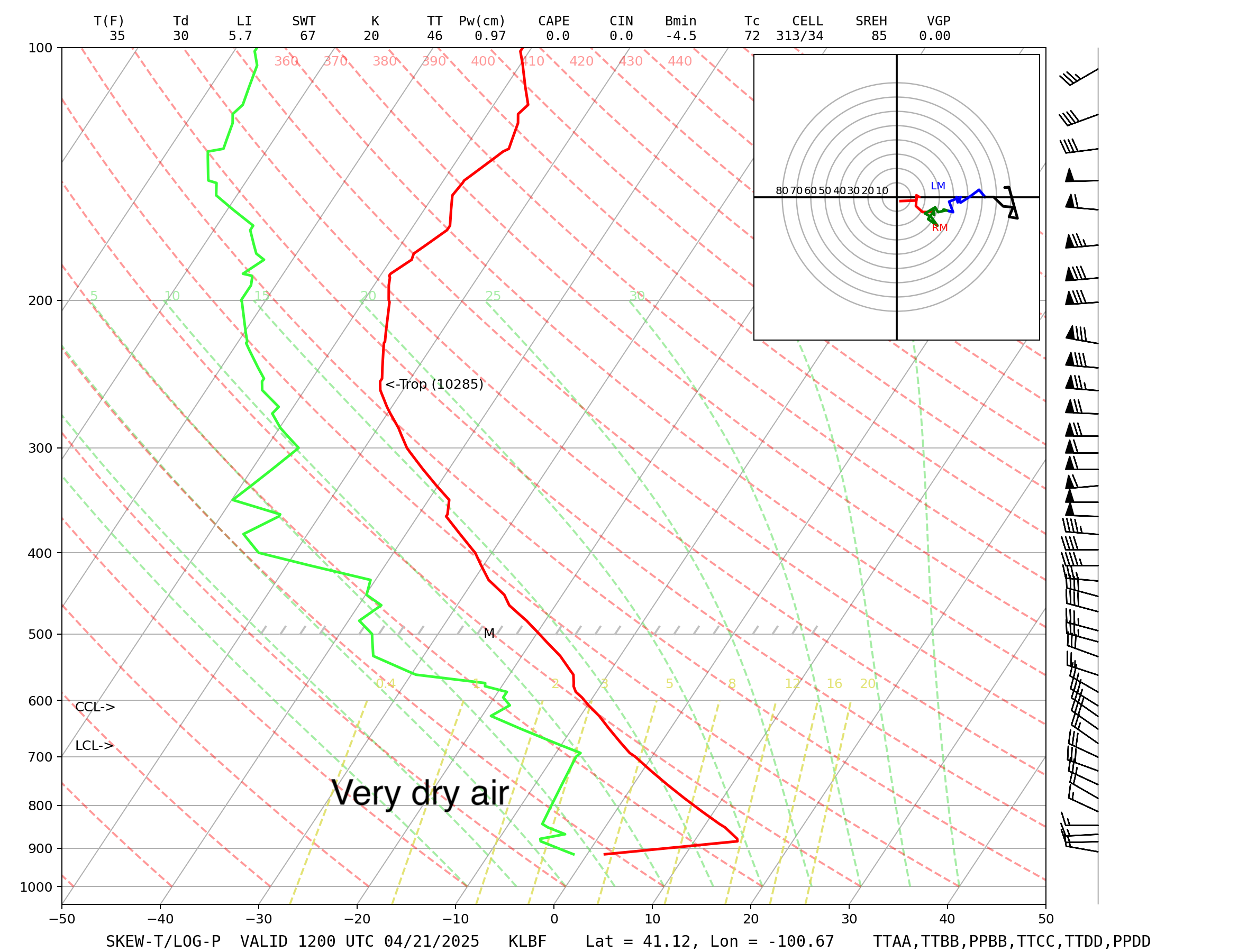
Figure 1. Sounding from North Platte on Monday morning. The red and green lines represent the temperature and dewpoint respectively.
This area of the state is currently in moderate drought on the U.S. Drought Monitor and conditions look worse according to the latest soil moisture percentiles and VegDRI maps. Most of the Drought Monitor map remained unchanged this week but there was a pocket of degradation to severe drought in the Eastern Sand Hills (Valley, Garfield, and Wheeler counties) and a small area of degradation in the southeast corner of the state. The map released yesterday was based on data through Tuesday morning so the rainfall in southeast Nebraska on Wednesday afternoon wasn't considered.
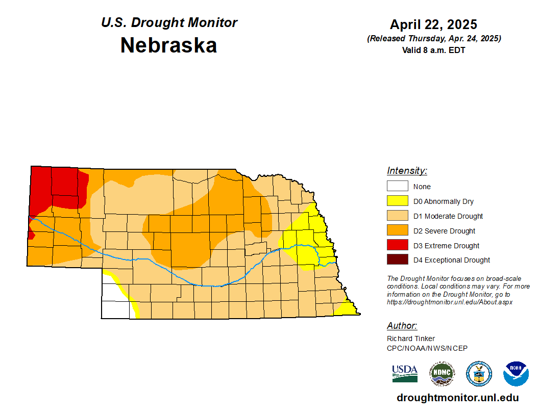
Figure 2. Latest U.S. Drought Monitor
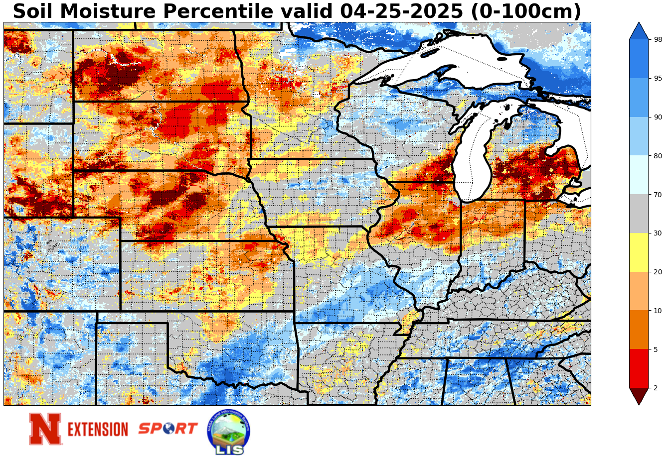
Figure 3. Latest soil moisture percentiles based on modeled output from NASA's SPoRT LIS
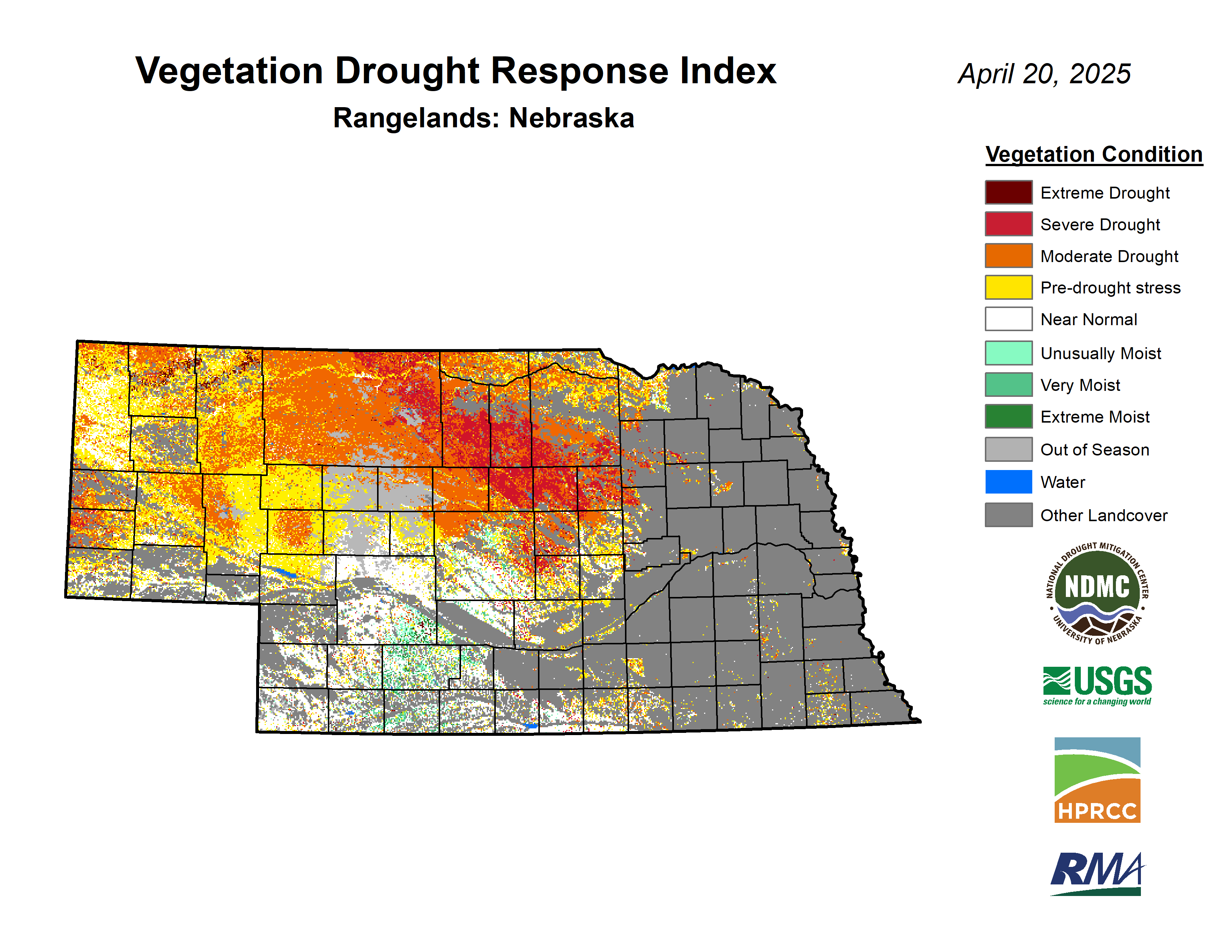
Figure 4. Latest VegDRI map
Omaha area flooding yesterday
An upper level low moved through the region yesterday and was able to tap into richer low-level moisture and deliver enough instability to produce rain and thunderstorms across south central and eastern Nebraska. Amounts varied significantly but totals over a half inch were common with amounts of 1-2" more common in Saline, Jefferson, Dodge, Sarpy, and Washington counties. Peak near the Kansas border was found in Western Jefferson County, which had 3.15" (Gilead 3.17 E).
Flooding was a big problem in the eastern half of Omaha yesterday. Two separate rounds of storms in the late afternoon and early evening hours produced very intense rainfall rates, which were over 4"/hour at Omaha Eppley around 6:00 PM and may have been worse in the hardest hit area around Saddle Creek. The storms also brought hail and a tornado just across the river in Iowa. A CoCoRaHS observer (Omaha 2.9 W) near the flooding video reported 3.15" total and it is likely much of that fell in two separate 20-25 minute bursts. Video coverage and the archived radar loop from yesterday are available in the Related Links.
Additional severe weather will be possible Sunday afternoon across the state and on Monday afternoon/evening in eastern Nebraska. Greatest risk on Sunday is in north central Nebraska where the SPC currently has a slight risk in place.
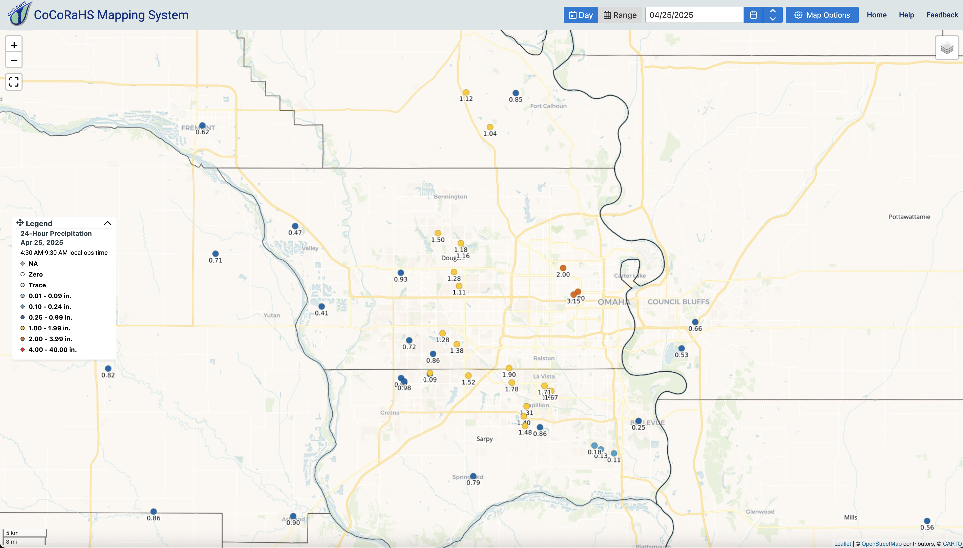
Figure 5. Observed precipitation in the Omaha metro area yesterday


