Heat wave this weekend
It's a warm one across the state today and storms are likely for most at times in the next 36-40 hours. Amounts over an inch seem probable for most of south central and southeast Nebraska and a half inch seems a reasonable prospect for almost everyone. That rain will be welcome as it has been dry and warm for the last week in much of the eastern half of the state. More importantly the moisture is needed before we enter a 3-4 day stretch of heat and breezy conditions later this week.
By Friday morning a ridge will be building in the central U.S. (Figure 2) and there will be a very warm nose of air at 850-mb moving into Nebraska (Figure 3).
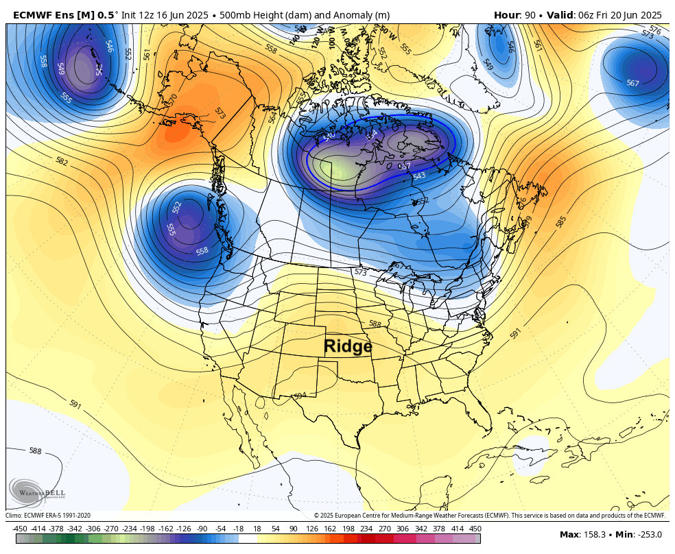
Figure 2. 500-mb height anomalies on Friday morning
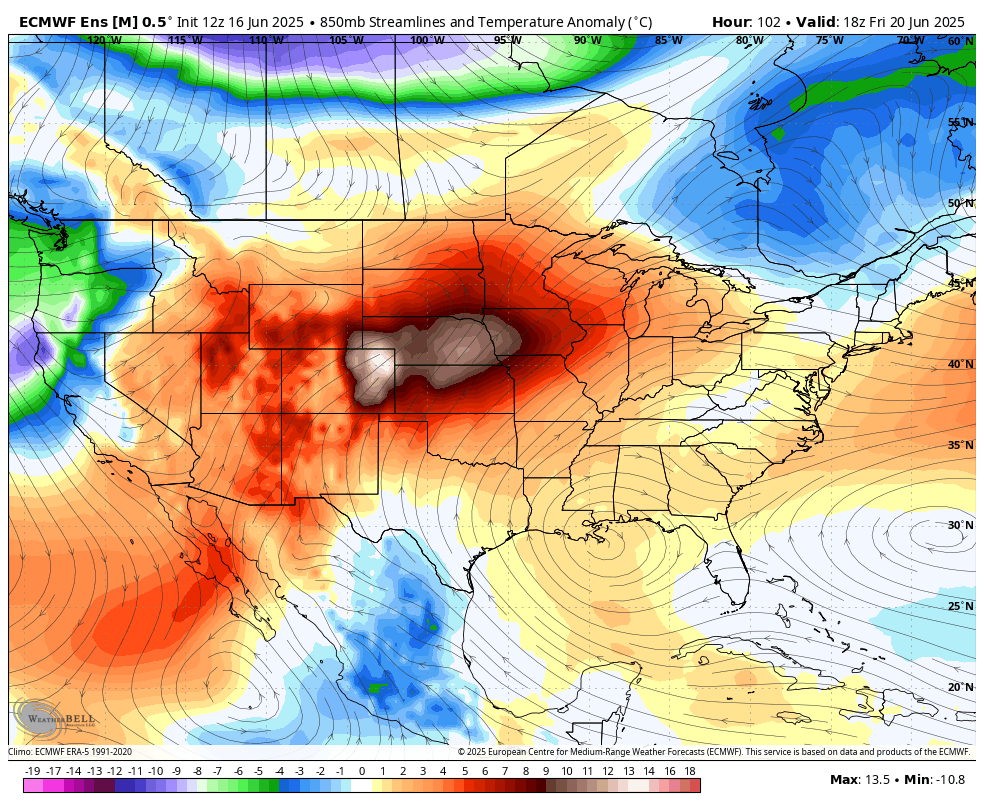
Figure 3. 850-mb temperature anomalies
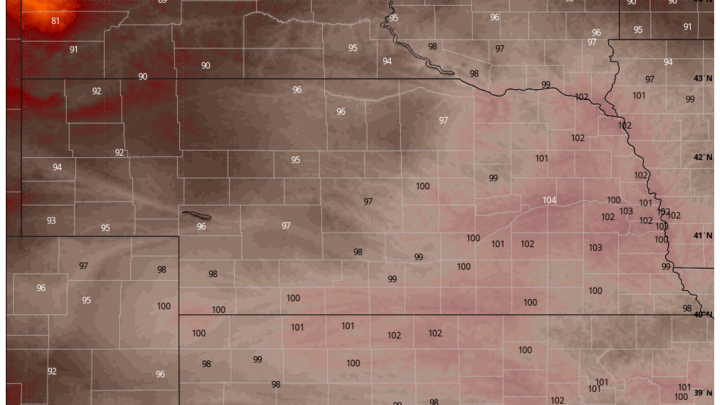
With a stronger pressure gradient setting up wind speeds will increase at the surface across the region and the warm/hot air mass should mix down reasonably well to the surface. This will lead to temperatures getting into the 90's most of the state by Thursday afternoon and well into the 90's on Friday, with temperatures over 100°F likely in southwest Nebraska. Saturday will also be another hot one with temperatures likely being around Friday's levels.
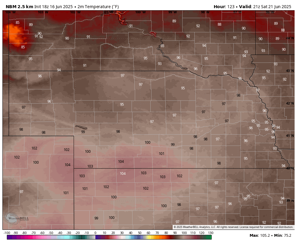
Figure 4. Temperature forecast for 4 PM CDT/3 PM MDT on Saturday
The wild card is how high dewpoints manage to get. We aren't to peak crop ET yet but there may be enough transpiration and low-level moisture transport from the south to keep things more humid than currently projected by models, especially in eastern NE. Regardless, the heat index likely be around 105°F on Friday and Saturday afternoons in the southeast quadrant of the state and around 100°F elsewhere. If mixing is even greater than currently expected, air temperatures may crack 100°F across all but the far northern sections of the state. But if that happens, the humidity will be lower and with a breeze, human and livestock heat danger levels will remain below the most extreme levels.
For those interested, the heat index at first pitch Saturday in Omaha is likely to be at or above 100°F and the wet bulb global temperature (WBGT) is expected to be around 83. That is in the moderate danger category. Hot but probably not hot enough to postpone the game. Lower wind speeds and/or a little higher dewpoints would push it into the high danger category.
How long will it last?
The warmest air at 850-mb and 700-mb will push off to the northeast on Sunday so temperatures should be a bit cooler on Sunday afternoon. A front will move through the state next Monday bringing a return to chances for precipitation and also cooler temperatures to the western 1/2 to 2/3 of the state. Eastern sections likely will be hot again on Monday before cooling off on Tuesday. The latest ECMWF ensemble shows a stout ridge over the Eastern Corn Belt next week with troughing in the northwest. This should open a corridor of showers and storms in the Western Corn Belt and keep the warmest temperatures should be to our east and south. But southeast Nebraska may see temperatures remain closer to seasonal levels.