
Fire danger risk
Fire danger will remain elevated through the evening hours with winds remaining strong out of the north. Winds back off some tomorrow and temperatures will be more seasonal, if not a touch on the cool side with highs in the upper 40's to mid 50's. Subfreezing temperatures will be likely statewide on Saturday morning, so any sensitive vegetation that has started to bud will be vulnerable. By midday Saturday, high pressure will have moved east into the Ohio River Valley. A tight pressure gradient will exist in the Central Plains and Western Corn Belt and wind speeds will be in the 20-30 mph range by late Saturday morning over the eastern 2/3 of the state. Temperatures will rebound nicely on Saturday but the south winds will just be bringing in dry air from the east instead of from the Gulf. Thus, relative humidity levels will be low on Saturday. With strong wind speeds, fire risk will be high in all of central and eastern Nebraska.
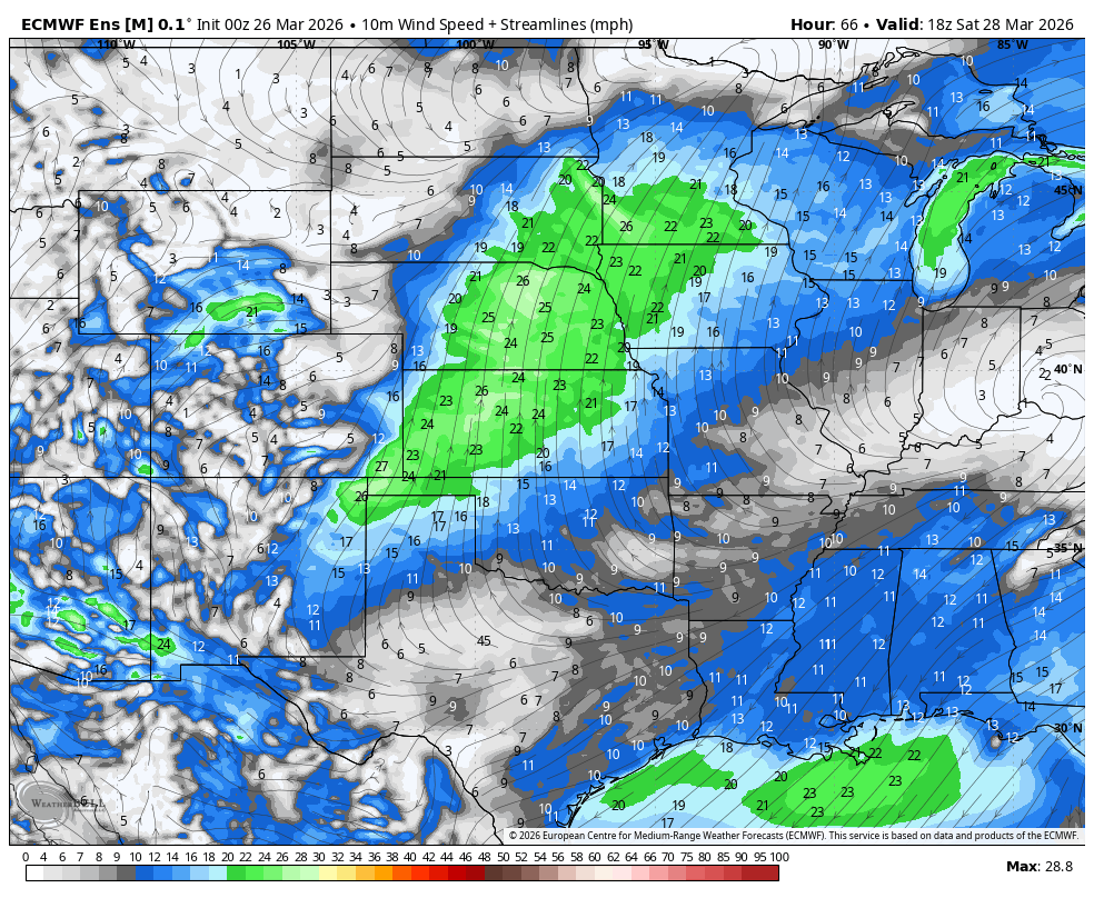
Figure 1. Projected wind speeds on Saturday afternoon
Fire danger will likely be at critical levels in the Panhandle on Sunday. West winds, warm temperatures, and very low relative humidity will lead to high fire danger.
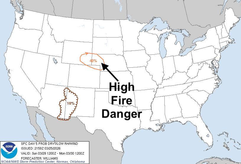
Figure 2. Critical fire danger risk from eastern Wyoming into the Panhandle on Sunday
Very warm start to the week
Very warm temperatures for late March will return on Sunday and highs likely be in the upper 70's to lower 80's east and north. Highs in the middle to upper 80's likely will be more common in the western and south central sections of the state. Ridging moves east on Monday and the warmest of the air mass likely will reside between central Nebraska and western Iowa. Highs in the 80's likely statewide and may be well into the 80's for central and eastern Nebraska.
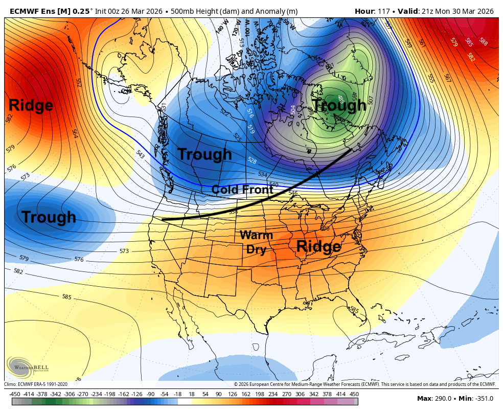
Figure 3. 500-mb height anomalies on Monday afternoon
Mid-week moisture?
But a cold front will be moving through the state by later Tuesday, which will start cooling things off. Available moisture looks unimpressive along and behind the front but forcing will be strong, so it's possible that we could see scattered showers later Tuesday. Wouldn't be a lot but it would be better than nothing. Better chances of moisture come in later Wednesday into early Thursday when a shortwave moves into the Central Plains from the Rockies. Chances of a tenth to quarter inch are not 100% but it does represent the best chance of moisture that we have seen in the region for quite a while.
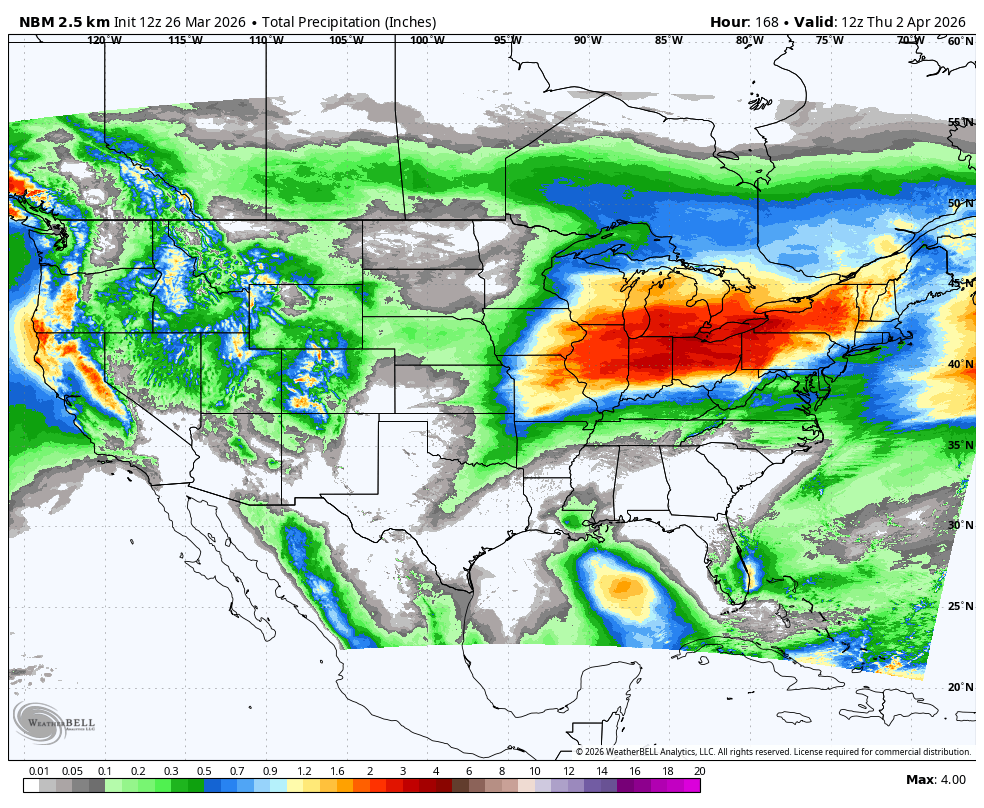
Figure 4. Projected 24-hour precipitation from the National Blend of Models through Thursday morning
More potent storm system later next week
By later next week, a deeper trough will be moving into the western U.S. before coming out into the central U.S. With high pressure off the East Coast, we should get some moisture coming up from the Gulf. Biggest question is how quickly the system moves.
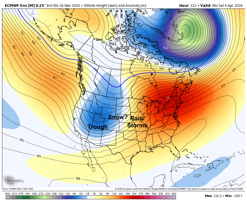
Figure 5. 500-mb height anomalies on Saturday morning
If it's faster than currently expected, then only the eastern and northern fringes of Nebraska are likely to see any respectable precipitation. But if it's a little slower (as is currently expected), then the chances for accumulating snow in western Nebraska and heavier precipitation in the eastern third to half of the state become more likely. Severe weather may be possible in southeast Nebraska and points east. Recommend paying attention to the forecast next week. The good news is the ECMWF ensemble does show a reasonable chance of over a half inch of rain for eastern Nebraska and some chance of a half inch out to the Highway 183 corridor. Behind the storm system temperatures will drop to below seasonal averages and it will be windy from the north. A cooler than average Easter is probable and it's not impossible some of the northern Panhandle could have a white Easter.


