
High wind warnings
Another sharp upper trough will be diving into the north central U.S. over the next 24 hours and will bring a chance of rain tonight in the eastern half of the state and much colder temperatures tomorrow. At the surface, a strong cold front will be moving through the state later tonight and there will be a surface low moving through the region along that front. A strong surface high will also be building to the west. This will create a very tight pressure gradient and strong winds from the northwest across the state. The strongest winds will be felt in the Panhandle early in the morning and those winds will move toward the east into eastern Nebraska and Iowa during the morning and early afternoon hours. High wind warnings are in place tomorrow for all but the southeast corner.
Wind speeds over 70 mph will be possible between Highways 281 and 83 in the late morning and early afternoon hours. Gusts to 55 mph will be possible statewide and blowing dust will be an issue. Fire danger risk will be high and power outages will be possible. Be prepared for limited to no visibility in areas experiencing dust storms, which will be likely in areas where fallow fields without cover crops are common.
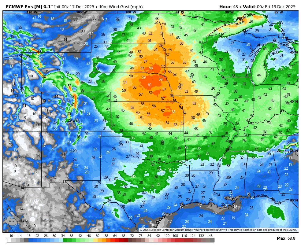
Figure 1. Projected wind gusts tomorrow afternoon.


