Warm and windy Panhandle. Cold and gloomy east
Most of the state is stuck with low clouds and cold temperatures. In eastern Nebraska there is patchy fog and freezing drizzle. Minor ice accumulations are possible in far eastern NE. But in the Panhandle the sun is shining and a much warmer air mass is about to invade from the west.
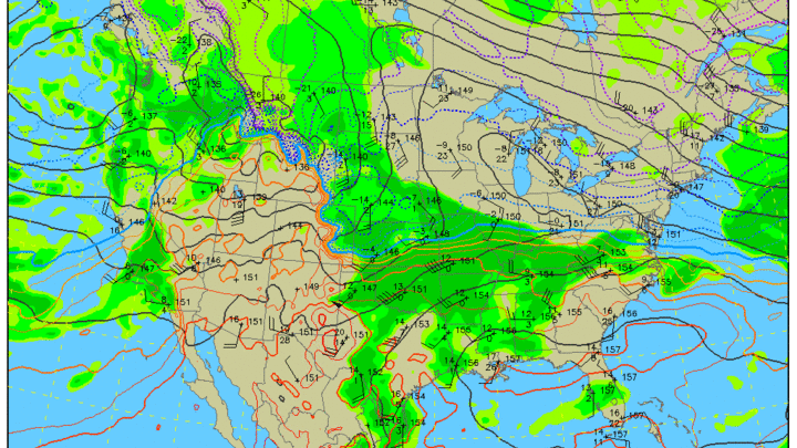
The 850-mb plot (above) shows a much warmer air mass existed along the Front Range this morning, with temperatures likely being almost 20C warmer between the North Platte observation of -14C (~5F) and Cheyenne, WY. With this air mass moving into western Nebraska and optimal downslope westerly winds this afternoon, temperatures are going to shoot up into the 60's. This will create quite the west to east temperature gradient across western Nebraska this afternoon. It may be 30-35F warmer in Sidney than in North Platte (Fig. 2, below). Temperatures also will climb rapidly after the warmer air mass moves in. The Bushnell Mesonet in the far southwest corner (elevation of 5200 feet) climbed from 28°F to 54°F in the last hour.

Figure 2. Forecast temperatures at 1600 CST/1500 MST.
While the warm temperatures may be welcome, the wind will not be. No advisories have been issued in Nebraska but southeast Wyoming has high wind warnings posted. Be advised that winds may gust close to 50 mph this afternoon in the Panhandle. The HRRR forecasts sustained winds over 30 mph for both Kimball and Alliance. Given the lack of snow cover and ongoing drought conditions, fire danger will be high this afternoon.
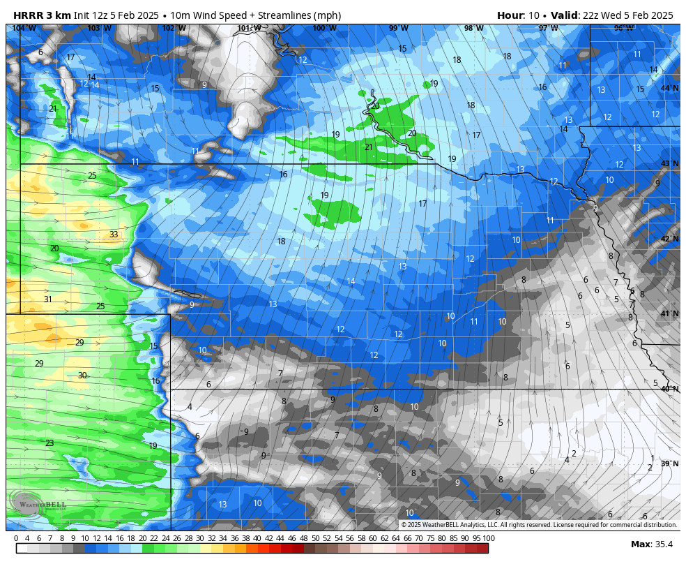
Figure 3. Forecast wind speeds this afternoon