Summary
June 2025 was warmer and wetter than average (Fig. 1). The average temperature for the state of Nebraska in June 2025 was 70.6°F, which was 2.3°F above the 20th-century average and the 35th warmest overall. All climate divisions in the state were above average. Nebraska's average precipitation in June 2025 was 4.90 inches, which is 1.21 inches above the 20th-century average and the 19th wettest on record. It was the wettest June since 2018 and all climate divisions except the Panhandle were above average for precipitation for the month. For the U.S. as a whole, it was the 7th warmest and 32nd wettest June on record. The U.S. has not been below the 20th century average in June for over 20 years.
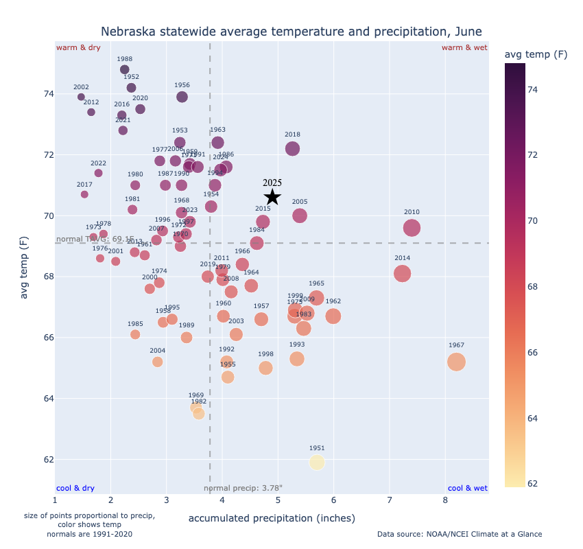
Figure 1. Statewide average temperature and precipitation anomalies compared to years since 1951.
Below are relevant maps from NCEI's Climate at a Glance for June 2025:
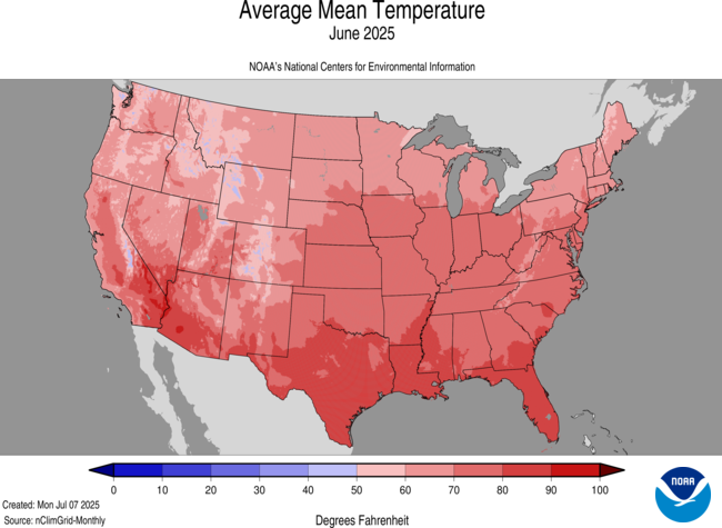
Figure 2. Average mean temperatures in June 2025
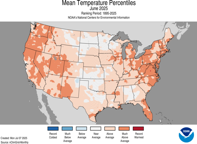
Figure 3. June 2025 average temperature percentiles
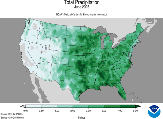
Figure 4. June 2025 total precipitation
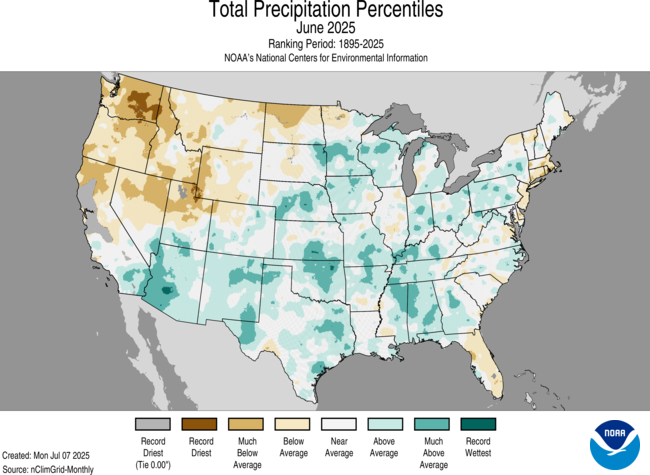
Figure 5. June 2025 total precipitation percentiles
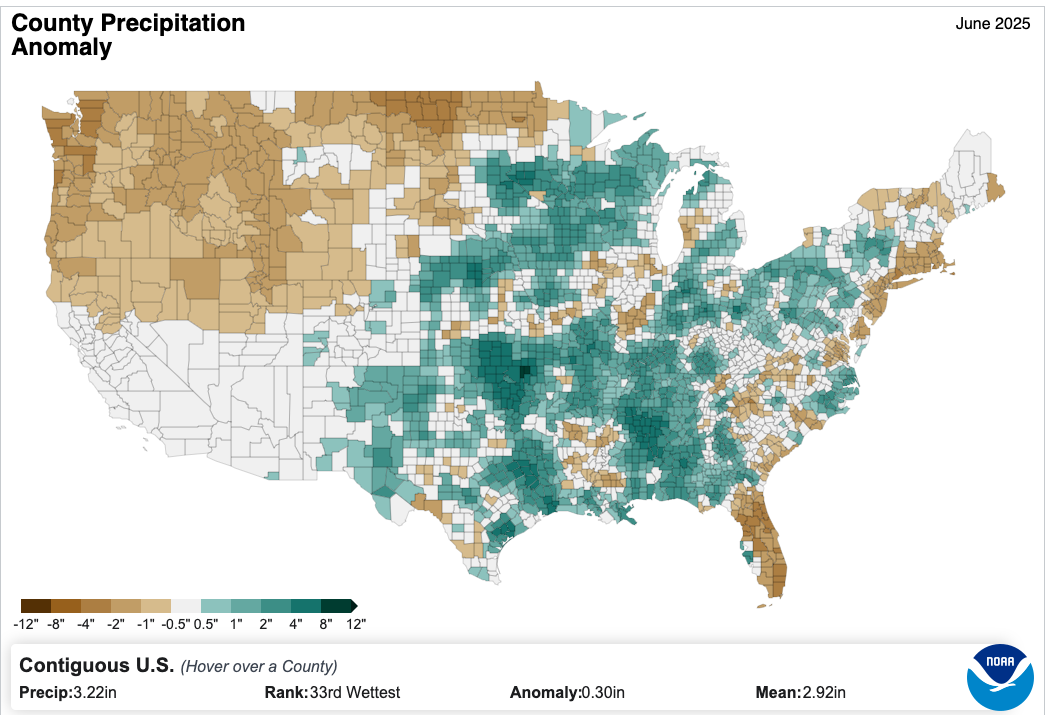
Figure 6. County-based precipitation anomalies
Drought improvements
Precipitation was above average across much of central and northeast Nebraska and this region of the state saw broad one and two category improvements in drought. The heaviest precipitation fell during the week of June 22nd with Grand Island receiving record rainfall on the 25th-26th. See the related links article for the story on the Grand Island flooding event. There were parts of southeast Nebraska that generally missed out on the most significant precipitation did see a 1-category decrease. The above average precipitation across much of the state did help improve soil moisture, which benefited cropping systems and pastures.
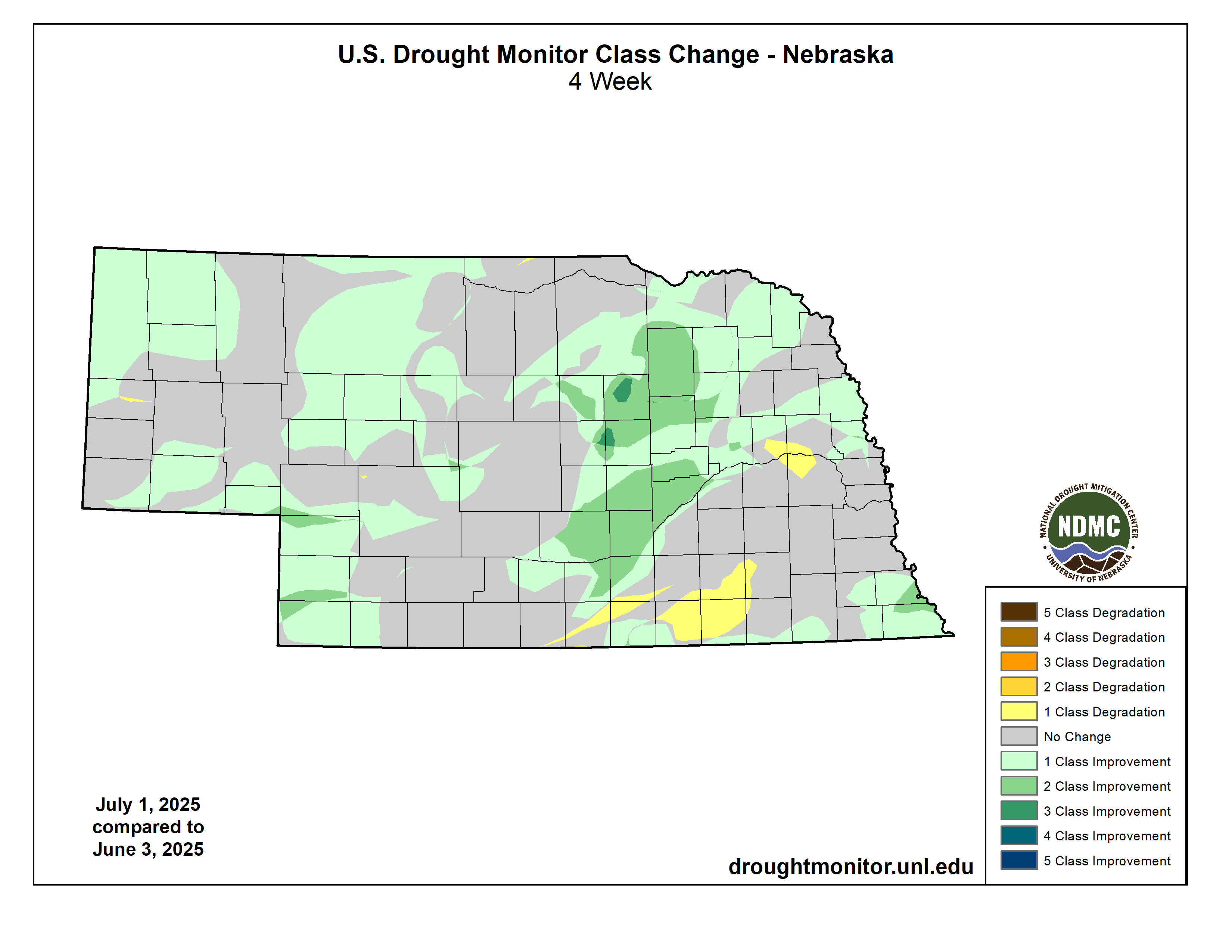
Figure 7. Drought Monitor categorical change
Storm reports
June was fairly average for storm reports with the highest concentration of severe storm reports coming out of western Nebraska. June 15th had the highest number of storm reports with 57, split about equally being wind and hail.
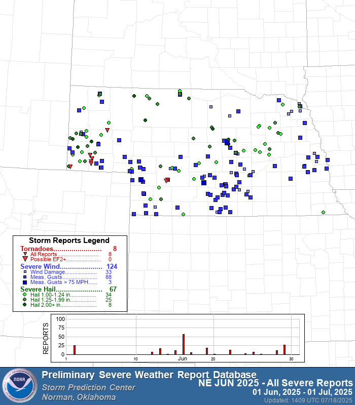
Figure 8. Total storm reports for June 2025
Temperature and precipitation extremes
Record daily warm minimum temperatures were observed in Hastings, Norfolk, Omaha, and Lincoln during the period of June 21-22. For Omaha and Norfolk these were tied for the warmest minimum temperatures set in the month of June going back to the late 19th century.
Here are the temperature and precipitation extremes around the state in June 2025:
Maximum high temperature: 107°F, Springview 2 NW
Minimum high temperature: 54°F, Bushnell 15 S
Maximum low temperature: 82°F, Omaha Eppley Airfield
Minimum low temperature: 36°F, Agate 3 E
Maximum precipitation: 12.87", Loup City 7.1 NNE
Minimum precipitation: 1.28", Alliance 10.1 SW