Main highlights
The average temperature in Nebraska for March 2025 was 44.2°F, which was 8.4°F above the 20th-century average and was the 5th warmest overall. There were no major cold outbreaks in the state and no location went below 0°F during the month. However, it was cold enough to support two different blizzards and some locations in the state more than doubled their season to date snowfall totals. More on the blizzards in a bit.
Nebraska's average precipitation in March 2025 was 1.13" inches, which is -0.15 inches below the 20th-century average and 65th driest on record. Precipitation was around average across most of the state. Pockets of above average precipitation were found in northeast and north central Nebraska where heavier snow fell. The area along the Kansas border was generally drier than average, thanks to spending longer in the dry slot of many storms.
Figures
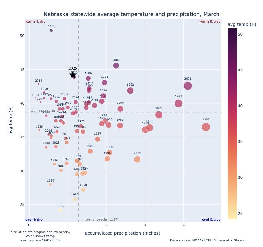
Figure 1. Quad chart of average temperature and total precipitation relative to other years
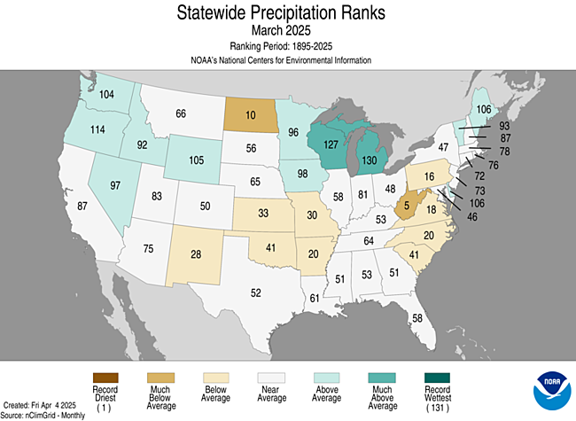
Figure 2: Statewide Precipitation Ranks
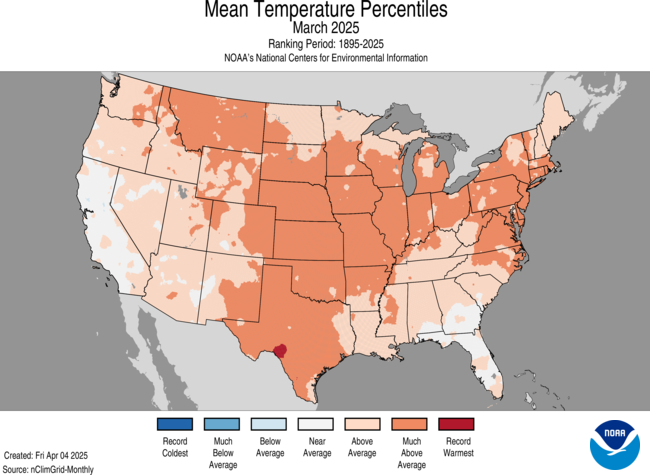
Figure 3: Mean Temperature Percentiles
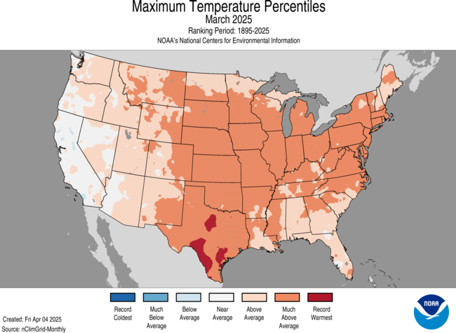
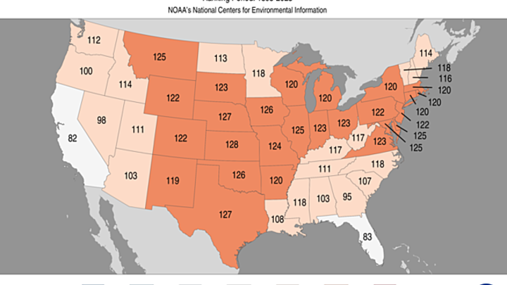
Figure 4: Maximum Temperature Percentiles
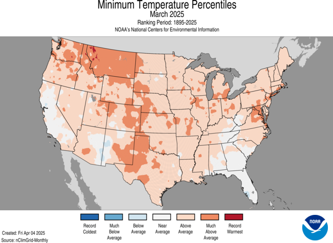
Figure 5: Minimum Temperature Percentiles
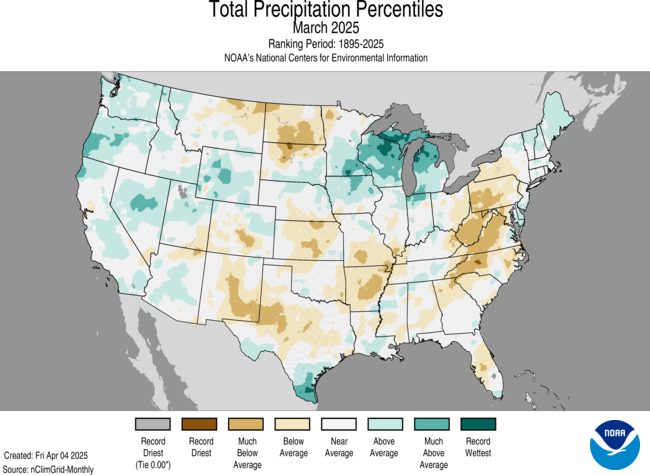
Figure 6: Total Precipitation Percentiles
Blizzards and wind
Just looking at the statewide statistics of temperature and precipitation for March, it would be easy to assume there were no major snowstorms. But Mother Nature does have a sense of humor so that's not exactly what happened. There were multiple events with significant snow across the state in March. The first came on March 4th into early March 5th when a blizzard affected eastern sections of the state. Wind gusts over 55 mph were common and the transition from rain to sleet and then snow made for quite a mess. Some areas around Omaha received significant rainfall before the transition to frozen precipitation. Significant snow fell across much of the northern sixth of the state a few days later, with upwards of 10" in spots around Valentine.
The more impactful blizzard affected the state on March 19th with a transition from thunderstorms to heavy snow and very high winds. An article from last month that recaps the blizzard is available in the Related Links. It also was a windy month in general and may have been the highest average wind gusts on record for many places in the state.
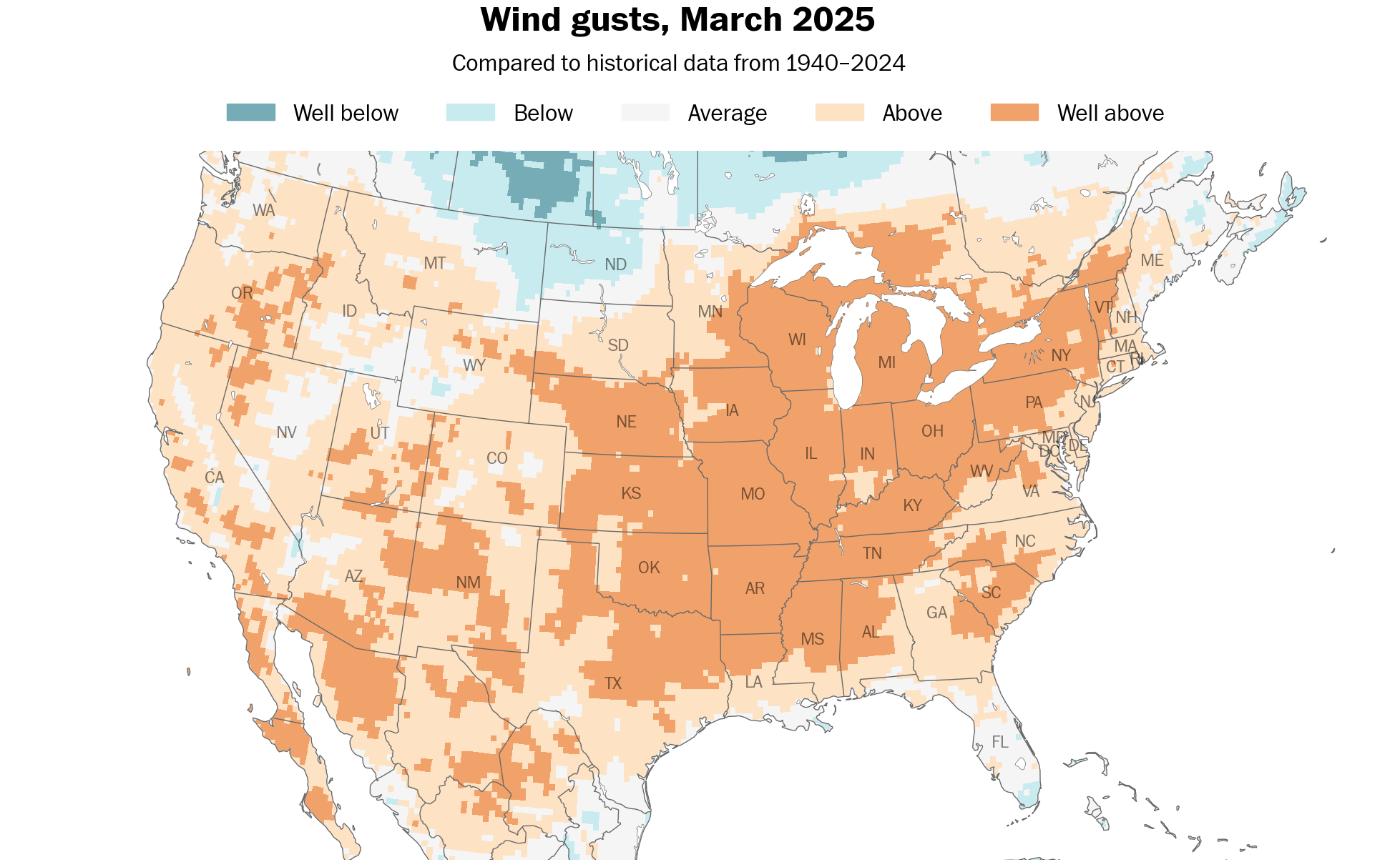
Figure 7. Wind gust average in March 2025
Drought Update
The state as a whole was not wet but areas that had more significant precipitation, including the western Sand Hills and much of south central and eastern Nebraska, did see a 1-category improvement on the Drought Monitor. This officially eliminated drought from much of east central Nebraska. Portions of far southeast Nebraska and the southern Panhandle did see some degradation during the month.
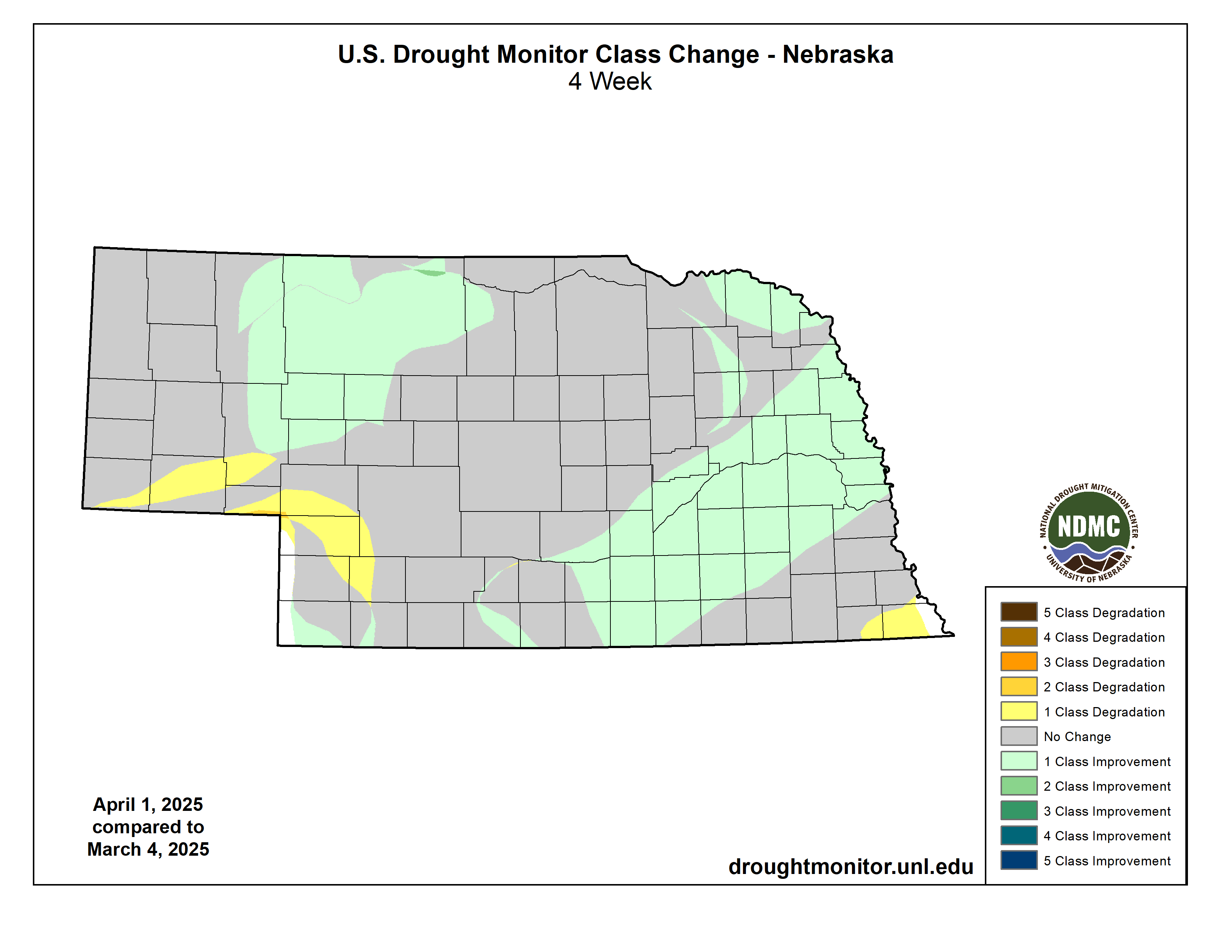
Figure 8: Changes in Drought Monitor category in March 2025
Temperature and Precipitation Extremes
Maximum high temperature: 90°F, Cambridge
Minimum high temperature: 27°F, Bushnell 15 S
Minimum low temperature: 3°F, Valentine Miller Field
Maximum low temperature: 63°F, Lincoln Airport
Maximum precipitation: 4.74", Bennington 2.9 SSW
Maximum snowfall: 17.0", Lyons


