
BLUF:
Severe storms possible this evening in southeast Nebraska and a warm to hot day tomorrow. Cooler, wetter weather this weekend, with the best moisture falling in the northeast quadrant of the state. Snow possible in the Sand Hills and Panhandle. Additional moisture likely mid-week, with rain east and snow/wind possible in western and north central Nebraska. Temperatures generally cooler than average next week and cool/wet may last into the middle of April. Drought improvements in parts of central and eastern Nebraska and some degradation in the southern Panhandle.
Severe storm risk
The SPC has put the southeastern part of the state in a marginal or slight risk of severe weather for this evening. By late this afternoon, model projections suggest there will be an area of enhanced vorticity at 700 mb with sufficient convective available potential energy (CAPE) to produce thunderstorms in southeast Nebraska. There also will be some warmer air aloft to overcome so the chance of getting widespread thunderstorm development this evening is rather low. Storms that are able to develop will have a hail risk. For what it's worth, the 12Z run of the HRRR is completely dry in our area this evening and the NAM only shows isolated storms southeast of Lincoln. Warmer temperatures than projected would help achieve more widespread thunderstorm development. Otherwise it will be an unseasonably warm day with highs in the 70's and 80's statewide.
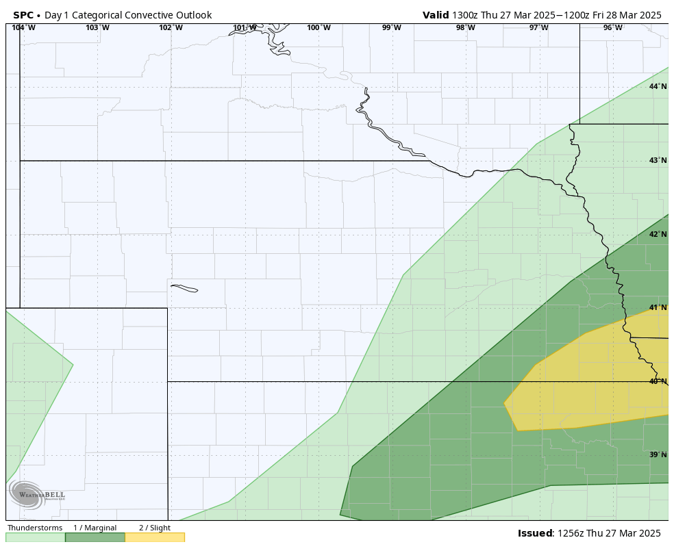
Figure 1. SPC severe storm outlook for this evening
There will be additional chances for thunderstorms tomorrow evening across central and northeast Nebraska tomorrow evening as the cold front moves into the state. Severe risk is lower tomorrow but there is still a marginal risk for severe storms according to the SPC across most of southwest, central, and northeast Nebraska. Thunderstorms do appear to be likely between Lexington northeast toward Wayne and will be possible across a broader section of the eastern 2/3 of the state tomorrow night. Widespread showers are also expected to develop across the Panhandle with reasonable prospects of a quarter inch of moisture in that area. Certainly be welcomed.
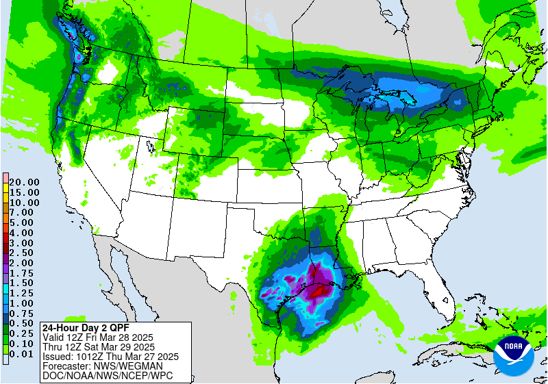
Figure 2. WPC precipitation projections for tomorrow night
Record temperatures
After a week with temperatures staying well below record thresholds, tomorrow likely will bring record temperatures to much of central and northeast Nebraska. 90°F will be possible in the eastern Sand Hills tomorrow afternoon as there will be optimal downslope flow and mixing of a very warm air mass ahead of the cold front. Temperatures will be a bit cooler in the Panhandle (70's) but every one else should easily exceed 80°F tomorrow afternoon. Daily record highs are in danger in places like Ord, Hastings, and Norfolk. All-time record highs for March could be achieved at O'Neill and Niobrara.
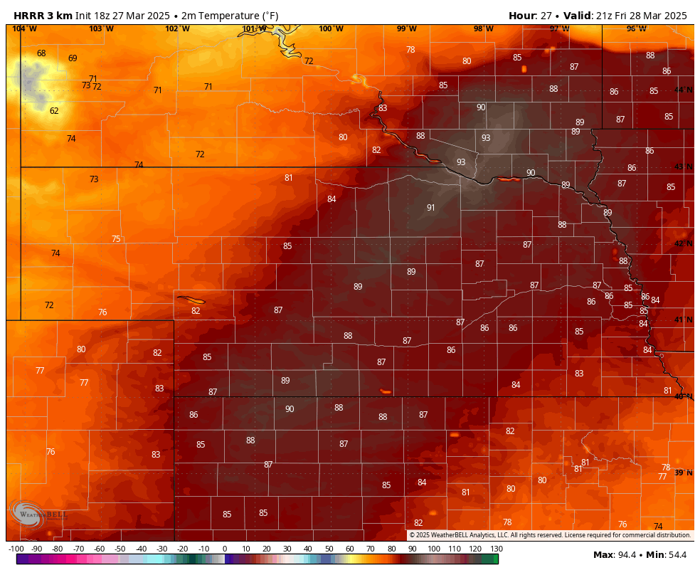
Figure 3. Projected temperatures at 3:00 PM CDT/2:00 MDT tomorrow.
Wet weekend. Snow 24 hours after 90°F?
Two different systems will traverse the state this weekend bringing chances for moisture to everyone. In the first system, the surface low is projected to move parallel the Platte River through the state, with the best moisture falling to the north and west of it with some chance of scattered showers and thunderstorms to its east. Thus, widespread showers are expected across the western and northern sections of the state with scattered showers and thunderstorms possible in southeast Nebraska. This likely will not be much of a rain maker for areas along the Kansas border in south central Nebraska.
Rain likely will transition to snow across western and north central sections of Nebraska later Saturday, including places in north central NE that may have been 90°F just a little over 24 hours earlier. Warm ground temperatures would limit accumulations but areas with higher snow rates could get 3-4" on grassy surfaces. Latest model runs show a good chance of 1-2" of snow across the Panhandle and western side of the Sand Hills. Temperatures will be much cooler statewide by Saturday evening with temperatures in the 30's and 40's for all but the far southeast.
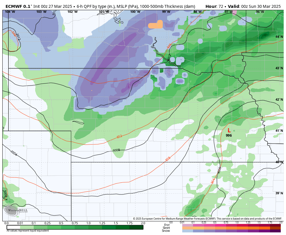
Figure 4. ECMWF projection of precipitation and precipitation type on Saturday evening
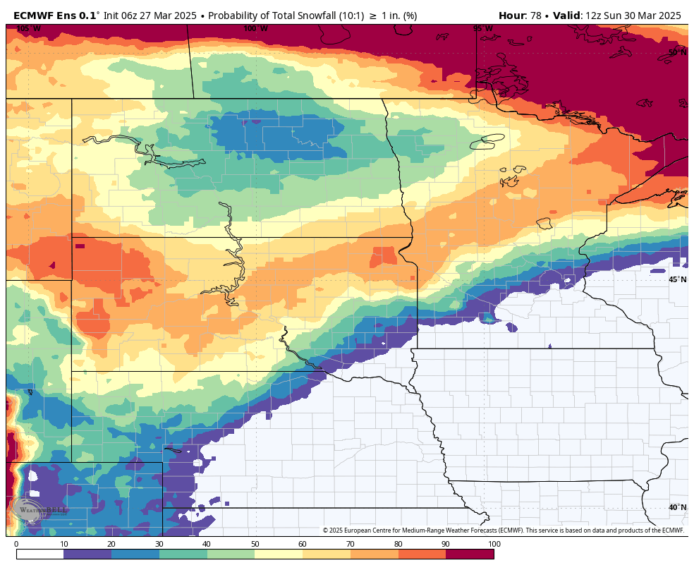
Figure 5. ECMWF probability of 1" of snow by Sunday morning
Another system will move into the Central Plains on Sunday with rain likely Sunday afternoon across south central and southeast Nebraska. Snow possible across portions of central and western Nebraska. Total precipitation amounts are not likely to be terribly significant but the system on Sunday should bring beneficial moisture to portions of south central and southeast Nebraska that miss out earlier in the weekend. It will be a raw, breezy day for all on Sunday with highs in the 30's across the Panhandle and Sand Hills. Highs in the low to mid 40's in southern and eastern sections of the state will be prominent.
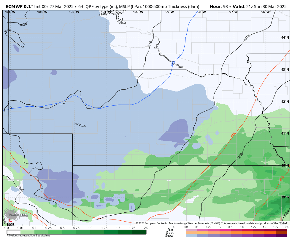
Figure 6. Figure 4. ECMWF projection of precipitation and precipitation type on Sunday afternoon
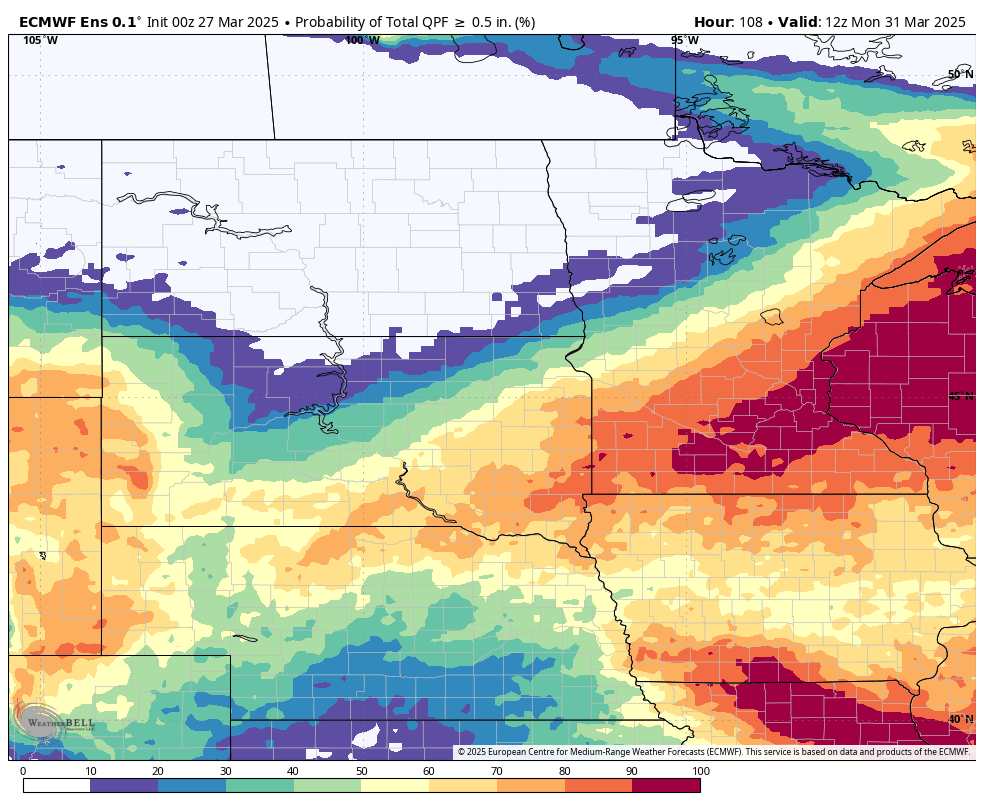
Figure 7. ECMWF probability of 0.5" of total moisture by Monday morning
Cooler, wet week ahead
Drier weather should be the rule statewide on Monday and most of Tuesday but temperatures will remain seasonally cool, especially on Monday. Another deep upper-level trough will move into the western U.S. by Tuesday afternoon and a surface low is expected to develop in the lee of the Rockies. This will push to the east into northern Kansas and then northeast into Iowa and Minnesota on Wednesday.
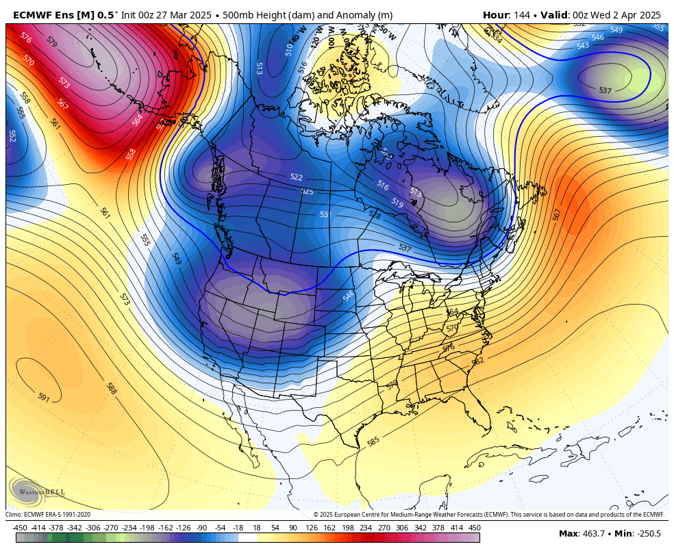
Figure 8. 500-mb height anomalies on Tuesday afternoon
Western Nebraska snow an April Fool's joke?
Rain, changing to snow in the Panhandle, will be likely by late Tuesday with precipitation chances increasing further east by Tuesday night. Moisture return looks generous ahead of the system in eastern Nebraska, so areas east of Highway 81 have a reasonable chance at over half an inch of rain by Wednesday morning. Further west in the Sand Hills and eastern Panhandle, snow is likely and it will be on the breezy side. Travel may need to proceed with caution.
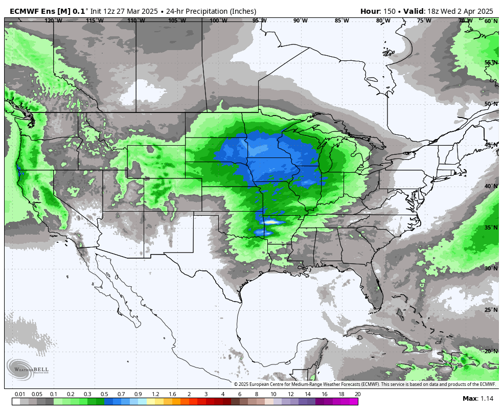
Figure 9. Projected 24 hour precipitation through Wednesday afternoon.
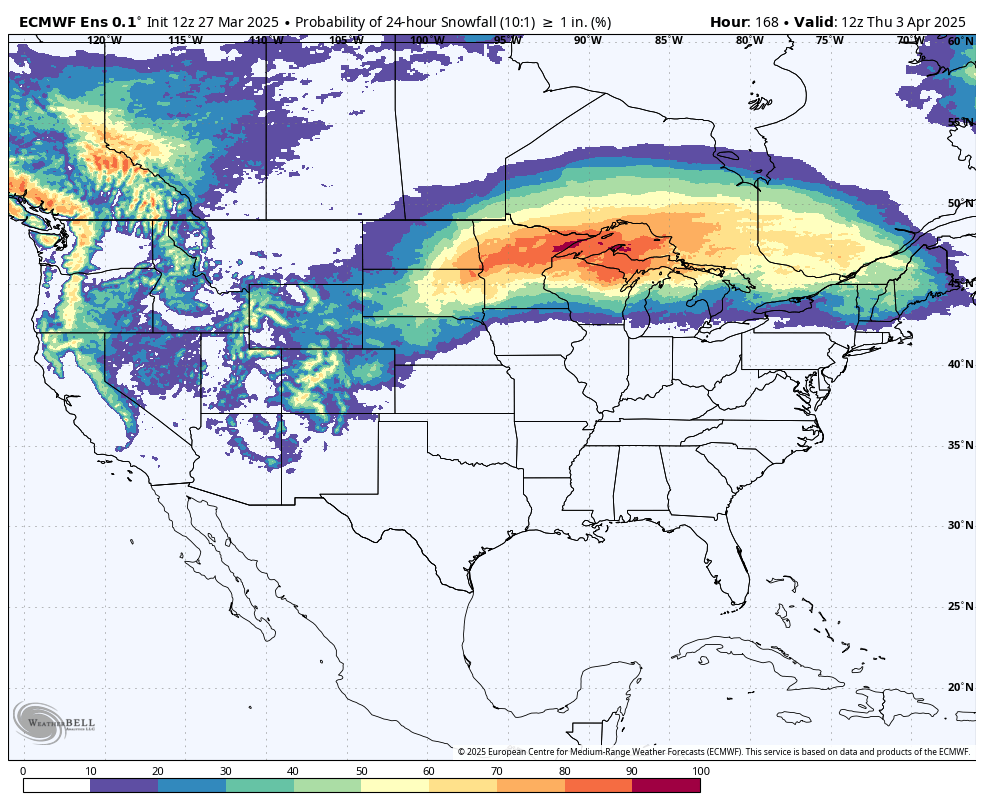
Figure 10. Chance of 1" of snow midweek according to the ECMWF ensemble
Temperatures should rebound somewhat later in the week, albeit likely not warmer than the 60's anywhere. The 8-14 day outlook from the CPC shows warmer than average favored in the period from April 3-9. It may be a little above average at the beginning of the period in eastern Nebraska but recent model runs from the ECMWF suggest a series of troughs coming into the western U.S. through the week after next. If semi-accurate, we are in for a chance of precipitation (including snow) every 2-4 days through the second week of April. This would bring very beneficial moisture to the state and the region, especially to the drought stricken Panhandle.
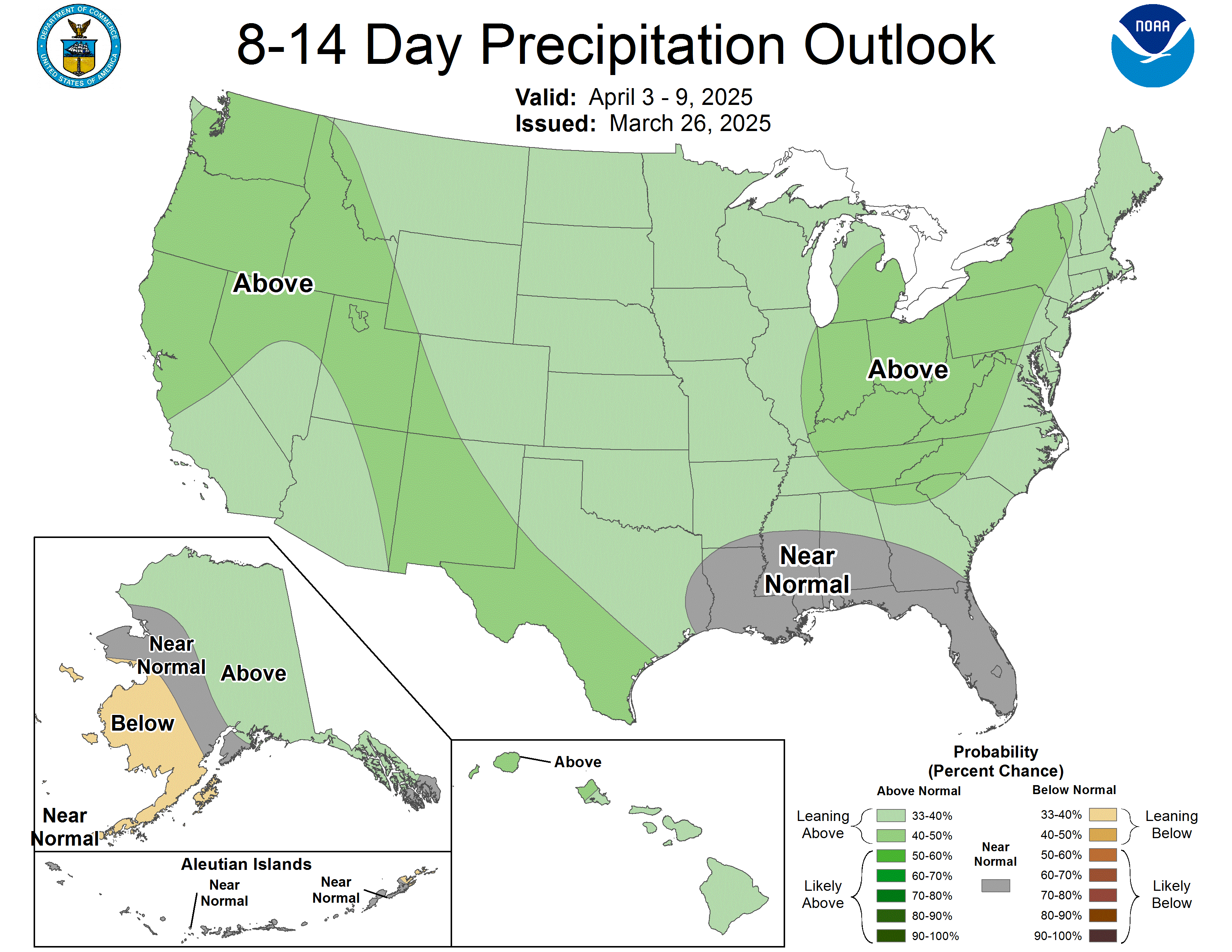
Figure 11. CPC's 8-14 day precipitation outlook
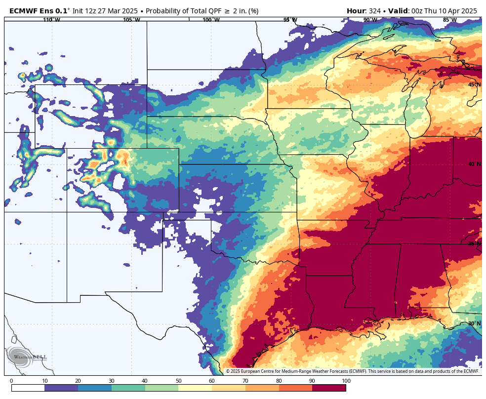
Figure 12. ECMWF ensemble probability of 2" of moisture over the next two weeks
But the unsettled weather and cloud cover also would likely keep temperatures below average during the period, especially during the day. Sub-freezing temperatures also appear to be possible in the period from April 10th to April 15th statewide. We have had a warm March (when we aren't getting blizzards) but April may be starting off on a cooler note. I also can't rule out snow as far south and east as Lincoln, Omaha, and Nebraska City the middle of the week of the 7th if a few things line up properly (or improperly depending on your perspective!)
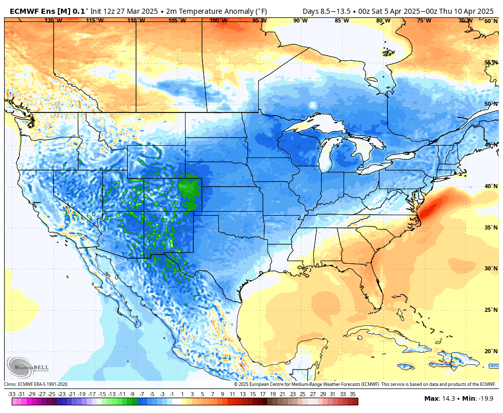
Figure 13. ECMWF ensemble projected temperature anomalies April 5-9th
Soil temperatures around the state are currently quite warm for March, reflecting the mild month. But if the forecast comes to fruition, it may be difficult for soil temperatures to punch above the upper 40's until later in April. In other words, between cooler soil temperatures and expected precipitation, early planting windows may not be there this year. But the good news is we should be getting moisture and that is good news for crop fields, pastures, lawns, golf courses, and streams.
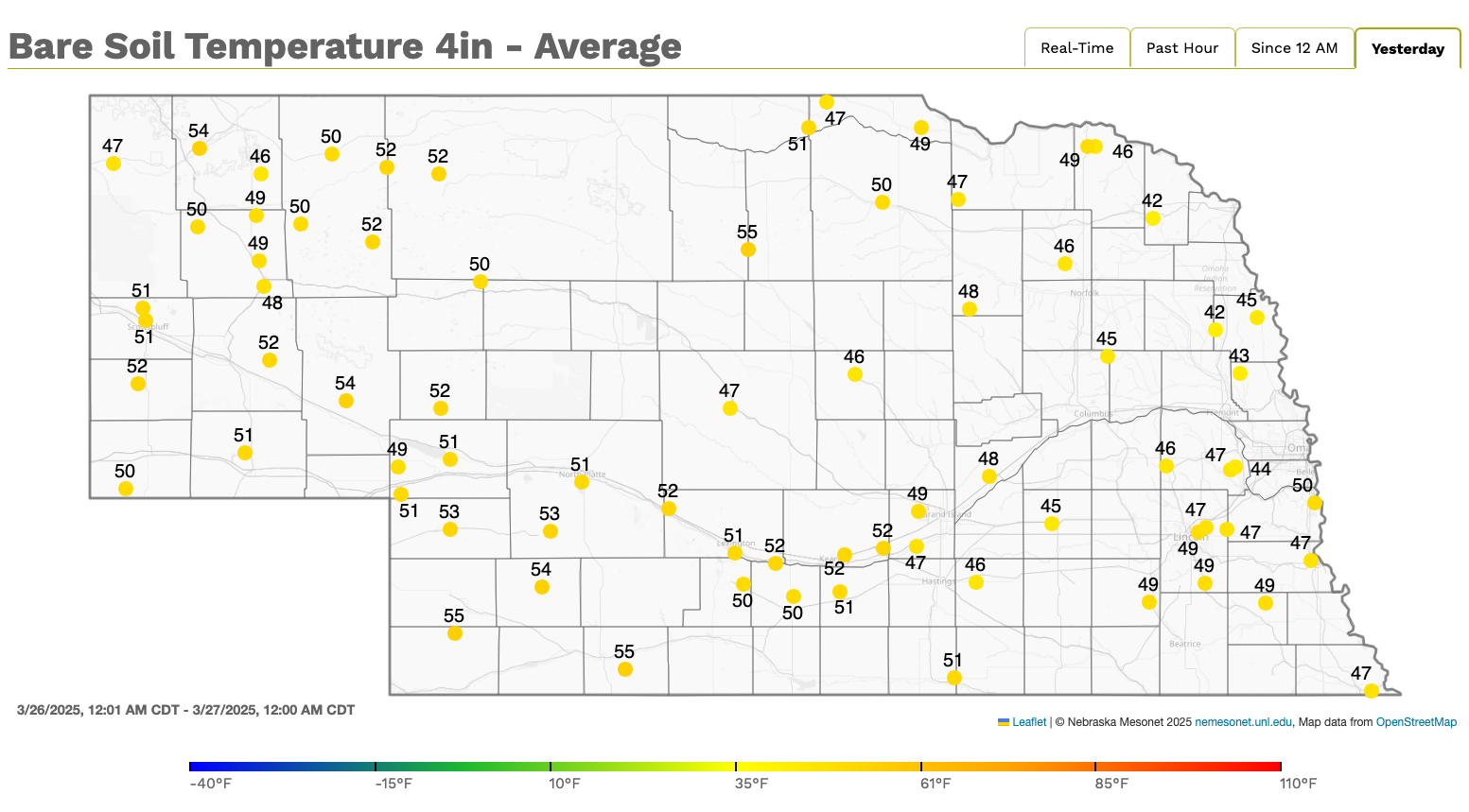
Figure 14. Current 4" soil temperatures at Nebraska Mesonet sites
Drought Monitor update
The latest Drought Monitor was released this morning and included a large area of 1-category improvements in central and eastern Nebraska based on the robust precipitation that fell last week after the data cutoff for last week's map. Drought still covers 75 percent of the state but that is down from 91 percent on last week's map. The area of severe drought in the northeast corner was upgraded to moderate drought but the percentage of severe drought in the state remained about the same, as degradation occurred in the southern Panhandle.
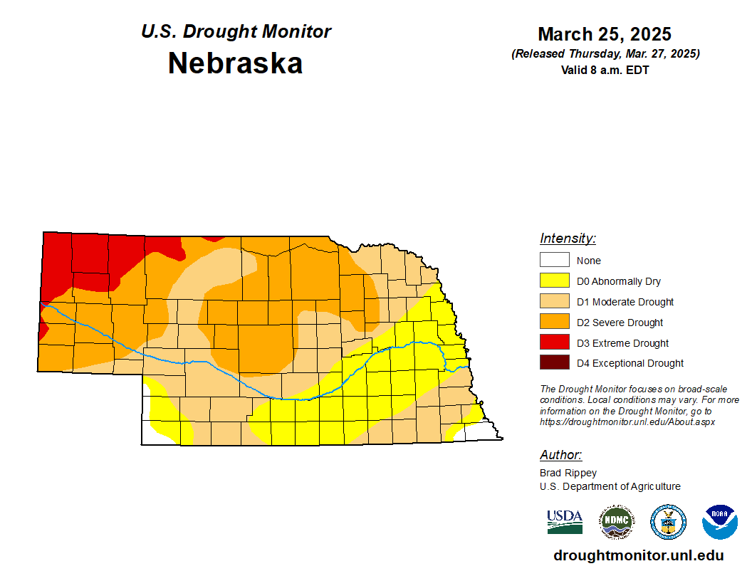
Figure 15. Latest U.S. Drought Monitor


