Drought improves
The latest Drought Monitor, which was released last Thursday morning (based on data through Tuesday AM) show that we are down to roughly half of the state in drought These improvements in drought occurred before the precipitation that fell last Wednesday and Thursday nights, which was quite significant in northeast Nebraska. But while there is a shrinking percentage of the state in severe drought and these areas have had some moisture, most of the southern part state does not have a lot of margin for error for moisture. The western Panhandle has also been missing out of late, potentially putting improvements earlier this summer in jeopardy.
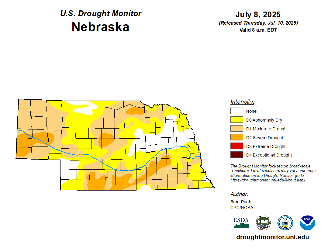
Figure 1. Latest U.S. Drought Monitor map for Nebraska
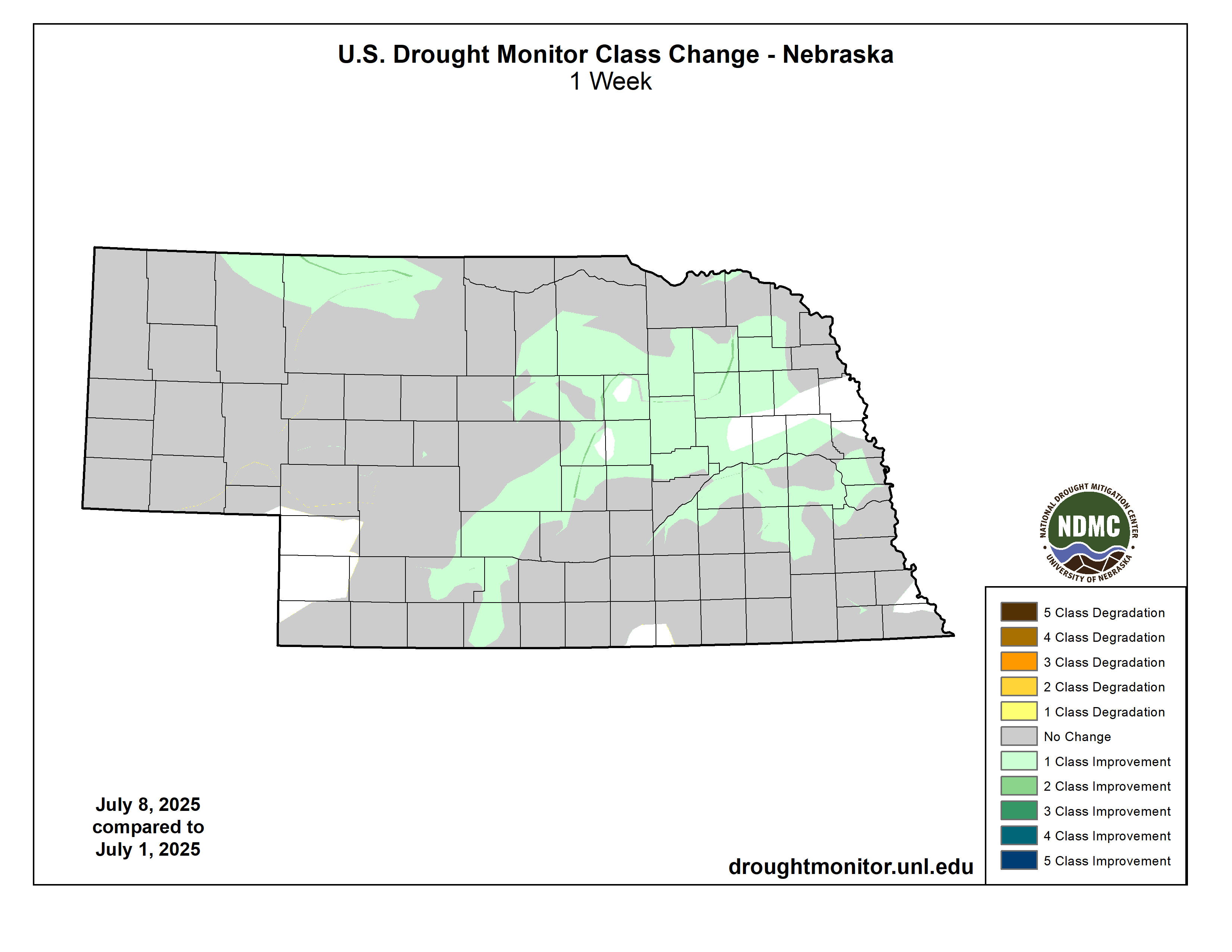
Figure 2. One-week USDM change map
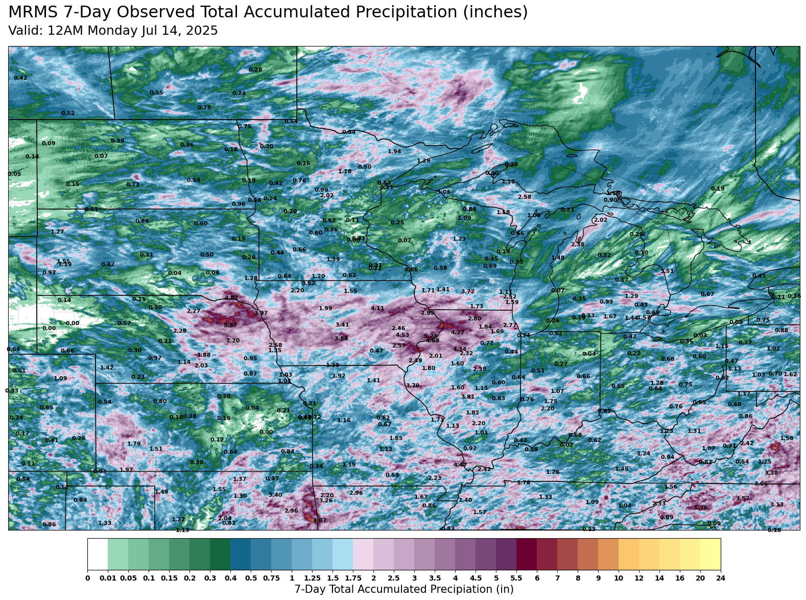
Figure 3. Seven-day precipitation totals. Figure courtesy of Eric Snodgrass, Nutrien Ag Solutions.
Severe storm and flash flood potential
Today and most of tomorrow look quiet, save for a chance of afternoon thunderstorms in the Panhandle. That changes tomorrow night as a mesoscale convective system (MCS) looks likely to develop across north central Nebraska and South Dakota later tomorrow. This would then slide toward the south-southeast into southern and eastern sections of the state. There is certainly wind damage potential across much of central and eastern Nebraska tomorrow night into early Wednesday and is the primary reason for the slight risk in the SPC's convective outlook for tomorrow. Flash flooding will also be a concern, particularly in areas of northeast Nebraska that had significant moisture last week.
Additional showers and storms will likely form somewhere between Highways 30 and 136 on Wednesday evening and sliding toward the east and southeast along the cold front. How far south the front penetrates will determine where those storms form as it will be a focal point for development. If it makes into Kansas on Wednesday morning, then our chances on Wednesday night would be confined to the southernmost counties. Additional chances of showers and storms are probable later in the week in the eastern half of the state.
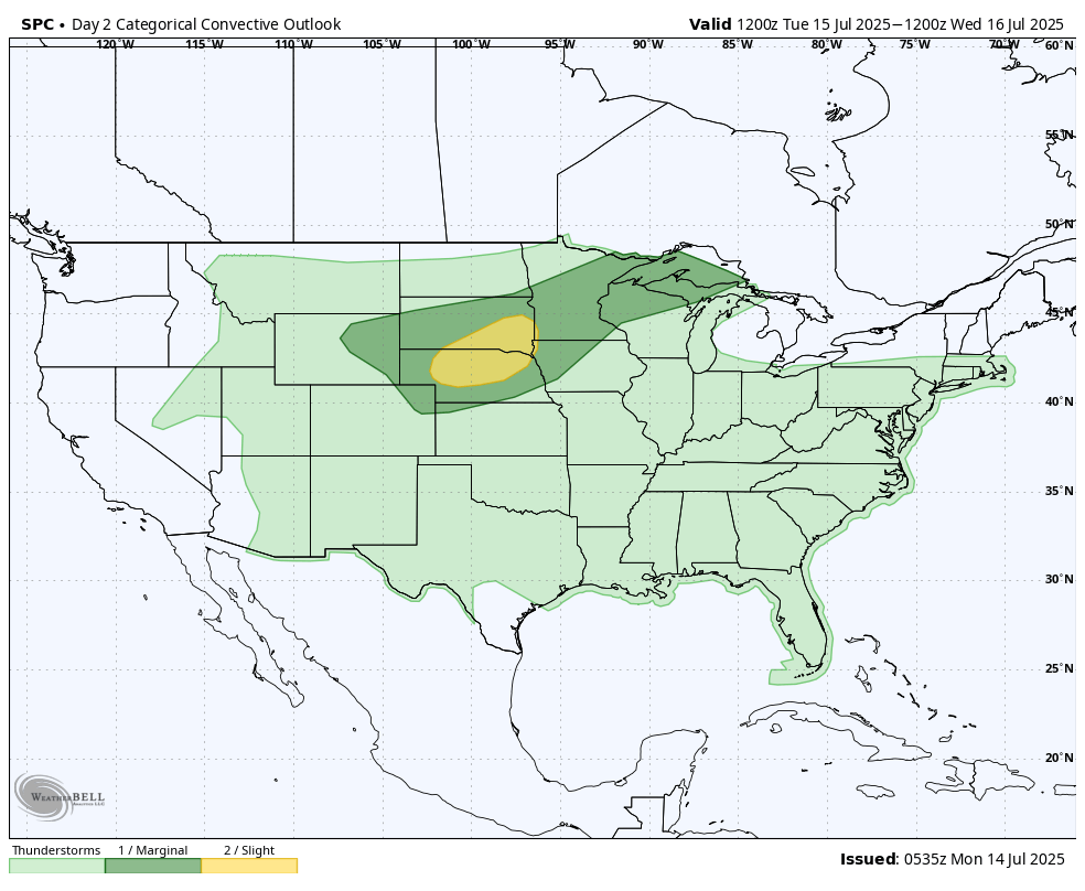
Figure 4. SPC severe storm outlook map
Heat coming back
Ridging looks to be more prominent across the central and eastern section of the U.S. as we head into the back half of next week. If this projected pattern ends up being fulfilled, then we are looking at the potential for several days in a row of hot and/or hot&humid weather being prominent across our region. Storms may be possible with this patter but this weekend may be the last chance for widespread precipitation for a bit. Storms would be more likely to our north and east in such, which could mean beneficial moisture to portions of Illinois and Indiana that need it, but the faucet may still be on occasionally in the eastern and north central sections of the state.
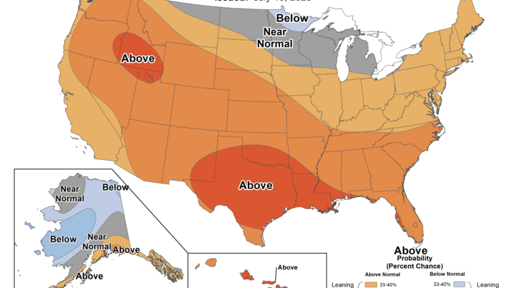
Going over drier is certainly a concern but my bigger concern is the possibility for the most prolonged stretch of heat we have seen this summer. The CPC is favoring warm in the 8-14 day period and this setup would mean highs in the 90's (possibly some lower 100's) in the afternoons with overnight lows in the 70's in south central and eastern sections of the state. Historic precedent would suggest this pattern would be in place for at least a week and I think we will have to carefully watch to see if this becomes a dominant signal into mid-August. All signs currently point toward record U.S. corn yields but a 3-week stretch of a lot of heat through the middle of the country would accelerate the reproductive stage, which would limit high-end potential. A more prolonged stretch of heat would also have detrimental impacts to livestock so my advice is to start preparing now for a hotter stretch of weather.
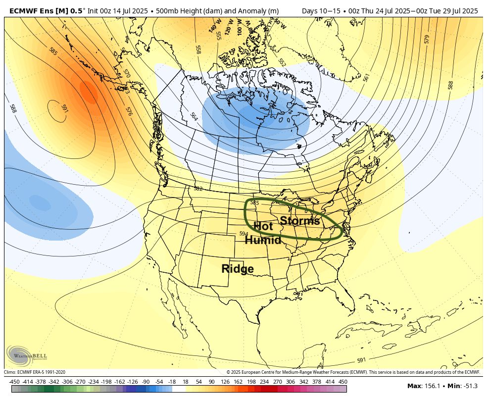
Figure 5. 500-mb height anomalies


