Thaw begins tomorrow
Temperatures across the state this morning were much colder than in Alaska but that is about to change. Upper level ridging will be moving over our region and this will bring much warmer temperatures. Expect highs to get above freezing tomorrow afternoon in the Panhandle, into the 20's in central sections of the state, and between 15-20°F in eastern Nebraska. Temperatures will still be very cold tomorrow morning in the eastern third of the state but not as cold as this morning.

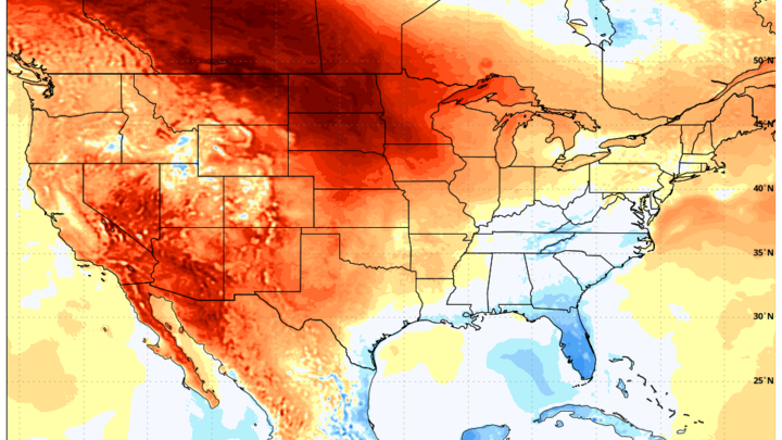
Figure 1. 500-mb height anomalies on Saturday afternoon
Temperatures warm up another 10°F on Saturday with areas east of Highway 50 possibly remaining below freezing for one more day. Western Nebraska likely will get into the 40's. Warming may be limited somewhat initially by the snow pack in the region and it's possible that Saturday's high temperatures are a bit too optimistic. But the snow pack is closer to 4-6" for most areas (not 12-18") and with the comparably stronger late February sun, we should see it melt off pretty quickly over the weekend. Temperatures should easily exceed 40°F everywhere on Sunday and much of the western third of the state should see 50-55°F.
Beach weather
Early next week will feel like beach weather compared to this week and golf enthusiasts could get in a round of golf by Tuesday. High temperatures should exceed 50°F everywhere on Monday, with the possible exception of northeast Nebraska. A run at 65°F will be probable in the western half of the state on Monday and low 60's will be possible everywhere on Tuesday if there is sufficient sunshine. If temperatures around Broken Bow were to make a run at 70°F next Monday or Tuesday, it would represent a 100°F swing in air temperature in less than a week.
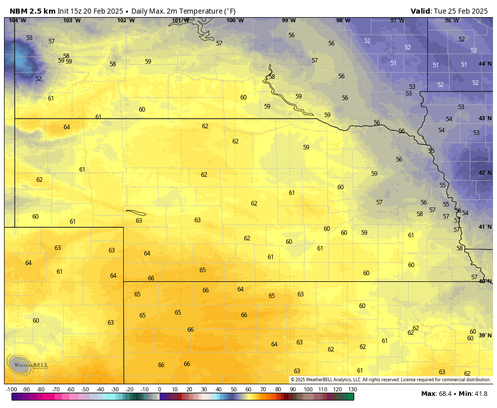
Figure 2. Forecast high temperatures on Tuesday, 2/25.
The amount of warming next week will be determined by how quickly the snow melts but imagine the snow will be mostly gone by Monday afternoon. Overnight temperatures much of next week are likely to be 20-30°F warmer than the highs were the past few days, so that will expedite the snow melt and should start allowing the ground to thaw out quickly. The rapid rise in temperatures is likely to cause ice jams on rivers around the state next week. Follow your local National Weather Service office for more details.
Rain chances
A weaker system will be moving into the state by Tuesday night and that will bring chances of rain for central and eastern sections of the state and a chance for light snow to western Nebraska. Amounts are not likely to be significant, most likely under a 0.25", if there is anything at all. But by Wednesday morning the ground could hold a little bit of rain and it would be welcome. Precipitation likely would be out of the state by midday Wednesday with slightly cooler temperatures after a weak cold front passes through.
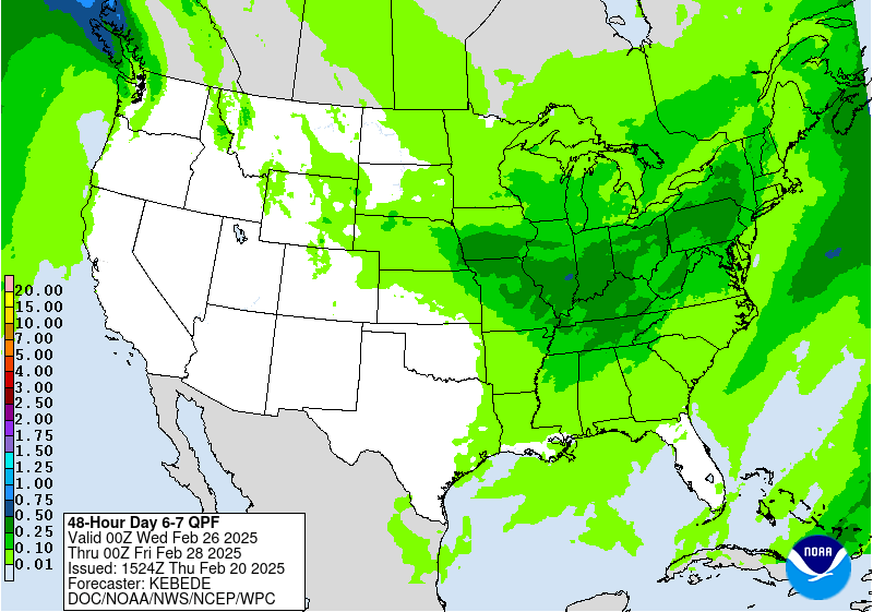
Figure 3. Forecast precipitation amounts for the middle of next week
Warm last day of February before cool down
Temperatures look to rebound again late in the work week and highs on Friday are likely to be in the mid 50's to mid 60's statewide. A more potent looking front looks to enter the state next Friday night bringing temperatures back down to more seasonal levels next weekend. A look a little deeper into the crystal ball shows a chance of a bigger storm coming in around March 4th-5th. Lots of details to work out but there will be a chance for rain and/or snow across a good portion of the state if some recent model runs come to fruition. An inch of rain by then would be welcome for recharge. Snow also would be useful if it has a higher water content than the snow that has fallen over the last 10 days. Regardless, it does appear that winter isn't going away quickly this year like it has in some recent years.
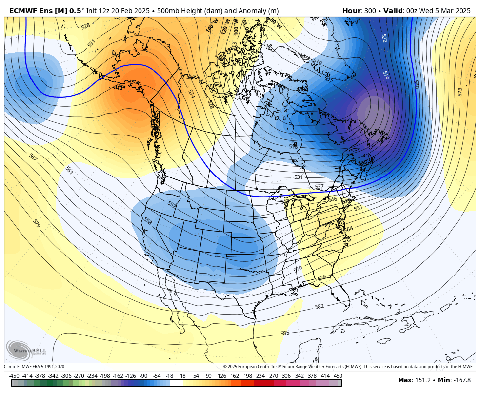
Figure 4. ECMWF Ensemble's 500-mb height anomalies on March 4th
Recent snow and drought update
Speaking of snow, the past 10 days has brought measurable snow to pretty much everyone. Total amounts of 4-10" between have been common, with pockets of 12" total in areas around McCook, Kearney, Columbus, and Blair. Season to date snowfall totals are still generally well below average but most places have surpassed the lowest snow season on record threshold. The amount of water in the snow has been quite low with 15:1-20:1 snow to water ratios being common. Thus, don't expect a big boost in soil moisture once this snow melts. But it will keep the wildfire risk lower in early March at least.
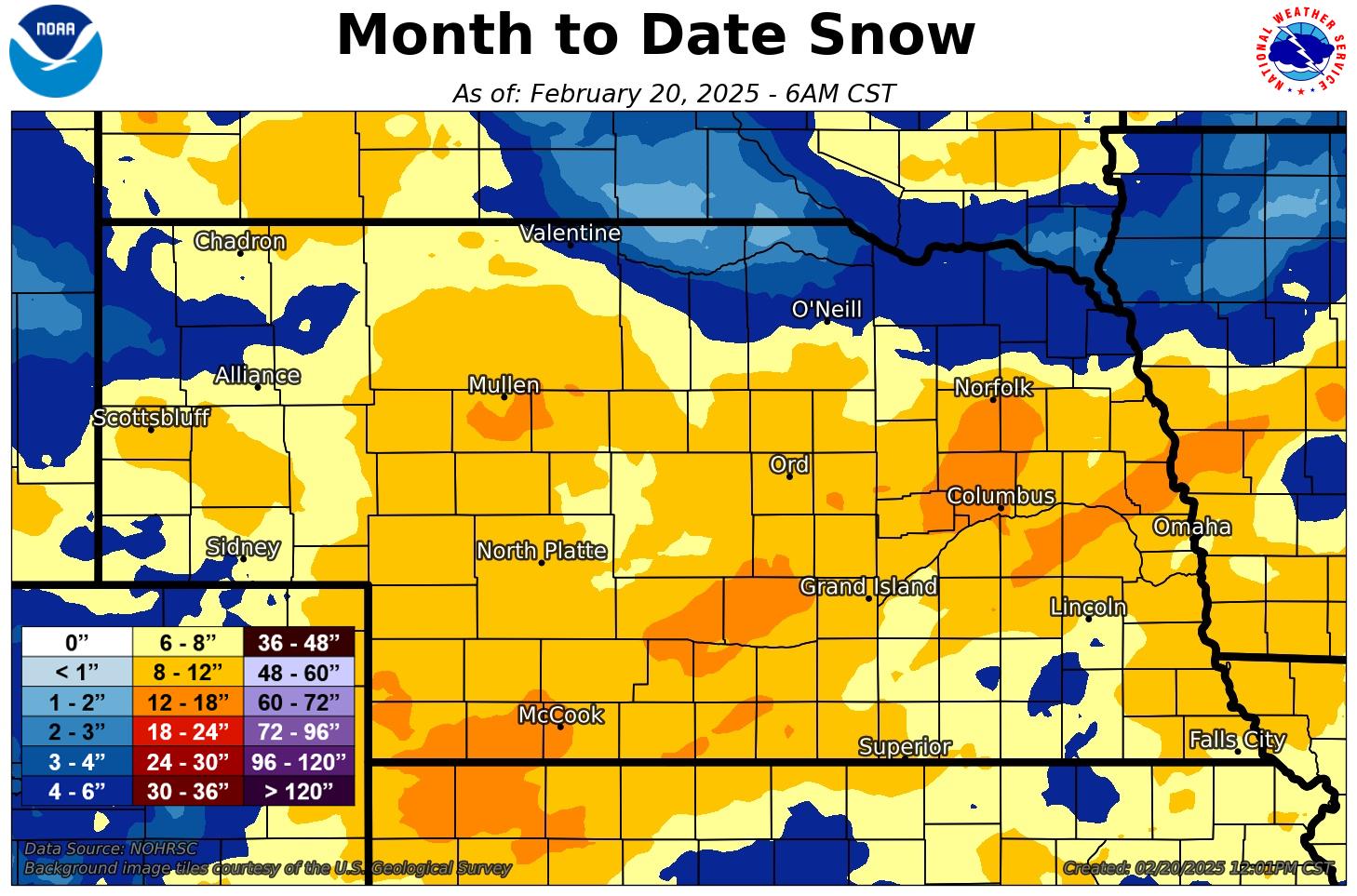
Figure 5. Snowfall so far this month across the state.
The combination of recent snow and precipitation earlier this winter did lead to improvements on the U.S. Drought Monitor across far southeastern Nebraska. A couple of good rains in March would likely eliminate or at least improve drought across much of south central and eastern Nebraska.
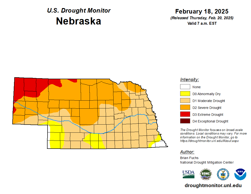
Figure 6. Latest U.S. Drought Monitor


