Fire danger risk
Very windy conditions have returned to the Panhandle as have the warmer temperatures, creating another large temperature gradient from west to east across the state. Current temperatures are in the lower 20's in northeast Nebraska and in the lower 60's in parts of the western Panhandle where strong downsloping west winds are present. That warm air will spread east this afternoon with temperatures likely getting into the 50's from Lincoln and points westward. Big change from yesterday afternoon! Fire danger risk is quite high in the Panhandle and is not super low elsewhere.
Mild to near-record temperatures
A large ridge will be centered over Texas next week and will build into the central U.S. This will keep the main storm track well to our north and with it, the colder weather. Mild weather will be the rule next week and likely will be in place through early January. Temperatures will be a bit cooler tomorrow and Sunday (40's to low 50's) before bouncing back to well above average levels in the 50's and lower to mid 60's by Monday. A weak front will come through on Tuesday morning, which will bring slightly cooler temperatures for a few days. A weak shortwave on Christmas Eve morning also will be the best chance of getting any moisture next week, though it is not a strong likelihood.
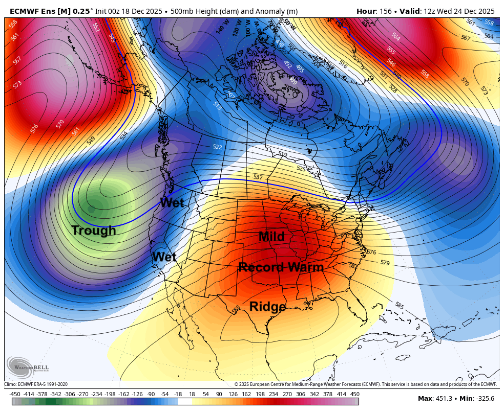
Figure 1. Projected 500-mb height anomalies on Christmas Eve morning
Santa just needs a t-shirt
There will not be a White Christmas for anyone in Nebraska this year. Record temperatures in the 60's are probable on Christmas Day for many locations, particularly in Omaha and Grand Island where the record highs on Christmas Day are a bit lower. Very mild to downright warm weather will be the rule across the region too. If the ridge sets up a bit further to the north it is possible that we may have some low 70's creeping into McCook, Superior, Hebron, and Beatrice on Christmas Day. Very mild temperatures are likely to remain in place through the end of December and possibly into early January. No significant precipitation in sight either.
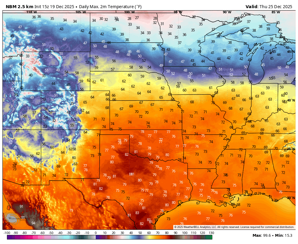
Figure 2. Projected high temperatures on Christmas Day


