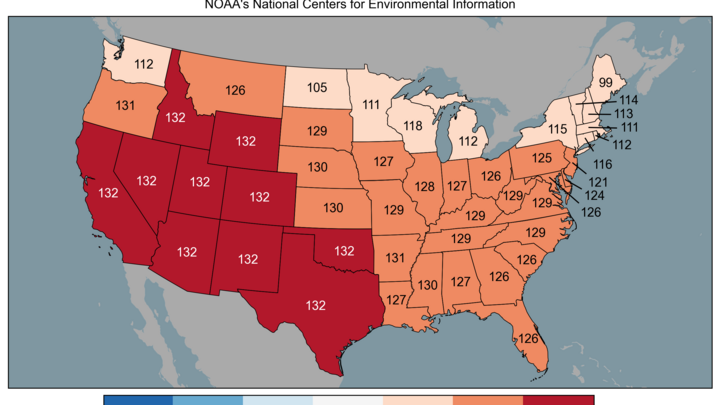
Warm and dry
Analysis of the 12Z 500-mb map shows a massive ridge in place over the southwestern U.S. The heights of the 500-mb level in the western U.S. are typical for June and not July, not March. Records are being broken left and right in the southwest and that warm air has been spreading east over the last 48 hours. Closer to home, we are currently in the right exit region of the jet stream, which means we have massive subsidence (sinking) of air. Clear skies and a warm air mass aloft means very warm temperatures will be in place. Temperatures tomorrow should be in the 80's statewide. Records are possible for many locations. Temperatures like this are very unusual for mid-March but we do have comparable daylight to later September. If you have a warm air mass in place and a dry, snow-free landscape, it is not all that hard to achieve these temperatures with the amount of daylight we have.
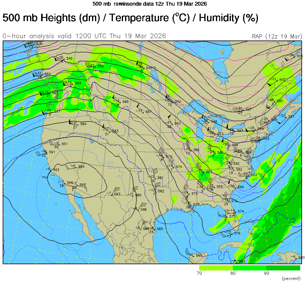
Figure 1. Analysis of 500-mb heights and winds from this morning
Record temperatures and very high fire danger
Saturday will be even warmer still with highs in the lower to mid 80's north and in the lower 90's south. The models have generally been underestimating temperatures the last few afternoons so it's probable to see some mid 90's between Grand Island and York. Winds from the southwest will be a gustier (Fig. 2) and relative humidity will be very low in the afternoon (Fig. 3). Fire danger will be very high on Saturday, especially in central and west central sections of the state.
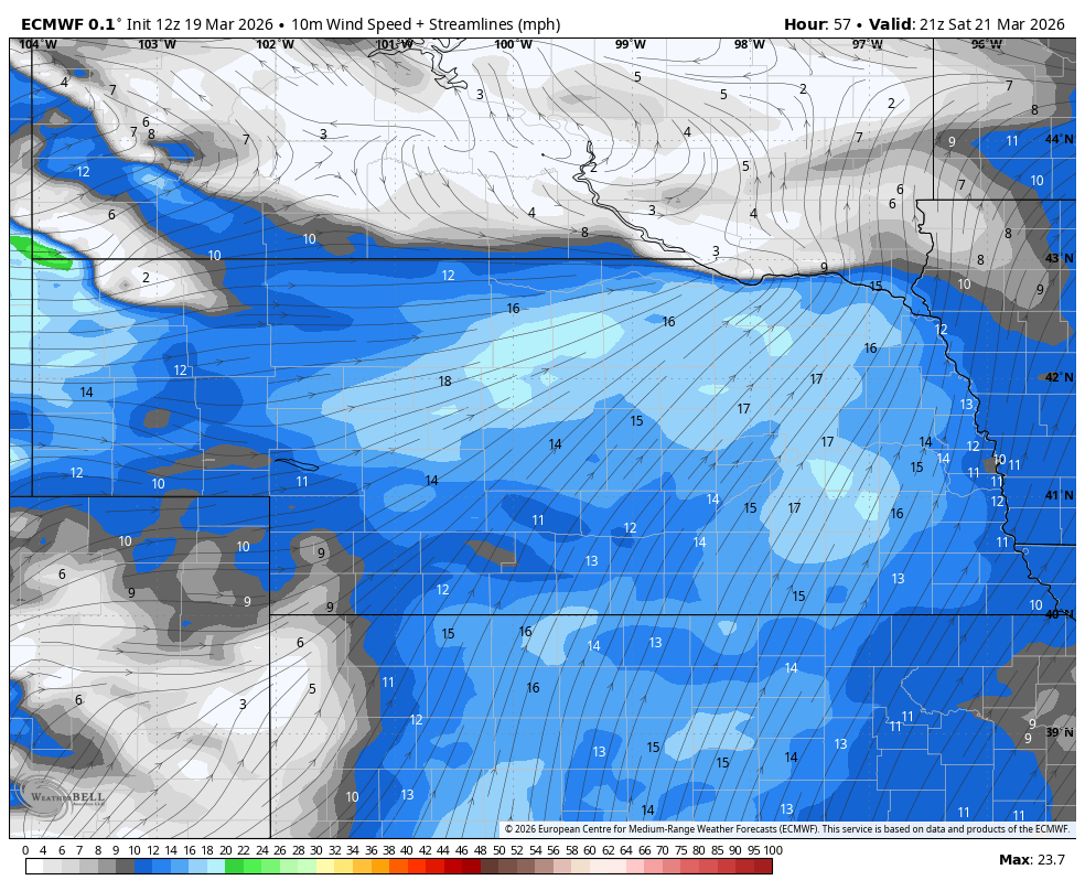
Figure 2. Wind speed on Saturday afternoon
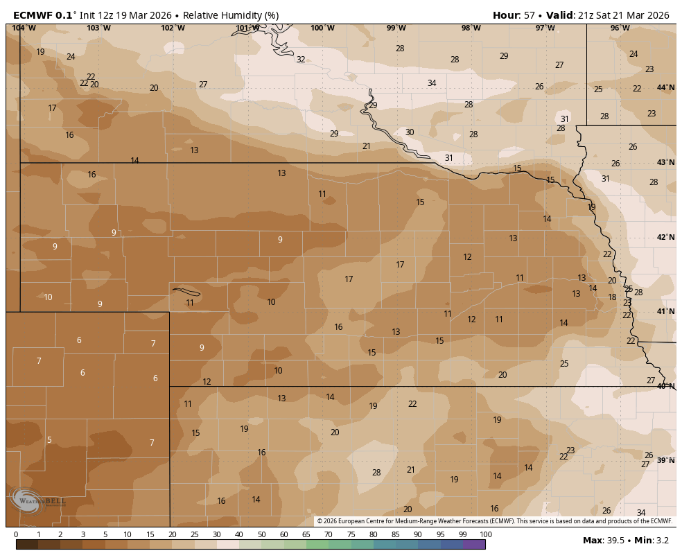
Figure 3. Projected relative humidity values on Saturday
A cold front will move through the state on Saturday night but will have very limited moisture to work with and should come through dry. Any large fires that start on Saturday will be difficult to contain as winds will be gusty (30-40 mph) early on Sunday night from the north. Temperatures will be much cooler on Sunday but only back to more seasonal levels in the 50's. Temperatures should remain seasonal statewide to possibly even seasonally cool in the eastern part of the state on Monday before rebounding Tuesday.
The dominant pattern for most of next week is continued ridging across the western half of the country and a very northward displaced jet stream for late March (Fig. 4).
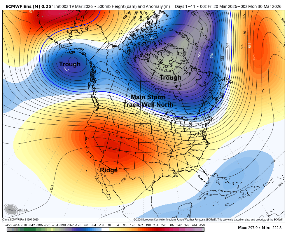
Figure 4. Projected 500-mb height pattern
This will keep the main storm track to our north. This means no real shot at meaningful moisture until at least the end of the month or early April. Much warmer temperatures are likely by mid-week and fire danger will remain high, especially in the west. A deeper trough will likely move into the Great Lakes region by the end of the week. That will help drag a surface cold front down through our region. Timing of the frontal passage and extent of the cold are a little uncertain. But it does look quite windy next Friday and temperatures will be back to seasonal or seasonally cool levels.
There is some signal that we could get another quick cold snap at the end of the month too. We are certainly not done with freezes and don't put away the winter coats. The ridge is in the wrong place for us to have sustained warmth like we did in March 2012. What we have currently is semi-comparable to what happened in mid-March of 2015, albeit not this exceptional. But if 2015 is a useful guide to the future, the faucet will turn on toward the latter half of April and we would start seeing some potential for drought relief.