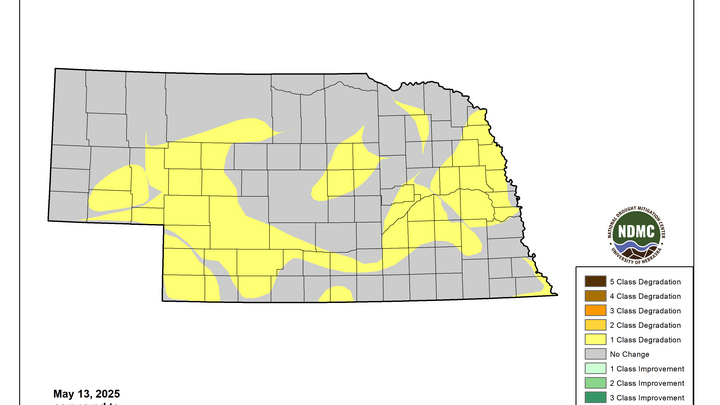
Drought continues to get worse
The latest U.S. Drought Monitor was released this morning and for the second week in a row, it showed a wide expansion of severe drought. This time the expansion was focused on east central and parts of northeast Nebraska with places like Norfolk, Aurora, York, Seward, Stromsburg, Clay Center, and Lincoln going into D2. Drought was introduced to a broad area of the eastern side of the state (as a step down from abnormal dryness) in places like West Point, Oakland, Bellevue, and Wahoo. Extreme drought was introduced into the southeast Panhandle between Sidney and Oshkosh and also from east of Broken Bow into Ord and Bartlett in the Sand Hills. Degradation also occurred over the previous week in southwest Nebraska with Chase and Dundy counties going into drought and severe drought expanded from North Platte down to McCook.
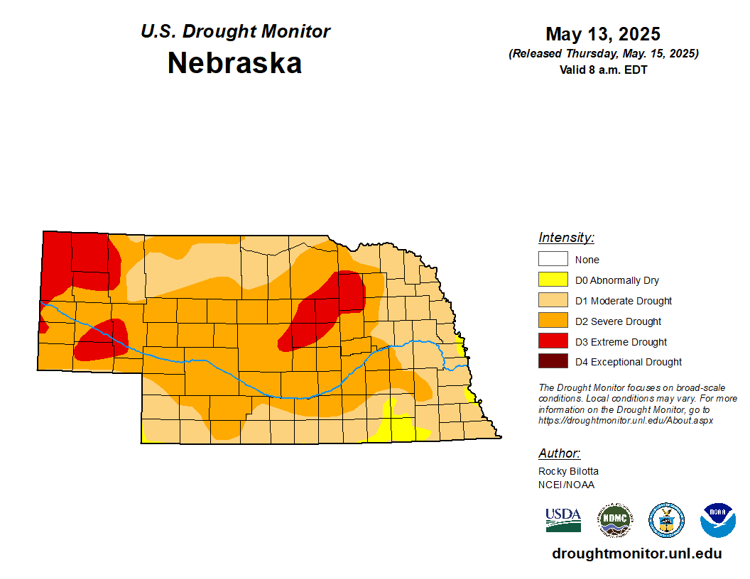
Figure 1. Latest U.S. Drought Monitor
Atmospheric greed
Last week I covered the precipitation deficits more thoroughly and those continue to get worse across southern and eastern sections of the state. Thankfully most of north central and western Nebraska received precipitation over the past 24 hours, significant in some cases, so that may help stave off degradation for a bit and possibly allow for pockets of improvements depending on what happens in the next 4-5 days. But this week I wanted to discuss a variable that probably deserves more attention: potential evapotranspiration. Potential ET takes into account factors like temperature, humidity, radiation, and wind speed to determine how much water could evaporate in a day from a well-watered surface. It is essentially a way of determining how "thirsty" or "greedy" the atmosphere is.
The Evaporative Demand Drought Index (EDDI) is not a pure drought index per se but it does allow us to see where atmospheric demand has been abnormally high (ED0-ED4) or abnormally low (EW0-EW4) over the previous weeks and months. Areas with persistently high levels of potential ET show up in the more extreme drought categories on an EDDI map and such is the case for almost all of Nebraska dating back to last August. According to EDDI, the potential ET for the state is top 5th to top 2nd percentile over the last 9 months. The acuteness of the abnormally high ET combined with longer periods of dry weather (i.e., lack of precipitation) has led to a rapid increase in drought conditions across the state since last summer. It means that the precipitation that did fall was used up even more quickly than usual, which helped dry out soils even faster. More on soil moisture in a minute.
One concern we have with a warming planet is that atmospheric demand for moisture could more than offset any marginal increases in precipitation. That will make recovery from drought more fragile and allow for more rapid swings from very wet to drought. That is why regenerative practices that can increase organic matter and water holding capacity are so critically important: you can keep more of the water that does fall from the sky and have it longer.
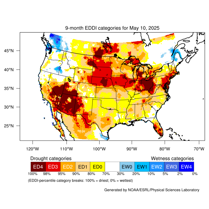
Figure 2. 9-month Evaporative Drought Demand Index
Soil moisture percentiles
That is the most logical reason for soil moisture percentiles persisting at percentile levels that are lower than what one would expect based on precipitation over the last several weeks to months. Soil moisture percentiles according to SPORT LIS are generally under the 10th percentile statewide as of yesterday and in many cases are under the 5th percentile. Many areas in north central Nebraska will likely see some improvement after picking up significant precipitation last night. But the rest of us will have to wait until next week for the possibility of getting improvement.
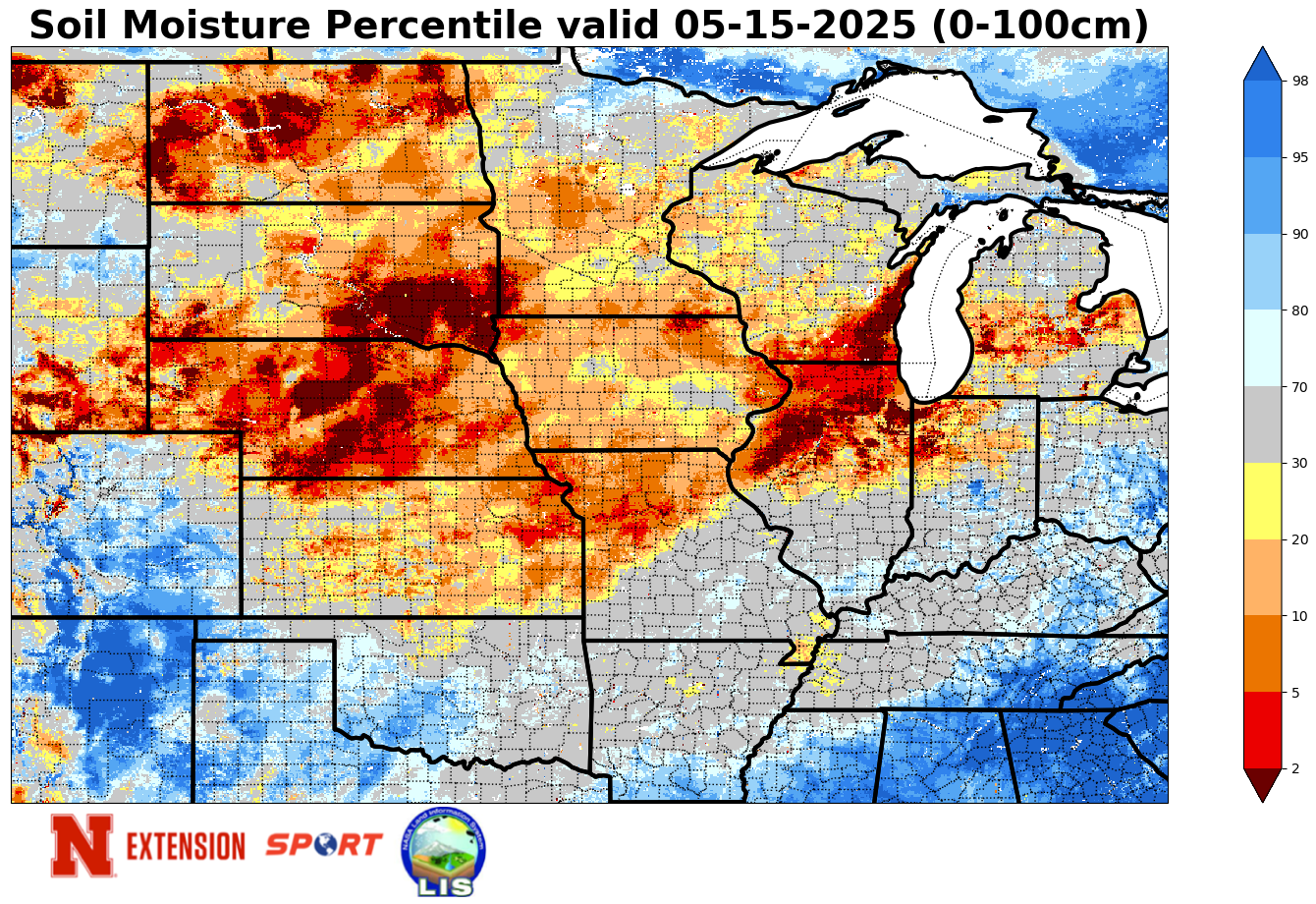
Figure 3. Soil moisture percentiles


