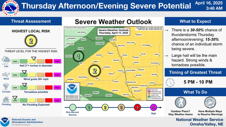
Severe threat
Tomorrow looks much more interesting than it did a week ago. Broader troughing over the western U.S. with multiple embedded atmospheric shortwaves will be featured at 500-mb tomorrow. As this trough moves to the east, a surface cold front will move into the state by early tomorrow morning and push toward the southeast during the day.
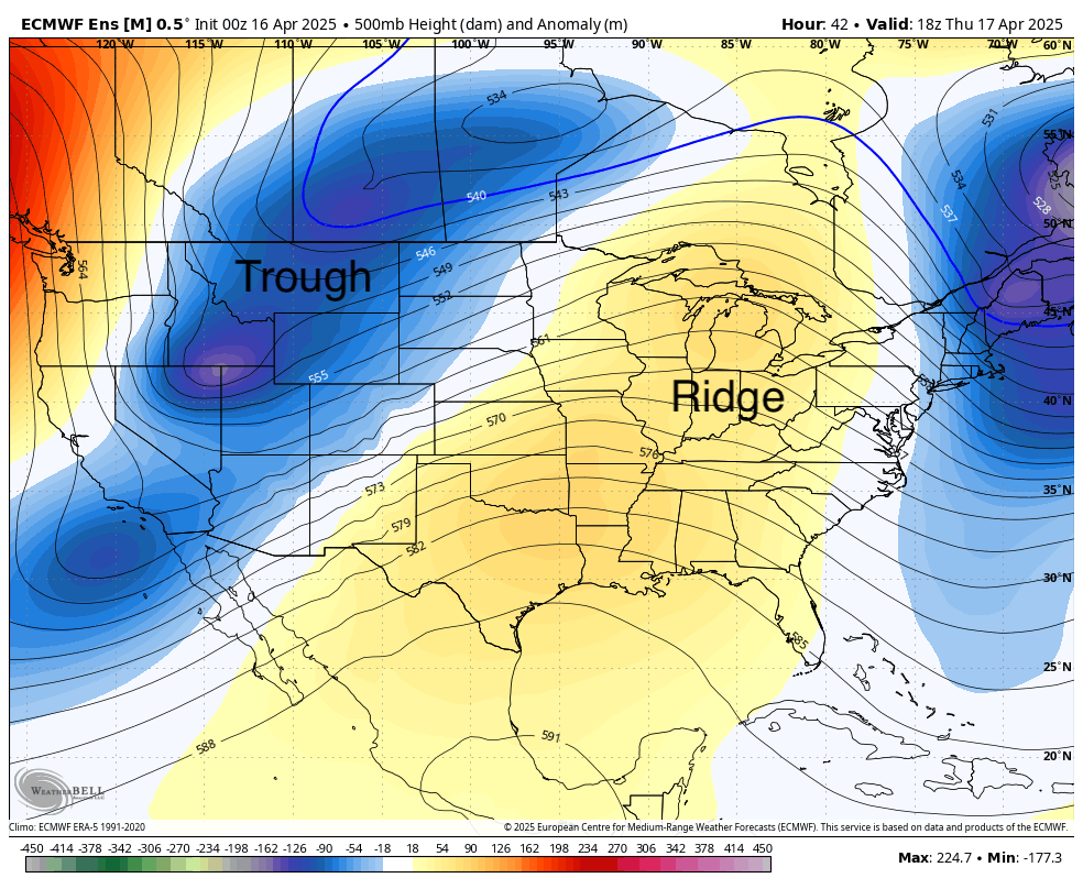
Figure 1. 500-mb height anomalies midday tomorrow
It will be much cooler tomorrow behind the front in the Panhandle and western Sandhills and there will be a sharp northwest to southeast temperature gradient tomorrow afternoon, with temperatures near the Kansas border in southeast Nebraska possibly being 50°F than around Harrison. Low-level moisture will also be returning to the south central and eastern sections of the state overnight, with dewpoints possibly getting into the 60's tomorrow afternoon in eastern Nebraska.
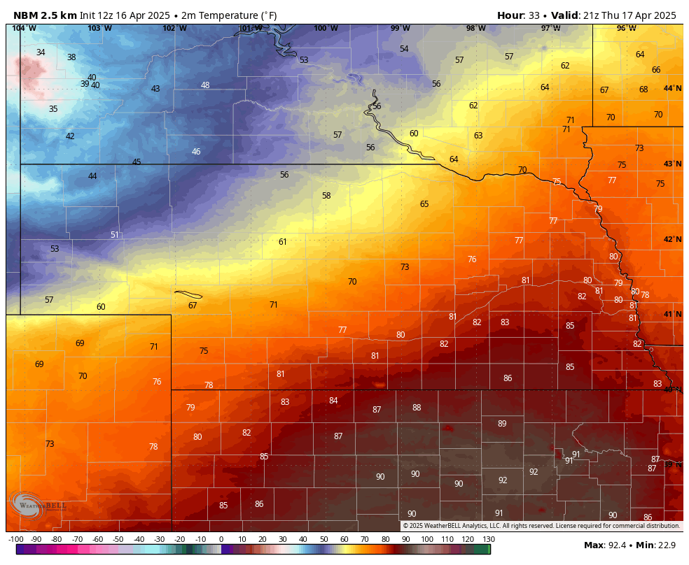
Figure 2. Late afternoon temperatures
As the surface low moves from northeast Colorado across southern Nebraska tomorrow afternoon, much drier air from the southwest will be drawn to the northeast, creating a sharp dry line between very dry air in north central Kansas and more humid air in the south central and southeastern sections of the state. The "triple point" (cold front, surface low, and dry-line) will be a focal point for thunderstorm development and storms with very large hail will be possible in the I-80 corridor east of Kearney tomorrow, with York to Nebraska City and Blair being the most likely area to get hammered tomorrow evening. Tornadoes are much less of a risk but the risk isn't zero in eastern Nebraska tomorrow evening.
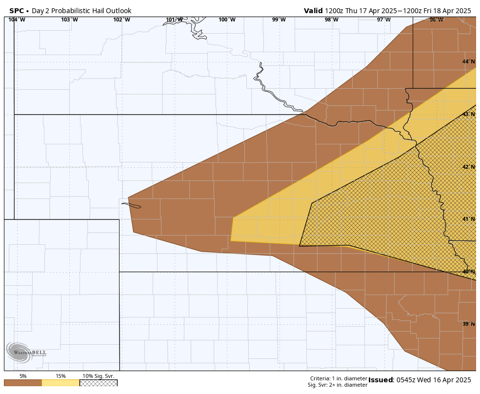
Figure 3. Hail risk tomorrow
A severe weather outbreak isn't a slam dunk and will be contingent upon where that triple point ends up being, how much clearing we get tomorrow, how warm the surface temperatures get, and how warm temperatures aloft are tomorrow. The NAM has been most aggressive at showing clusters of storms developing during the mid-afternoon hours around North Platte and moving east into the Lincoln/Omaha area with additional development of elevated thunderstorms behind the cold front in central Nebraska moving east-northeast into northeast Nebraska and Iowa. The upside is some areas of central and eastern Nebraska that haven't had much rain have a chance at getting some.
Panhandle and Sand Hills snow
On the colder side of the storm, the Panhandle should get beneficial moisture thanks to an atmospheric shortwave rolling up from the Southern High Plains. Scattered rain showers should turn to snow pretty quickly Thursday afternoon in the higher elevations with more widespread snow in the Panhandle and western Sand Hills overnight. Significant accumulations are not expected but up to 4" could fall on grassy areas in some spots. Snow should be out of the area by early Friday morning with rain showers possible Friday morning along the Highway 20 corridor in northern Nebraska.
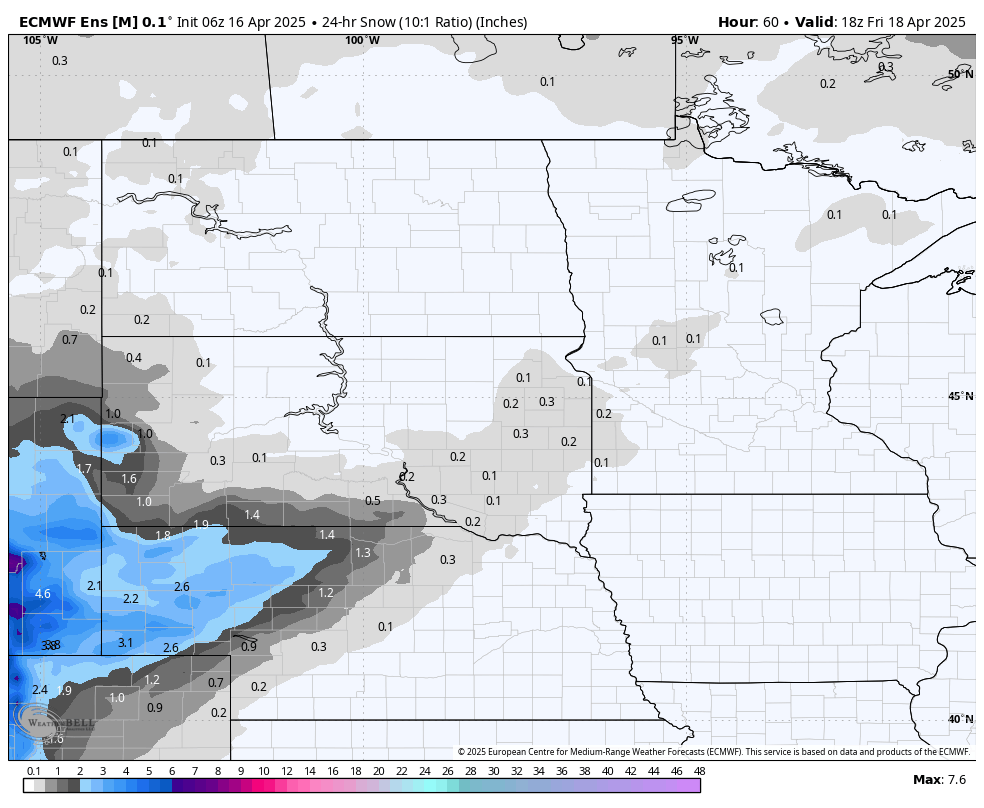
Figure 4. ECMWF ensemble projections of snow