Hot weather
A quick look at the upper air analysis shows a potent ridge centered over the southwestern U.S. with a trough in the Pacific Northwest. With the ridge building northward, it's going to be a hot day in Nebraska with temperatures exceeding 90°F statewide, with temperatures possibly getting to 104°F around Chadron this afternoon. Heat advisories are posted for much of central Nebraska where humidity levels will be high enough to warrant the advisory.
The heat will be relatively short lived as a surface cold front enters the northern Panhandle by tomorrow afternoon. South of it temperatures will still be hot to very hot, with temperatures over 100°F likely across southwestern Nebraska. Temperatures in eastern Nebraska will be in the lower to mid 90's. But dewpoints in the 70's will push the heat index values well over 100°F. There will be a breeze from the south, which will make it marginally less dangerous.
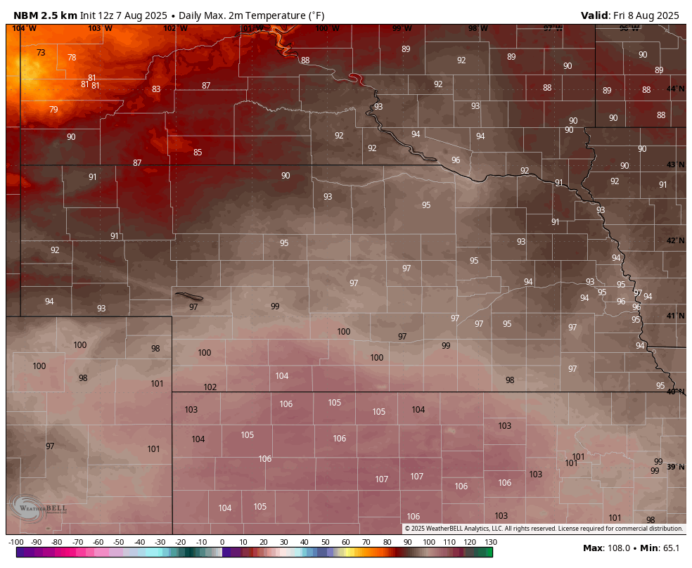
Figure 1. Projected high temperatures tomorrow (August 8th)
Storm chances
By tomorrow evening the trough should be centered over eastern Montana with a surface cold front moving through the Northern Plains and extending into western Nebraska and eastern Colorado (Fig. 2). This will be a focal point for showers and thunderstorms and the SPC does have a slight risk for severe storms across the northeastern quadrant of the state for tomorrow evening (Fig. 3)
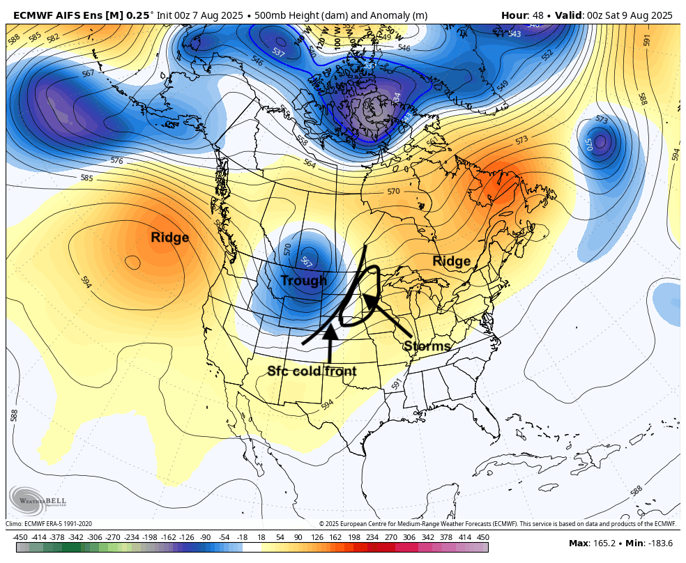
Figure 2. 500-mb height anomalies tomorrow evening
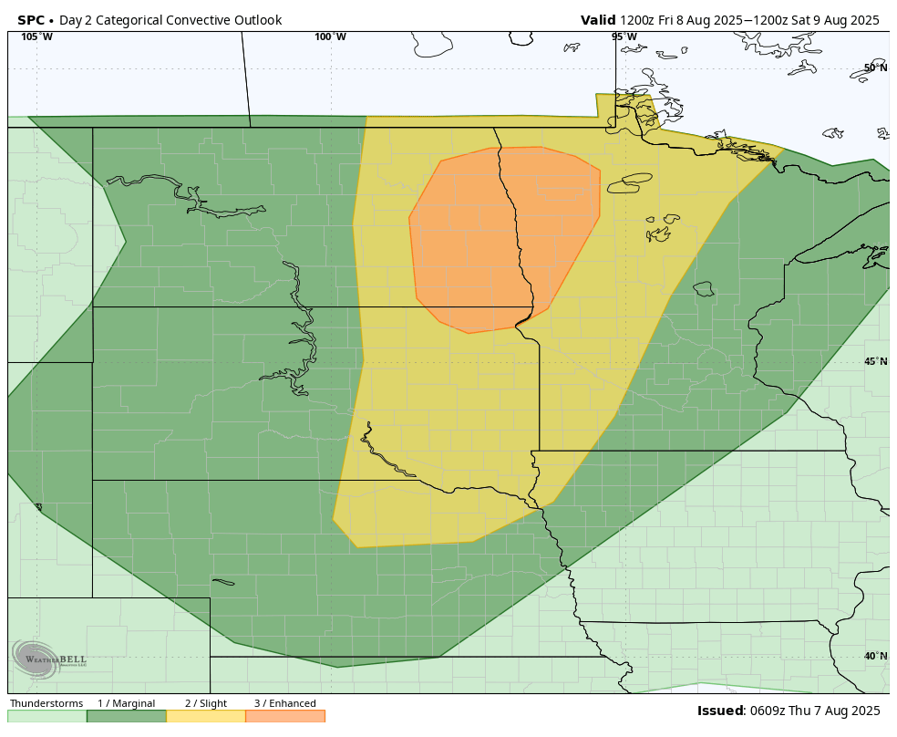
Figure 3. SPC's severe storm outlook for tomorrow evening
The front should clear the state on Friday night with temperatures back into the 80's statewide on Saturday, though it will still be humid in eastern Nebraska. Most areas should see dry weather during the bulk of day on Saturday but our attention then turns toward a series of shortwaves coming on the south side of the aforementioned trough and on the periphery of an eastern ridge (Figure 4). The exact "path" of these shortwaves are a little uncertain but these will help produce multiple chances for showers and storms between Saturday night and Tuesday morning, especially across the southern half of the state.
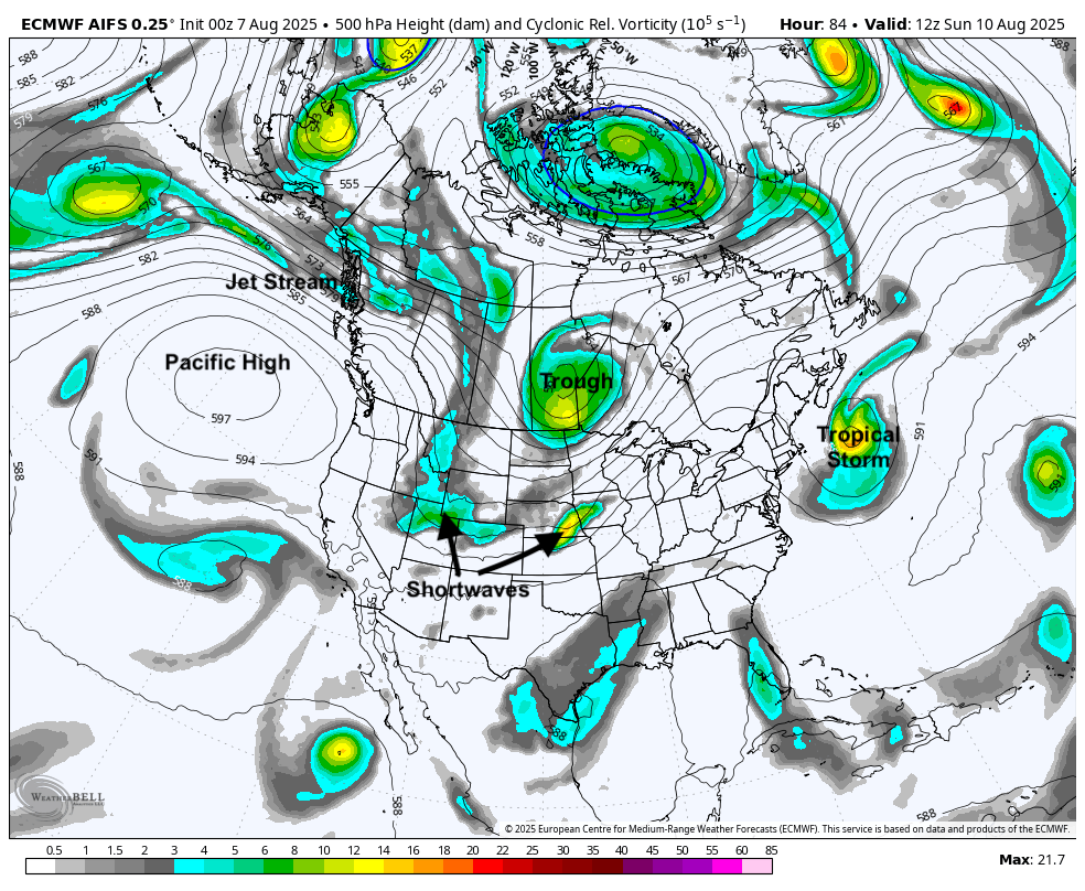
Figure 4. 500-mb height and vorticity map on Sunday morning
The best chance for widespread precipitation right now appears to be Saturday night into Sunday morning, especially along/south of Highway 30. But there will be additional chances for overnight and early morning storms through early next week. Complexes likely will develop along the Front Range and move east-northeast into the Western Corn Belt. The WPC has the southern 2/3 of the state in the marginal risk for excessive rain on Saturday night and southeast Nebraska is in a marginal risk for excessive rainfall on Sunday and Monday nights.
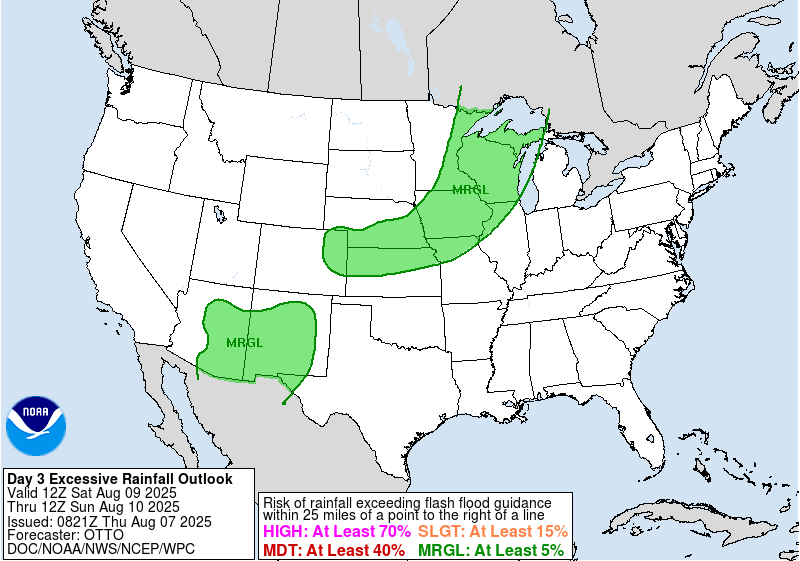
Figure 5. WPC excessive rainfall outlook
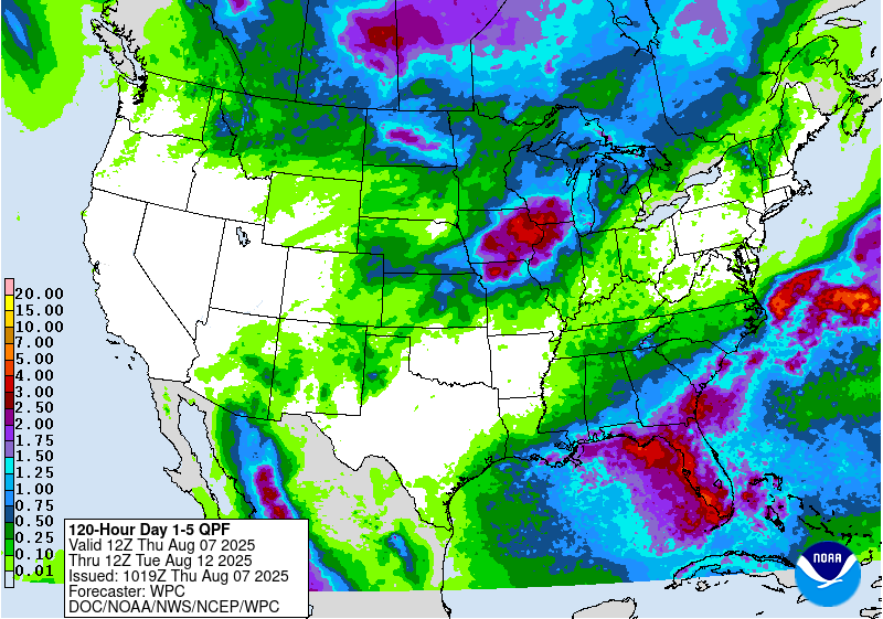
The best chance at an inch through early next week is in the southeast quadrant of the state where there may be multiple rounds of storms starting this weekend. The WPC is less bullish on precipitation along and north of Highway 20 but this area will have a chance of storms and pockets of heavy rain tomorrow night into Saturday morning.
Active pattern continuing
Temperatures will likely remain at or below average early next week with highs in the 80's statewide on Sunday and Monday. Ridging will briefly return to the north central U.S. by mid-week and temperatures will warm back up. Highs in the 90's will be likely in western Nebraska by Tuesday with highs of 88-94°F across the state on Wednesday. Higher levels of humidity will keep overnight temperatures slightly elevated mid-week, especially east of North Platte.
Another trough will be moving into the Northern Plains later in the week and this will help drive another cold front into the state with chances of storms in the late afternoon and evening hours Wednesday night into Thursday in eastern Nebraska. There will be additional chances of showers and storms next weekend across the state as more shortwaves come around a western trough and moisture should be flowing in from the Gulf with broad high pressure in the Atlantic.
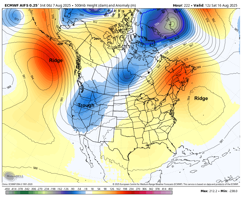
Figure 6. Projected 500-mb height anomalies next Saturday
Extended forecast
Ridging in the east and troughing in the west is likely as we head into the back half of the month. for our region, this will help keep temperatures generally above seasonal levels as we head into the last third of August. There is some signal in the AI runs of heat advisory criteria type conditions around August 18-20 but in general, I think the above average temperatures will be driven more by warm nights. While warm would be favored with the projected pattern, this is not one that favors extended dryness. There's a reasonable chance that the faucet stays on a while longer and would allow us to head into the fall in the best shape we have been in from a moisture standpoint in several years.
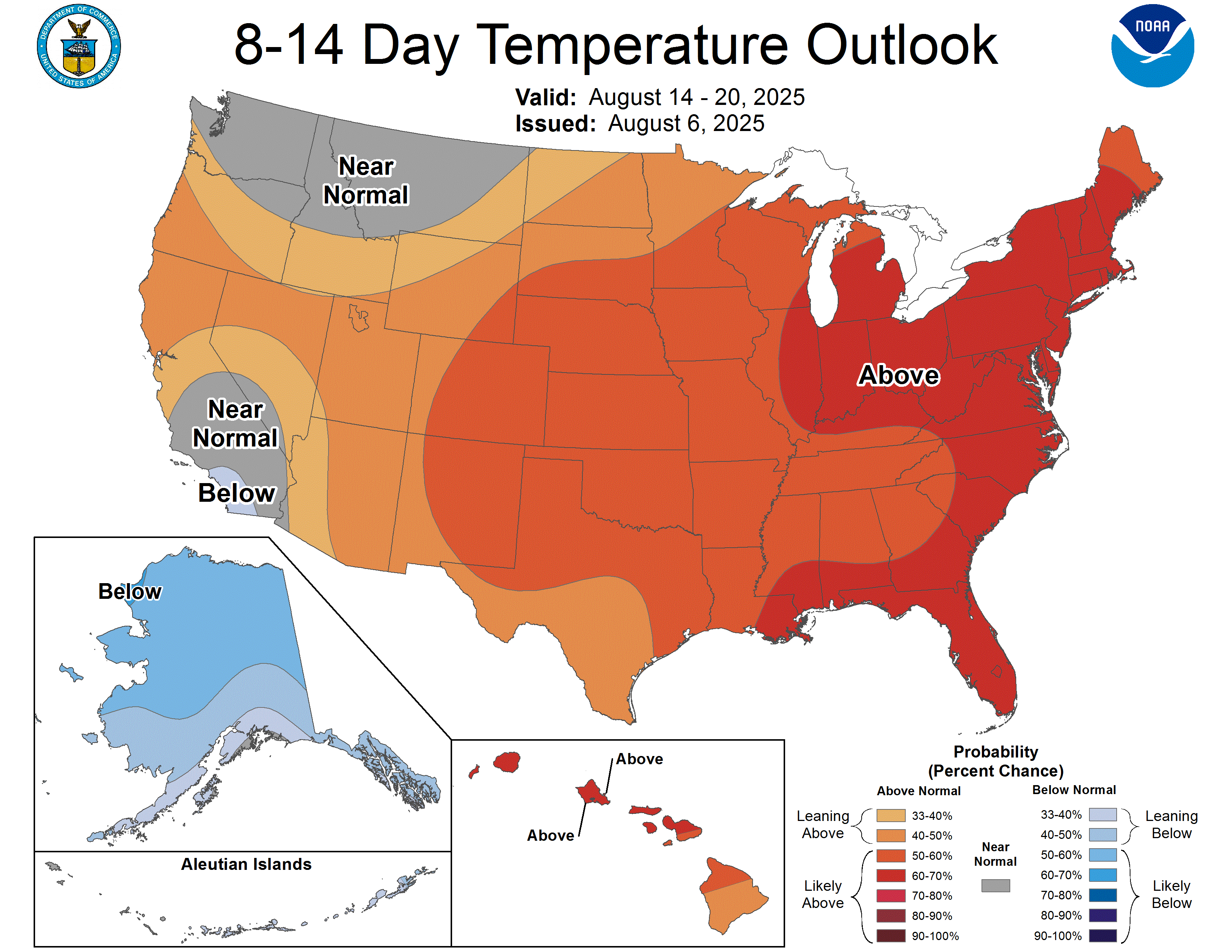
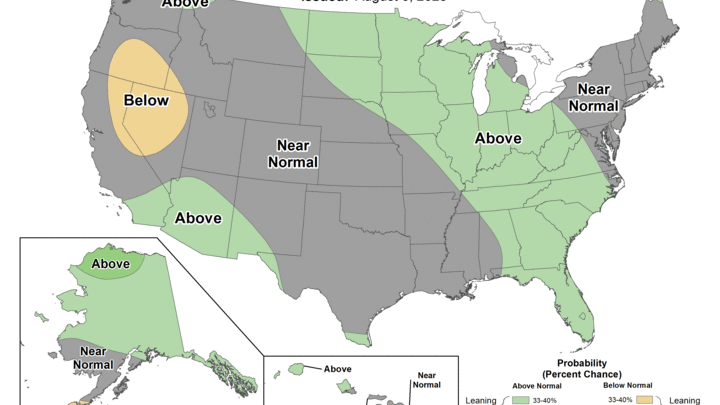
Figure 7. CPC's 8-14 day outlook


