Good chance of moisture
It's been a very dry spring for most of the state and many areas haven't had anything measurable in almost two weeks. Some places have barely registered a quarter inch in the last 40 days. The good news is that there is a strong possibility of getting an inch or more of moisture across most of the state early next week. The responsible party for the moisture chances is a trough moving from the western U.S. into the Central Plains and there will be a couple of different shortwaves coming around the base of said trough into our region to help produce the rising motion needed for precipitation.
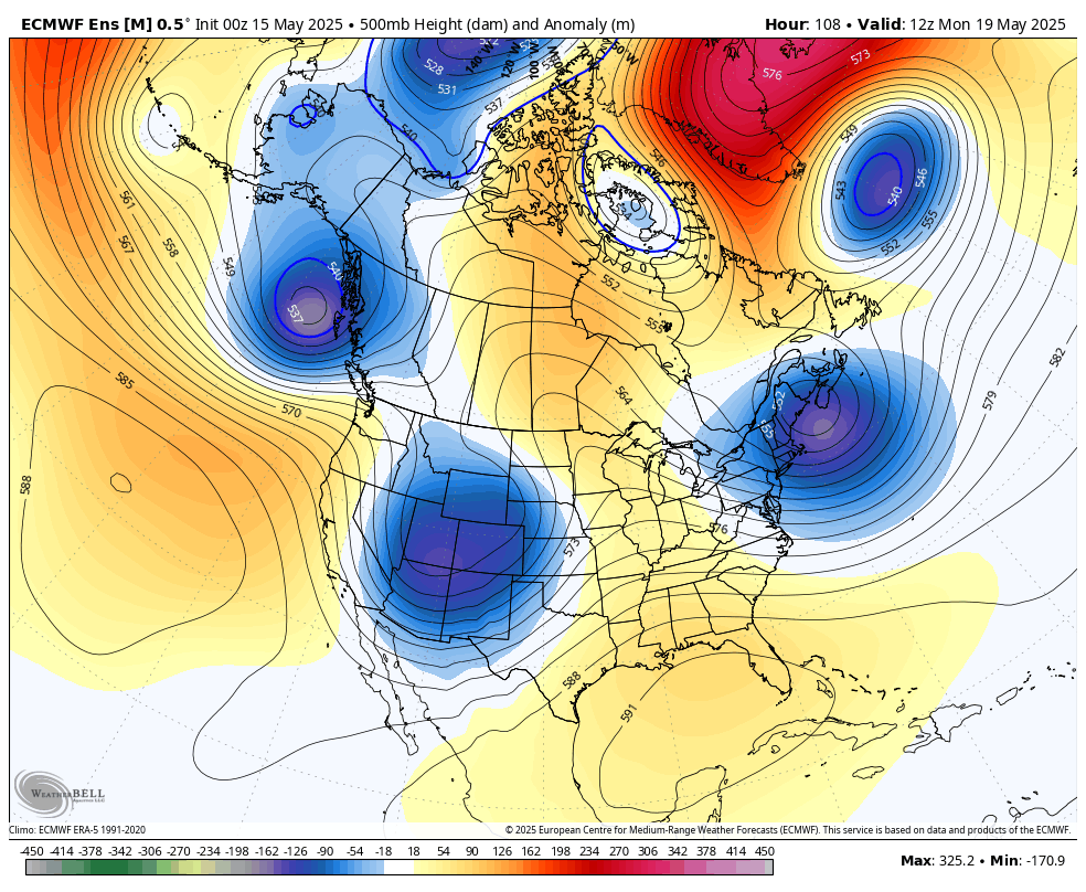
Figure 1. Projected 500-mb height anomalies next Monday morning
The first shortwave and associated surface low will move into the state from late Sunday into Monday and that will bring a good chance of rain to most of the state starting Sunday afternoon. Chances for significant moisture in western Nebraska are best in the Panhandle and Sand Hills and lowest in the southwest corner where the duration of precipitation may be shortest. Further east, chances for rain Sunday night and Monday morning are looking quite good as well and may be significant for many if the low-level jet is as enhanced as it is currently depicted by the models.
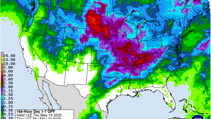
There likely will be some break during the day on Monday for most of us and then chances will increase again on Monday night into Tuesday, particularly in the eastern 2/3 of the state. Exactly where the surface low tracks and how quickly it moves will determine how much precipitation falls in central and eastern Nebraska. There is a good chance of an inch for all but the southwest early next week. 2" is possible by next Wednesday morning in central and eastern NE and reasonably likely across much of the Sand Hills where some precipitation is falling . Some areas in the Sand Hills received significant moisture last night and this would be outstanding supplemental rainfall. This would be very needed rainfall for crops in central and eastern sections of the state.
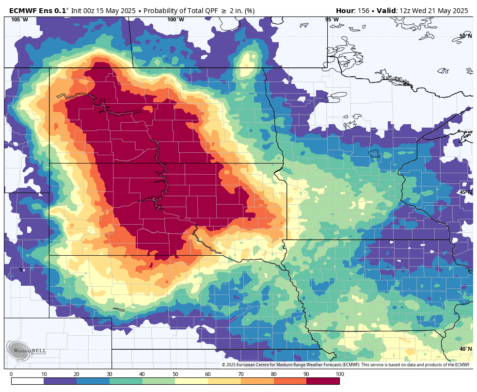
Figure 2. Probability of 2" through next Wednesday morning
The main concern is that some portion of the precipitation may be more convective in nature, which means that some areas may possibly get several inches of moisture, some spots will get 1-2", and a few unlucky souls may pick up less than an inch. The good news is the moisture return does look significant and there may be a period of more steady showers on the back side of the system on Tuesday into Tuesday night.
Severe storms
The bad news is there will be a chance of severe weather on Sunday evening across southwest Nebraska on Sunday evening and on Monday afternoon and evening across south central and eastern Nebraska. The SPC already has that area in the Day 4/5 convective outlooks for severe weather potential. Monday evening may need to be watched carefully if the surface low, cold front and dry line intersection is in south central Nebraska and the dry line between moist air to the east and dry air to the south and west is sharp. Largest threat would be large hail but tornadoes certainly can't be ruled out. Recommend keeping an eye on this as we get into the weekend. We certainly need the rain but not the damaging hail and winds.
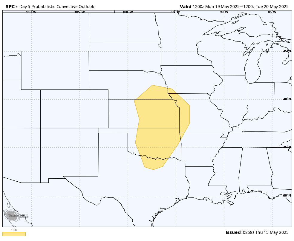
Figure 3. SPC outlook for severe weather next Monday afternoon and evening
Cooler temperatures
With the passage of the cold front, temperatures have dropped off compared to yesterday and will be at or below seasonal averages for most of northern and western sections of the state. Will still be a little above average in southeast Nebraska but around 10 degrees cooler than yesterday. Temperatures should be mostly in the 60's and 70's statewide tomorrow with coolest temperatures (upper 50's) confined to the north central section of the state where cloud cover will be more prominent and showers will be possible.
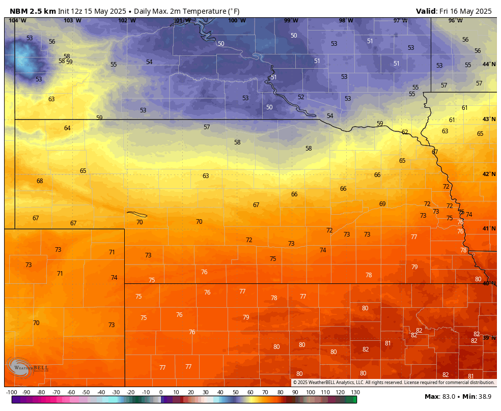
Figure 4. Projected high temperatures tomorrow afternoon
Temperatures will rebound somewhat across the western and northern sections of the state on Saturday and likely will be back into the 70's everywhere except the western Panhandle on Sunday. A cold front will start moving through the state on Monday and will set up a sharper east-west temperature gradient by Monday afternoon as temperatures likely will be in the lower 80's from Hastings to Plattsmouth and may struggle to get to 50 in the northwest Panhandle. Temperatures more likely to be in the 70's ahead of the front north of Highway 30.
Temperatures will be cooler after the frontal passage and by Wednesday, highs are likely to only be in the 50's and 60's statewide. They will rebound some by next weekend but with the cooler overnight lows, average temperatures are expected to be below seasonal averages for the back half of next week. A light freeze will be possible in the higher elevations of the Panhandle next Wednesday and Thursday mornings.
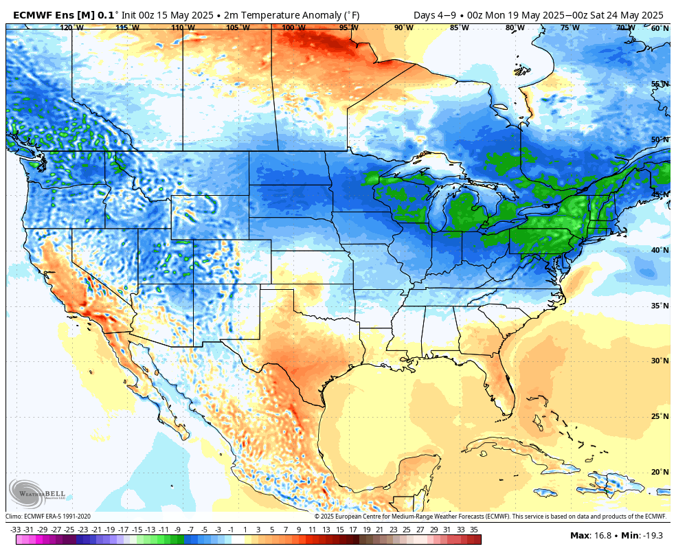
Figure 5. Projected temperature anomalies next week from the ECMWF ensemble


