Warm, breezy on Sunday
The weekend will begin with a shortwave moving into the region. Moisture is limited so widespread precipitation is not likely. But there may be some sprinkles and it will be fairly cloudy most of Saturday. Temperatures may be held down in areas with more extensive cloud cover but generally will be around seasonal levels. A frontal passage will start to move through the state on Sunday and the increased pressure gradient will lead to windier conditions. Western Nebraska will be on the cooler side of the front with high temperatures in the 60's to low 70's with breezy winds from the west. The eastern half of the state will see temperatures getting into the 80's with gusty winds from the south. Fire danger will likely be elevated in parts of western Nebraska where humidity levels will be lower and may be a bit higher in northeast Nebraska where drought is starting to become a concern again.
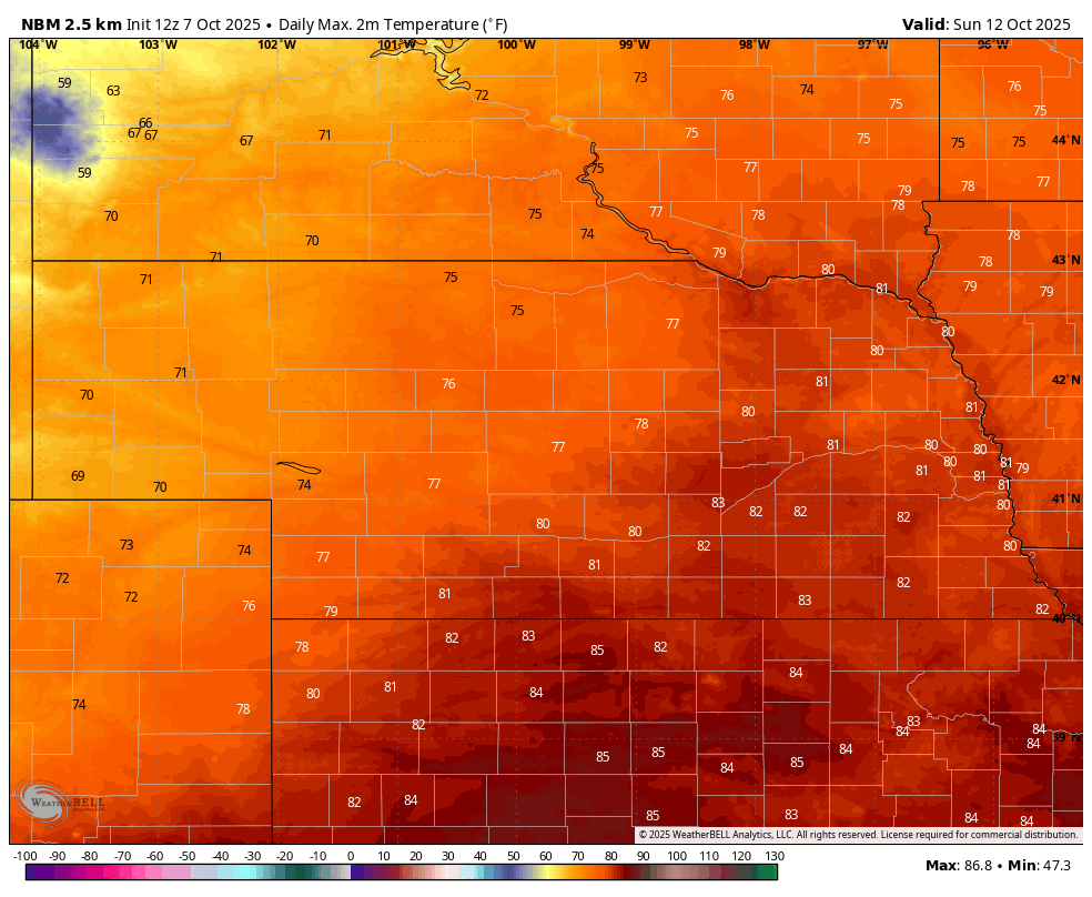
Figure 1. Projected maximum temperatures next week
Good rain chances mid-week
Next week will feature troughing in the western U.S. with ridging prominent over the southern Plains. Atmospheric shortwaves (energy) will be moving into the region and will produce chances for showers and thunderstorms mid-week for the state. Precipitation will likely come in two separate rounds. The first round comes in on Tuesday into early Wednesday and more likely to be focused on southern and eastern sections of the state. The second round will be focused along in the northern section of the state in association with a cold front. Rainfall is not likely to be excessive; flood risk is low. But amounts over half an inch are certainly going to be possible in the north central and eastern sections of the state between Tuesday and Thursday. Severe storm risk is low.
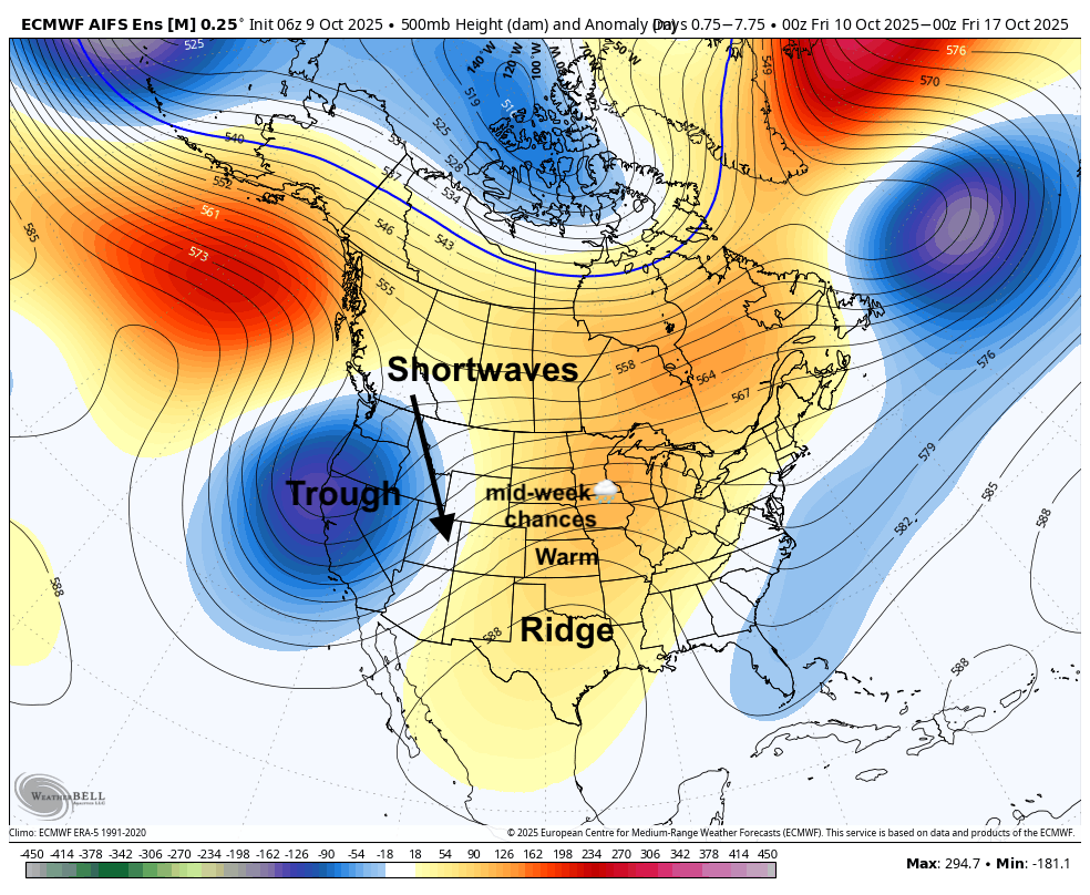
Figure 2. 500-mb height anomaly average next week
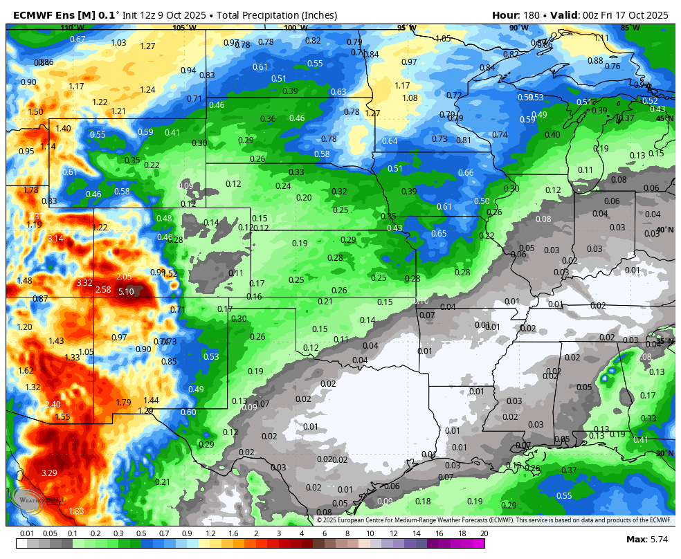
Figure 3. Total precipitation according to the ECMWF ensemble
Typical October temperature swings
Temperatures may be much cooler on Tuesday as clouds and rain showers move into the state with easterly winds. Temperatures will be warmer after the warm front moves through on Wednesday, with areas along and south of Highway 30 likely getting back into the mid to upper 70's. Another cold front will move into the state during the day on Thursday keeping western and north central Nebraska at or below seasonal averages while the southeastern half of the state is likely to be seasonally warm in the 70's, maybe even low 80's in southeast Nebraska. Temperatures will be cooler in the 50's to mid 60's on Friday after the frontal passage. Freezing temperatures possible later in the week in the higher elevations of the Panhandle. No freeze risk elsewhere but nights will be seasonal in the 40's. All in all, pretty typical October temperature swings for this region.
Extended outlook
Temperatures look warm next Saturday across the state but that may begin to change on Sunday the 19th as a cold front moves into the state. This cold front will bring the coldest air of the fall so far (albeit far from record cold) and showers and thunderstorms will be possible along and head of it. The CPC does have This is 10+ days out so exact timing of features is still uncertain. But suffice to say that it likely be sweatshirt weather around the 20th. This also may bring the first freeze to many residents of the state, which for some places in the state would be a fairly late first freeze.
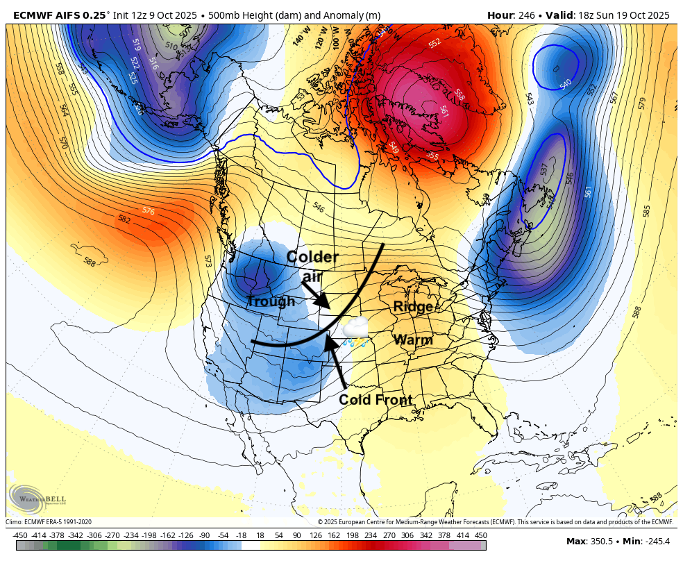
Figure 4. Projected 500-mb height anomalies and other features on Sunday October 19th
After that cool snap, ridging looks to build back into the central U.S. This would bring warmer temperatures back to the region in the last week of October. Too early to project trick or treat temperatures but the period from the 24-28th certainly could be quite warm for late October across the state and the central section of the U.S. as a whole.
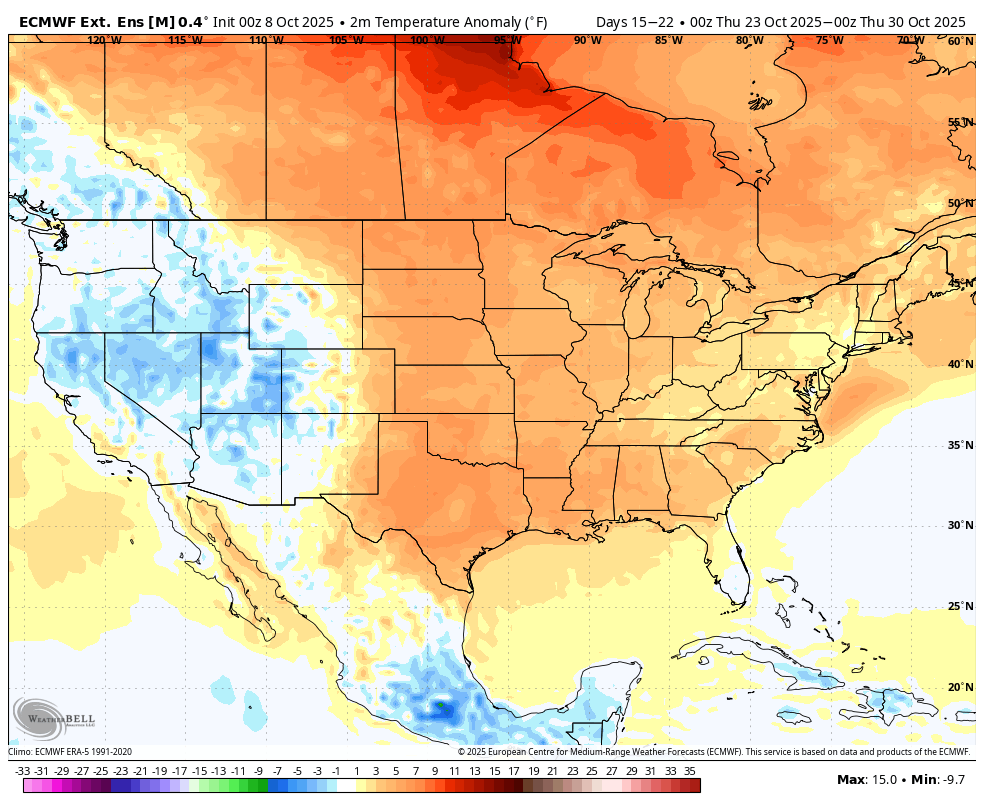
Figure 5. Temperature anomalies for the last week of October from the ECMWF weeklies


