
Rain chances
The majority of the state is socked in with low clouds or fog as moisture has pooled in the lower levels behind the cold front that went through overnight. Given the weak sun angle, seems probable that the low clouds will hang around for most of the day. We also have a trough moving from the southwestern U.S. into Texas and clouds associated with that system are already spreading into southwestern Nebraska. The storm system is staying further south than what was projected a week ago and as such, rainfall totals for most of us are going to be much less than what was originally forecast for most of us. Areas north of Highway 30 may get nothing but perhaps some drizzle. Nevertheless, rainfall should spread into the southwestern part of the state this evening and into south central and southeast Nebraska overnight. Rainfall totals between half an inch and an inch will be possible along the Kansas border.
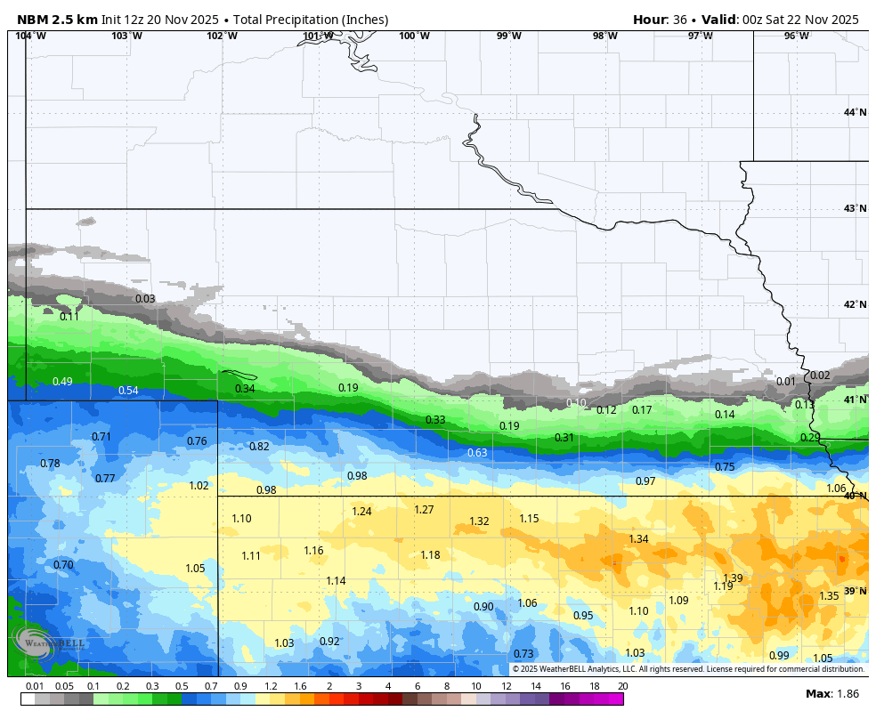
Figure 1. Projected precipitation from the National Blend of Models (NBM)
Pleasant weekend
Upper-level ridging will be prominent this weekend over our region. That will allow a return to seasonally mild afternoon temperatures in the upper 50's to mid 60's and sunshine. The latter would certainly be welcome in eastern Nebraska as it has been a gloomy week. I would also strongly recommend enjoying the weather this weekend as it may be a long time before it is this nice again.
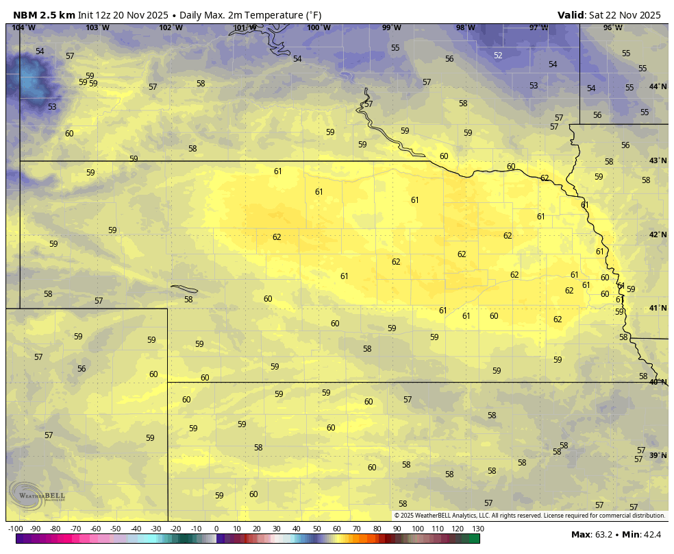
Figure 2. Projected high temperatures on Saturday
Rain chances return
By Sunday night into Monday morning another trough will move into the Southern Plains and some shortwave energy will rotate northeast into our area by Monday morning.
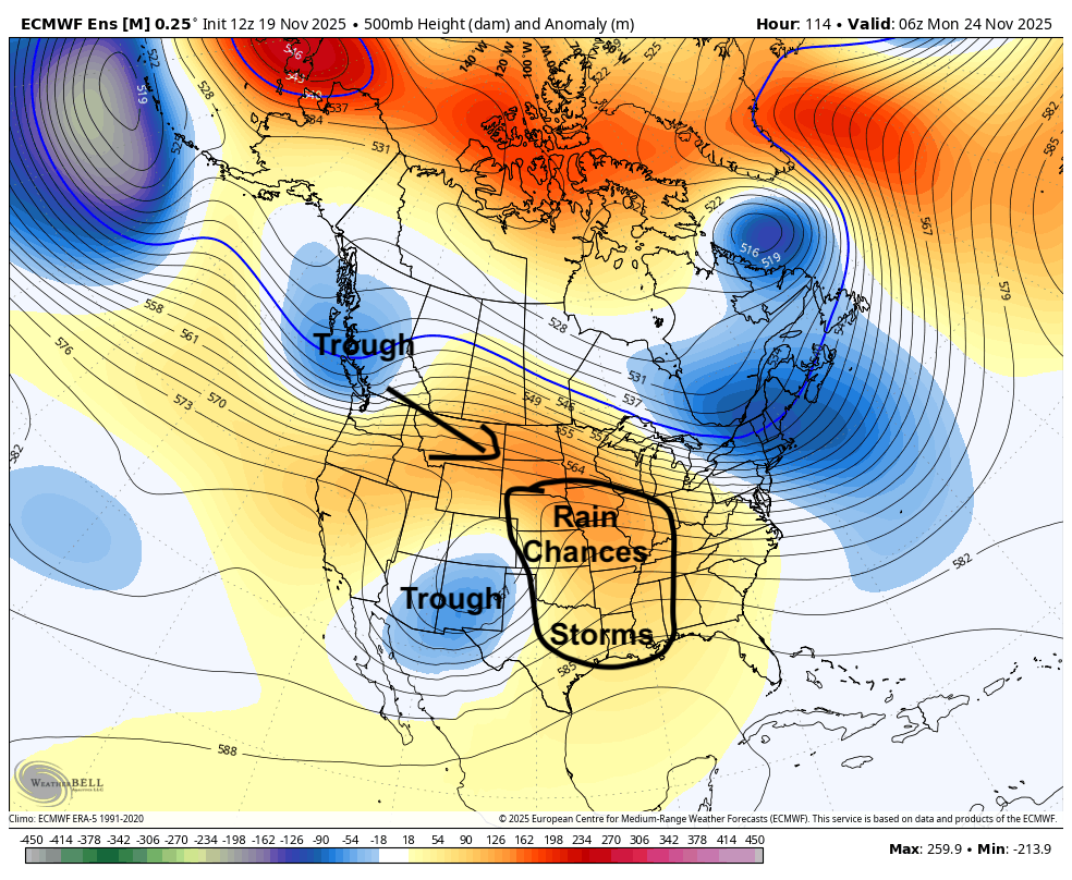
Figure 3. Projected 500-mb height anomalies on Monday morning
This will help create the rising motion needed for precipitation across the state. Totals are not likely to be significant and the northwestern quadrant of the state is not likely to receive much moisture. But light rainfall is a good bet in southern and eastern sections during the day Monday, possibly into Monday evening across eastern Nebraska. Highs on Monday likely will be kept at 55°F or under in areas socked in with clouds and light rain.
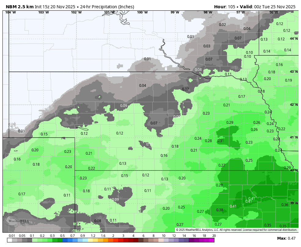
Figure 4. Projected total precipitation on Monday from the NBM
Seasonally cool Thanksgiving
A cold front will move through the state on Tuesday, bringing gusty northwesterly winds by midday for everyone and especially for the north central section of the state. Temperatures likely will still make it into the lower 50's in southeast Nebraska with temperatures topping out in the lower 40's in western Nebraska and mid to upper 40's across southwest, central, and northeast sections of the state. High temperatures will likely remain in the mid 30's to mid 40's on Wednesday and will be cooler still on Thanksgiving Day and Friday in eastern Nebraska. Highs may not get above freezing in northeast Nebraska on Friday and it will be a chilly Black Friday game in Lincoln. Kickoff temperatures likely will be around 30°F and won't rise appreciably above freezing during the game. Winds aren't likely to be super strong but a persistent breeze of 10-15 mph from the north-northeast won't help. Dress warm!
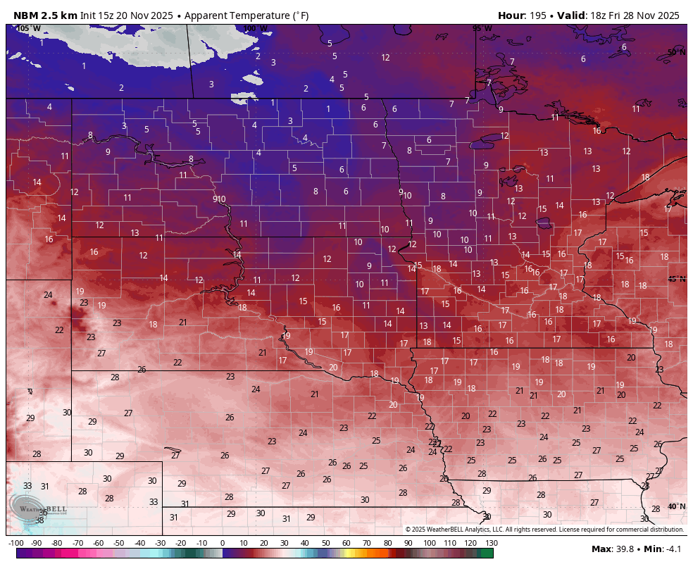
Figure 5. Projected wind chills next Friday at noon
Uncertainty on bitter cold and snow potential
Will speak much more about this in an article tomorrow but there is a strong likelihood of cold to very cold temperatures in the week after Thanksgiving. There are also hints of a brewing winter storm late next weekend into early the following week. The CPC does have almost all of Nebraska and the north central U.S. in general in the slight risk category for heavy snow in the period between November 30th and December 3rd. At a minimum, I would recommend thinking about possibly adjusting travel plans in our region just in case a storm does hit the Sunday or Monday after Thanksgiving.
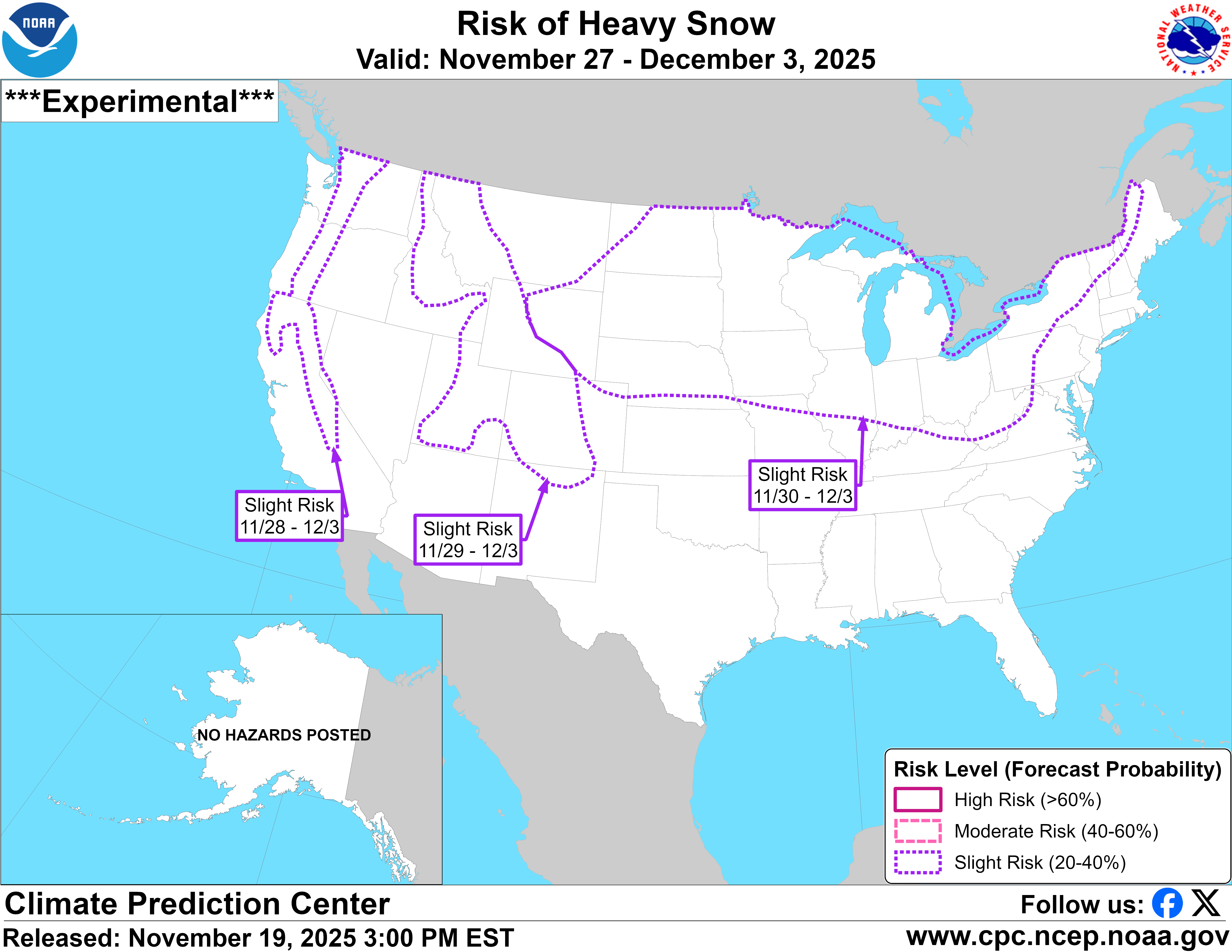
Figure 6. CPC's heavy snow risk map


