All-time temperatures
Saturday's high temperatures set records statewide and obliterated all-time records for the month of March in much of central and eastern Nebraska. Only a few sites in the northern Sand Hills/Panhandle didn't achieve 90°F. Southern and eastern sections of the state had temperatures in the mid to upper 90's where the warmest air mass and best mixing resided. Temperatures in the 90's were prevalent throughout the Southern/Central Plains and Western Corn Belt as the 90°F line approached the Quad Cities later Saturday afternoon.
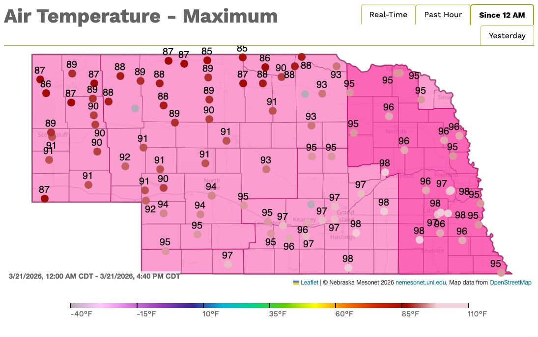
Figure 1. Maximum temperatures last Saturday, March 21
How was it this hot in March?
1) Very strong ridge over the southwest that shifted a bit further east on Friday and Saturday. This allowed for massive amounts of sinking air over our region of the country, which effectively killed any chances of precipitation and cloud cover that would inhibit warming.
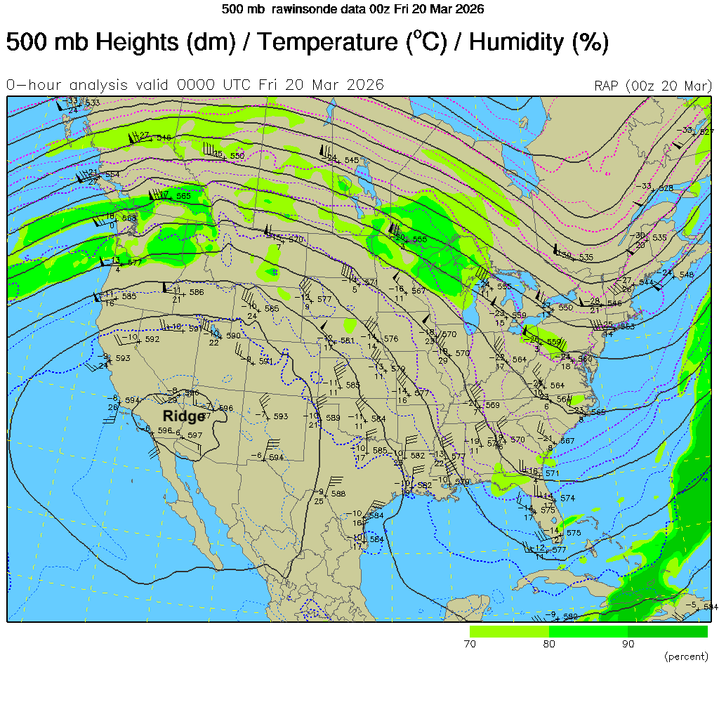
Figure 2. 500-mb chart from last Thursday evening
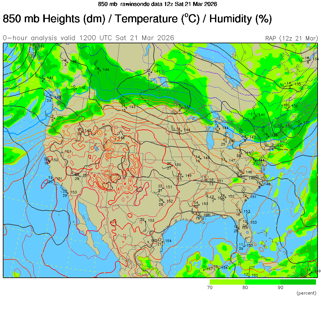
2) Very warm air mass in the lower part of the atmosphere. A look at analysis from 850-mb showed a very warm nose of air that extended into the Central Plains. With no cloud cover and a dormant vegetative landscape, there was nothing inhibiting the boundary layer from growing and allowing for optimal mixing. This brought the very warm air down adibatically to the surface and temperatures quickly shot into the 80's and 90's. The percentage of the state in severe and extreme drought also contributed to the insane temperatures.