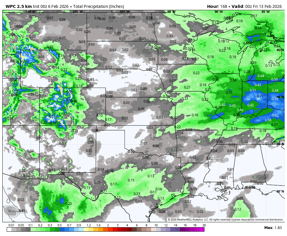
Record warmth on Monday
A very warm air mass will spread from the west on Sunday and by Monday, the combination of highly abnormal 850-mb temperatures and decent mixing with some downslope component will lead to temperatures at or near record levels. Forecast highs from the National Blend of Models currently shows lower 70's in much of west central Nebraska and upper 60's elsewhere. Given the drier ground and decent amount of sun expected, it would seem probable to hit 70°F as far east as Columbus and Lincoln. Possibly even getting into western Iowa. Temperatures yesterday were well above forecast highs and it wouldn't surprise me to see a repeat on Monday.
Figure 1. Projected high temperatures on Monday
Cooler and gloomy
A distinct pattern change will occur next week with troughing coming into the western U.S. A stronger fetch from the Pacific via the sub-tropical jet will bring atmospheric moisture into our region. This will lead to more extensive cloud cover for much of next week starting on Tuesday.
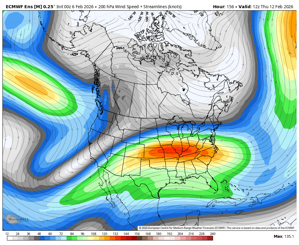
Figure 2. 200-mb winds (jet stream)
There will be a few different shortwaves moving into the central U.S. from the southwest in the second half of the week. This will bring chances of precipitation on Wednesday and perhaps a better chance of precipitation next weekend. It would most likely be in the form of rain for the eastern and southern sections with snow more probable in the western and northern sections. Models currently show the best forcing staying to our southeast next week but it will be worth watching. Regardless, the WPC does show some light precipitation falling across the southern part of the state through next Thursday night. The storm system late next week is more likely to bring better moisture to the eastern half of the state but that will be highly dependent on the track. Will be back with another update early next week.