Record warmth in western Nebraska
Sunday was a mild day for early November statewide. But it was especially warm in western Nebraska temperatures were well into the 70's and lower 80's. Warmest temperature was the Enders 10 SW site with a maximum temperature of 86°F after a morning low of 27°F.
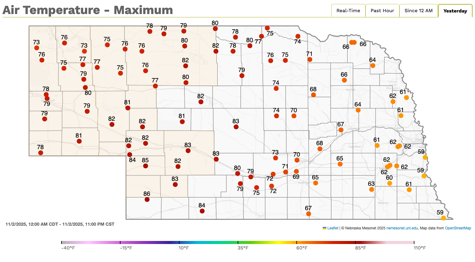
Figure 1. Max temperatures at Nebraska Mesonet stations around the state.
Analysis from yesterday morning showed a deeper trough in the upper levels over the eastern U.S. with a ridge over the southwestern U.S. At the surface high pressure was to our east, which brought southerly flow into the state and more mild air. In the western portion of the state, mixing of warm air aloft (associated with the western ridge) and downsloping westerly winds brought strong compressional warming. Many sites in western Nebraska had a 50°F or greater diurnal range in temperature and a 40°F rise in temperature over a four period was common. These temperatures were also 25-35°F warmer than the high temperatures on Saturday. A similar setup will be in place on Tuesday, though the gradient between eastern and western Nebraska will be less sharp.
Drought Update
The latest U.S. Drought Monitor, which was released last Thursday, shows the vast majority of the state (65%) is free of all drought and abnormal dryness. This is the highest percentage of "no drought" going into the fall since 2019 and also is the first time since 2019 that no one in the state is in severe drought at this point in the fall. That is good news as drought is hard to eradicate in the winter in this part of the country and usually means that the next spring is starting out with deficits of root zone moisture.
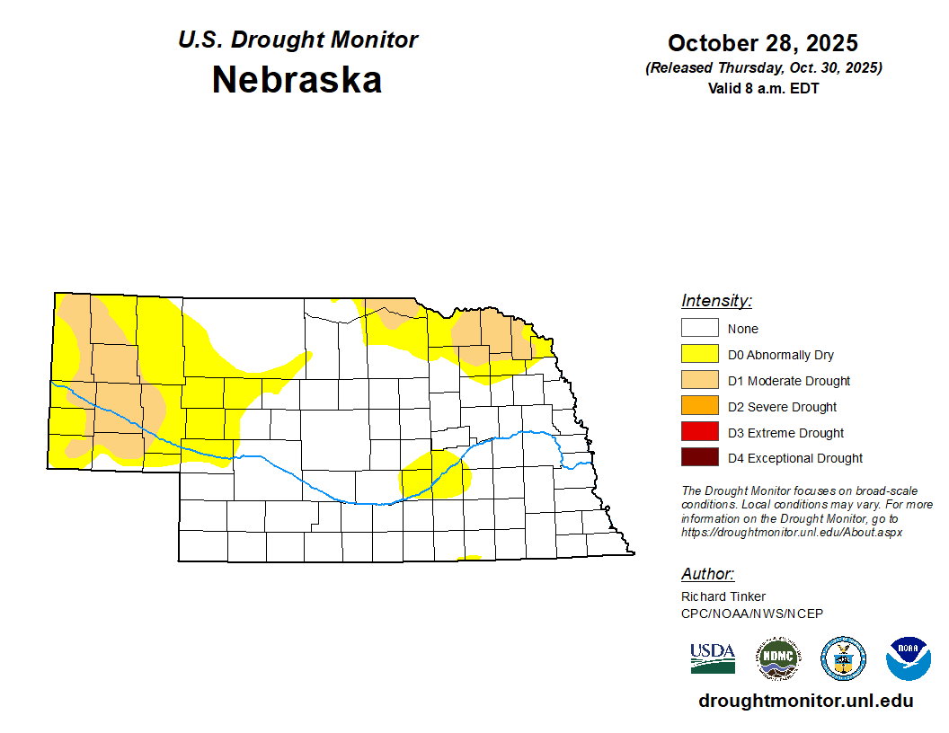
Figure 2. Latest U.S. Drought Monitor for Nebraska
Most of the state has received adequate moisture this fall so far but there are areas of concern. The 90-day departure map shows 2-3" deficits being common from York to Grand Island up through much of northeast Nebraska, with pockets of deficits over 4" around Pierce and Concord. There are also some mild deficits in the Panhandle. The former has seen degradation on the U.S. Drought Monitor since October and there are small pockets in Boyd County that are flirting with being in severe drought.
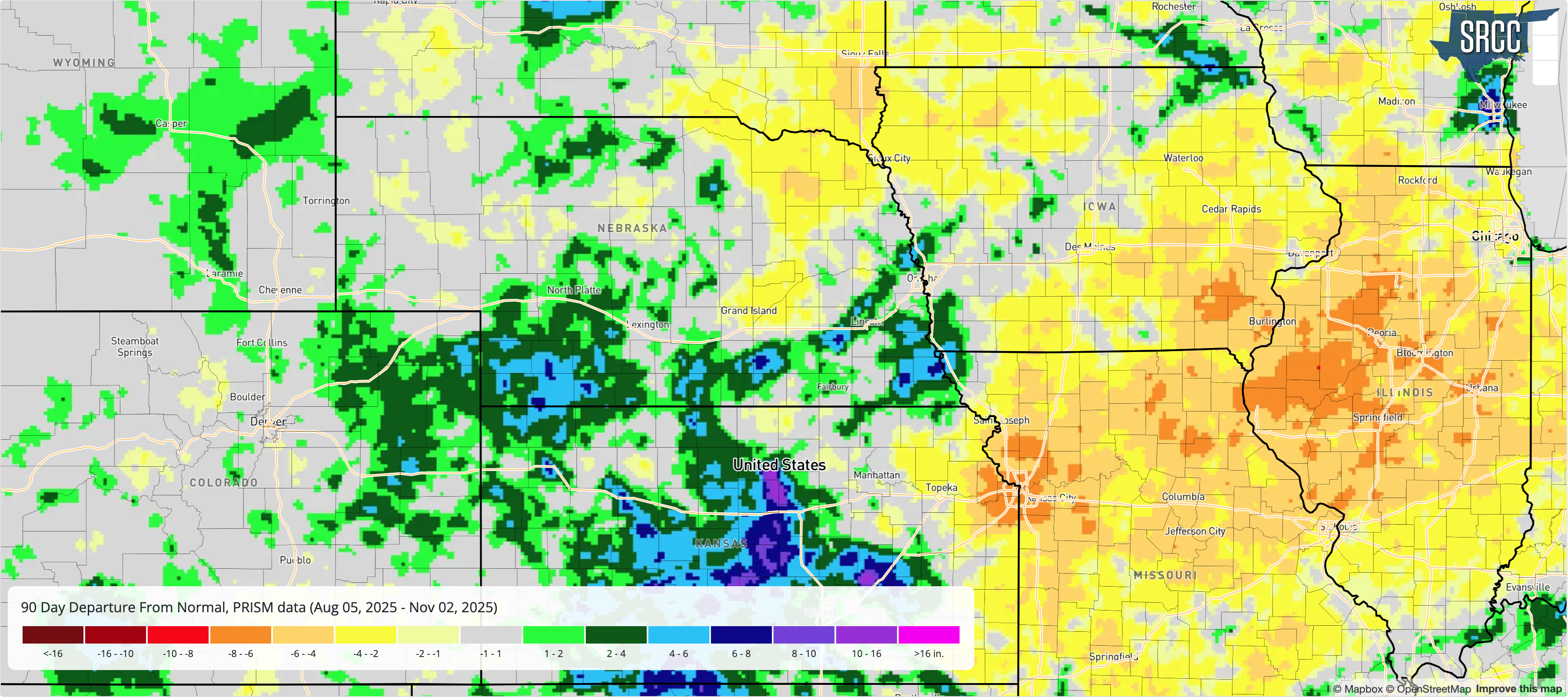
Figure 3. 90-day departure map from the Southern Regional Climate Center's Integrated Water Portal
Drought Outlook
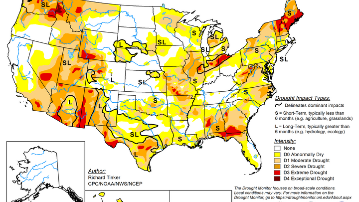
The latest Drought Outlook from the CPC shows drought persisting in the Panhandle and across northeast Nebraska. This seems reasonable given the recent deficits and historical probabilities of breaking drought during the late fall and early winter period, which is a dry time of year.
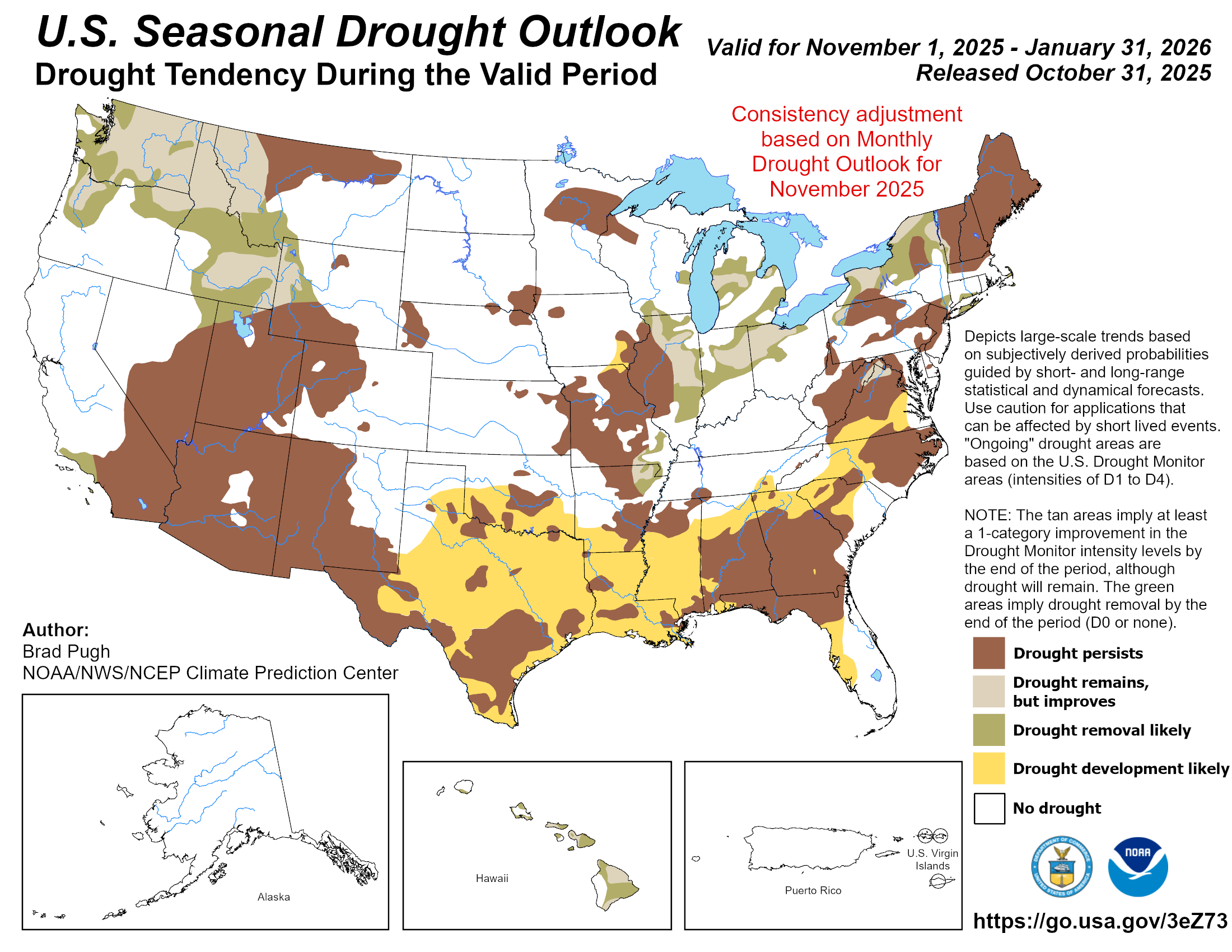
Figure 4. CPC's seasonal drought outlook


