Record warmth
Today will be a very warm day across the state for mid-November and tomorrow is likely to set records in some places. With a very warm air mass in place and downsloping winds from the southwest and west, if there is sufficient sunshine temperatures are likely to exceed 70°F statewide and may exceed 80°F in much of central Nebraska. If temperatures got over 80°F in Grand Island and Hastings tomorrow, it would be the latest >80°F on record. As it is, records are likely in Holdrege, Grand Island, Hastings, and Lincoln. Temperatures have generally overachieved high temperatures of late and if that is the case again tomorrow, it could be an historic day.
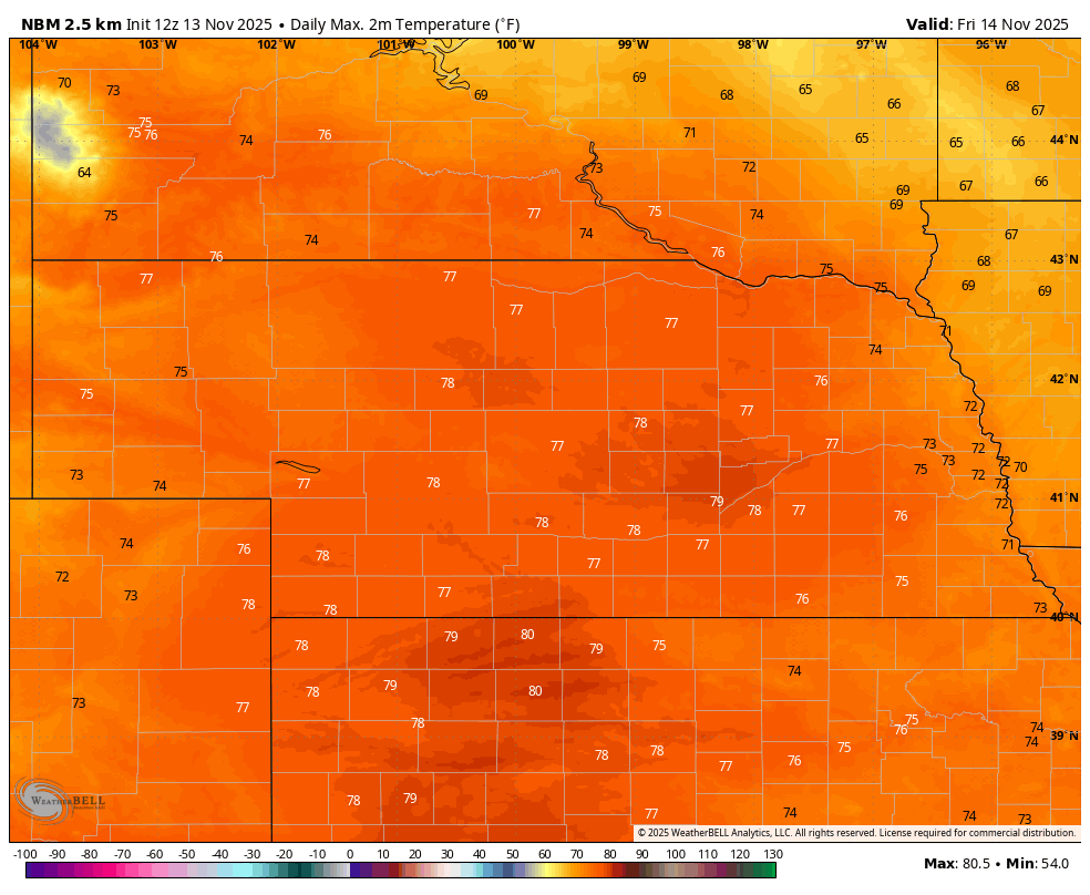
Figure 1. Projected high temperatures on Friday
Chances of moisture on Monday
A cold front will move through the state on Saturday, which will start bringing in cooler (albeit still seasonally mild) temperatures. Highs will be cooler than Friday and likely will be much cooler across the northern portion of the state if the front makes an early appearance. Temperatures will be more seasonal on Sunday and by Monday we should see some shortwave energy coming out of the Rockies into the High Plains region. This will open up chances for moisture on Monday, with the best chance for a quarter inch across the Panhandle and northern third of the state.
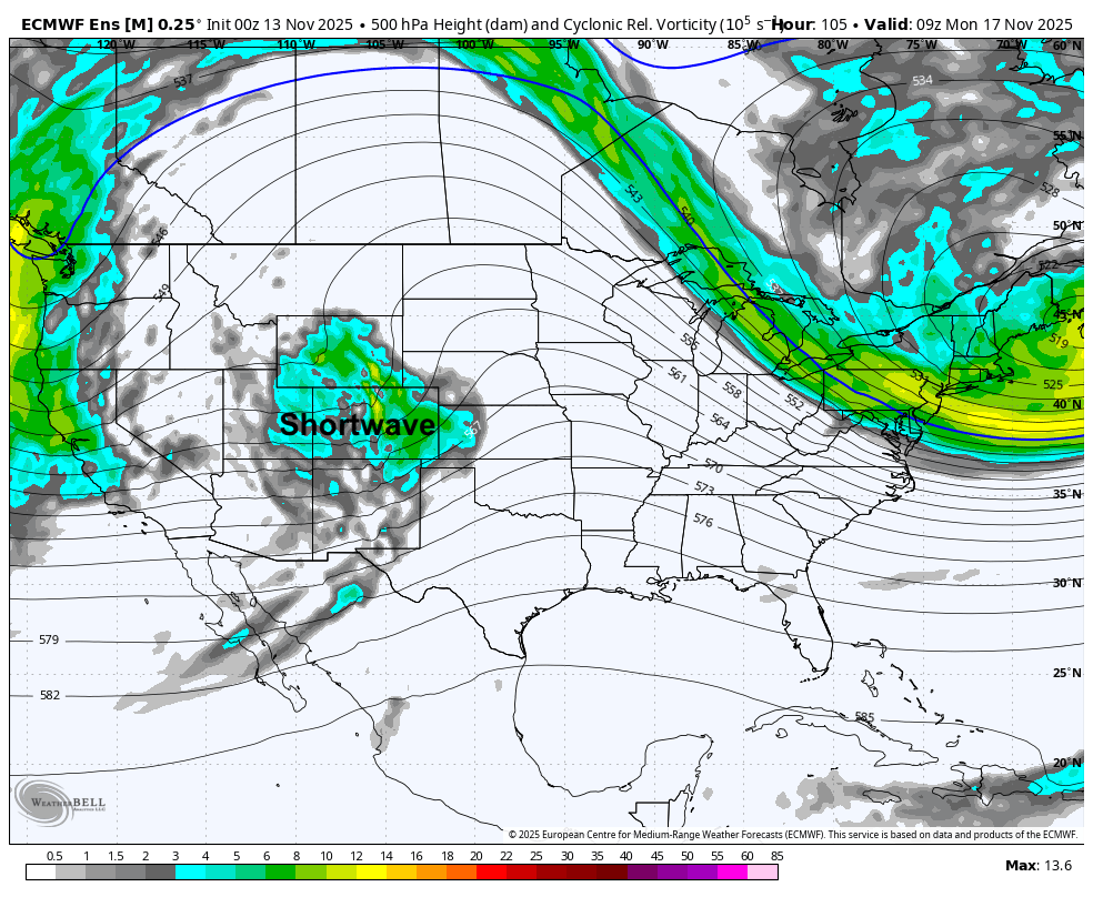
Figure 2. 500-mb vorticity depicting shortwave energy
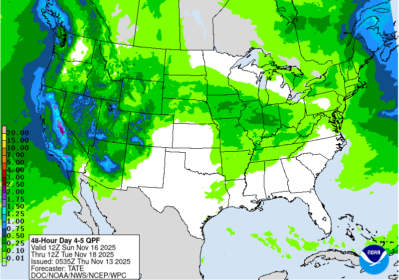
Figure 3. WPC projected precipitation on Monday
More robust moisture chances. Snow?
By later next week a slow moving upper-level low is expected to move from the Southwest into the Central U.S. A surface low is expected to develop in Oklahoma and move NNE into Missouri and southeastern Iowa by late Friday. With high pressure off the southeast coast, there looks to be good moisture return into the storm system. This will open chances for more significant precipitation totals, especially across the southern and eastern portions of the state. An inch plus of moisture will be possible and some areas further east may get over 2" of moisture.
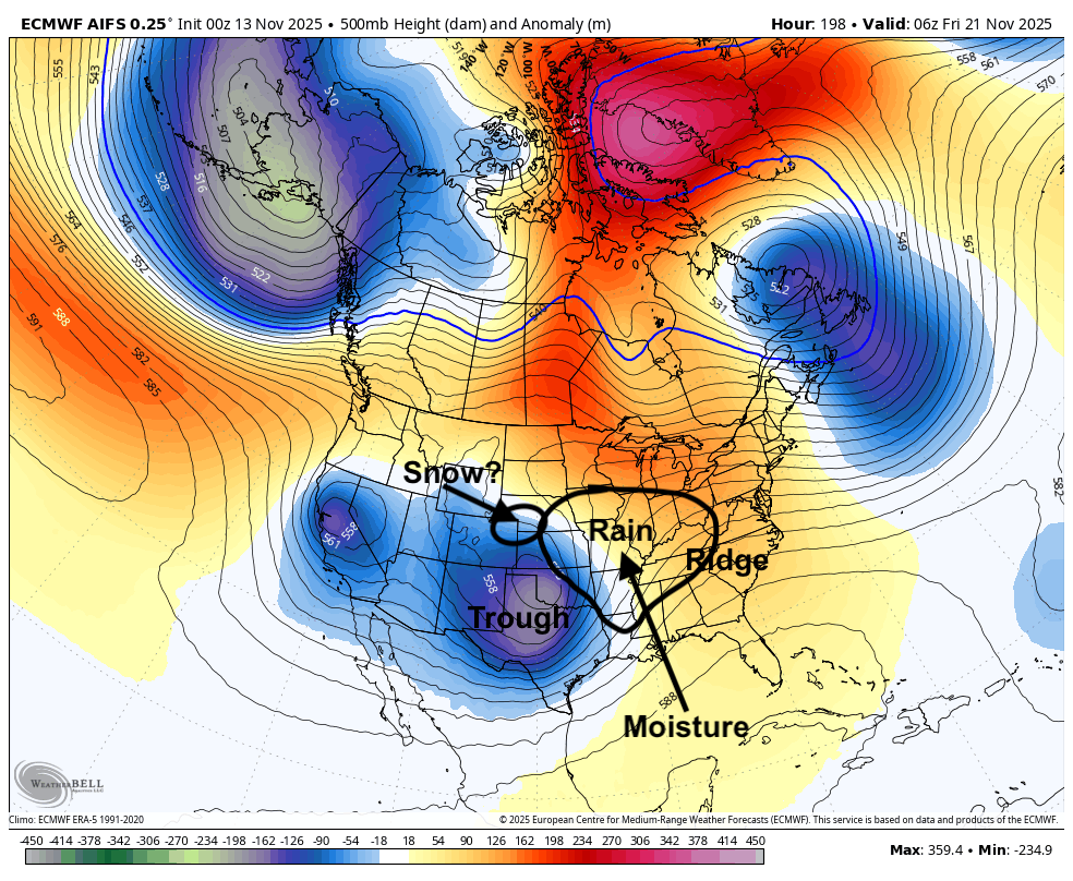
Figure 4. 500-mb height anomalies next Friday morning
The exact track of the storm system and how much moisture can get wrapped around the storm are still a bit uncertain. But most indications are that this could be the best moisture some of us have seen in quite a while. There also is a possibility that this may come at least partly in the form of snow across the west central section of the state if there is sufficient cold air in place or if evaporative cooling of drier air near the surface can help produce a period of snow. Too early to project totals but snow may be possible in places like North Platte and Lexington. Recommend checking the forecast as we get into the middle of the week.
Mild temperatures
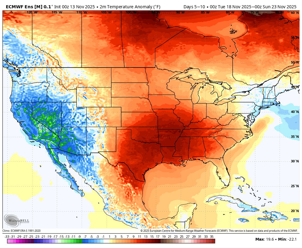
Figure 5. Temperature anomalies next week
Temperatures should generally be on the mild side next week as ridging will remain prominent to our east and troughing out west. But temperatures will be less exceptional than the next few days with highs closer to seasonal averages in the 40's to mid 50's and overnight temperatures generally running 5-10°F above average. In other words, the mild temperatures next week will be driven a bit more by it being less chilly overnight and less by T-shirt weather in the afternoons. Temperatures may still crack 60°F early in the week closer to the Kansas border. Much colder temperatures are probable, perhaps even likely, in early December. But that's a story for another day.


