
Pattern setup
A slow upper level low (Figure 1) slowly moved through Wyoming and was able to tap into deeper moisture over the High Plains region to produce widespread rain and thunderstorms across much of the state over the past 24 hours, especially in the western half of the state.
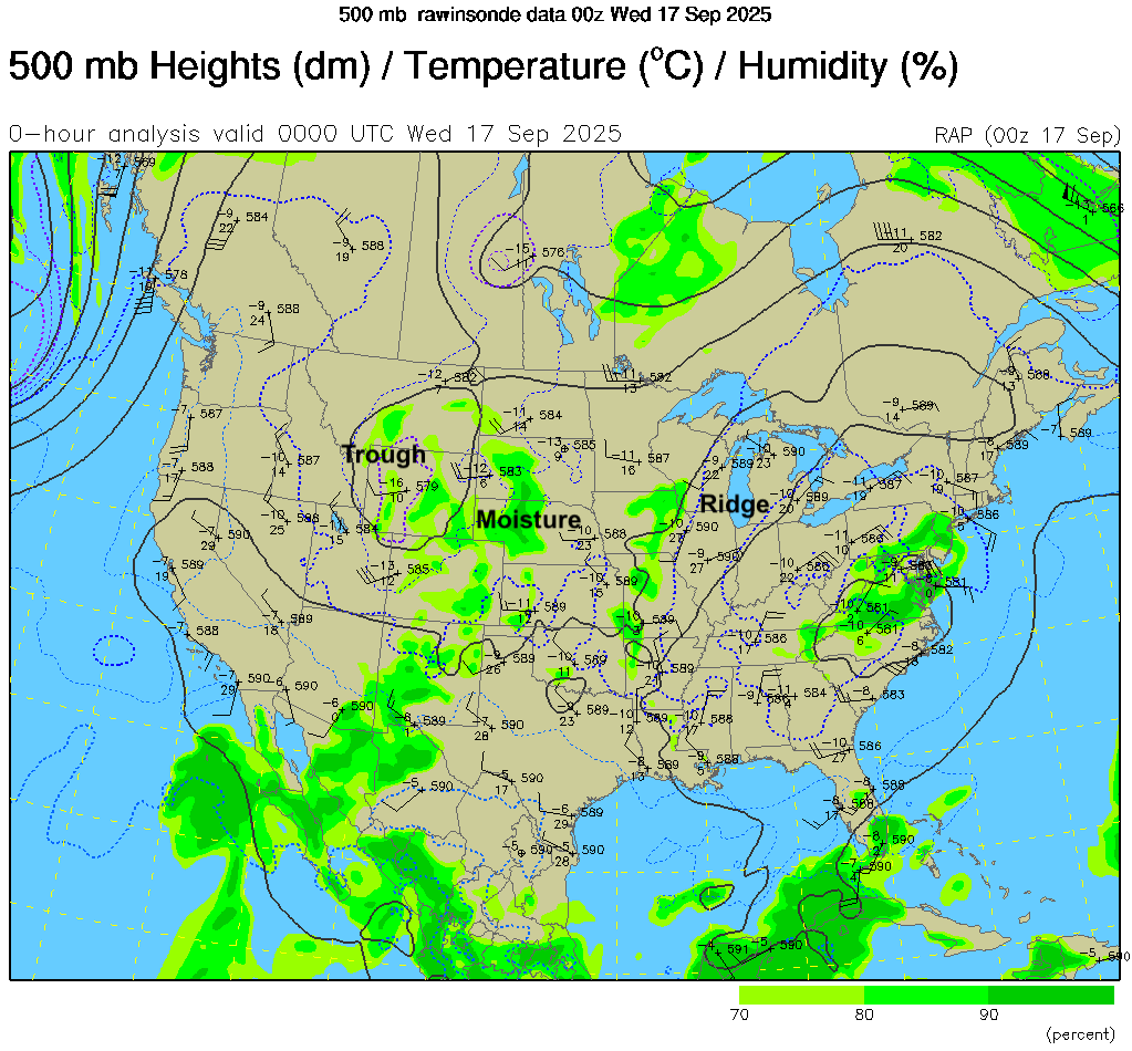
Figure 1. 500-mb heights at 7 PM CDT yesterday (9/16/25)
A look at the surface is even more revealing. A surface low was near Sidney, NE with strong high pressure over the southeast. The location of the high pressure helped lead to good moisture transport from the Gulf into Nebraska. The combination of moisture and good lapse rates (i.e., temperature decrease with height) led to sufficient Convective Potential Available Energy (CAPE) over much of the state by yesterday afternoon. Storms started going up in the Panhandle later in the morning and across southwestern Nebraska by mid-afternoon.
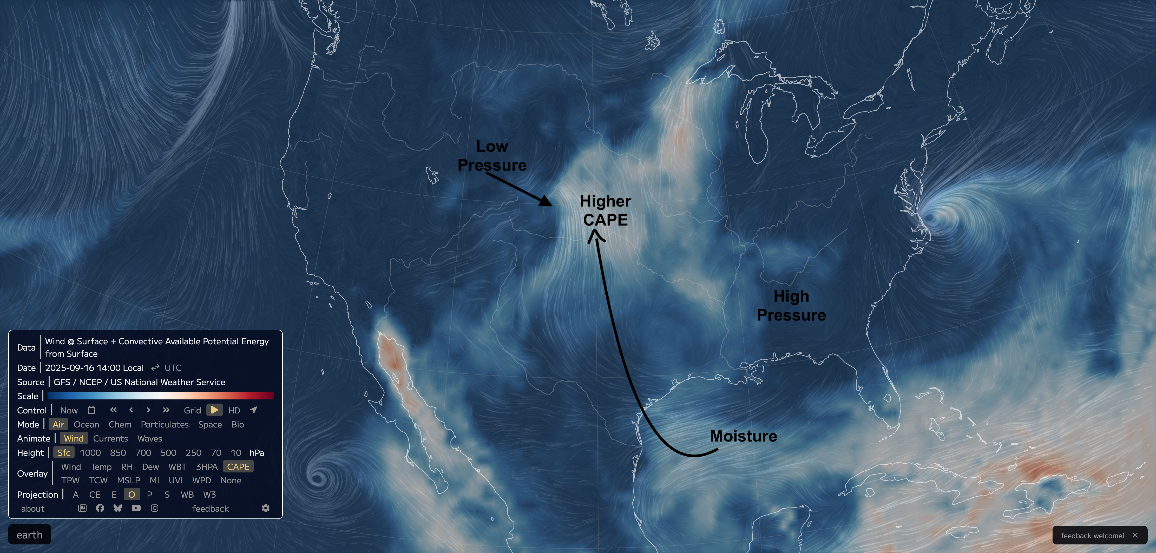
Figure 2. Surface winds and CAPE map from 2 PM CDT on 9/16/25. Compliments of Earth School.
Severe storms
With a favorable environment for stronger storms over that region because of directional wind shear, supercells did form. But because the winds aloft were relatively weak, as is the case when you have slow moving upper level lows, the storms were not necessarily in any hurry. So some places got the double whammy of wind & hail (Figure 3) plus excessive rainfall. Heaviest amounts fell near McCook where nearly 6" fell between early yesterday afternoon and last night, with over 2.5" in a single hour observed at the McCook airport. The daily total of 5.01" at the McCook airport is the third wettest day on record behind May 26, 2023 (6.06") and May 23, 2008 (5.13"). A CoCoRaHS observer in town reported 5.73" so it's feasible some isolated places around McCook set a new daily precipitation yesterday.

Figure 3. Storm reports from 9/16/25
The consequence of the heavy rainfall was some flash flooding and Frenchman Creek was close to minor flood stage earlier this morning.


