Rollercoaster ride
We are currently in the middle of what will be a rollercoaster ride of temperatures for our region as shots of arctic air will be interspersed with more mild air from the west. But how long you are in the arctic air will depend strongly on location. With a western ridge, eastern trough pattern being the more dominant signal for the next 7-10 days, we also are going to see sharp temperature gradients between northeastern Nebraska and the Panhandle at times. Right now it looks like there will be a frontal passage about every 48-60 hours, with temperatures being coldest in northeast Nebraska. The most active storm track will remain to our northeast but north central and eastern sections of the state will have periodic chances for light snow.
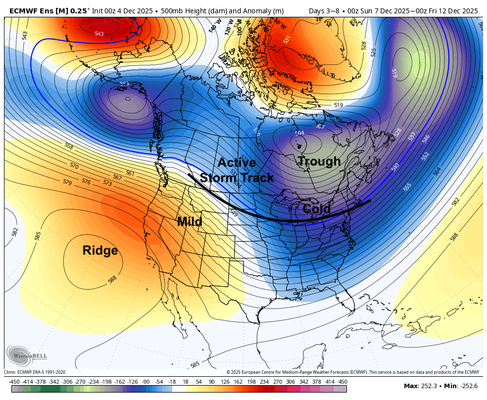
Figure 1. Projected 500-mb height anomalies next week
Snow chances Saturday
A shortwave and associated cold front will be moving through the state on Saturday. This isn't a significant storm system but there is likely to be period of light to moderate snow for northeast and east central sections of the state on Saturday before heading east into Iowa. The snow may extend as far south as Lincoln and Nebraska City. Accumulations are not likely to be significant (generally under 1.5") but travel may be affected for a few hours.
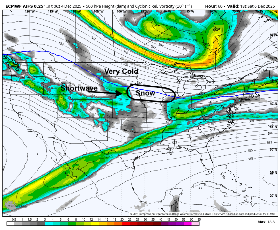
Figure 2. 500-mb vorticity

The next round of arctic air arrives afterward and Sunday will be a cold day in eastern Nebraska with highs mostly in the teens to and lower 20's. Temperatures will be in the 20's in central Nebraska with 30's in the Highway 83 corridor. Highs likely will get into the 40's in the Panhandle.
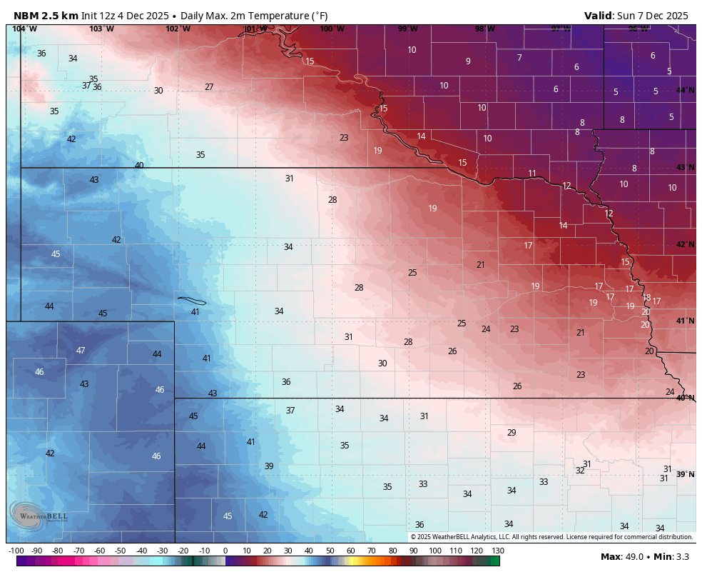
Figure 4. Projected high temperatures on Sunday
Temperatures should moderate on Monday with only far northeast Nebraska remaining below freezing. Tuesday will be warmer still with highs in the 40's for eastern sections of the state and 50's being likely central and west. Lower 60's will be possible around Imperial and McCook. Another front is likely to move through the state on Wednesday with slight chances of precipitation but significant precipitation is not likely. In general, next week is likely to be mostly dry for the state. Temperatures will drop off later in the week again, especially in eastern Nebraska, but shouldn't be as cold as today or Sunday.
Extended forecast
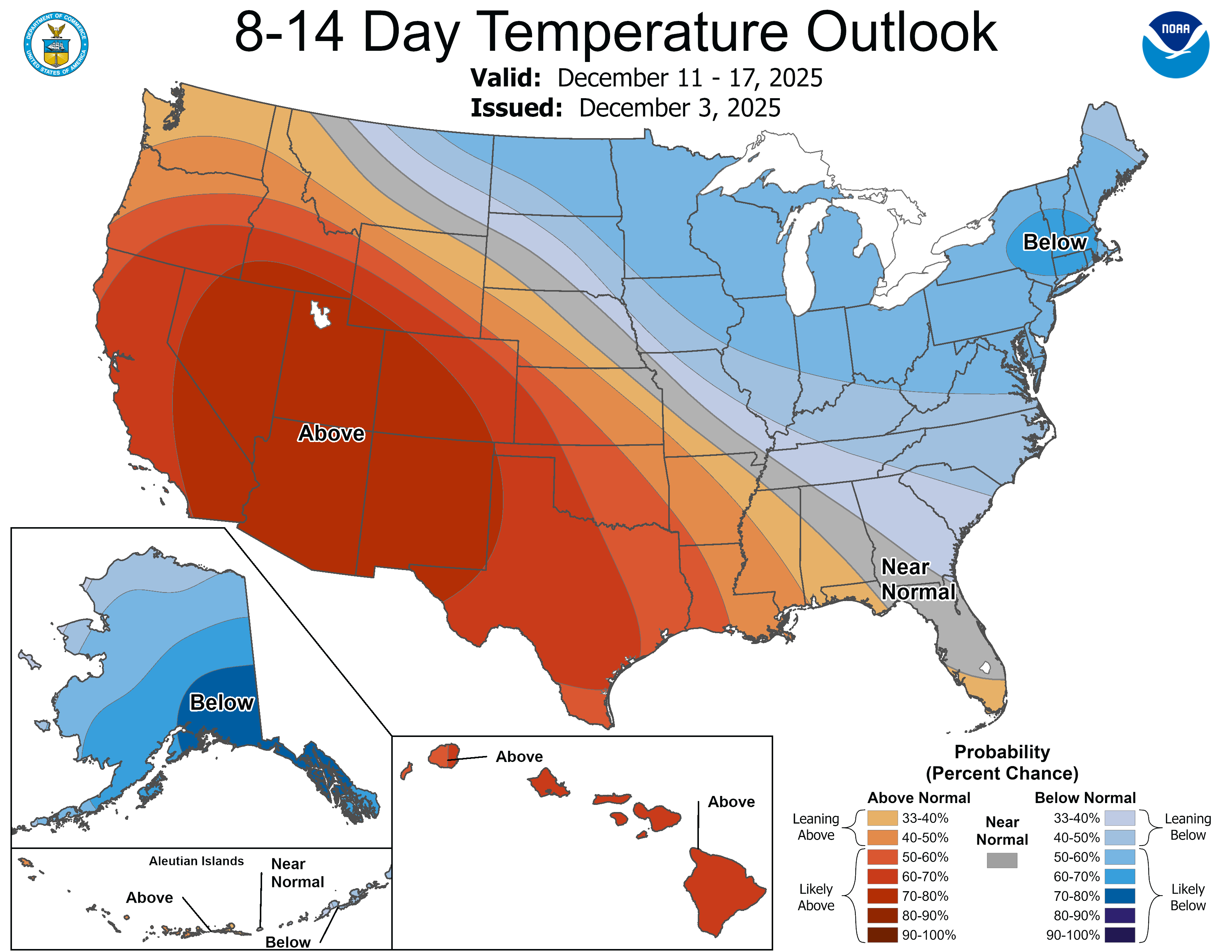
Figure 5. CPC's 8-14 day outlook
The CPC's 8-14 day outlook shows persistence of the pattern into the middle of the month. However, there does appear to be a chance that the cold east and warm west pattern starts breaking down during this period. Models are showing good signal for upper-level ridging to briefly return to the central U.S. next weekend with a trough coming into the western U.S. This would push the mild air east and north toward the Great Lakes and bring colder temperatures back into the west.
Some of the recent ECMWF AI runs suggest temperatures will shoot up Saturday afternoon and evening across the state before a sharp cold front comes in on Sunday the 14th to bring sub-freezing temperatures statewide. This would also potentially be just be another appetizer to very cold temperatures coming into the northern High Plains region around December 17th and slowly spilling southeast. In other words, this forecast for mild temperatures in western Nebraska is possibly dead wrong. There also may be chances for snow during that period too. But this is quite speculative at this point and uncertainty is high.
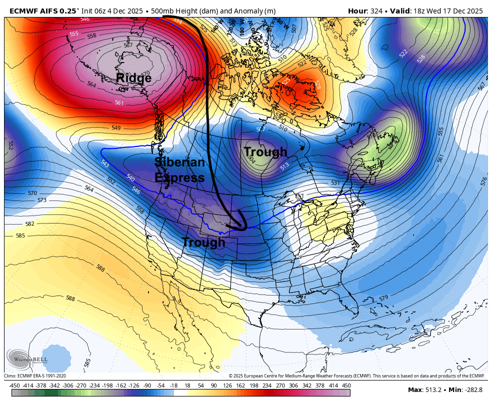
Figure 6. Projected 500-mb height anomalies on December 17th