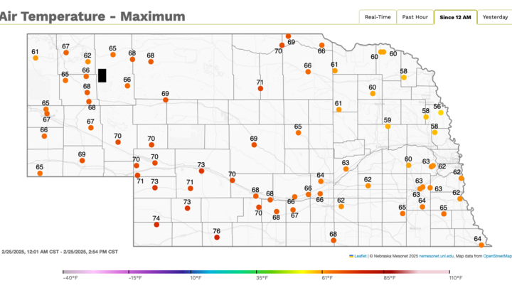
Update: 100F swing achieved
Temperatures yesterday afternoon made it into the 70's across much of central Nebraska and there were six Mesonet sites that achieved the magical "100F swing in less than a week: award:
Merna 2 SW (-32°F to 69°F, 101°F swing)
North Platte 3 SW (-28°F to 73°F, 101°F swing)
Gothenburg 2 NW (-29°F to 75°F, 104°F swing)
Lexington 4 S (-29°F to 73°F, 102°F swing)
Overton 6 SW (-29°F to 73°F, 102°F swing)
Axtell 5 NE (-27°F to 73°F, 100° swing)
Several other sites in the central section of the state were very close to a 100°F swing and many sites in the state set records for temperature swing over a 3.5 to 5.5 day period. These do appear to be the largest swings in temperature we have ever seen in a week across the state. Prior to this week, the biggest swing I could find was a 95°F swing (-18°F to 77°F) in Valentine between March 5-10 in 1989.
Warm week ahead
With ridging aloft for most of the week and some downsloping westerly component, it will be a warm week across the state and region. High temperatures tomorrow will be around where they are today, perhaps even a bit warmer across portions of central Nebraska. Highs over 70°F are possible tomorrow afternoon in southeast Nebraska and probable in southwest Nebraska into central sections of the state.
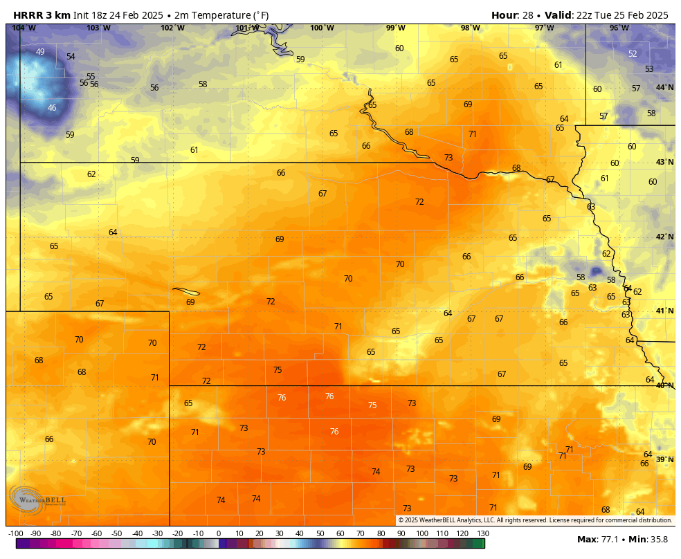
Figure 1. Temperatures tomorrow afternoon
This would mean that several locations in central Nebraska have a reasonable chance of achieving a 100°F swing over the coldest temperatures last Thursday morning. Temperatures will cool a bit on Wednesday and Thursday after the passage of a cool front, but will remain well above seasonal levels. Temperatures on Friday likely be close to levels on Tuesday, perhaps even a bit warmer in the eastern side of the state. Winds will be on the breezy side at times this week, especially in the western third of the state. Fire danger should be under critical levels with the recent melt of snow. But by the end of the week, this surface moisture will be mostly gone, so there may be some elevated levels of fire on Friday afternoon. Ice jams will also be a threat on the Platte and Elkhorn Rivers later this week.


