Very cold temperatures
The polar vortex is going to be doing more yoga later this week and the upper-air pattern in the troposphere is optimal for bringing that very cold air into the central and eastern U.S. The combination of ridging over Alaska and Greenland will help to squeeze that dense, polar air straight down into the north central U.S. later this week. Current projections show the arctic front barreling through the state starting Thursday afternoon into Thursday night. Temperatures will plummet from ~30 to subzero fairly quickly and wind chills will be subzero statewide by early Friday morning. Wind chills of 30-35 below are likely on Friday morning across north central and northeast Nebraska and a large section of the state will see wind chills colder than 20 below on Friday morning. This is not all-time cold for our area but it is certainly the coldest air we have seen in what has generally been a very mild winter. Thus, acclimation to this cold may be less than it would have been in the past.
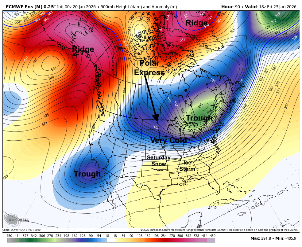
Figure 1. Projected 500-mb height anomaly pattern on Friday afternoon
The coldest air is likely going to remain a bit to our northeast. However, with the arctic high pressure expected to be in central South Dakota on Friday, winds in the state will be from the northeast. This is not a wind direction that gives us any downslope component for extra warming and for much of the state will be upslope. Thus, air temperatures will struggle to rise a lot during the day on Friday and likely will remain below 0 the entire day in the northeast quadrant of the state. I think there is a chance that Omaha, Lincoln, and Grand Island will have daytime highs below 0 as well. The western side of the state should get into the single digits.
Snow possible
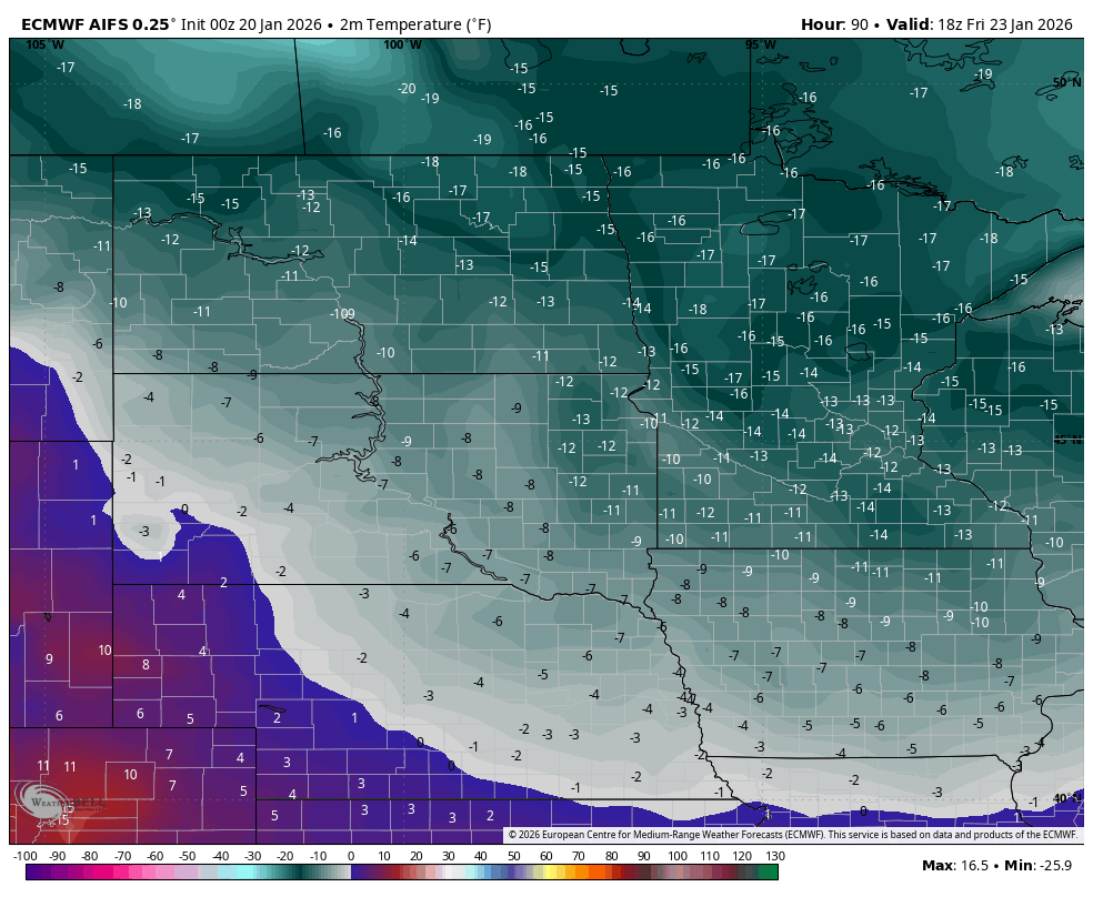
Several days ago it looked possible that we could be dealing with an eventful winter storm. Things aren't coming together for us to get a major storm but it is possible that the southern half of the state could see an inch or two of snow between late Friday night and Saturday night. With a slower mid-level trough moving from the southwestern U.S. into the southern U.S. and a stronger sub-tropical jet coming across the southern U.S., there will be a prolonged period of rising motion and precipitation across much of the southern U.S. This could be a catastrophic ice storm from east Texas into north Georgia and the southern Plains could see several inches of snow.
Some of this better rising motion could get as far north as I-80 on Saturday, which would help produce a period of light snow for the southern part of the state. The biggest hindrance to snow will be the very dry air being entrained from the east with the location of the surface high. If the storm takes a bit more a northward or northeastward shift, then the chances for accumulating snow would go up for the whole state. Temperatures will be a bit warmer on Saturday with single digits above zero (north and east) and teens (west and south) and back into the 20's (east) and 30's (west) on Sunday. Another big cold snap is possible next Wednesday but most signs point to a return to mild weather in early February.

Figure 3. Panel on precipitation types and amounts through next Sunday afternoon