Historic minimum snowpack
The massive ridge over the western U.S. last week led to record warmth and rapid snowmelt across the Rockies. At a time of year when the snowpack generally is building, last week brought a reduction and not a trivial reduction. In some years this could be viewed as a minor issue. But those reductions were from a historically low point and as of this morning, the current snow water equivalent for this period in March has no modern analog. Even the next worst year for snow water equivalent was roughly 3 inches higher than where we are currently.
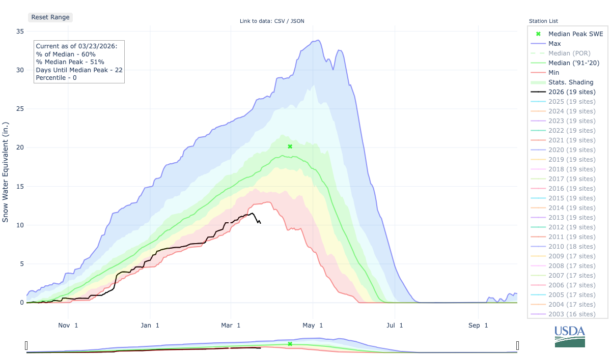
Figure 1. Snow water equivalent in the North Platte basin. Black line represents current year and red line represents the historical minimum for a given date based on data through 2025.
Will get worse before it gets better
Ridging will remain prominent over the western U.S. through the early portion of next week. This is not good news. This means that snow won't be falling since the main storm track is well north and that there will be additional melting.
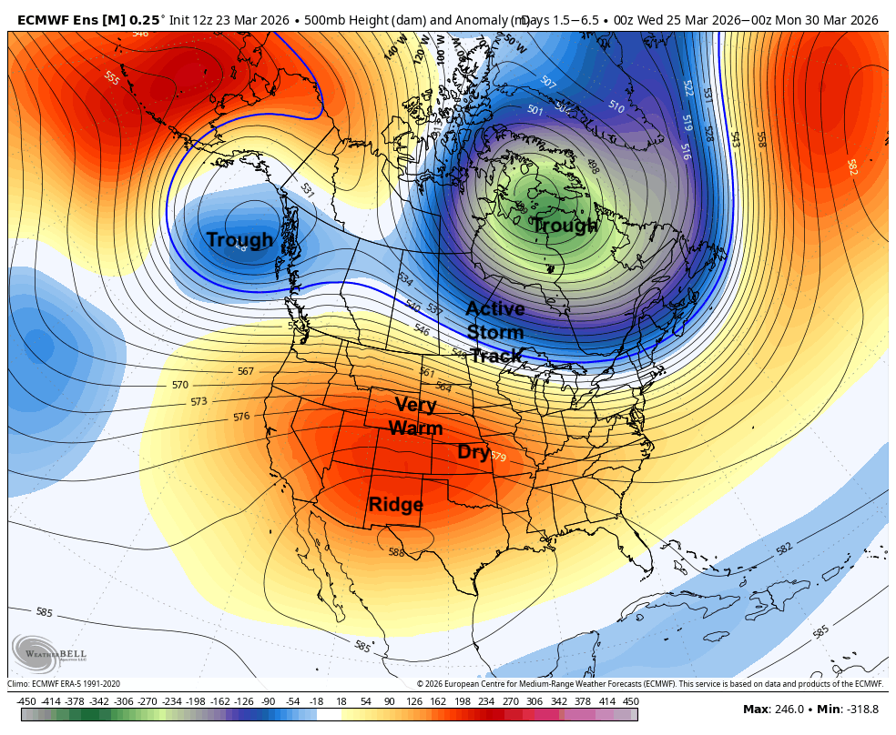
Figure 2. General upper air pattern expected through the early part of next week.
I would guess the snow water equivalent for the North Platte Basin will drop under 10 inches by this weekend. This would be at least three weeks earlier than in 2012 and the snow is currently on pace to be gone before the end of April. The good news is that a distinct pattern change is likely by the middle of next week.
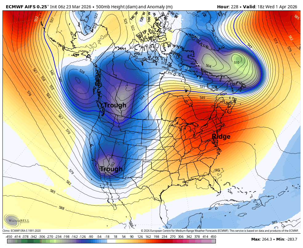
Figure 3. 500-mb height anomalies for next Wednesday afternoon.
This will bring good chances for moisture into the central Rockies and throughout much of the Central Plains and Corn Belt, which may be the first step toward halting perpetual drought degradation. It is very unlikely that enough snow would fall in the central Rockies in the first part of April to get near the median. But at least it may bring it more in line with 2012 snow water equivalent levels. Certainly not good but at least water managers would have something to compare it to.
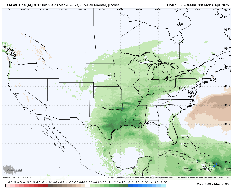
Figure 4. Projected precipitation anomalies in the first five days of April