Rain chances south of the Platte Saturday
A trough will be moving east from southern California into the Southern Plains this weekend, which will deliver much needed moisture to that region into the Mid-South between tomorrow night and Sunday. The northern extent of the precipitation is likely to be around Highway 136 but might possibly get closer to I-80 between North Platte and Omaha. Amounts will be light, likely on the order a few hundredths to a tenth of an inch. Some areas near the Kansas border may get over a quarter of an inch. Temperatures will be a little cooler in southeast Nebraska on Saturday with the cloud cover.
Record warmth probable early next week
The upper air pattern early next week will feature deep troughing across the Pacific Northwest and increasing heights across the central and eastern U.S. as ridging builds to the south.
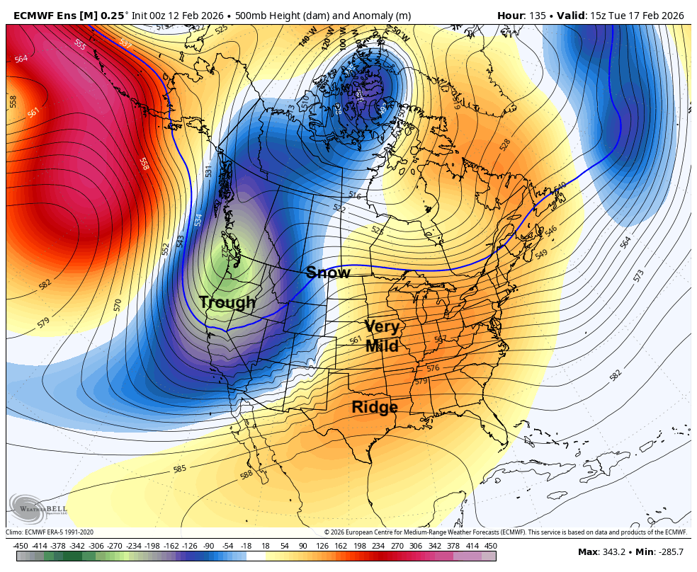
Figure 1. Projected 500-mb height anomalies next Tuesday.
A quick look at projected 850-mb and 925-mb temperatures shows very warm air advecting out of northern Mexico and west Texas into the Central Plains early in the week. With a breeze from the south, this will help lead to temperatures in the 60's and 70's from Sunday-Wednesday across the state, with warmest temperatures shifting from western Nebraska on Sunday-Monday into the eastern half of Nebraska and into Iowa and Illinois on Wednesday. Record temperatures may be possible Monday if temperatures are warmer than currently forecast- would not be shocked to see widespread 70's on Monday in Nebraska. Tuesday may be a bit cooler, particularly in the northern part of the state. Temperatures also will remain very mild at night, likely staying above freezing for several days in a row. This may wake up some vegetation that has no business attempting to bloom in mid-February.
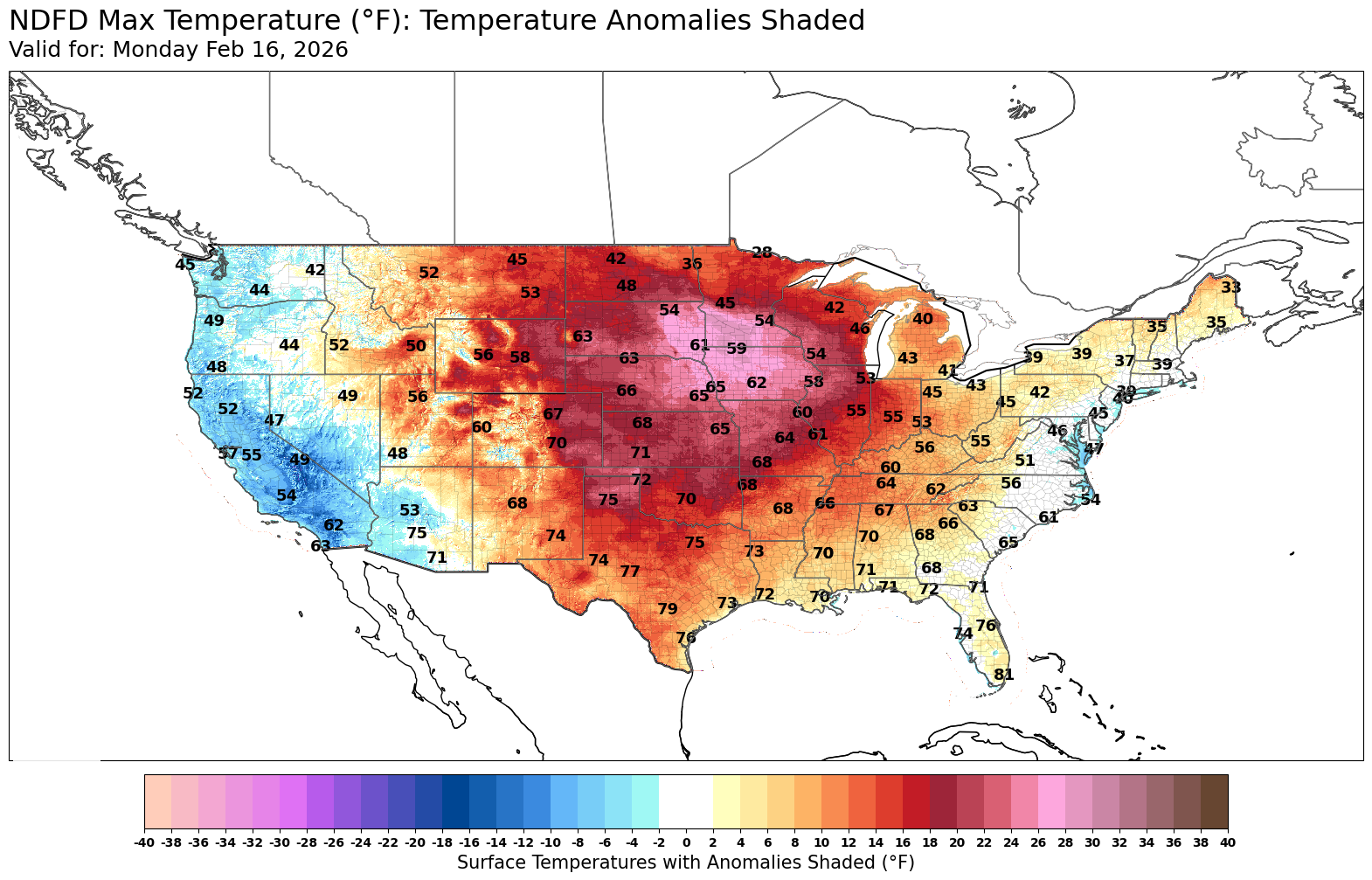
Figure 2. Projected high temperatures on Monday
Moisture chances
A surface low is likely to develop in eastern Wyoming and will move ENE into South Dakota by Tuesday afternoon. This will bring a good chance of snow in eastern Montana and North Dakota with rain possible along the I-90 corridor. Rain will be possible on Wednesday across the northern section of the state and possibly even into the I-80 corridor if the storm is a bit further south than currently forecast. The WPC does not show any moisture falling across the state the middle of next week, but it will be worth watching to see if there is a chance to get a tenth across the northern and eastern sections of the state.
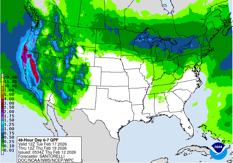
Figure 3. WPC expected precipitation between next Tuesday morning and next Thursday morning
Cooler temperatures to finish the week. Moisture chances next weekend?
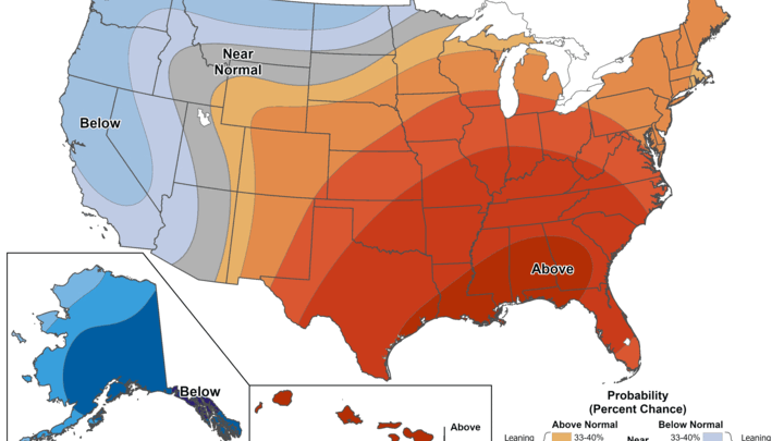
A cold front will move through the state by early next Thursday which will bring temperatures back closer to average for mid-February, though likely still above average in the 40's. There are indications of a storm system moving into the central Plains next weekend, which would open up better chances for moisture statewide. The CPC's 8-14 day outlook does show above average favored so that is a good sign for potential moisture. There are also indications that much colder temperatures may be coming into our region in about 10 days. Anything that decides it is spring early next week may be in for a very rude surprise.
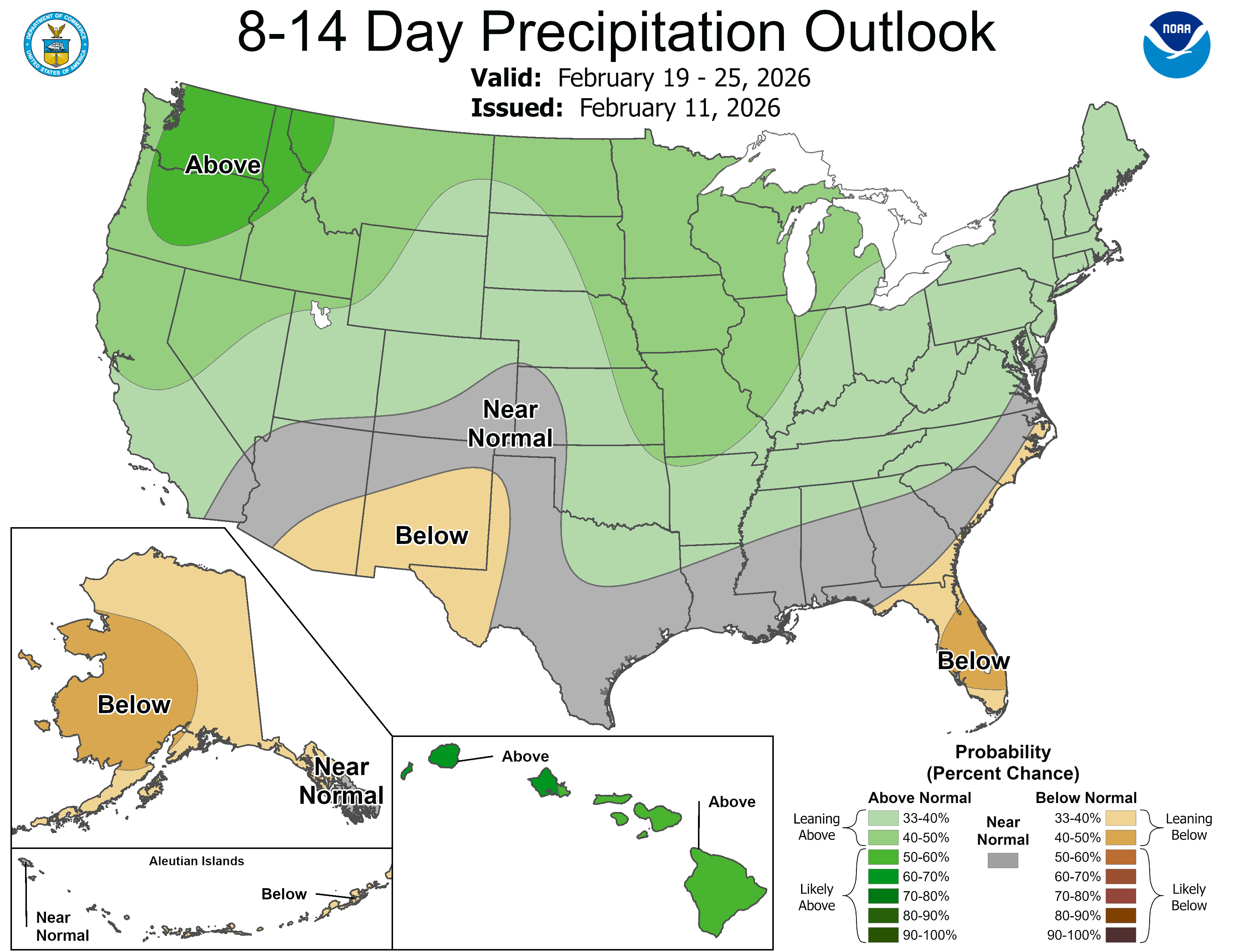
Figure 4. CPC 8-14 day outlook


