Precipitation chances through Saturday morning
The upper level low responsible for the active weather in recent days will be slowly working its way through the area over the next few days (Figure 1). Precipitation will be likely over eastern Nebraska this afternoon into the early evening hours. There likely will be a break tonight and through early tomorrow afternoon before another shortwave moves into the eastern half of the state from South Dakota. This will bring a reasonable chance of showers and storms across the northern and eastern sections of the state with rain/storms moving from northwest to southeast during the afternoon and overnight hours. Current indications are that it should be a very nice morning and early afternoon across the southern third of the state before things go downhill toward evening in southeast Nebraska.
Figure 1. 500-mb heights at 00Z last evening
Flash flood risk tomorrow night
There is some indication in the high-resolution models that there will be an extended period of rising motion in southeast Nebraska on Friday night into early Saturday as the shortwave rolls through the area. The WPC currently has much of this area in the marginal risk area for excessive rainfall. Thus there may be some heavier rainfall totals for places like Lincoln, Hebron, Beatrice, Auburn, and Falls City later Friday night into early Saturday morning. Flash flooding with training storms may be a concern along and south of I-80 in eastern Nebraska. Things likely will have cleared out in time for football festivities but there is a chance the day may start out wet in Lincoln. The southwestern portion of the state likely will remain on the dry side through the next few days, which is probably ok after Tuesday.
Figure 2. WPC Excessive rainfall outlook for early Saturday
Football forecast
As of now, the forecast for kickoff looks good with temperatures with some sunshine, temperatures in the 70's and winds light out of the south at 5-10 mph. Michigan will be tough but it's a road game for a freshman QB without the head coach. Nebraska 27 Michigan 21.
Additional chances of moisture
There should be a break in precipitation across the state Sunday and most of Monday. By early Tuesday, a shortwave trough will be moving through the state and showers and storms will be likely. Exact timing of the start of precipitation is tricky but likely would be late Monday night across northern and western sections of the state and during the day Tuesday further south and east.
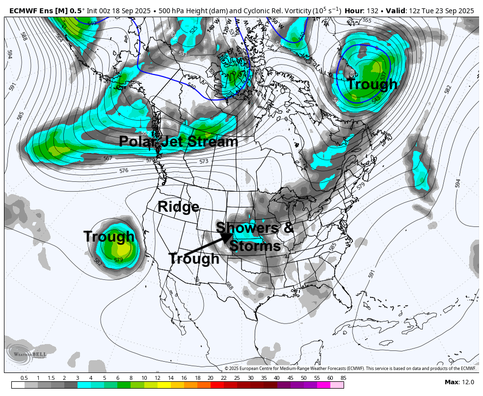
Figure 3. 500-mb vorticity map for early Tuesday morning (Sept. 23rd)
Total amounts of over half an inch will be possible statewide but current projections put the best chance of over an inch of moisture in the eastern third of the state. There is no significant severe weather signal showing up in the SPC Extended outlooks but this may need to be monitored as we get closer to Monday afternoon. Precipitation should be coming to an end by Wednesday morning and will start a longer stretch of dry weather.
Figure 4. WPC precipitation projections
Warm and dry
Upper level ridging looks to be building back into the north central U.S. across this region by later in the week. That looks to be a prominent feature for the remainder of the month and possibly into the first part of October. This should allow for an extended period of mostly dry conditions statewide with temperatures generally above seasonal averages. Highs likely will be in the 80's statewide by next weekend and that may persist into the first day or two of October. Overnight lows will also be above average in the 50's and lower 60's and there is no real frost risk for the remainder of the month, outside a small chance in the highest elevations of the Panhandle next Wednesday morning.
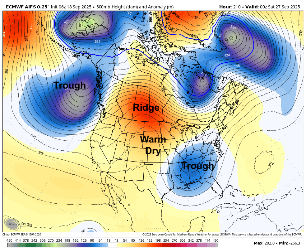
Figure 5. 500-mb heights next Friday evening
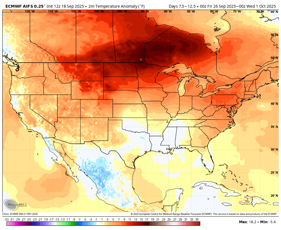
Figure 6. Projected 5-day temperature anomaly between September 26 and September 30.
October 1 storm?
Another storm system may be entering the region around the 1st of October according to some recent ECMWF AI runs, which would open up some chance of rain and storms for the region. This would appear to be a quicker moving system with a modest area of showers and storms along a cold front followed by a brief cool down in the first few days of October.
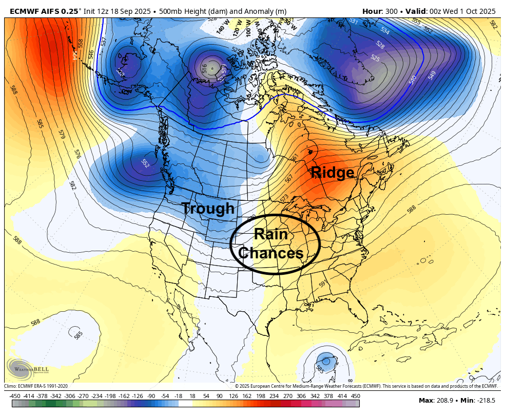
Figure 7. 500-mb height anomalies for 00Z on October 1st
Good harvest weather
Current forecasts and historic precedent would suggest that October will generally be a warm and dry month relative to average, though not likely as warm or as dry as last year. The 30-day precipitation anomalies for the period ending on October 22nd from the ECMWF show dry favored (Figure 8) across all of Nebraska and most of the central U.S. This would suggest mostly dry weather would be the rule in the first three weeks of October, which would allow for a good harvest window. Warmer than average also is likely through the first half of October. From a climatological standpoint, that would mean a lot of days with highs in the 70's and lows in the 40's to mid 50's. Good weather for harvest and other recreation activities.
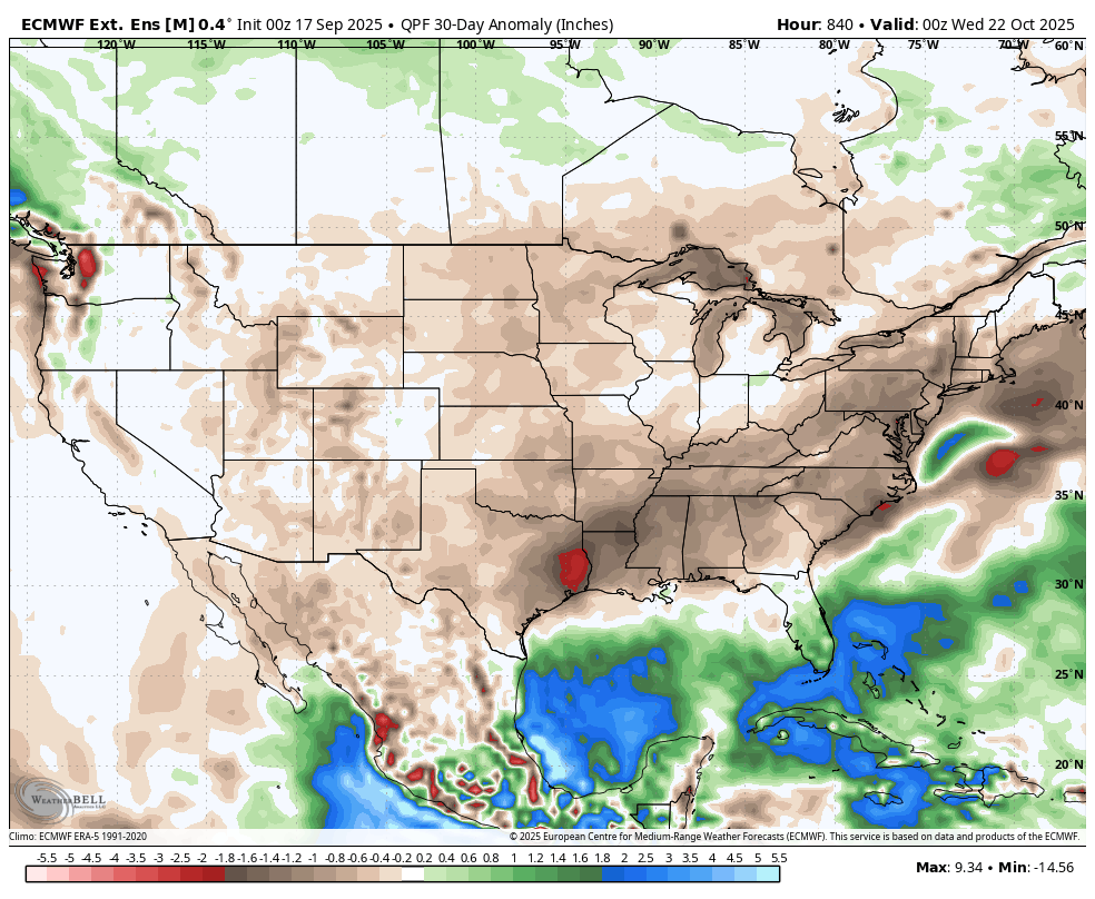
Figure 8. 30-day precipitation anomalies for the period ending October 22nd


