
Meteorological Summary
Hello, the NSCO community! This past week, Nebraska experienced a classic early-December winter trend, with several arctic air blasts followed by a brief warm-up. Early in the week, lows dipped into the single digits above and below zero across much of eastern Nebraska and western Iowa, with daytime highs only in the teens and 20s, with the coldest temperatures being in northeast Nebraska. Farther west, highs stayed around the upper 30s to mid-40s at times, especially in the central Sandhills and southwest. As the pattern briefly settled on Friday and again headed into early next week, highs climbed back into the 30s and 40s and are expected to push into the 50s and even low 60s in parts of western Nebraska on Tuesday. The humidity remained fairly low, except during brief intervals of low clouds, fog, and light snow or freezing drizzle. However, most of the state experienced dry conditions, with only sporadic light precipitation.
The northwest flow at 500 mb and 850 mb over Nebraska was a persistent trough for most of the week. There were some embedded shortwave troughs southeast of the northern Rockies and southern Canada that brought in colder air and light snow for that part of the state. One stronger wave late in the week and into the weekend drove a lee-side surface low from Wyoming across Nebraska. Ahead of these waves, warm air advection at 850 mb allowed temperatures to rebound into the upper 30s and 40s, especially west.
At the surface, a strong cold front pushed south out of South Dakota late Tuesday night into Wednesday, with highs in many areas occurring early in the day before temperatures dropped steadily into the teens and 20s by afternoon, with the most pronounced areas being from north-central into northeast Nebraska. Behind this front, gusty north winds of 15–25 mph drove wind chills into the single digits and teens. A cold front reinforced the cooler temperatures into eastern Nebraska and western Iowa, while further west, a bit more mixing helped to keep them slightly milder. Later in the week, a warm front lifted east across Nebraska on Sunday, bringing a wide gradient in temperatures from the mid-20s east of Highway 183 to the 40s in the western Panhandle and Sandhills.
That same warm front, combined with an upper-level disturbance, produced a narrow band of light snow across north-central Nebraska and flurries farther south. Localized impacts mainly included slick spots on untreated roads, especially where patchy freezing drizzle and light snow overlapped around the Sandhills and southwest Nebraska early Thursday, and again across parts of north-central Nebraska Friday night into Saturday.
Precipitation
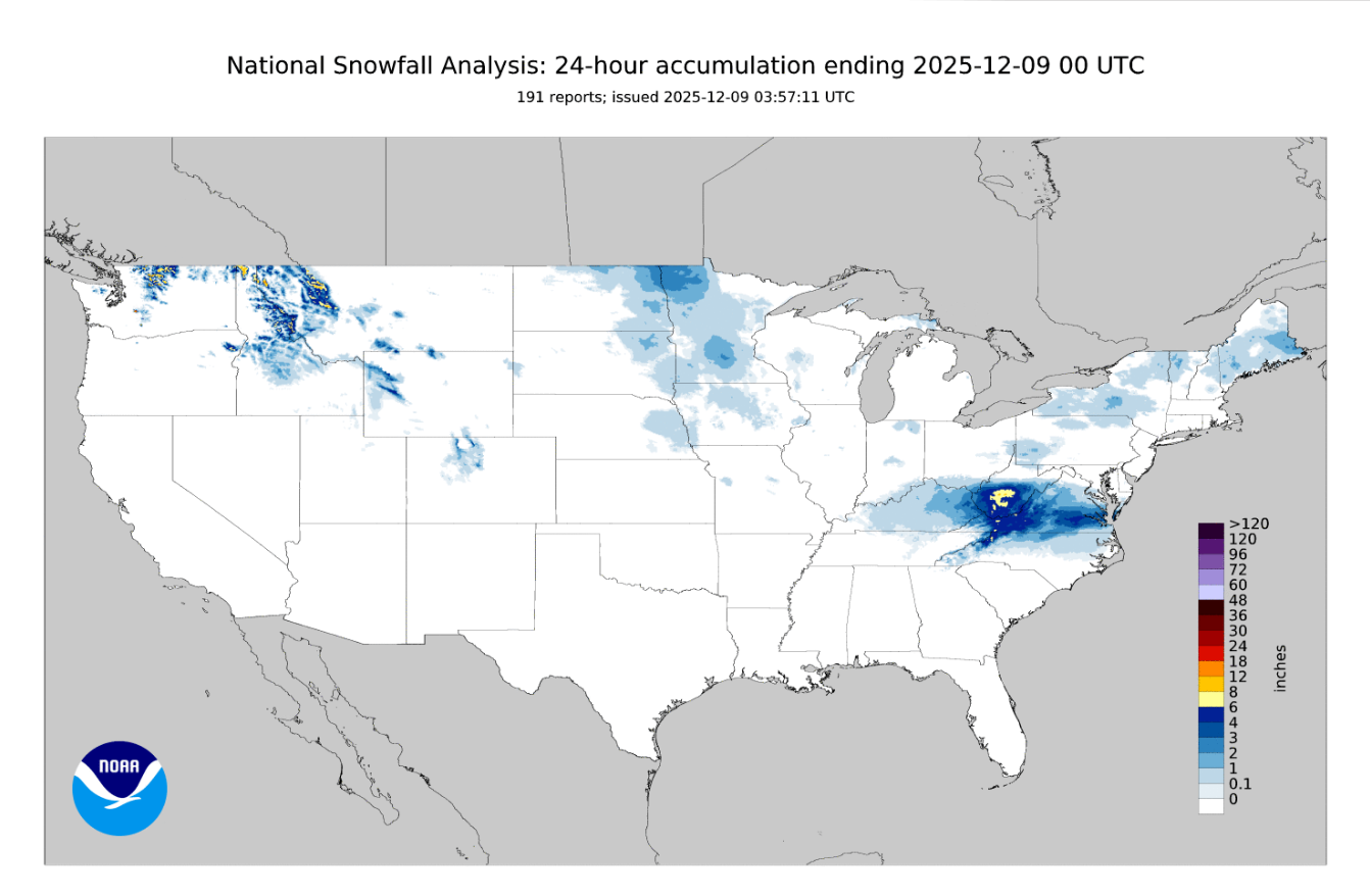
Precipitation for the week was light and somewhat spotty. The main events included scattered flurries and a few light snow showers or freezing drizzle along and just behind the early-week cold front, especially near the South Dakota border and across the Sandhills. We experienced a more organized light snow event on Saturday into early Sunday, with the heaviest snowfall concentrated over north-central and northeast Nebraska. In the counties of Holt and Boyd, a half inch to around 1–2 inches of snow fell. A good example of these totals seen can be shown below in this graphic representing the precipitation seen over the past week.
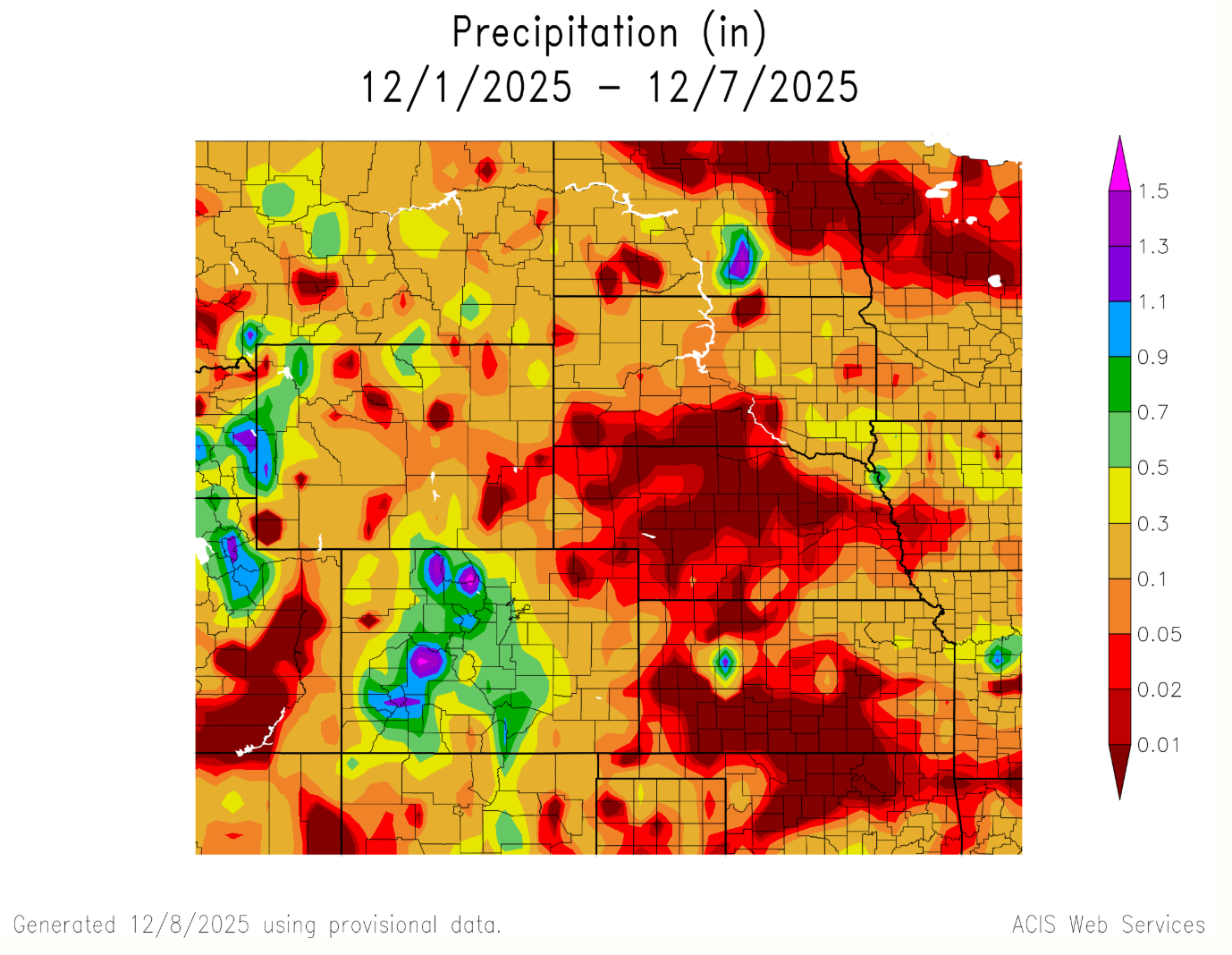
One more thing I would like to note is another fast-moving band of light snow associated with Sunday’s warm front over north-central Nebraska, although it only gave dustings of snow in most locations. Liquid-equivalent totals generally remained at or below a tenth of an inch over most of the state, with locally higher amounts in pockets under the heavier band in far northeast Nebraska. I have included a graphic below to showcase the light snowfall observed in the state over the past week.
Sharp temperature gradients
This week delivered some notable extremes for the state. The coldest readings arrived Wednesday night into Thursday morning, when many locations across northeast Nebraska and western Iowa dropped below zero, with some spots falling to around -10°F and wind chills as low as -15 to -20°F north of I-80. Farther southwest toward the Kansas border, lows stayed a bit milder, generally in the single digits above zero. On the warm side, strong downslope westerly flow and 850-mb temperatures are expected to push highs into the upper 50s to lower 60s across southwest Nebraska and parts of the Sandhills early in the week.
Snowfall extremes were modest. With the heaviest band on Saturday favoring north-central and northeast counties, around 1–2 inches of dry, large snowflakes accumulated. However, for the most part, central and southern Nebraska saw only a dusting of flurries. Where patchy freezing drizzle occurred (especially in southwest and west-central Nebraska early Thursday), ice amounts were very light but still sufficient to produce slick conditions for bridges and overpasses.
In summary, early December brought Nebraska an interesting week, marked by bitter arctic mornings and brisk, sub-freezing days midweek, as well as light snow and freezing drizzle events. The week also saw a quick transition toward much milder, breezy weather heading into early next week. Overall precipitation remained on the light side, with totals confined to narrow bands of light-to-moderate snow across the north and northeast. Looking ahead, ensemble guidance and NWS discussions indicate above-normal temperatures from Monday to Wednesday, with temperatures in the 40s and 50s common and 60s possible in the west. This is followed by another mid-week system, which brings a chance for light snow and a return to colder highs in the teens to 30s by late week.
Temperature and Precipitation Roundup
Max Daily High Temperature: 56°F, McCook
Min Daily High Temperature: 13°F, Valentine Miller Field
Min Daily Low Temperature: -16°F, Chadron 3 SW
Max Daily Low Temperature: 31°F, Scottsbluff W B Heilig Field
Max Weekly Precipitation: 0.33”, Steele City 1.8 NW
Max Snowfall: 4.5”, Fairbury 7 S

