
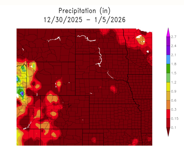
Hello NSCO community, and Happy New Year. This past week, Nebraska started the week transitioning out of the late-December cold snap, then warmed fast under building high pressure and increasing warm-air advection. By Tuesday and especially Wednesday, many spots were running above normal with western Nebraska pushing toward the 50s to near 60°F, while eastern Nebraska climbed into the 40s to low/mid 50s. Humidity trended lower across the west (especially the Panhandle and southwest), and that dry air became a big point of interest as the warm-up continued supporting elevated to near-critical fire weather concerns at times. Precipitation was limited for much of the work week, but late week did feature a wintry mix episode for parts of central/eastern Nebraska.
A broad ridge influence and warm advection helped push temperatures up through midweek, with guidance noting strong warm-air advection supporting highs in the low–mid 50s across much of central/southeast Nebraska by Wednesday. At the larger scale, the flow favored progressive northwest-to-zonal tendencies at times, which kept that deep Gulf moisture return was limited. Most of the week stayed dry even when frontal boundaries passed. Late this past week, a compact disturbance and weak cyclogenesis helped finally squeeze out precipitation.
The big boundary to watch midweek was a cold front crossing north-to-south Wednesday evening, bringing a wind increase (breezy conditions near the boundary) but not much moisture to work with. Then, late week, a shallow cold air setup plus an incoming wave of cold air supported a wintry mix of light freezing rain/sleet/snow and created travel impacts mainly along and north of I-80 and especially northeast/east-central Nebraska.
Most of the “everyday” precipitation chances stayed minimal early to midweek, which is featured below in the precipitation from the past week. By Friday (Jan 2) the system produced light freezing precipitation across portions of Nebraska, with the better impacts focused toward northeast and east-central Nebraska (light glaze + dusting potential). Even then, totals and accumulations were generally light, but the important part was road impacts with slick spots reported where precipitation occurred.
The week of Dec 29 featured a quick warm-up under ridging/downslope-friendly patterns, very dry air and fire weather concerns at times across western Nebraska, then a late-week wintry mix that caused localized travel impacts in parts of central/eastern Nebraska. Looking ahead from this pattern, temperatures were expected to rebound into the 40s/50s after the brief wintry mix, with warmer-than-average conditions persisting into early the following week, while the next meaningful precip chance looked more likely later in the work week as larger-scale troughing approached.


