
Hello NSCO community! I hope things have been going well, you all are staying warm in these frigid conditions. This past week across Nebraska we saw relatively quiet conditions for the first part of the week, with an inflow of freezing Arctic air and periods of light snow across some parts of the state. Temperatures avearged between the 30s and even low 40s, especially across southern and western Nebraska, as southerly to southwesterly flow. Humidity levels remained low during the warmth, particularly on Wednesday. By late this past week, a stronger push of Arctic air dipped south, sending temperatures well below normal statewide. Overnight lows fell below zero in many locations, especially north and east in the state, with dangerously cold wind chills developing. Precipitation was generally light and spotty early, but snow chances increased late week into the weekend, especially toward southern Nebraska.
Looking at the mid-levels, early ridging and relatively zonal (west to east) flow at 850 mb allowed a slight warmup, pushing highs into the 30s and 40s. By midweek, a trough deepened over the northern Plains and Upper Midwest, and colder air came south behind multiple shortwaves. At 500 mb, a broader trough dominated central North America later this past week, reinforcing the Arctic air mass that affected the state. The combination of cold air advection at low levels and persistent troughing aloft created those below-normal temperatures and supported the development of some snow as a low-pressure system, and later a high-pressure system made its way south.
Like what was mentioned above, a midweek cold front brought increasing northwest winds, with gusty conditions statewide and some elevated fire weather concerns where the little humidity levels fell. The more significant Arctic front arrived late last week, plunging temperatures rapidly Thursday night into Friday. Behind it, northerly winds combined with below zero wind chills produced dangerous wind chills, especially across north-central and northeast Nebraska. Light snow accompanied some of these boundaries and upper-level disturbances, particularly late week into Saturday, with the better chances for accumulating snow generally southward and westward depending on the system track between Cambridge and Audburn.
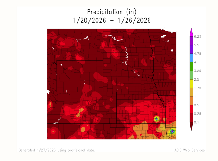
In terms of precipitation, most of the state saw light amounts overall, but timing and location were pretty important. Early-week flurries and light snow showers produced little to no accumulation for the areas of south-southwest Nebraska that experienced winter weather. Later this past week into the weekend, snow became more widespread in parts of Nebraska as moisture levels slightly increased and moved along the southern edge of the Arctic air mass that was and is permeating the northern part of the US. Overall, this was more of a light to moderate snow setup for most areas rather than a major statewide event.
Temperature and precipitation extremes showed just how sharp the pattern shift was. Warmer readings earlier in the week reached into the 40s in parts of southern and western Nebraska during the brief warm period. By contrast, late-week highs in some northern areas of the state struggled to get out of the single digits, with overnight lows dropping below zero in many areas, namely near Valentine, Chadron, and O'Neill. Wind chills were what really affected the area, dropping temperatures into the teens and 20s below zero. Again, between –10 to –20 degrees Fahrenheit, and locally colder, creating dangerous conditions for anyone outside unprepared for the cold, and for any animals, such as pets or cattle.
I would like to thank Eric Hunt, the Extension Educator for the School of Natural Resources at the University of Nebraska-Lincoln for providing these well-documented maximum and minimum temperatures and snowfall totals for the state this past week. I would further like to note the lows noted in Harrison, and Springview, which provide an example of just how cold this Arctic air has caused for the area.
Max Daily High Temperature: 58°F, Trenton Dam 1 N
Min Daily High Temperature: -4°F, Springview 2NW
Min Daily Low Temperature: -28°F, Harrison 20SSE
Max Daily Low Temperature: 22°F, Scottsbluff W B Heilig Field
Max Precipitation: 0.25”, Grant 2.5 S
Max Snowfall: 3.0”, Superior
To wrap up this past week’s events, brief moderation, then a hard return to winter. A midweek bump in temperatures followed by a sharp plunge into subzero lows and daytime highs in the 10s and 20s in most locations in the state, along with a late uptick in snowfall in the south-southwest area of Nebraska. The combination of Arctic air, gusty winds, and periodic light snow defined the period, with the cold being the most impactful hazard statewide. This week, especially, we will be seeing a continuation of cold weather, with the outlook showing this trend continuing into early February.


