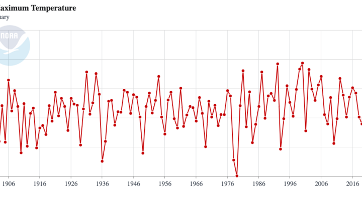
Hello NSCO community! Happy second week of March! I will be diving right in to last week's weather events! This will mostly focus on the temperatures and precipitation experienced in the state.
During the early part of the past week, much of Nebraska experienced cool, dreary conditions as extensive low clouds and persistent moisture occupied the region. Temperatures generally remained in the 40s across eastern and central Nebraska on Monday and Tuesday, with slightly warmer conditions in western Nebraska where partial clearing allowed highs to reach the 50s to near 60°F in some locations. Humidity remained elevated due to persistent low-level moisture advection from the southeast, resulting in widespread drizzle and areas of fog across much of central and eastern Nebraska. Some areas, particularly across southeast Nebraska and portions of south-central Nebraska, experienced freezing drizzle early Monday morning as temperatures neared freezing.
At the synoptic scale, the weather pattern was largely driven by weak warm air advection and several shortwave disturbances moving across the Central Plains. Southeasterly flow at the surface transported moisture northward while mid-level shortwave troughs provided weak lift across the region. This setup supported extensive low-level stratus and periods of drizzle. As the week progressed, a transition toward weak upper-level ridging allowed temperatures to gradually increase, with 850 mb temperatures rising and supporting surface highs climbing into the upper 50s and eventually the upper 60s to near 70°F by Thursday.
Surface features during the week included persistent easterly to southeasterly winds associated with a developing surface low over eastern Colorado and the High Plains. These winds maintained upslope flow and helped sustain low clouds and drizzle across much of Nebraska. A disturbance moving through the region Tuesday brought additional light precipitation and drizzle, while fog was likely during the overnight and morning hours. Later in the week, a stronger system was expected to approach from the west Thursday night into Friday, potentially bringing rain showers and a few thunderstorms across portions of the state.
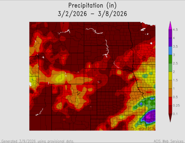
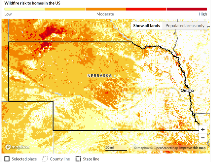
Precipitation during the early part of the week was generally light but widespread, consisting mainly of drizzle, light rain, and occasional fog-related moisture. Western Nebraska saw somewhat higher precipitation totals with light rainfall amounts generally between 0.10 and 0.25 inches, while eastern portions of the state mainly experienced light drizzle with minimal accumulation. By midweek, precipitation chances diminished as drier air and increasing sunshine returned to the region, though another system later in the week was expected to bring additional rainfall. The ACIS map shows a good representation of this, with the highest rainfall totals near the towns of Scottsbluff, in Western Nebraska, up by O'neill, and Norfolk in North Central Nebraska, and finally down south by the capital of Lincoln in Southeast Nebraska. We can compare this to current drought conditions, where precipitation, specifically in the eastern part of the state, had a positive impact on mitigating fire risks in the area.
Temperature and Precipitation Extremes
Maximum High Temperature: ~70°F, portions of central and eastern Nebraska late week
Minimum High Temperature: ~41–45°F, much of eastern Nebraska early week
Minimum Low Temperature: Low–mid 20s, western and northern Nebraska, early week
Maximum Low Temperature: Upper 30s, eastern Nebraska during cloudy overnight periods
Maximum Precipitation: ~0.25", western Nebraska
In summary, Nebraska experienced a predominantly cloudy and moist start to the week, characterized by widespread low stratus, drizzle, and areas of fog due to persistent southeast flow and weak warm air advection. Temperatures gradually moderated through midweek as weak ridging developed and sunshine returned, allowing highs to climb into the upper 60s and even near 70°F by Thursday. The overall pattern highlighted a transition from gloomy early-week conditions to warmer, more active weather late in the week, with another system expected to bring rainfall and possible thunderstorms before a drier weekend.