First winter storm
This weekend brought the first real taste of winter for the eastern half of the state with a few spots north and west of Omaha picking up more than 6". Most of the eastern third of the state (outside the far SE) had between 3-5" with 1-2" being more common in central sections of the state. Most of western Nebraska had lighter snowfall amounts.
The first round of snow went through the northeast section of the state on Friday with scattered snow showers and sleet pellets further south in eastern Nebraska with the first wave of energy that came in from the northwest. The more potent shortwave, which was centered in northeast Colorado on Friday afternoon, moved east into the Central Plains Friday night and started to tap into better moisture. Thus, the higher snowfall amounts in eastern Nebraska (and higher still into Iowa) were a reflection of the better available moisture further east.
For southeast Nebraska, snow amounts were a bit more limited due to precipitation beginning as rain (far southeast) or freezing rain (up to around I-80). But overall moisture from this system was decent for eastern Nebraska with liquid water equivalent amounts over half an inch common. The snow cover should help keep the ground from getting too frozen so this should seep into the profile once it starts melting next week with the more mild temperatures.
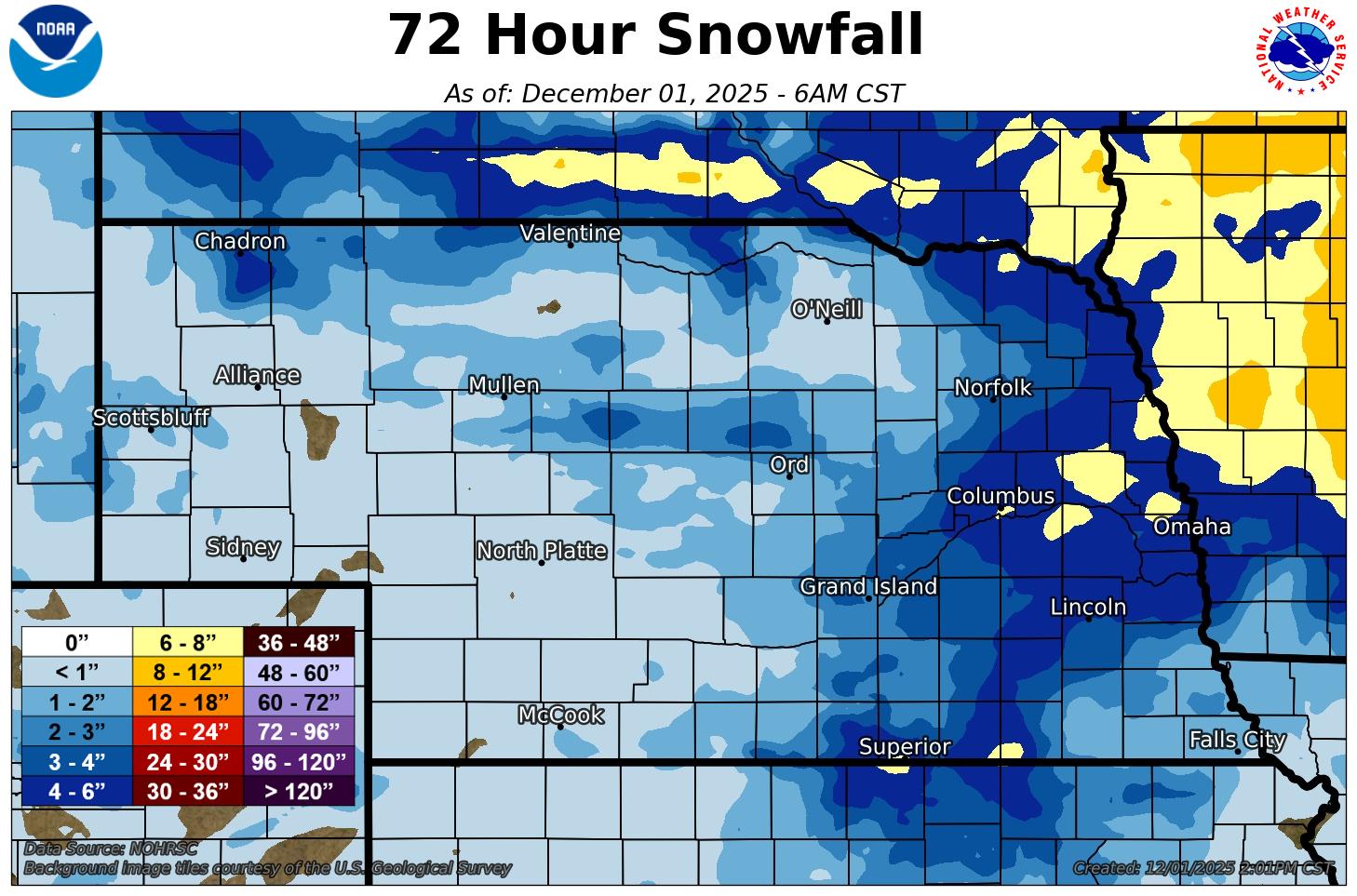
Figure 1. Snow totals from this weekend
More cold coming
Temperatures will thaw tomorrow across the state with highs in the 40's in the western half of the state, mid to upper 30's between Highway 281 and Highway 81 and 30-35°F in the eastern sixth of the state. Wednesday will start relatively mild and should get to around 30-34°F for most areas south of Highway 20 in the first part of the day. But a strong arctic front will barrel through the state during the day and temperatures will plummet in the afternoon and early evening hours. Winds will be strong out of the north-northwest on Wednesday afternoon but will diminish quickly overnight. Thursday morning will be cold statewide with the seasons first subzero lows likely for eastern NE. Single digit lows will be common in central Nebraska with teens (more seasonal) prominent in the Panhandle. Temperatures will remain quite chilly in eastern Nebraska on Thursday with highs in the upper teens to mid 20's. Central sections should see temperatures in the 30's with much warmer temperatures in the 40's out in the Panhandle.
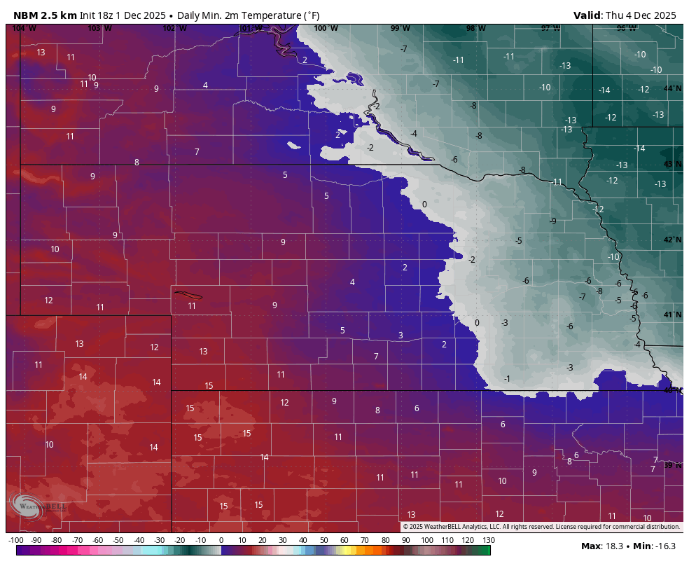
Figure 2. Forecast lows for Thursday morning


