Wetter weather
A look at the 12Z (7 AM Central) 500-mb map shows a deep trough in the eastern part of Canada and the U.S. with ridging prominent in the southwest. The position of the ridge is such that it is allowing monsoonal moisture to stream into the western U.S., which is badly needed in many spots. In the central U.S., a boundary between the eastern trough and western ridge is effectively stationary from eastern Montana into the mid-south. That boundary is the focus for showers and storms in the Southern Plains and excessive rain is falling in parts of Kansas, Oklahoma, and Arkansas.
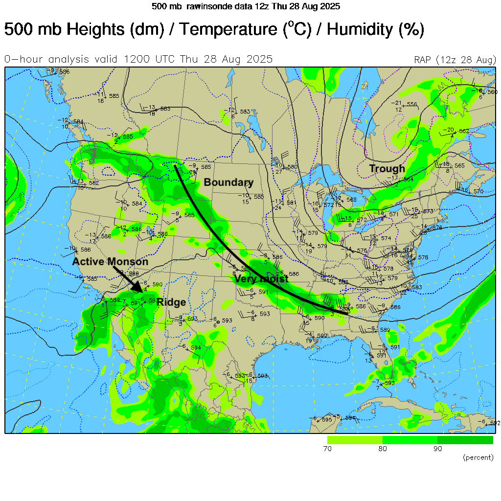
Figure 1. 500-mb heights and moisture from 12Z this morning. Green shaded areas represent higher levels of moisture at 500-mb. The top number is the temperature in degrees C and the bottom number represents the difference between the temperature and dew point. Higher numbers indicate drier air aloft. The number on the top right is the 500-mb height in decameters. The higher the height, the warmer the atmosphere. **
Over the next few days that boundary will slowly work its way east and multiple shortwaves will traverse the periphery of the western ridge (Figure 2) and come into the state from the northwest. As such, precipitation will be likely at times statewide through the holiday weekend. In the next 24-36 hours showers and storms will be most likely across the western third of the state with severe weather possible tomorrow evening across southwestern Nebraska. Temperatures over the weekend are likely to be below average for high temperatures and may have trouble getting out of the low 70's in areas where precipitation is more prominent. Areas that see more sun, especially in western Nebraska, likely will be more seasonal in the low to mid 80's.
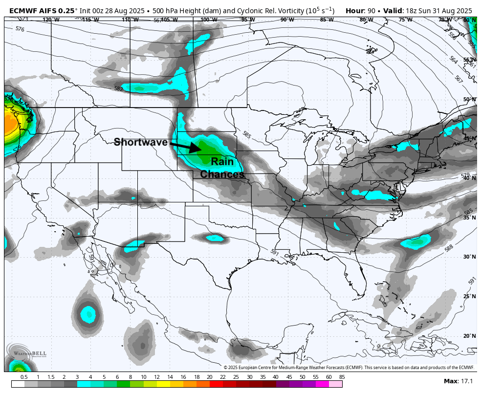
Figure 2. 500-mb heights and vorticity
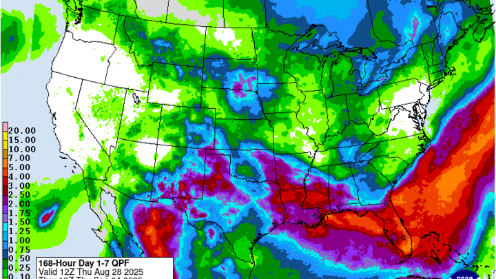
As the weekend goes on the chances will shift east into central and eastern Nebraska, with central Nebraska likely to be wettest on Saturday night into Sunday and eastern Nebraska more likely to be wet on Sunday evening into Monday. Recommend paying close attention to the forecast over the weekend as exact timing and location of heaviest showers/storms is still uncertain. Regardless, it likely will not be a total washout for anyone this weekend but pretty much everyone has a chance to pick up some moisture. The WPC currently projects that north central Nebraska has the best chance at picking up significant rainfall and the ECMWF ensemble shows a good probability of an inch-plus around Ainsworth, Ord, Columbus, and O'Neill with a reasonable chance of 1" in Grand Island, Kearney, Lincoln, and West Point.
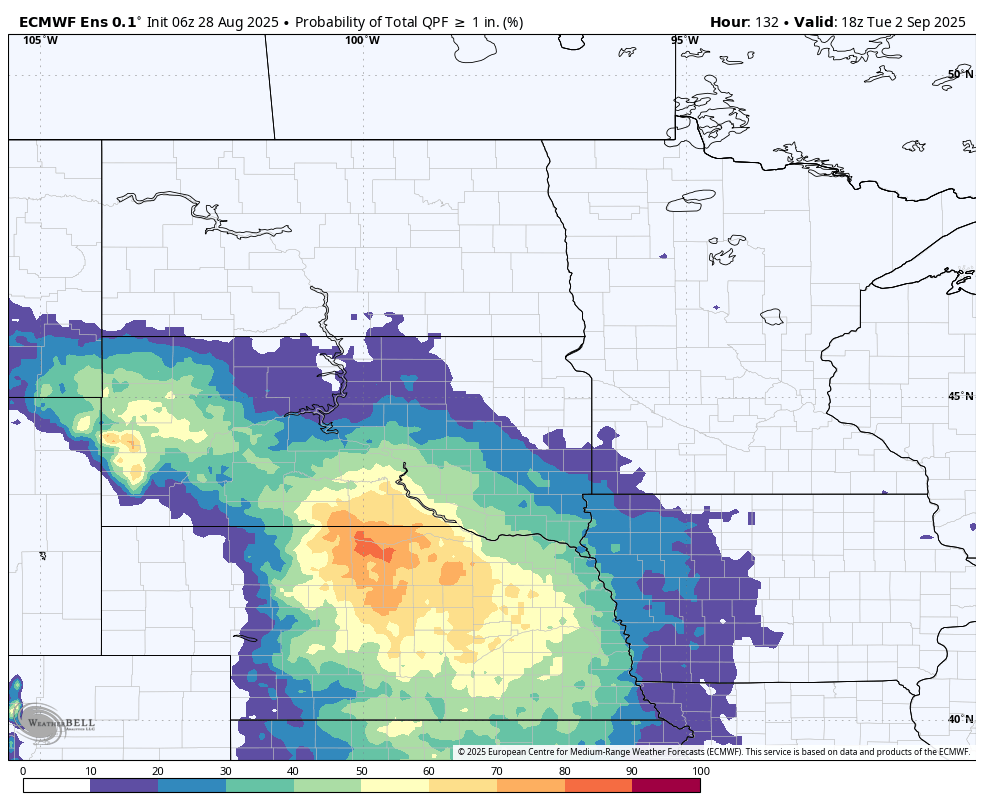
Figure 3. ECMWF ensemble probability of 1" of moisture
A quick look at parcel trajectory from NOAA's HYSPLIT shows that there is not going to be a direct fetch from the Gulf up into our area so the atmosphere won't be as moist as it has been at times this summer. But there will be remnants of monsoonal moisture to work with and precipitable water values are expected to be above average in central and eastern Nebraska over the weekend. Thus, it is reasonable to think that areas of central and southeast Nebraska that have been dry of late will have a shot at getting a nice drink.
Seasonally cool
Meteorological fall begins on Monday and it will most likely feel like fall weather, especially the back half of the work week. There is reasonably good consensus in the models that a ridge will build in strength over western Canada and downstream troughing will increase over the eastern U.S. by mid-week. At the surface this will drive a strong cold front through the state by Wednesday morning, likely coming through the state on Tuesday afternoon and night. There will be chances of showers and storms along the front but significant precipitation does not appear to be likely at the moment.
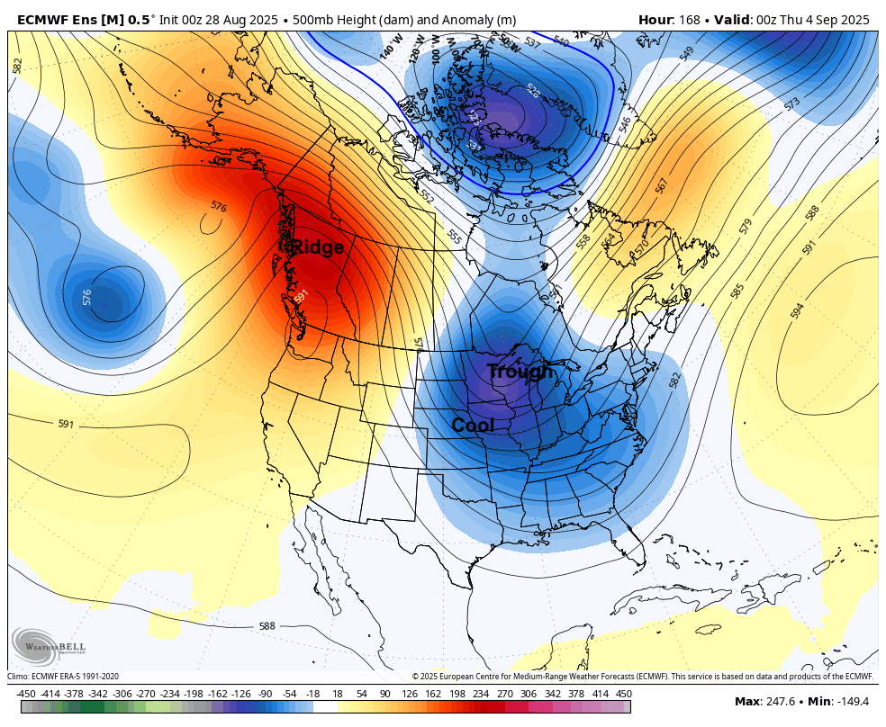
Figure 4. 500-mb height anomalies next Tuesday evening
The bigger story will be the cool, perhaps unseasonably cool, temperatures later next week. It may be briefly warmer on Thursday before another cold front moves through the state on Thursday, bringing possibly even cooler air for Friday and Saturday morning. There is a reasonable chance that north central and eastern sections of the state may remain in the 60's for high temperatures on Wednesday and later in the week as well. Regardless everyone in the state should remain safely below 80°F for a few days. Overnight lows in the 40's will be common statewide and can't rule out upper 30's in some spots in the northern part of the state on Saturday morning.
Frost does not appear to be a risk this time but it may not be a zero risk for low lying areas in the northern part of the state on Friday night. If this pattern sets up later in September, there would be a credible risk of early frost for much of western and northern Nebraska. There are hints of that possibility but should not be taken as gospel at this point.
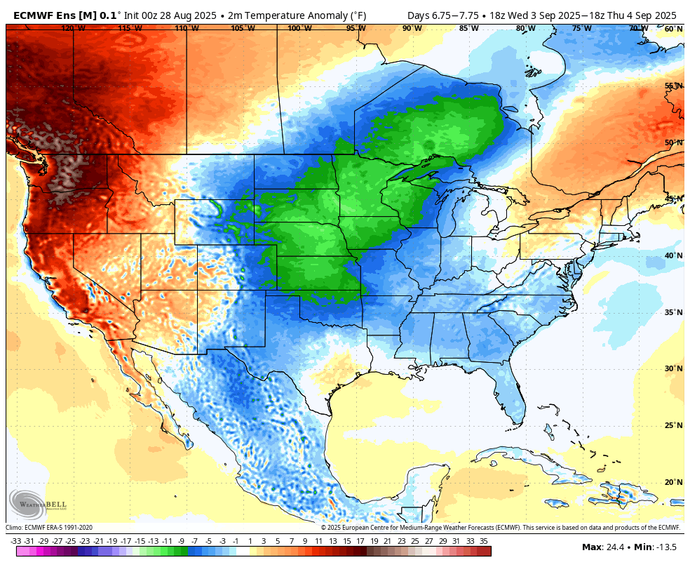
Figure 5. Projected temperature anomalies next Wednesday and Thursday
Temperatures should start to moderate a bit next weekend and may return to seasonally warm temperatures in the 80's the week if ridging returns the week of the 8th. It is not impossible we are done with temperatures in the 90's but historic precedent and certainly recent years would suggest we still have a few more hot days to get through yet. Recall that we had a nice cool down in early September last year only to have well-above average temperatures and no rain be the rule for most of the fall.
