February 2025 vs. February 2024
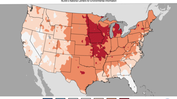
With polar vortex stretching being dominant this month, temperatures have been cold for February with much of Nebraska having an average temperature in the teens. This is cold but better than North Dakota where month to date average temperatures have been subzero. Much warmer temperatures are coming soon so the average temperatures for this February will end being warmer than where they are now. But for Nebraska and the entire north central section of the U.S., temperatures are considerably colder than last year, when many locations were at or near record warmth for February. The story is perhaps even more impressive when looking at the southward shift of temperature ranges between Figure 1a and 1b. The 21-25°F range last year was confined to the northern sections of North Dakota and Minnesota. This year that range is down in the northern half of Kansas into central Illinois and southern Michigan.
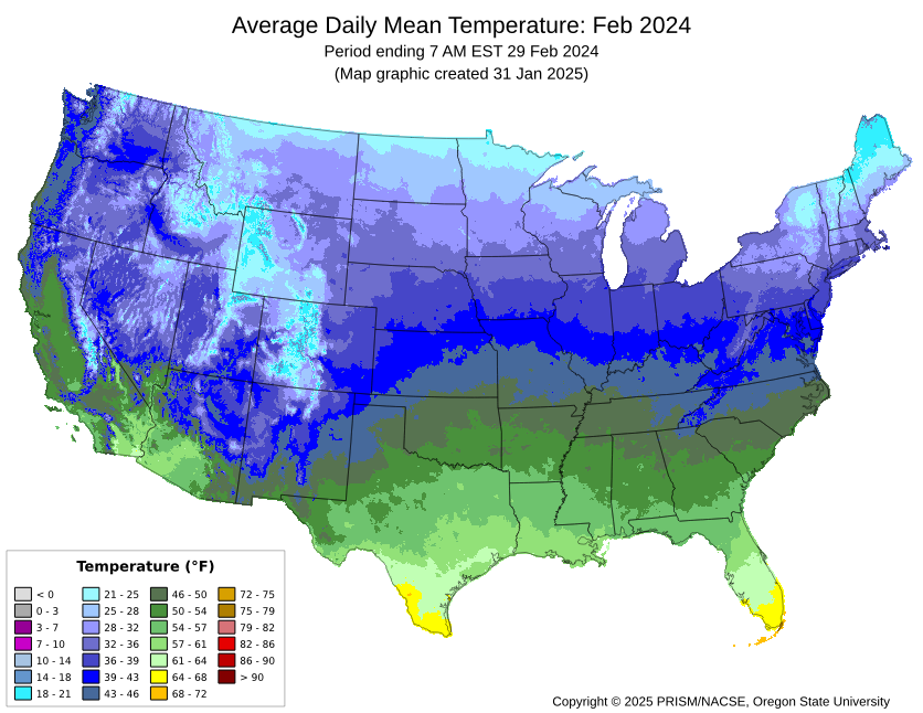
Figure 1a. Average temperatures in February 2024.
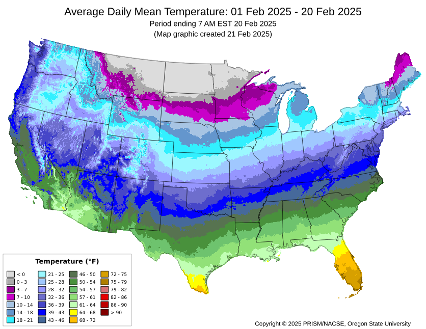
Figure 1b. Average temperatures so far in February 2025
The temperature gradient between Minnesota and Louisiana is also much sharper this year, with temperatures at or above last year's levels in Louisiana and temperatures running 15-20°F colder in Minnesota. The sharp temperature gradient has led to a much stronger jet stream across the northern United States this year (Figure 2b) compared to last February. The polar jet stream was much weaker across the northern U.S. last year with the weaker temperature gradient (Figure 2a) while the subtropical jet stream was more prominent over the southern U.S., which is typical of a late winter after an El Nino peak. This year the subtropical component has been mostly absent across the southern U.S., which is the main reason southern California and the southwest had generally been very dry this winter until earlier last week.
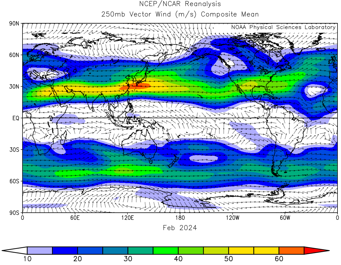
Figure 2a. 250-mb wind speed and vectors for February 2024
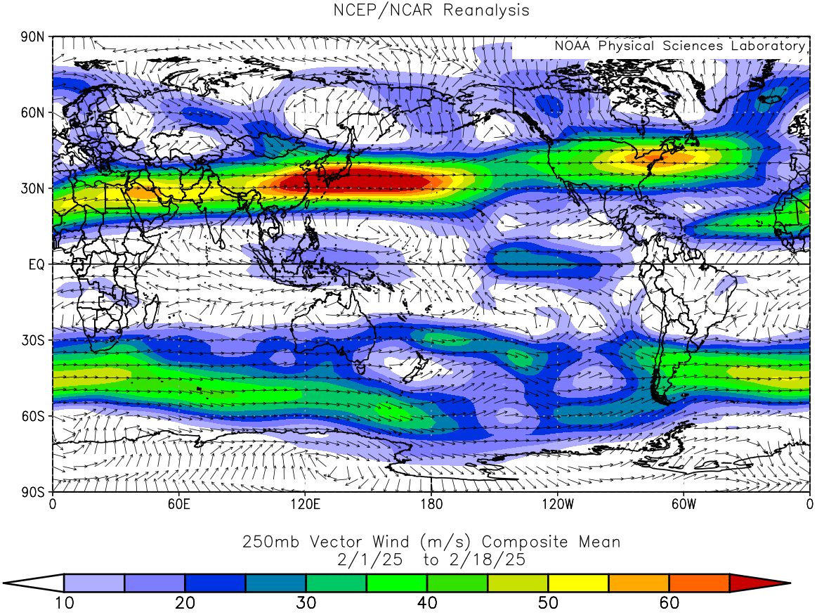
Figure 2b. 250-mb wind speed and vectors through February 2025
Connection to influenza spread?
The amount of polar vortex stretching this year (10 times) and prevalence of cold, dry air masses may also be contributing to the amount of influenza going around this winter in much of the country. The very dry air that is present in these Arctic outbreaks translates to indoor humidity being very low unless moisture is added. Research has shown that upper respiratory viruses like influenza spread better in dry environments than in more humid environments. When dewpoints are -15°F (as they were much of the week), it takes effort to keep indoor spaces from getting too dry.


