Bottom Line Up Front
The current wildfires are shattering state records. Prior to this year, 2012 was considered Nebraska’s worst fire season. Like this year, a combination of extreme drought, high temperatures, and high winds caused over 500,000 acres to burn statewide. The most recent information (March 17 at 8:15 pm) from the National Interagency Fire Center (NIFC) indicates that the Morrill Fire alone has surpassed this, at 643,361 acres. Add in the other three active fires (Cottonwood – 131,259 acres; Road 203 – 36,913 acres; Anderson Bridge – 17,400 acres), and the total acres equal 827,933 (Figure 1.)
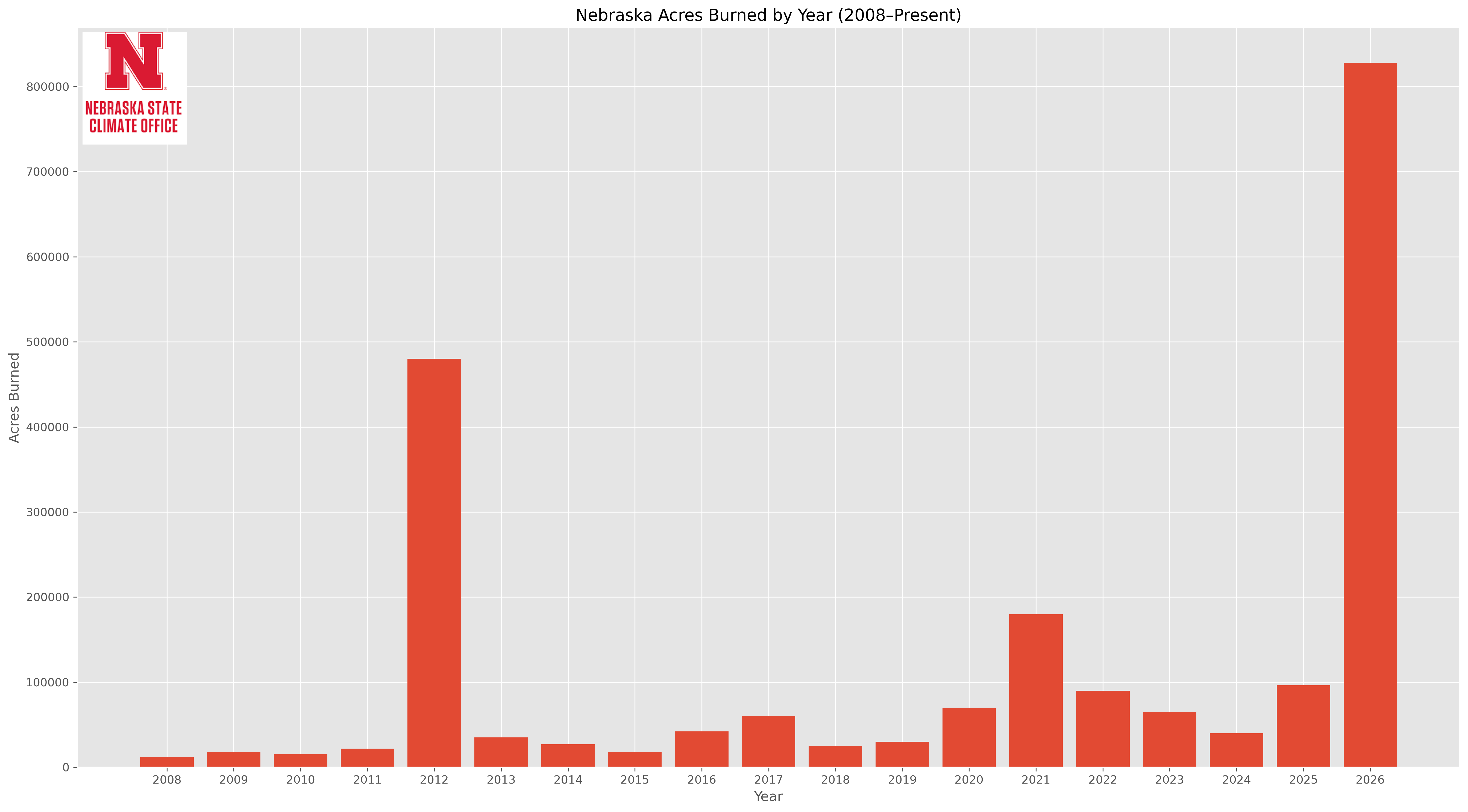
Figure 1. Acres burned in Nebraska in a calendar year since 2008. Data from National Interagency Fire Center.
Antecedent drought
According to the U.S. Drought Monitor (USDM), Morrill County (where the Morrill Fire started) has been in at least abnormal dryness (D0) since October 2024. Conditions deteriorated through May 2025, with a peak of D3 (Extreme Drought). While seasonal rains during the summer and early fall of 2025 brought some improvement, the area never fully recovered beyond D0 (abnormal dryness) and D1 (moderate drought). Drought expansion began in November and continued due to the warm, dry winter. As of the most recent USDM, released March 12, all of Morrill County is in extreme drought-D3) and has been in extreme drought since February 10th. Statewide, more than 96% of the land area is in abnormal dryness or worse, nearly 90% in moderate drought or worse, about 41% in severe drought, and about 8.5% in extreme drought. The state also saw a record amount of drought expansion between October 1st (start of the water year) and the end of February. Much of that came after the start of meteorological winter as shown in Figure 1.
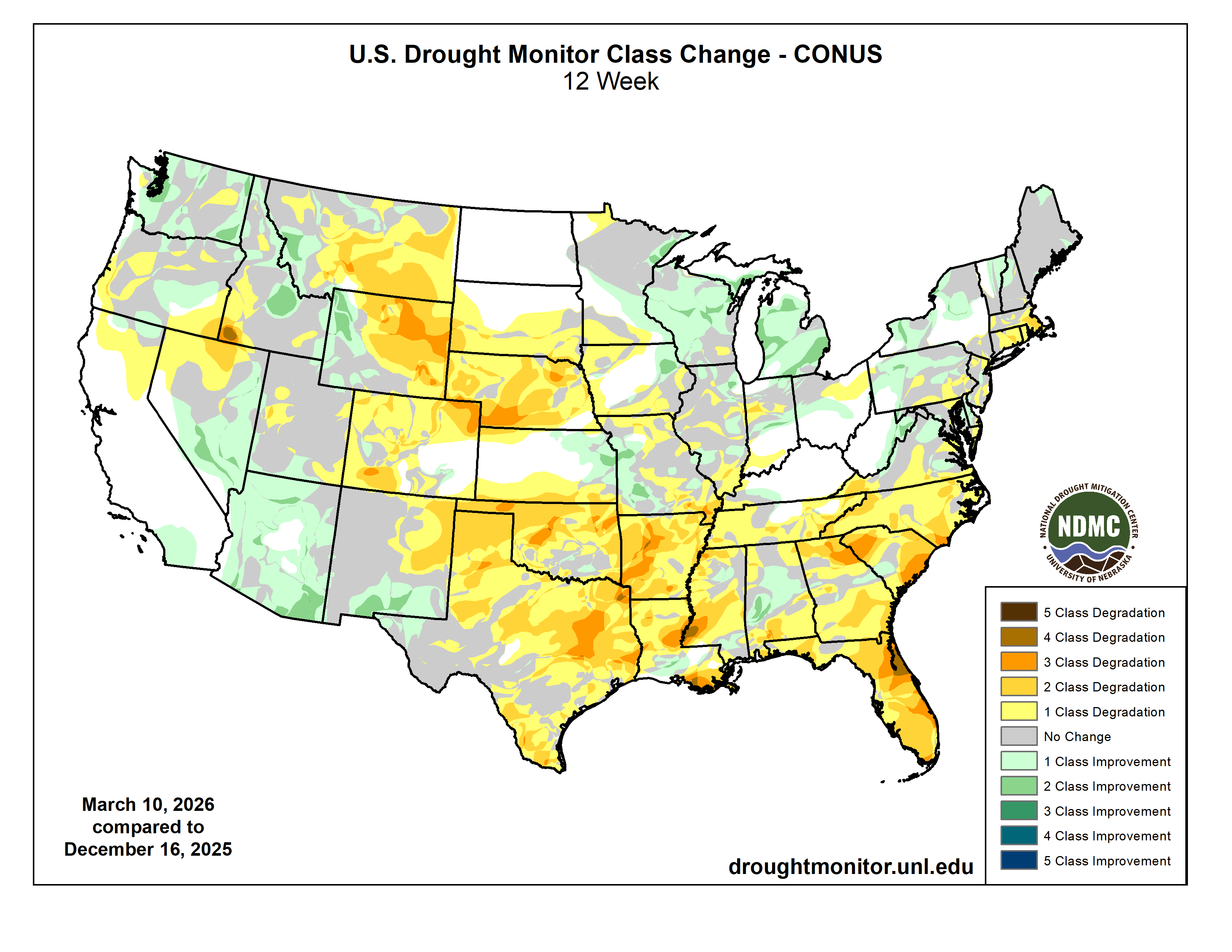
Figure 2. 12-week change in Drought Monitor classes
Very windy
The Northern Plains was in the left exit region of a powerful jet streak last Thursday. With strong upper level divergence of air aloft, surface pressures dropped quickly. This created an intense pressure gradient across the north central part of the U.S. and very strong winds. For most of Nebraska, this meant strong westerly winds. This downslope component meant warm temperatures and very low relative humidity. Winds also were very strong- gusting over 70 mph at times in the Panhandle. It is likely winds were that strong and perhaps stronger at the time the fire started.
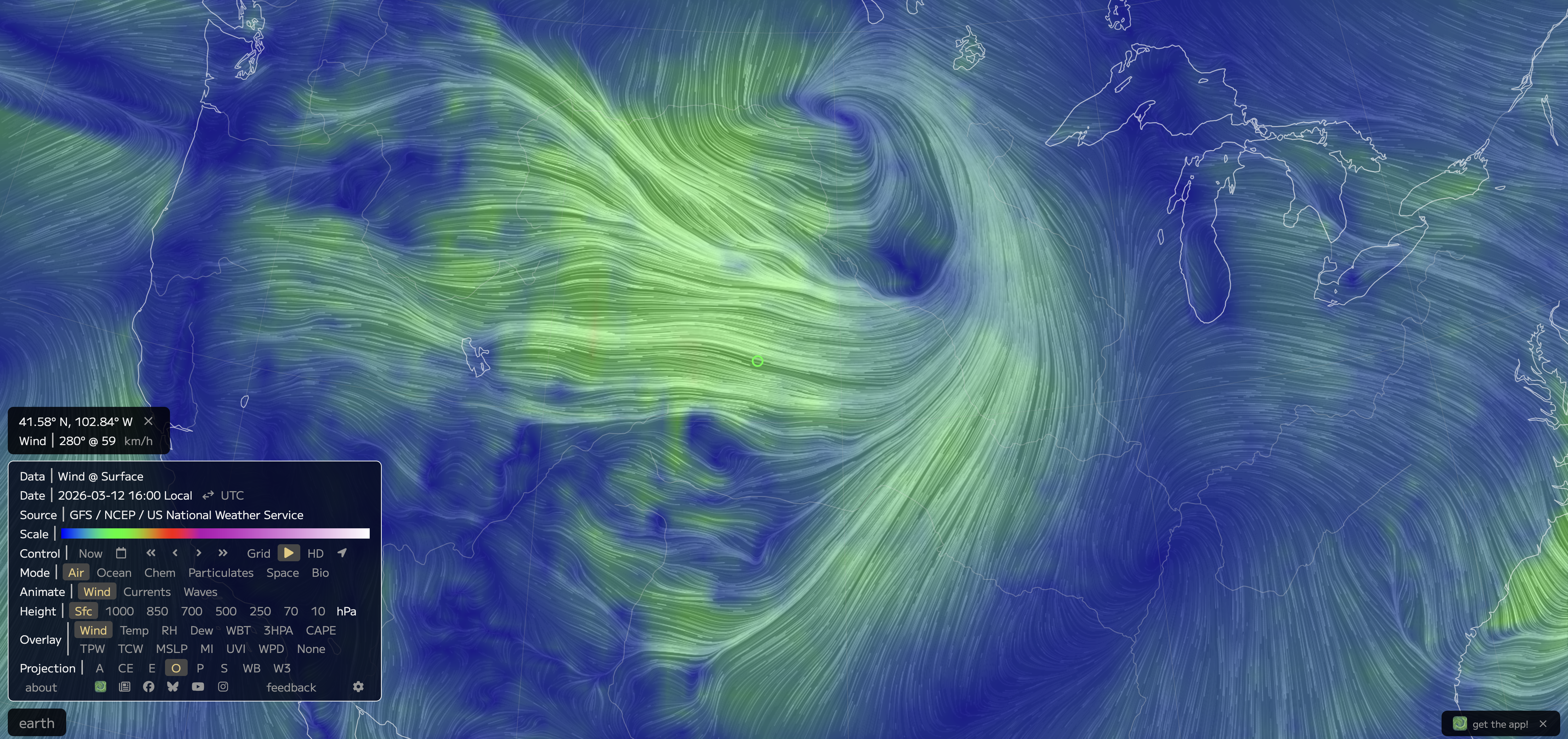
Figure 3. Surface wind map from Earth Null School from last Thursday afternoon.
Additional analysis and research will be coming in a future report.
Maximum ASOS wind gusts last Thursday
Alliance Municipal Airport, WNW 71 mph at 15:41 MDT
Sidney Municipal Airport, WNW 70 mph at 15:24 MDT
Scottsbluff W.B. Heilig Airport, WNW 69 mph at 15:31 MDT
Gurley, WNW 67 mph at 14:01 MDT
North Platte Municipal Airport, WNW 55 mph at 16:04 MDT