Snow in the forecast
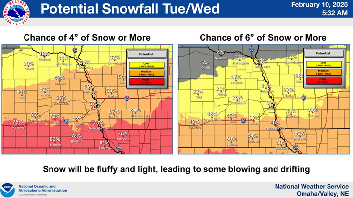
For the first time this winter there is a legitimate chance of snow for most of the state over the next 48-60 hours. The first system is weaker and further north, so only the northeast quadrant of Nebraska has much chance of picking up an inch or more in the next 24 hours. Snow showers will be possible in the I-80 corridor later tonight and early tomorrow but are unlikely to amount to much.
Figure 1. Probability of 1" of snow by tomorrow morning from the ECMWF Ensemble
A more potent shortwave will be moving into the region later tomorrow which *should* help lead to a longer period of light to moderate snow across much of the state. Exception will be the northwestern part of the state, which is unlikely to see much snow from this system. Snow is forecast to begin tomorrow afternoon across the southern Panhandle and southwestern Nebraska and will slide east and a bit north overnight on Tuesday into Wednesday morning. Snow likely will be falling during the main rush hour time frame in the Omaha and Lincoln areas. Normally by now we are well seasoned at dealing with snow but with record low amounts this winter for much of the state, this mid-February snow could be a little more troublesome.
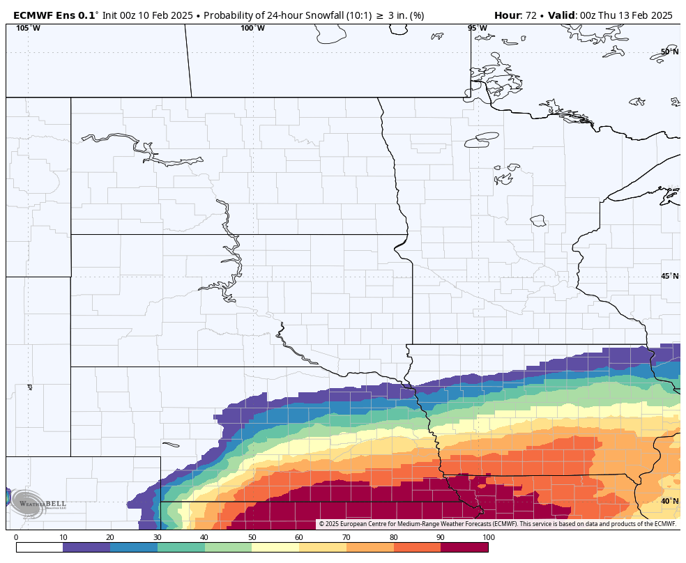
Figure 2. Probability of 3" of snow by Wednesday evening from the ECMWF Ensemble.
Total snow amounts will depend on how much dry air has to be overcome and the snow to liquid water ratio. If the drier air from the east is overcome quickly and the snow to water ratio is 15:1, then a lot of south central and eastern sections of Nebraska are looking at a reasonable chance of 6". Best chances for this are along the Kansas border where the NWS has issued a Winter Storm Watch. If it is not overcome quickly, then snowfall amounts of 1.5-3" are going to be more prevalent. Caution is advised with longer distance travel on Tuesday night and Wednesday across most of the state even if snowfall amounts are lighter.
Cold temperatures
There will be a decent breeze from the north (10-15 mph sustained) and it will be cold. It is probable that the northern third of the state won't get out of the single digits on Wednesday and it is possible to be that cold as far south as the I-80 corridor. It will also be pretty cold Thursday morning with temperatures falling below 0 statewide. It likely will be below 0 across the northern third of the state tomorrow and Wednesday mornings as well. Temperatures are likely to moderate a little bit on Friday, especially across the Panhandle where it is likely to get into the upper 30's to mid 40's. Temperatures may sneak above freezing in the afternoon across the southern third of the state, though a heavier snowpack will limit moderation.
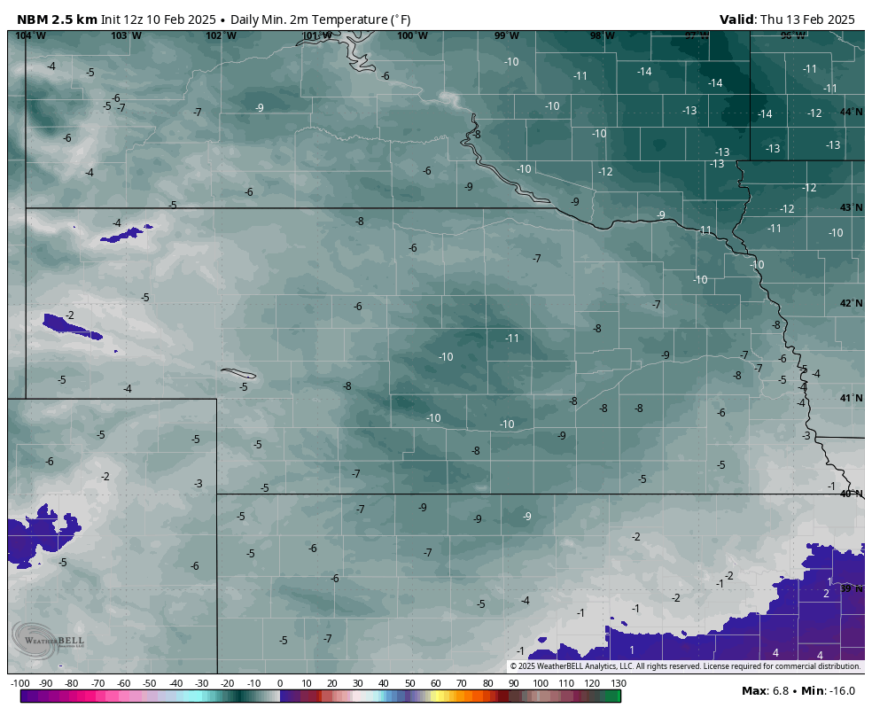
Figure 3. Forecast low temperatures for Thursday morning
With polar vortex doing yoga in the next few weeks, we are going to remain pretty cold through next week, and it looks quite cold this weekend across the state. Subzero low temperatures are likely everywhere on Sunday morning and likely in eastern Nebraska on Monday morning. Highs will struggle to get out of the lower teens on Saturday in western Nebraska and on Sunday in eastern Nebraska.
This also is going to be a more prolonged cold spell. For Wayne, Norfolk, and Oakland, yesterday was the last day above freezing for at least 10 days. It is possible Omaha, Nebraska City and Lincoln may also not be going above freezing for the next 10-12 days after today. There also is another storm system that may be bringing accumulating snow and wind to southern and eastern sections of the state this weekend. Will talk more about that soon.