Windy Saturday
The next few days will feature nicer conditions with sunshine and temperatures running a bit above seasonal normals for most of the state. The southern Panhandle will be the exception where temperatures may climb into the lower 60's tomorrow afternoon. A weaker storm and frontal passage will move through the area on Saturday morning, bringing a chance of a light wintry mix to the northern half of the state. Winds will pick up from the northwest on Saturday behind the front, likely gusting over 40 mph for much of the state between 10 AM and 3 PM. Temperatures will be seasonal in the 30's on both Saturday and Sunday but the wind will make it feel rather cold.
The Polar Express
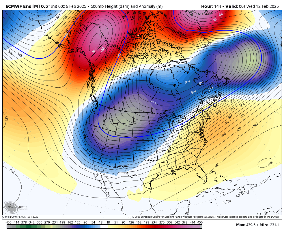
Figure 2. Projected 500-mb heights next Tuesday evening
A highly amplified pattern coupled with some polar vortex stretching will bring much colder temperatures to the northwestern and north central sections of the U.S. next week. Arctic air should start invading northwest Nebraska on Sunday night and will move southeast during the day on Monday. In addition, multiple shortwaves moving into the region will help produce a few rounds of light snow starting Monday evening. First round of snow should give everyone a shot at an inch and should be done by Tuesday afternoon. The next round is likely to concentrate accumulating snow along and south of I-80 with an additional 1-2" later Tuesday night into Wednesday.
Snowfall rates on Tuesday won't be high. But the wind will be gusty from the north, which will make the visibility lower, and air temperatures will likely be holding in the upper single digits to mid teens. Thus, travel should be done with great caution. Temperatures will remain very cold on Wednesday, with highs possibly not breaking the double digits in the northern fringe of the state. Subzero low temperatures are likely along and north of I-80 the middle of next week and probable in the southern third of the state.

Figure 3. Projected temperature anomalies next week
A brief thaw will be possible later next week with highs possibly getting above freezing in western and southern sections of the state next Friday. But another round of polar vortex stretching is looking likely next weekend, which will bring down more Arctic air. The CPC has much of the state in the slight risk for hazardous cold next weekend. In addition, there is signal in the models for another storm system to enter the central U.S. next weekend, which could bring additional chances for snow. A few model runs over the last few days suggest it will be possible for significant snow to fall over eastern Nebraska next weekend. Too early to make a definitive statement on a winter storm but something to watch out for.

Figure 4. CPC's risk of hazardous temperatures for next weekend