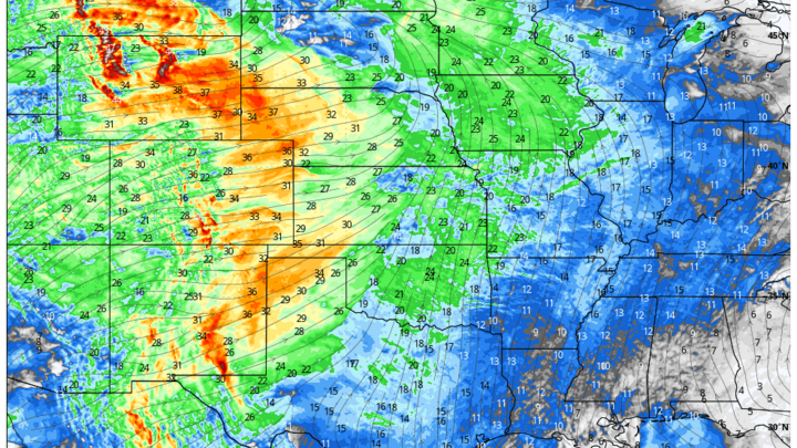
Rain chances next 48 hours
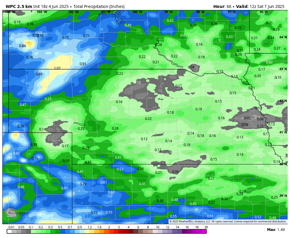
Figure 1. WPC expected precipitation over the next 60 hours.
A slower moving trough will move into the region tomorrow and bring good chances of moisture to western Nebraska tomorrow morning and chances of rain to the eastern 2/3 of the state tomorrow afternoon. Additional chances of rain will be possible on Friday. Most areas east of Highway 183 are unlikely to see significant precipitation but portions of the northern Panhandle could get an inch by Friday afternoon. Additional chances of rain and thunderstorms are possible in the pre-dawn hours Saturday morning in eastern Nebraska but significant precipitation looks unlikely at the present time.
Cooler temperatures to start next week
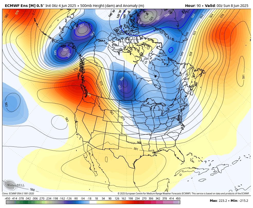
Figure 2. 500-mb height anomalies on Saturday evening
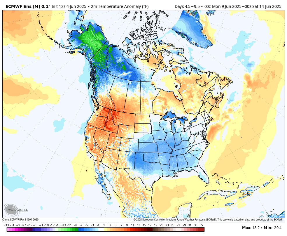
Figure 3. Projected temperature anomalies next week
A trough will be moving into the Great Lakes region later this weekend and a surface cold front will move through the state on Sunday. Showers and thunderstorms will be possible with the frontal passage, especially along and south of Highway 30. Models are not currently bullish on significant precipitation and the best atmospheric forcing will be well to our northeast. Nevertheless, it is possible that storms will develop along the front and move southeast through the state in the late afternoon and evening hours. Having a sufficient local source of moisture from precipitation early this week would increase chances of storms developing on Sunday if the boundary forcing is sufficient.
After the frontal passage temperatures will be seasonally cool to start the work week- likely in the lower to mid 70's statewide. Temperatures will remain on the seasonally cool side through Tuesday statewide and through Wednesday in the southeast quadrant of the state. But temperatures should rebound into the 80's in western Nebraska by Wednesday and should be in the 80's statewide to close out the work week.
Warmer weather coming
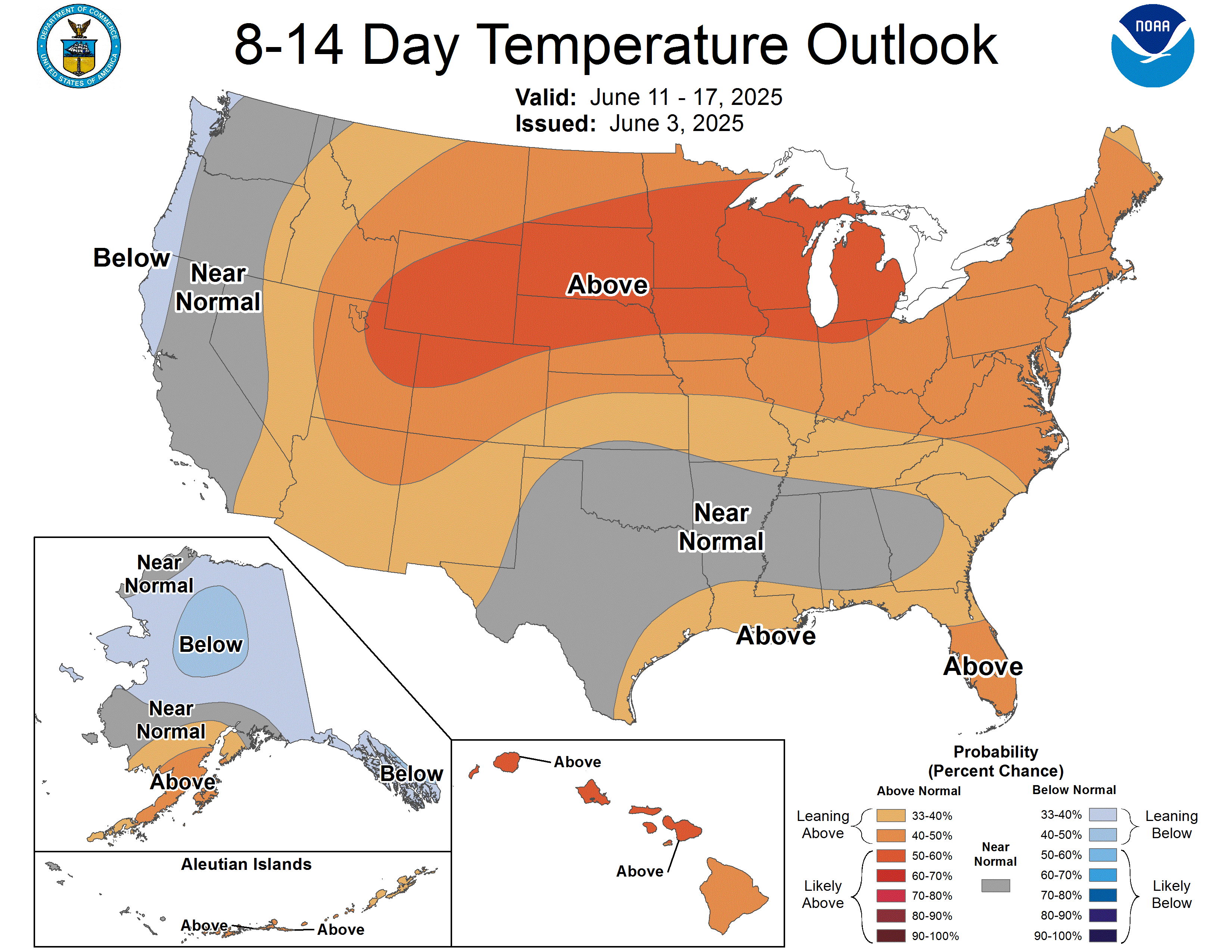
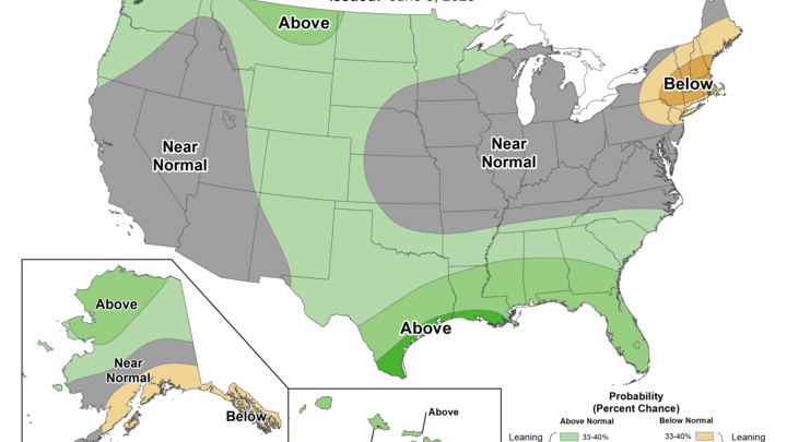
Figure 4. CPC's 8-14 day outlook
Warmer than average temperatures are likely by later next week and may persist through the solstice. At this point, this looks more like highs in the mid 80's to low 90's and not significant heat. The warmer temperatures (but not too hot) would be welcome news for crops that are running just a little short on growing degree days so far this season. For the first time in several years we didn't move straight into mid-summer weather immediately after Memorial Day. But true summer weather will be the rule by later next week across the state and region.
Late week rain chances
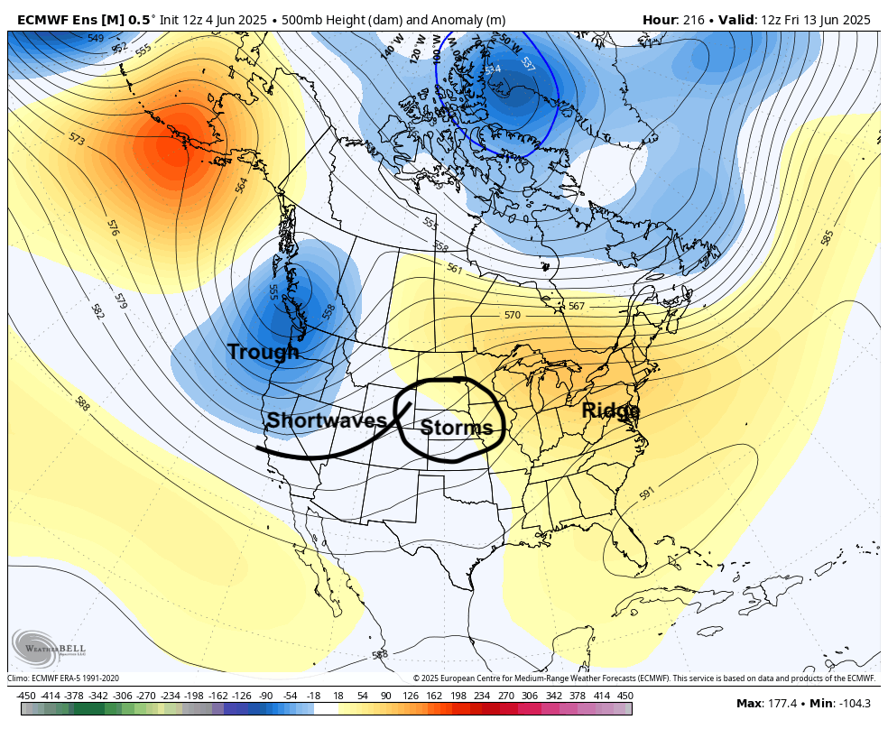
Figure 5. 500-mb height anomalies next Friday morning.
A trough is expected to be situated off the Pacific Northwest by late next week and a couple of shortwaves are likely to round the base of the trough into the Plains. This will help produce the rising motion needed for precipitation and the ridging further east would help with moisture return. Thus, the prognosis is good for showers and thunderstorms across the region later in the week. Exact timing of precipitation and amounts are difficult to pin-down but 0.5-1.0" would certainly be possible across the state and region between next Thursday night and Saturday. Also too early to pin down severe weather chances but chances of hail and flash flooding could be possible.