Wind and snow showers
A strong arctic high pressure will move into central Montana tomorrow and will create a tight pressure gradient across the north central U.S., particularly across the High Plains region. The result will be strong winds during the day tomorrow from the north-northwest with gusts over 60 mph possible in the Panhandle. Winds will be a bit lighter in the eastern part of the state tomorrow but will still be gusty. Blowing dust may be an issue in the western third of the state. Brief periods of snow showers are likely in the eastern half of the state, with the best chance for accumulating snow occurring between O'Neill and Wayne. Even areas where accumulations are minimal may still have brief periods of reduced visibility.
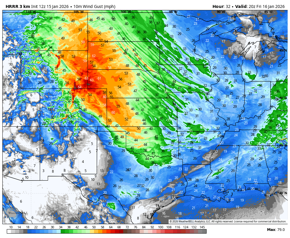
Figure 1. Projected wind gusts tomorrow afternoon
Cold Saturday and MLK Day
The coldest air will arrive from the north Friday night and it will be a cold day on Saturday statewide with subfreezing highs statewide. Temperatures may struggle to get out of the single digits in far northeast Nebraska and temperatures are likely to hold in the teens in all of central and eastern Nebraska on Saturday. Temperatures will moderate briefly on Sunday with highs in the upper 30's to mid 40's for most. But another arctic front will plow through the state Sunday afternoon and bring more gusty winds and a chance for snow showers to the eastern side of the state. Temperatures on Monday should be a bit warmer than Saturday but will still be cold, especially in central and eastern Nebraska.
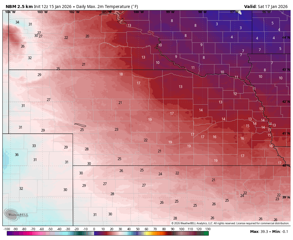
Figure 2. Projected high temperatures on Saturday
Brief warm up
Ridging will temporarily build back toward the central U.S. during the middle of the week, which will help bring in milder air to the state. Temperatures are not likely to be as mild as we have been recently but most everyone should get into the 40's for a few days, with 50's being probable in western Nebraska.
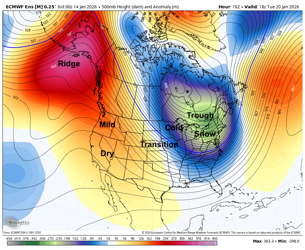
Figure 3. Projected 500-mb height anomalies next Tuesday
Cold returns. Chances of snow late week
Polar vortex stretching will pick up again later in the week and it appears the deep troughing in the middle to upper part of the troposhphere will be oriented further west than we have seen so far this winter. This will help bring in much colder temperatures to the entire state and for most, if not all, it will probably be the coldest air we have seen this season. There also is a chance at getting measurable snow across the state between later next Friday and Saturday. But at this point confidence is lower in timing, amounts, and impacts. Would pay close attention to the forecast next week as details should be much more clear by next Tuesday and Wednesday.
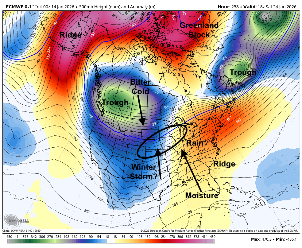
Figure 4. Projected 500-mb height anomalies next Saturday
What I am more confident in is the cold. We are likely to see multiple days in a row of cold, perhaps very cold, temperatures between the 24-27th. This does not appear to be a truly prolonged bitter cold snap but we are likely going to be on the cold side in the last week of the month, especially in the eastern half of the state. How cold it will be next weekend and early the week after should also be more apparent by the middle of next week as well.
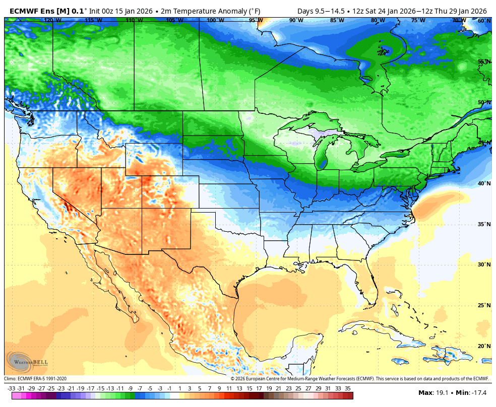
Figure 5. Projected temperature anomalies between January 24th and January 29th.


