
Soils drying out in the Western Corn Belt
The recent heat and lack of rain over the last 10 days has led to soil moisture loss over the top part of the profile. Figure 1 shows that the soil moisture percentiles are in the bottom 5th percentile across the northeast quadrant of the state with pockets of significant dryness in south central NE. Near-average moisture is depicted across more of western Nebraska but this does not reflect the lack of deeper moisture and near-average soil moisture in the Panhandle in late July is not indicative of favorable conditions for any rainfed crops.
In northeast Nebraska, the lack of widespread, decent rain over the last month will start leading to more significant stress on rainfed crops if moisture doesn't materialize soon. The same is true over in west central Iowa. There's still time to recover and achieve decent yields but something resembling 2020 may be setting up in western Iowa and northeast Nebraska if meaningful moisture isn't delivered before the end of the month.
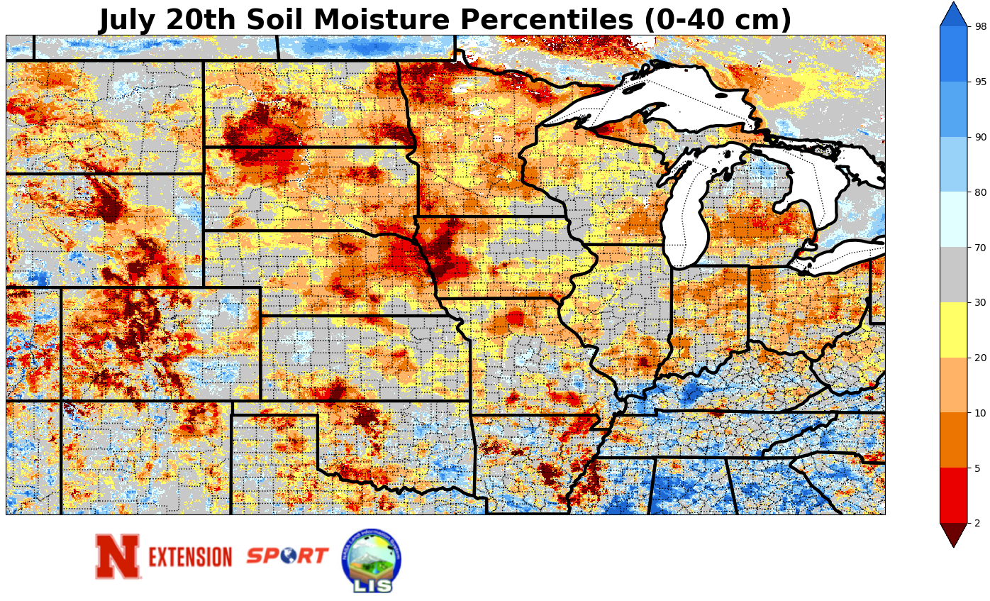
Figure 1. Soil moisture percentiles for the 0-40 cm layers according to NASA's SPORTLIS.
Cooler temperatures and moisture
The ridge that has been responsible for the heat and lack of moisture over the last several days is moving south and this will accomplish two needed things: 1) bring back decent chances of moisture and 2) bring cooler temperatures, especially to the eastern two-thirds of the state.
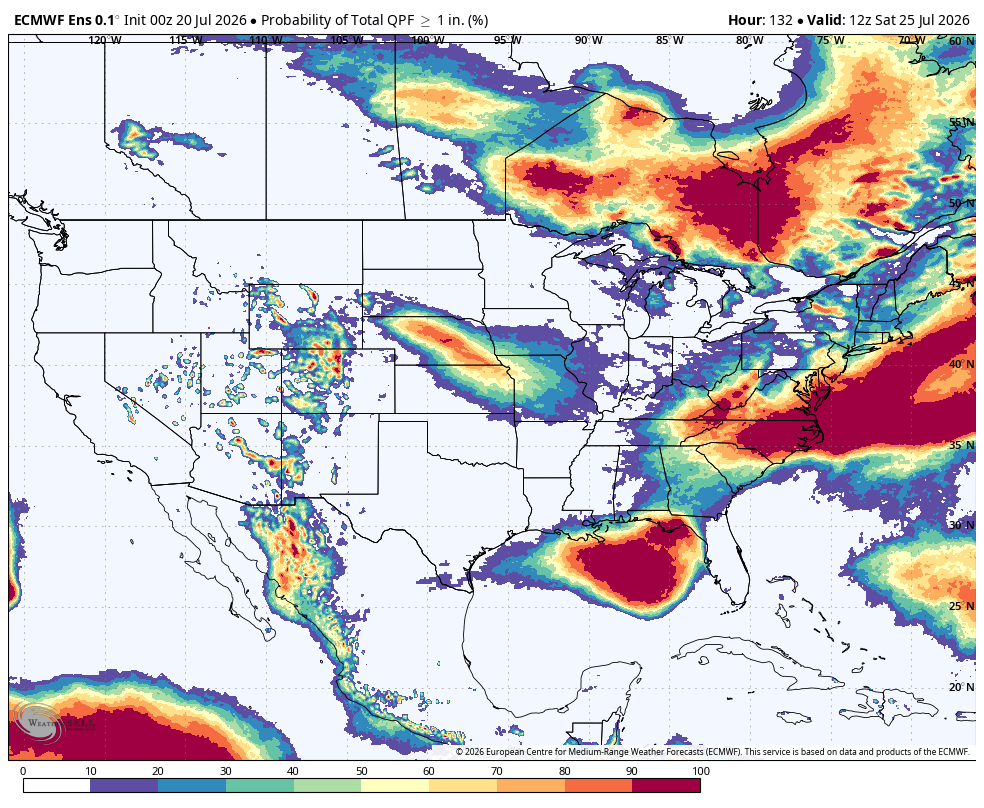
Figure 1. Probability of 1 inch of precipitation through Saturday morning
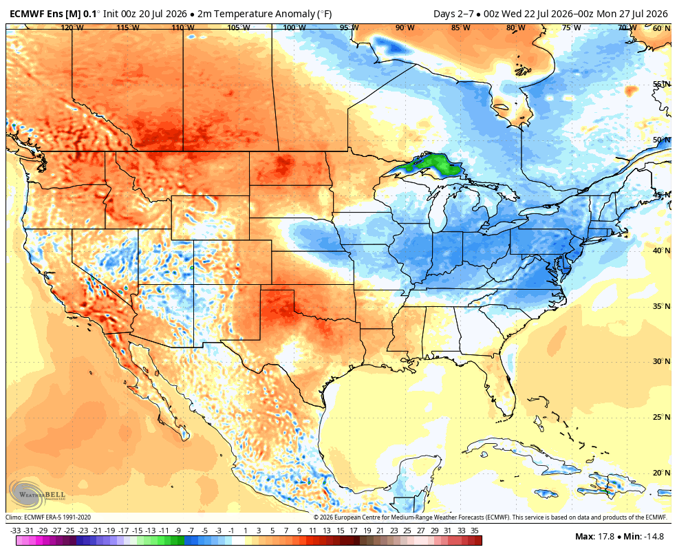
Figure 2. Projected 5-day temperature anomalies through this weekend
There will be chances of showers and storms later this afternoon between Highways 20 and 30 and again overnight in central and eastern Nebraska along the front. Best moisture tonight looks to be in eastern Iowa and western Illinois. The better chances come Wednesday into Friday as multiple shortwaves come around the periphery of the ridge. Rain and storms look to develop in the Sand Hills on Wednesday morning and slide east-southeast. Additional rounds of storms Wednesday and Thursday nights from north central into eastern Nebraska could deliver significant precipitation for some. Best chances of an inch of rain right now are from Ord down through York.
Temperatures in central and eastern Nebraska are likely to be held down by cloud cover later this week and highs may not get out of the 70's to lower 80's on Thursday and Friday. Warmer conditions are likely to hold in the Panhandle where there will be more sunshine, but will be cooler than today and yesterday. Temperatures will likely be well into the 90's by next weekend and those temperatures likely be paying the remainder of the state a visit by early next week. In other words, the precipitation that may fall over the next five days is going to be critical to the overall success of this season's corn and soybean crops. Without it may be challenging to achieve above-trend yields for rainfed producers for increasingly large areas of eastern Nebraska.


