
Summary
July 2025 was warmer and wetter than average (Fig. 1). The average temperature for the state of Nebraska in June 2025 was 74.8°F, which was 0.3°F above the 20th-century average. The Panhandle was the warmest relative to average (+1.3°F) while the rest of the state was generally right around the long-term average. This is consistent with most of the past decade(s) as mid-summer temperatures in the Panhandle have generally been much warmer relative to average than the rest of the state.
Nebraska's average precipitation in July 2025 was 4.35 inches, which is 1.30 inches above the 20th-century average and the 14th wettest on record. Only small pockets in western Nebraska were below average for the month. This is the fifth time in the last eight years that statewide average precipitation in July has been above the 4" mark. Precipitation was above average for almost all of central and eastern Nebraska and was wettest on record for pockets of northeast Nebraska. It was also a humid month (see related links article) with most of the state having dew points that were well above average for the month of July, though short of record levels for the state. The humidity was a catalyst for fungal diseases that affect soybean and corn cropping systems.
For the U.S. as a whole, it was tied for 19th warmest and was the 24th wettest July on record. 13 of the top 20 warm July's have occurred since 2000, though 1936 still lays claim to the hottest July and hottest month on record in the U.S.
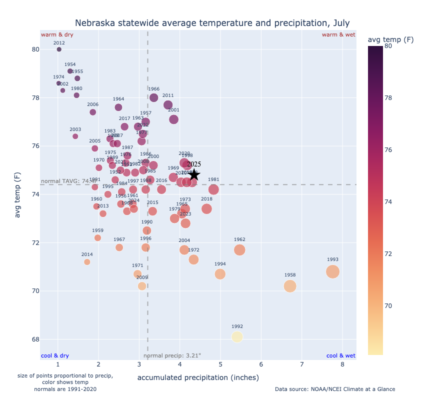
Figure 1. Statewide average temperature and precipitation anomalies compared to years since 1951.
Below are relevant maps from NCEI's Climate at a Glance for July 2025:
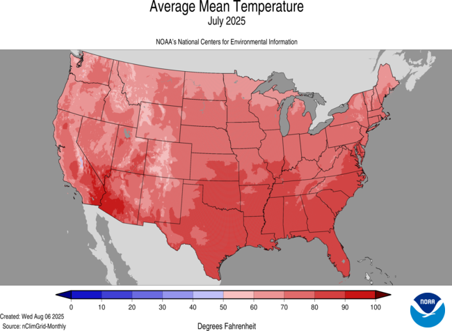
Figure 2. Average mean temperatures in July 2025
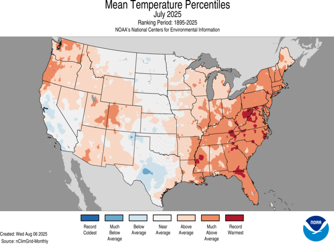
Figure 3. Average temperature percentiles for July 2025
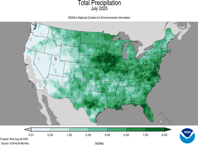
Figure 4. Total precipitation in July 2025
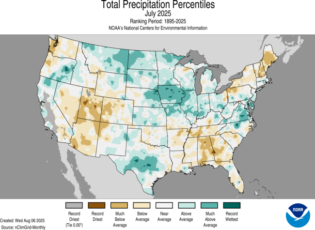
Figure 5. Precipitation percentiles in July 2025
Drought improvements
With most of the eastern half receiving significant rainfall and no pronounced heat waves occurring, there was a sharp decrease in the area of the state experiencing drought conditions (62 to 34 percent) and a decrease in the area experiencing severe drought conditions (15 to 8 percent). Furthermore, the percentage of the state free and clear of all drought and abnormal dryness increased from 5 percent to 38 percent. 1-category improvements were common in central and eastern Nebraska with a broad area of 2-category improvements across the eastern Sandhills and into northeast Nebraska. Pockets of Loup and Holt counties had 3-category improvements during the month.

Figure 6. USDM changes in July 2025 across Nebraska
Storm reports
July was a fairly active severe weather month in Nebraska with over 100 wind reports and over 70 hail reports. The majority of the severe weather reports were in central and northeast sections of the state with no severe storm reports in the northwest Panhandle or the southeast corner. There were no major outbreaks with reports being fairly evenly distributed among 8-10 days (Fig. 7).

Figure 7. Severe storm reports in July 2025
Temperature and precipitation extremes
There were no widespread records broken for temperatures but NCEI analysis does suggest some areas in far northeast Nebraska may have had their wettest July on record.
Here are the temperature and precipitation extremes around the state in July 2025:
Maximum high temperature: 106°F, Chadron Municipal Airport
Minimum high temperature: 59°F, Harrison 20 SSE
Maximum low temperature: 77°F, Nebraska City 2 NW
Minimum low temperature: 40°F, Chadron 3 SW
Maximum precipitation: 12.12", Spalding 6.2 N
Minimum precipitation: 0.65", Ellsworth 2 W


