BLUF:
Mostly mild and dry weather is expected over the next 10 days, with warmest temperatures relative to normal in western Nebraska. Light snow will be possible later tomorrow into early Sunday in the eastern half of the state with only minor accumulation expected. Same story for Tuesday night into Wednesday. Fire danger may be elevated across most of the state on Friday with gusty northwest winds. A more active pattern with colder temperatures is possible by Valentine's Day.
Chances of snow
A modest shortwave will be moving through the state tomorrow afternoon into Sunday morning. An area of light snow is likely to develop across central Nebraska later tomorrow afternoon and move east-southeast into eastern Nebraska and Iowa Saturday night. Accumulations will generally be under an inch and mostly under a half inch.
February starts off mild
It has been a cold last week across the state and most of the eastern 2/3 of the country with the influence of polar vortex stretching. Tomorrow will be cold across the eastern half of the state with highs in the lower 20's (east) and mid 20's to low 30's (central). Much warmer air will start to spread into western Nebraska tomorrow with highs in the 40's and 50's likely in the Panhandle and western Sand Hills.
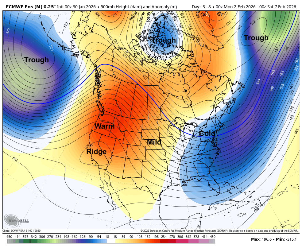
Figure 1. 500-mb height anomalies next week.
This mild air will spread east on Sunday with highs ranging from around 40 in northeast Nebraska to the lower 60's around Imperial.
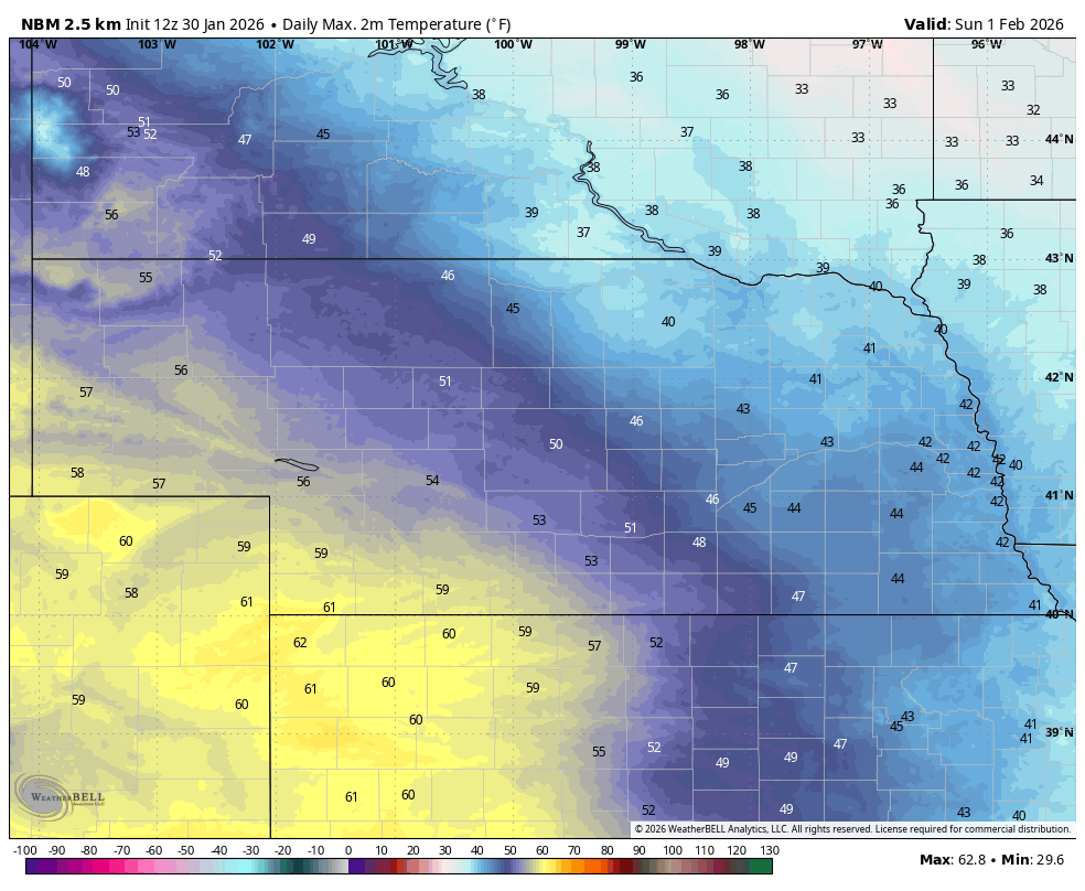
Figure 2. Projected high temperatures on Sunday
Temperatures will remain mild in the western half of the state on Monday and Tuesday with highs in the upper 40's to 50's. More seasonal temperatures in the 30's are likely in the eastern side of the state where cloud cover may be more extensive. A cold front will push through the state Tuesday night into Wednesday morning, which will bring a chance of light snow in the eastern half of the state Tuesday night and a brief cool down on Wednesday. No major accumulations are likely and it is possible no precipitation falls. The WPC currently favors no moisture for the state.
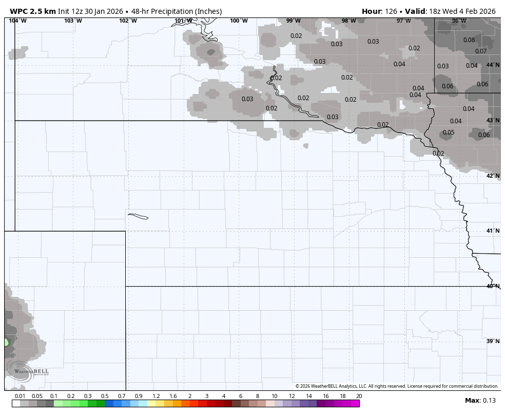
Figure 3. WPC projected precipitation between Tuesday and Wednesday
Warmer temperatures return on Thursday with highs possibly getting into the 50's statewide, with highs in the 60's probable for the southwest quadrant of the state. Mild southwest winds on Thursday will shift to the northwest and strengthen on Friday after a frontal passage with colder temperatures entering the state by later in the day. Highs on Saturday likely will be the coldest of the week for most with sub-freezing highs probable east of Highway 81 and highs in the 30's in central sections. Somewhat warmer temperatures will be found in the Panhandle. No precipitation is expected late in the week and for many of us, it will likely be a completely dry week. Fire danger is likely to be elevated next Friday.
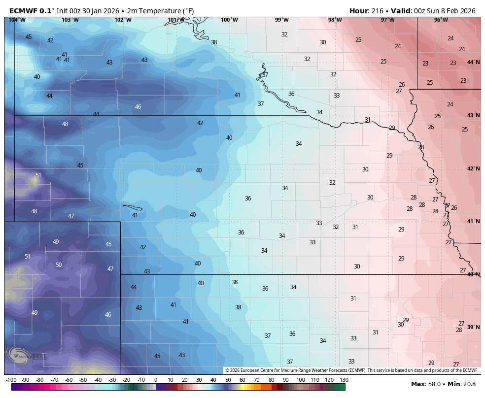
Figure 4. Projected temperatures next Saturday late afternoon
More active weather mid-month?
Mild weather will return to the state early the week after next. But a return to cold temperatures with the possibility of a more active pattern and snow chances appear possible if not probable by Valentine's Day. Recent ECMWF determinstic runs do show the possibility of a winter storm affecting the Central Plains and Western Corn Belt around the 12th. That's still quite a ways out so confidence is low. But there is signal in the ensembles for more western troughing in 10-14 days, which would open up the possibility for better moisture chances, including chances for wintry precipitation.